Soulanges Canal
Between Lake St Louis and Lake St Francis the Soulanges Canal was constructed on the north bank of the St Lawrence to replace the 9-foot Beauharnois Canal on the south bank. Both canals provided a by-pass of the Cascades, Split Rock, Cedar and Coteau Rapids.
|
Between Lake St Louis and Lake St Francis the Soulanges Canal was constructed on the north bank of the St Lawrence to replace the 9-foot Beauharnois Canal on the south bank. Both canals provided a by-pass of the Cascades, Split Rock, Cedar and Coteau Rapids. The new canal was started in 1891 and completed in 1899. The length was 15 miles, and the depth 15 feet. Five locks raised or lowered shipping a total of 84 feet. |
ST. LAWRENCE WATERWAY
SOULANGES CANAL - Mileage - 14.67 - Total Lift - 83.50 ft.
Mile |
Description |
Dimensions |
Lift |
| 0.00 | Lake St. Louis | ||
| 0.25 | Cascades Point Lock 1 | 280 x 46 x 15' | 23.5 ' |
| 0.52 | Cascades Point Lock 2 | 280 x 46 x 15' | 23.5 ' |
| 0.89 | Cascades Point Lock 3 | 280 x 46 x 15' | 23.5 ' |
| 0.95 | Quinxe Chiens Rd. Swing Br. | ||
| 2.86 | St. Antoine Rd. Swing Br. | ||
| 3.38 | Lock 4 | 280 x 46 x 15' | 12' |
| 3.57 | Guard Gates | ||
| 5.70 | St. Fereol Rd. Swing Br. | ||
| 8.00 | St. Dominique Rd. Swing Br. | ||
| 9.94 | St. Emmanuel Rd. Swing Br. | ||
| 11.51 | Riviere Rouge Rd. Swing Br. | ||
| 14.01 | C.N.R. Swing Br. | ||
| 14.03 | Lock 5 | 280 x 46 x 15' | 1' |
| 14.10 | Coteau Landing Rd. Swing Br. | ||
| 14.67 | Lake St. Francis |

SHSC001: MAP OF SOULANGES AND BEAUHARNOIS CANALS
Map showing the path of the two canals that were built to bypass the rapids between Lake St. Francis and Lake St. Louis. The southern route, or Beauharnois Canal, from what is now Valleyfield to the village of Melocheville, was completed in 1845. The northern route, or Soulanges Canal, opened in 1899.
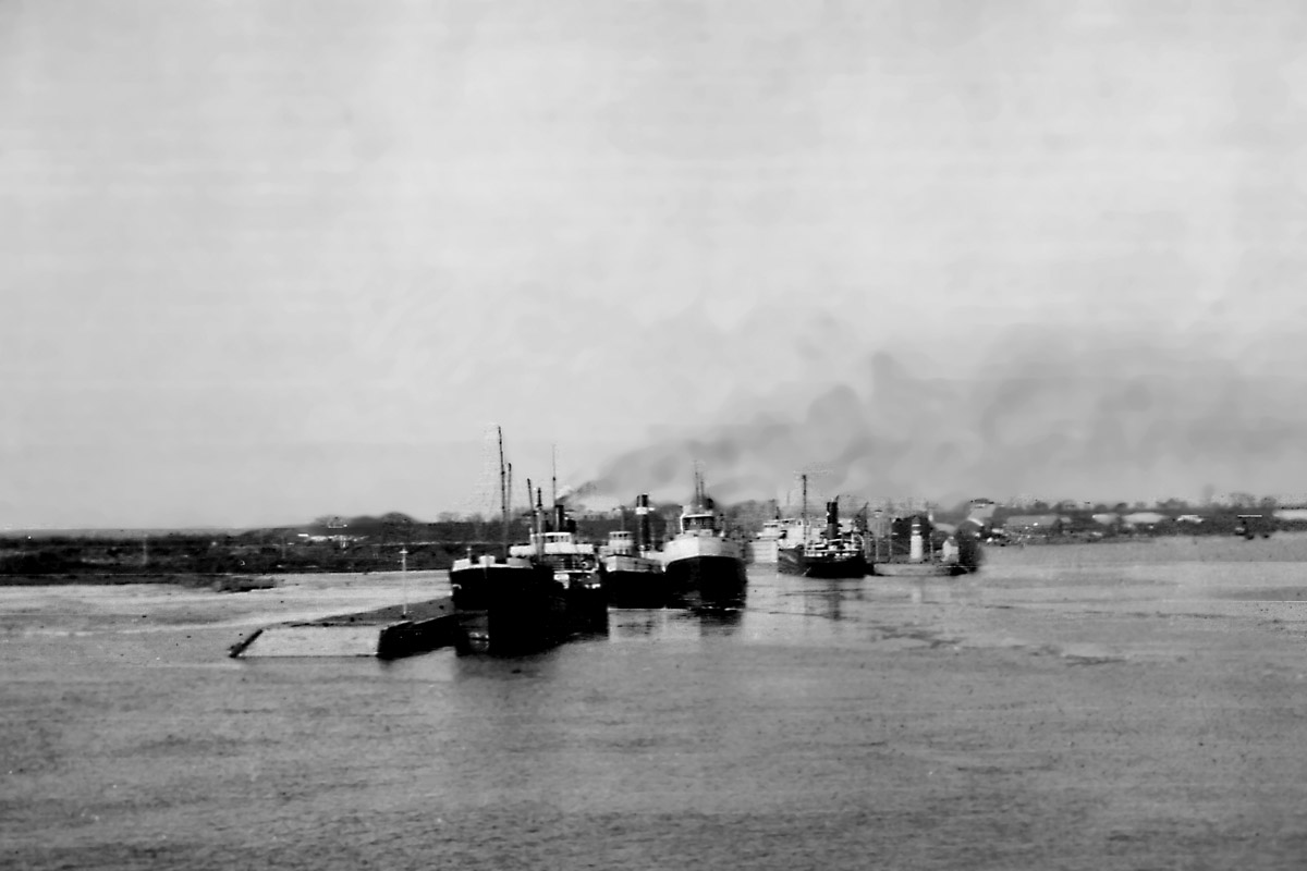
SHSC002: Entrance to the Soulanges Canal at Cascades Point as seen from Lake St. Louis.
The ships secured to the south wall are most likely waiting for traffic to clear the upper entrance to the Lachine Canal. The nearest ship is one of the Tree Line fleet of package freighters. Immediately behind her is ROYAN with the CSL canaller SASKATOON beside her. The Quebec and Ontario canaller on the north approach wall up bound is thought to be CHICAGO TRIBUNE.
Duff Brace photo
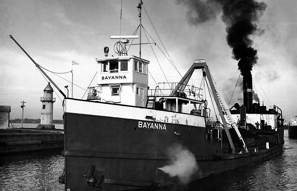
SHSC003: BAYANNA at entrance to the Soulanges Canal.
BAYANNA was a self unloading bulk carrier that sailed for the Bayswater fleet of Brockville, Ontario.
She is approaching Lock 1 of the Soulanges Canal. The light tower in the background is on the end of the north pier at Cascades Point.
Photo John H. Bascom, Oct. 21, 1958
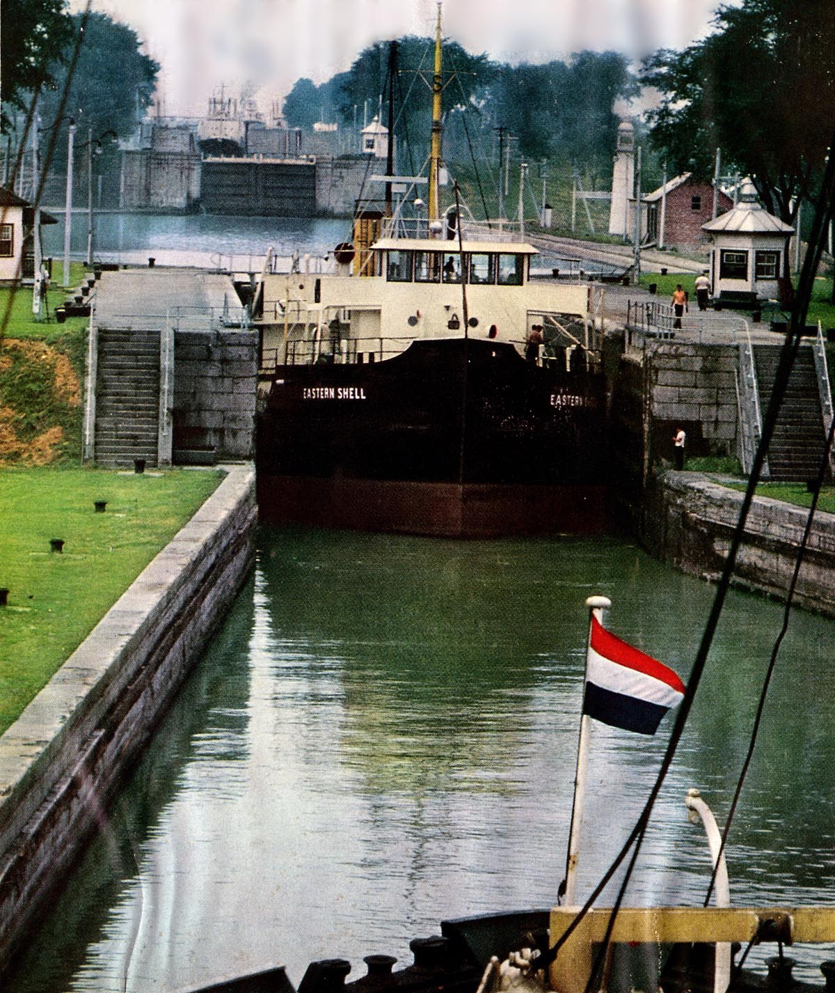
SHSC004: The tanker EASTERN SHELL is about to depart
Cascades Point Lock 1 down bound.
In the background can be seen a “salty” making her way out of Lock 3 and waiting above that lock is GEORGE S CLEET.
National Geographic photo.
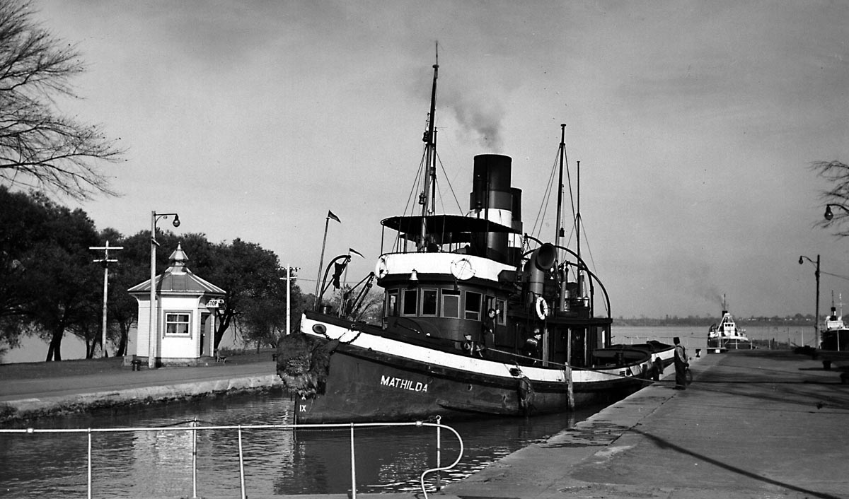
SHSC005: MATHILDA in Cascades Point Lock 1.
The Sincennes McNaughton tug MATHILDA raised in Lock 1. The tug right behind her in the lock (you can see the stack and masts) is the YOUVILLE. BAYANNA is waiting on the lower approach wall for her turn.
Photo Jim Kidd , Oct. 22, 1958
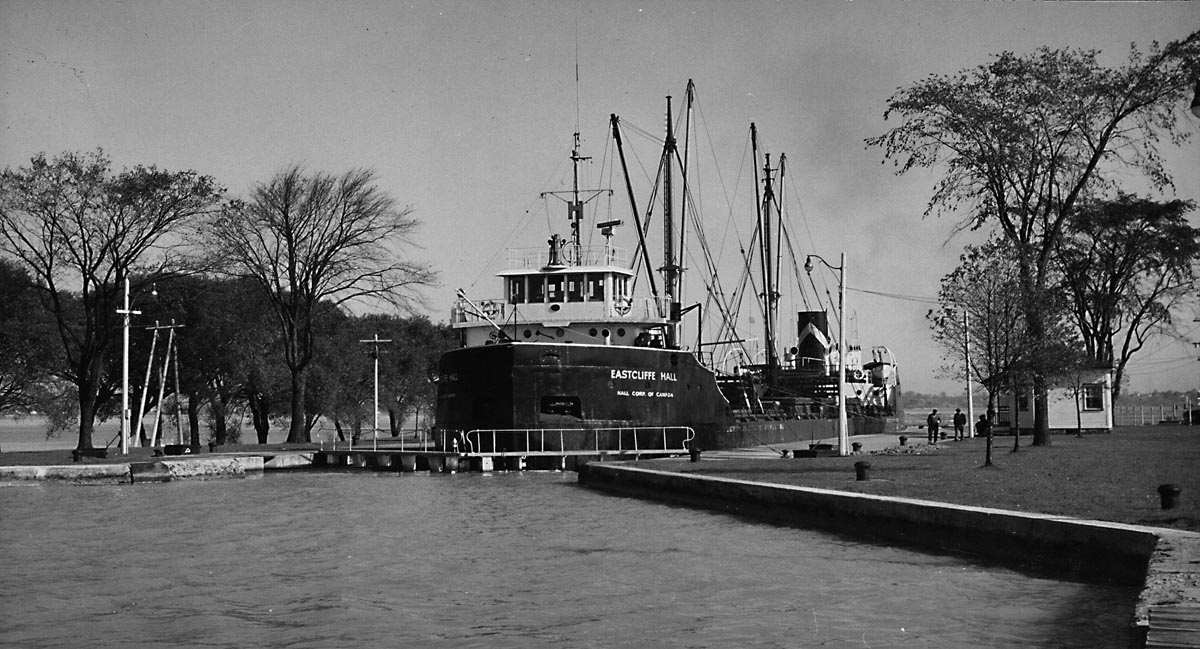
SHSC006: EASTCLIFFE HALL in Cascades Point Lock 1.
The EASTCLIFFE HALL would later be rebuilt and enlarged from her original canal dimensions. She foundered in the St. Lawrence River off Crysler’s Marina, a few miles east of Morrisburg, on July 14, 1970, with a loss of nine lives.
Photo Jim Kidd , Oct. 21, 1958
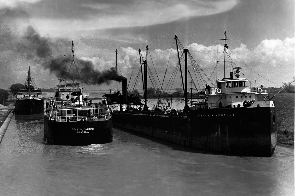
SHSC007: The basin between Locks 1 & 2 of the Soulanges Canal at Cascades Point.
The tanker COASTAL CARRIER slips between the canaller CHARLES R. HUNTLEY and the Norwegian flag steamer DUX as she moves from Lock 2 down to Lock 1. The sailors who went ashore to handle the cables complained of having to “Walk from Montreal to Cardinal.”
Gord Macaulay photo.
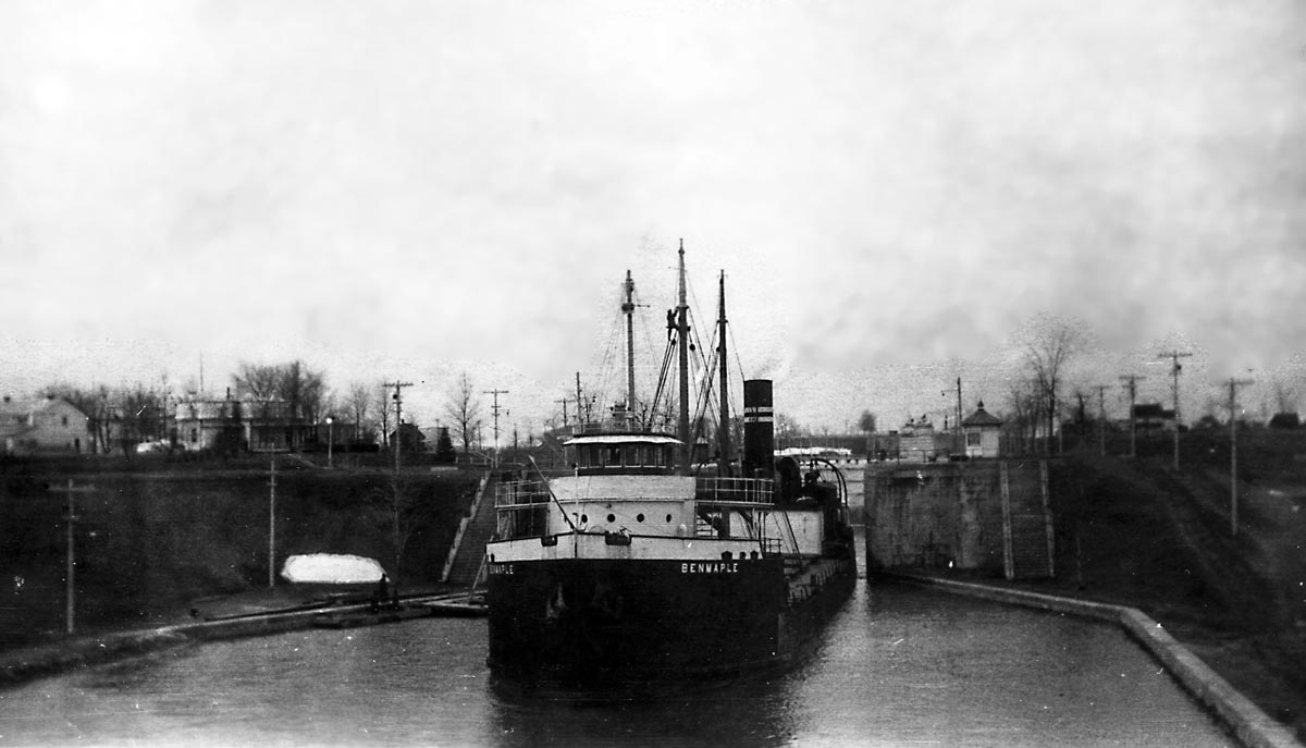
SHSC008: BENMAPLE departing Lock 2 of the Soulanges Canal.
The BENMAPLE was sunk in collision with propeller LAFAYETTE, August 31, 1936, off Bic, Quebec, in Lower St. Lawrence River, 165 miles below Quebec City.

SHSC008a: ACADIAN in Lock 2.
The CSL canaller ACADIAN is down bound in Lock 2 of the Soulanges Canal.
SHSC009:The CSL canaller ACADIAN crossing the basin between Locks 3 & 2.
The ACADIAN has just negotiated passing an up bound canaller in the basin between Locks 2 & 3. The up bound canaller is one of the Beaconsfield fleet of “Red Barges.” Going straight into a lock without sliding down an approach wall is referred to as “Taking the lock on the fly.”
Photo by John H. Bascom - 21 October 1958.
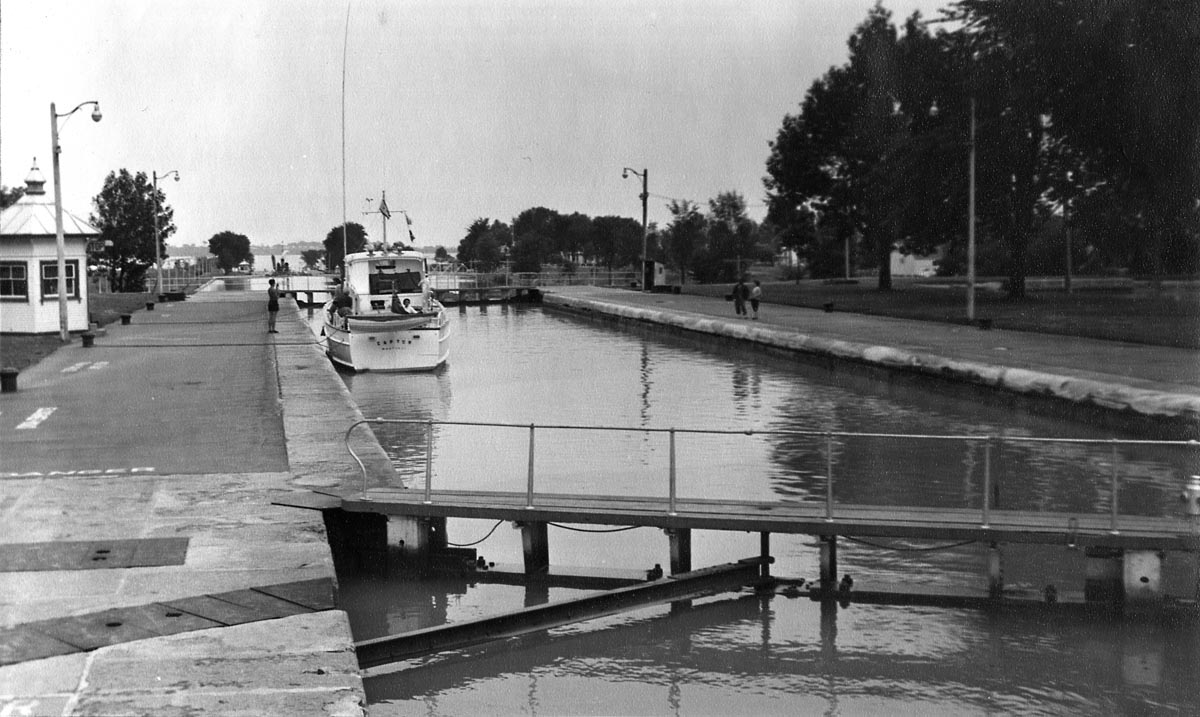
SHSC010: Yacht in Lock 3 of the Soulanges Canal.
When this yacht is lowered in Lock 3, it will be 23.5 feet down from its present elevation.
Photo by Ivan Brookes - August 4, 1954.
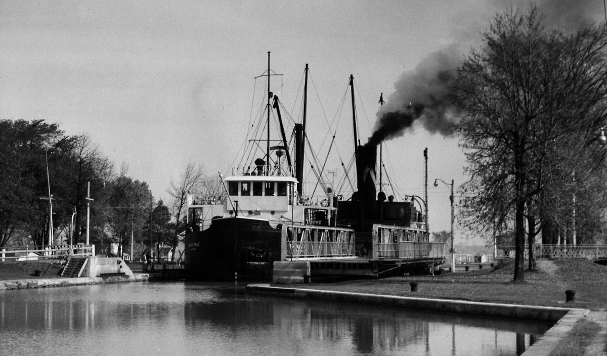
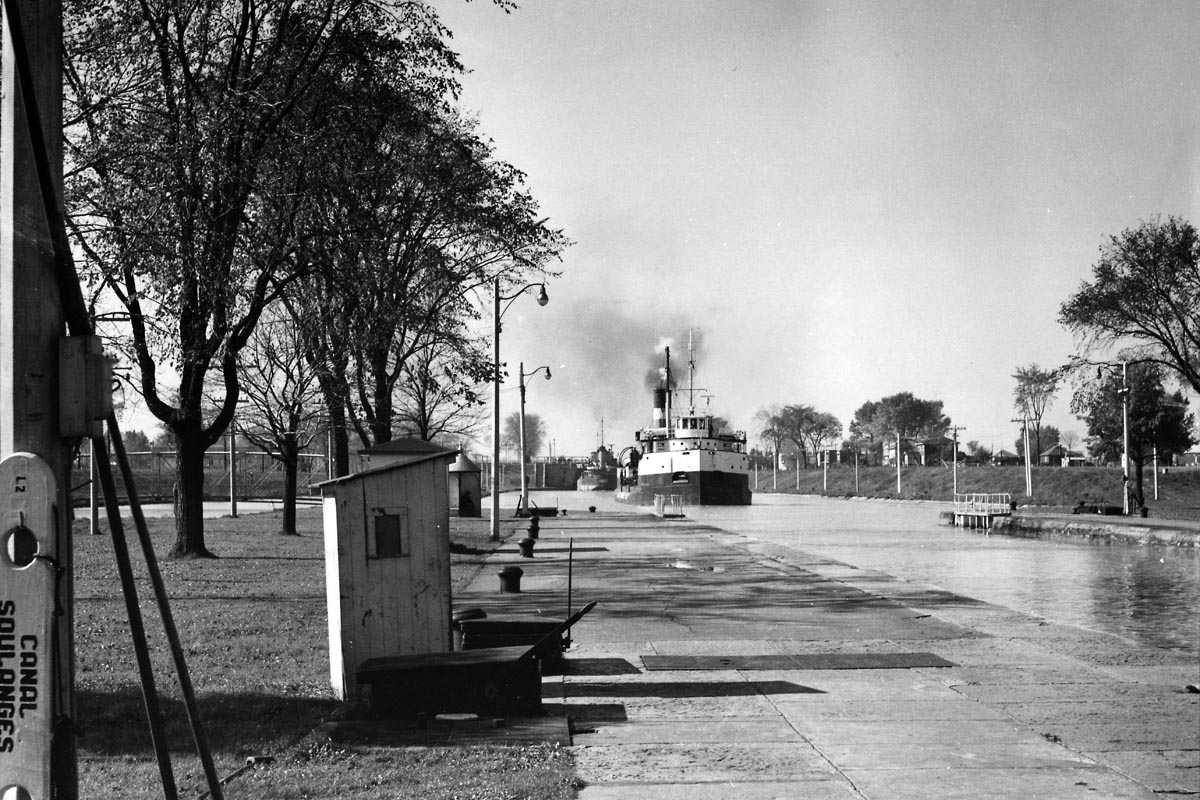
SHSC011: JOHN H PRICE departing Lock 3 of the Soulanges Canal.
The Halco canaller JOHN H PRICE burns a little extra coal as she works up to speed coming out of Lock 3. The next lock is 2.5 miles up the canal.
Photo by Jim Kidd.
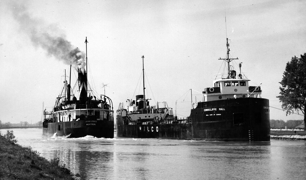
SHSC012: The Halco canallers JOHN H PRICE and CONISCLIFFE HALL
pass on the level above Lock 3.
The steamer PRICE was built in 1927. The motorvessel CONISCLIFFE HALL was built in 1957.
Jim Kidd photo - October 1958.
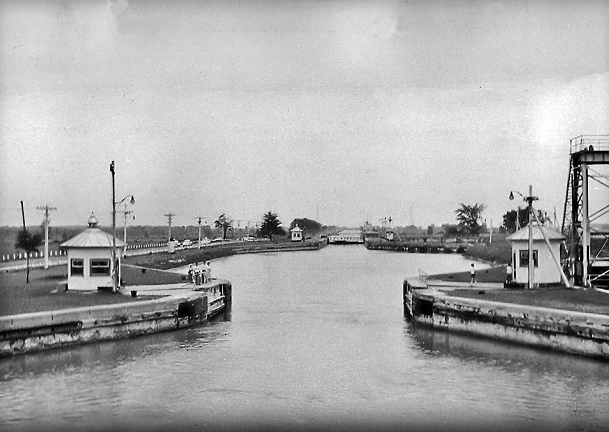
SHSC013: Guard Gate and Lock 4 of the Soulanges Canal.
The Guard Gate structure was built to be closed in case of an emergency. Such emergencies did indeed occur when ships did not stop in time when entering the locks. Several times ships crashed through the wooden gates when down bound, both in the Welland and St. Lawrence canals, releasing a torrent of water from above the lock. The Guard Gate would be closed if a ship hit the gates at Lock 4. This would stop the flooding below the lock. This type of accident would not occur with up bound ships as they would hit the sill below the upper gates.
National Archives photo.
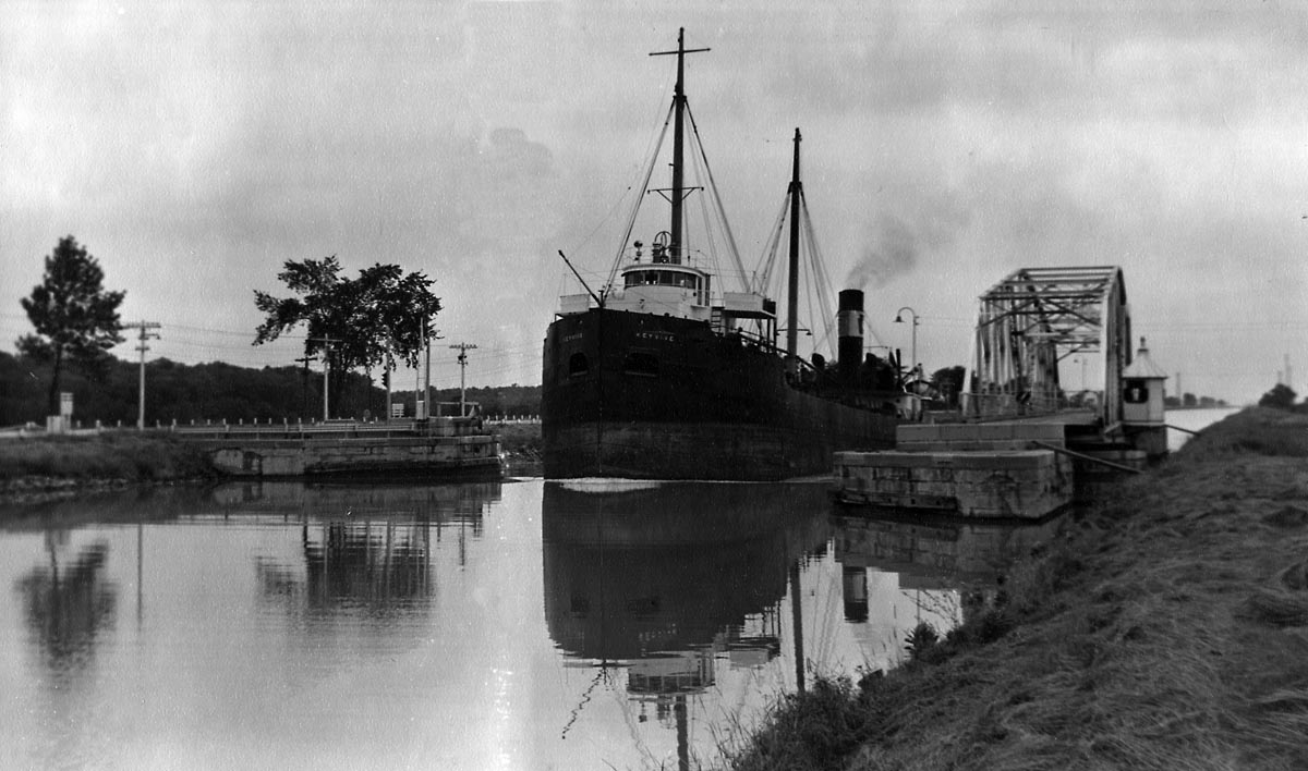
SHSC014: KEYVIVE passing through the draw at the St. Fereol Road Swing Bridge.
Located 5.7 miles up the Soulanges Canal, the bridge was two miles above the Guard Gates.
Photo by Ivan Brookes - August 4, 1954.
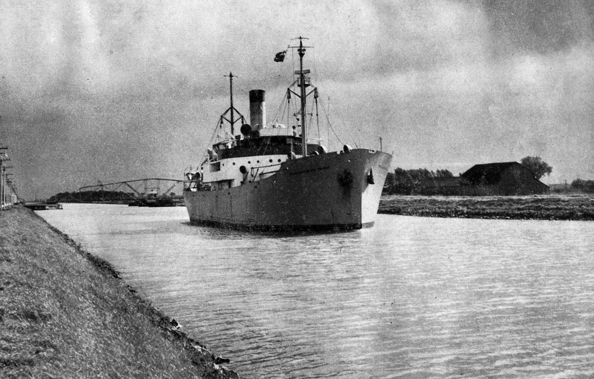
SHSC015: St. Dominique Road Swing Bridge located 8 miles up the Soulanges Canal.
The PRINS WILLEM VAN ORANGE was from Rotterdam and one of several of the Orange Lijn fleet of ships that came to the Great Lakes before and after the opening of the Seaway.
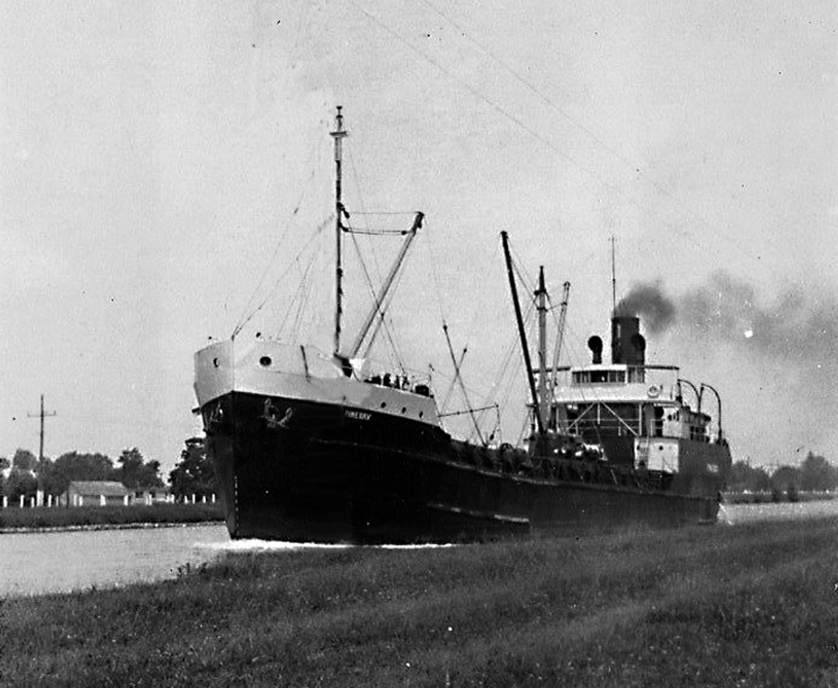
SHSC015a: PINEBAY up bound in the Soulanges Canal.
The package freighter PINEBAY was one of the fleet of ships known as “The Tree Line.”
SHSC016: The St. Emmanuel Road Swing Bridge at Mile 9.94
Photo by Ivan Brookes on board the RAPIDS PRINCE. August 1949
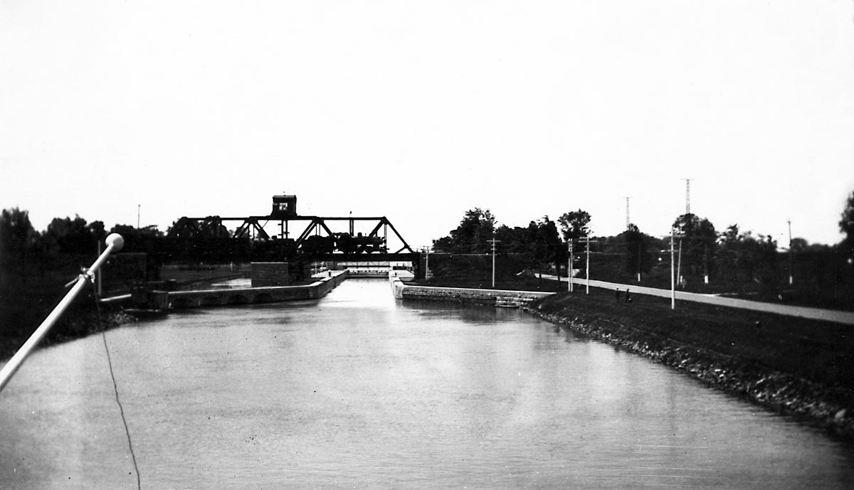
SHSC017: Lock 5 of the Soulanges Canal at Coteau Landing.
A freight train is crossing the canal on the CNR swing bridge. The lift in Lock 5 is only one foot as the water is allowed to flow freely through a bypass located on the south side of the lock.
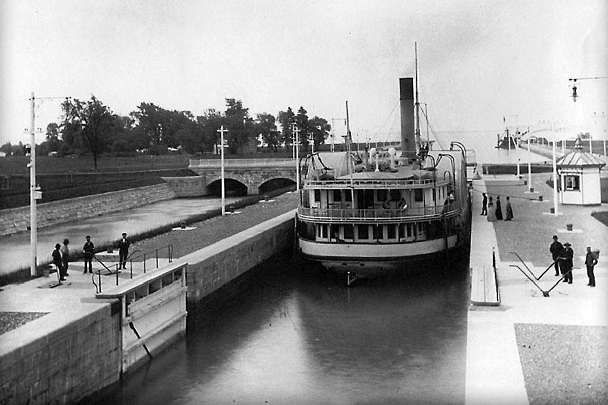
SHSC018: Sidewheel steamer CASPIAN in Lock 5 of the Soulanges Canal.
The CASPIAN is secured in Lock 5 at Coteau Landing. This passenger ship was well known for running the rapids down bound from above the Long Sault Rapids to Montreal Harbour. It was a thrilling ride! Note the men on the hand crank levers that moved the big wooden gates open and shut.
National Archives photo.
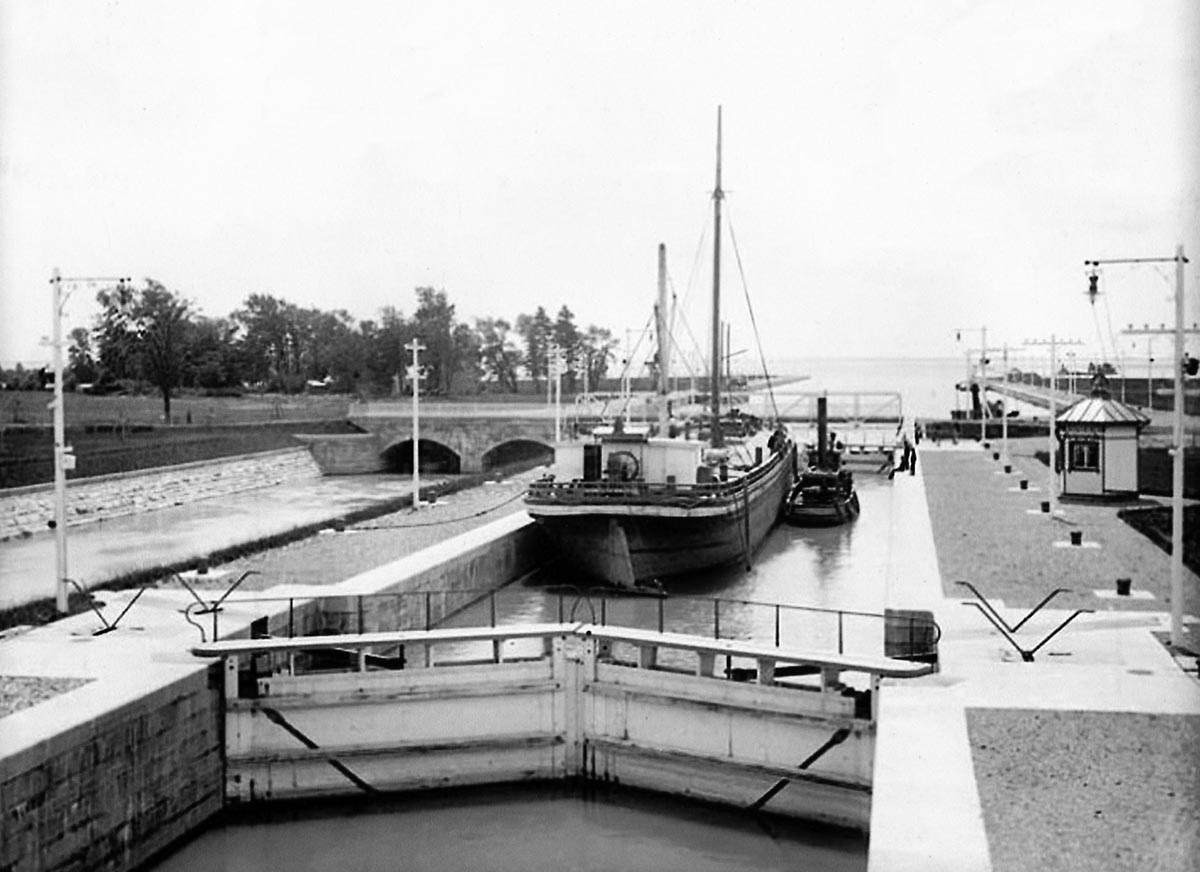
SHSC019: Lock 5 with the barge CHEROKEE and her tug in the lock.
Tugs hauling barges were very common in the old St. Lawrence Canals, especially at the time the Soulanges canal opened in 1899. The CHEROKEE was built at Garden Island, near Kingston, Ontario, in 1876.
National Archives photo.
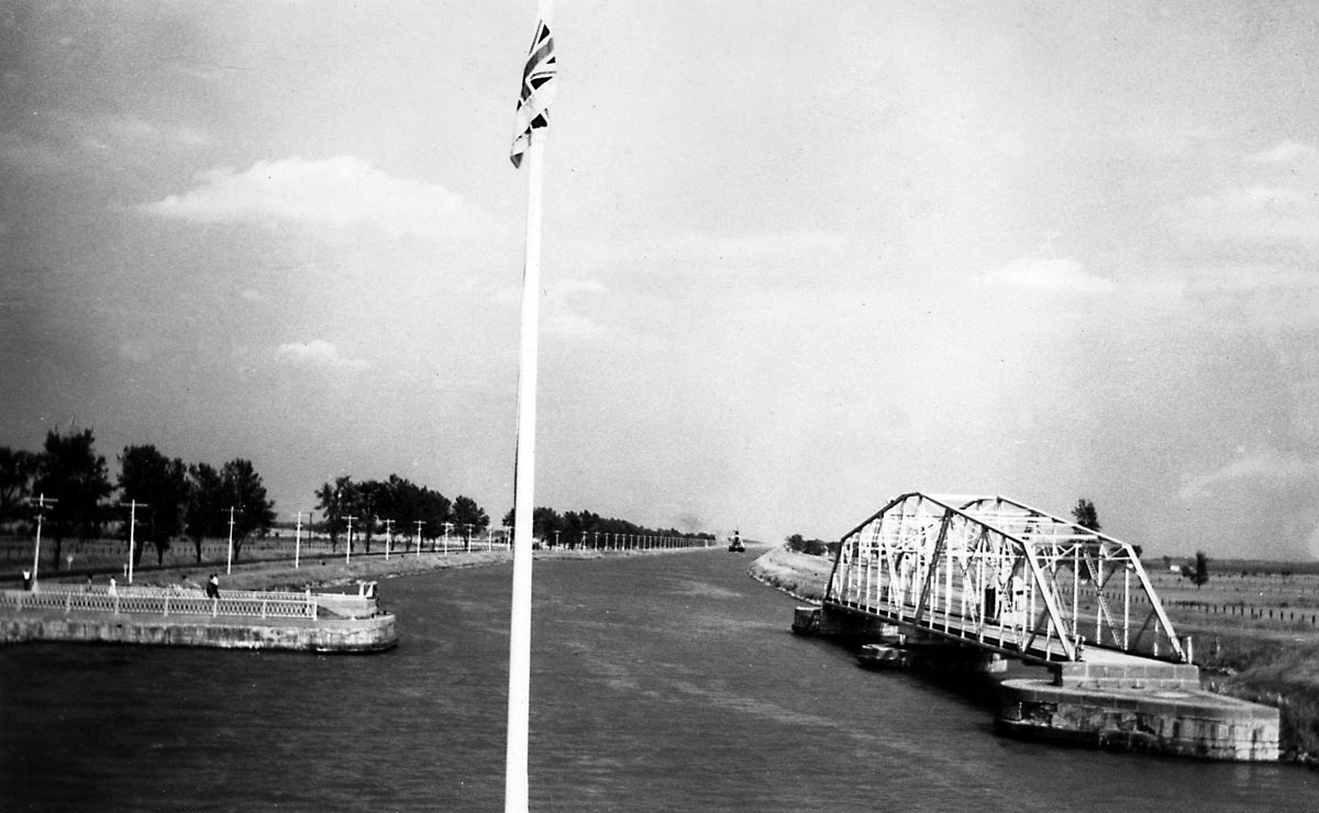
SHSC020: The road swing bridge at Coteau Landing.
This road crossed the canal just above Lock 5. Lake St. Francis can be seen in the distance. The aqueduct which allowed water to flow freely into the canal can be seen to the left
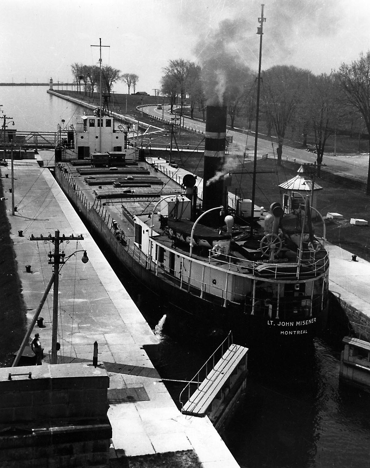
SHSC021: Lt. JOHN MISENER in Lock 5.
This classic canaller was built in England in 1929. She is sailing in Scott Misener’s Colonial Steamship Co. colours. Photo taken from the CNR railway bridge. The gates are now driven by electric motors.
Gord Macaulay photo.
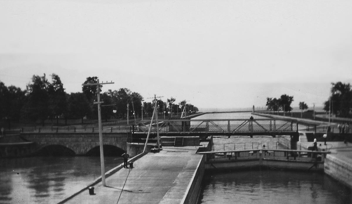
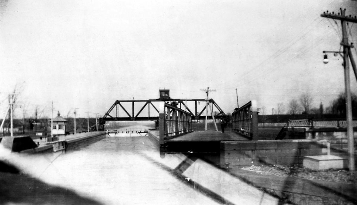
SHSC022: SOULANGE CANAL - Coteau Landing
-This view shows Lock 5 and the road swing bridge, looking out towards Lake St. Francis.
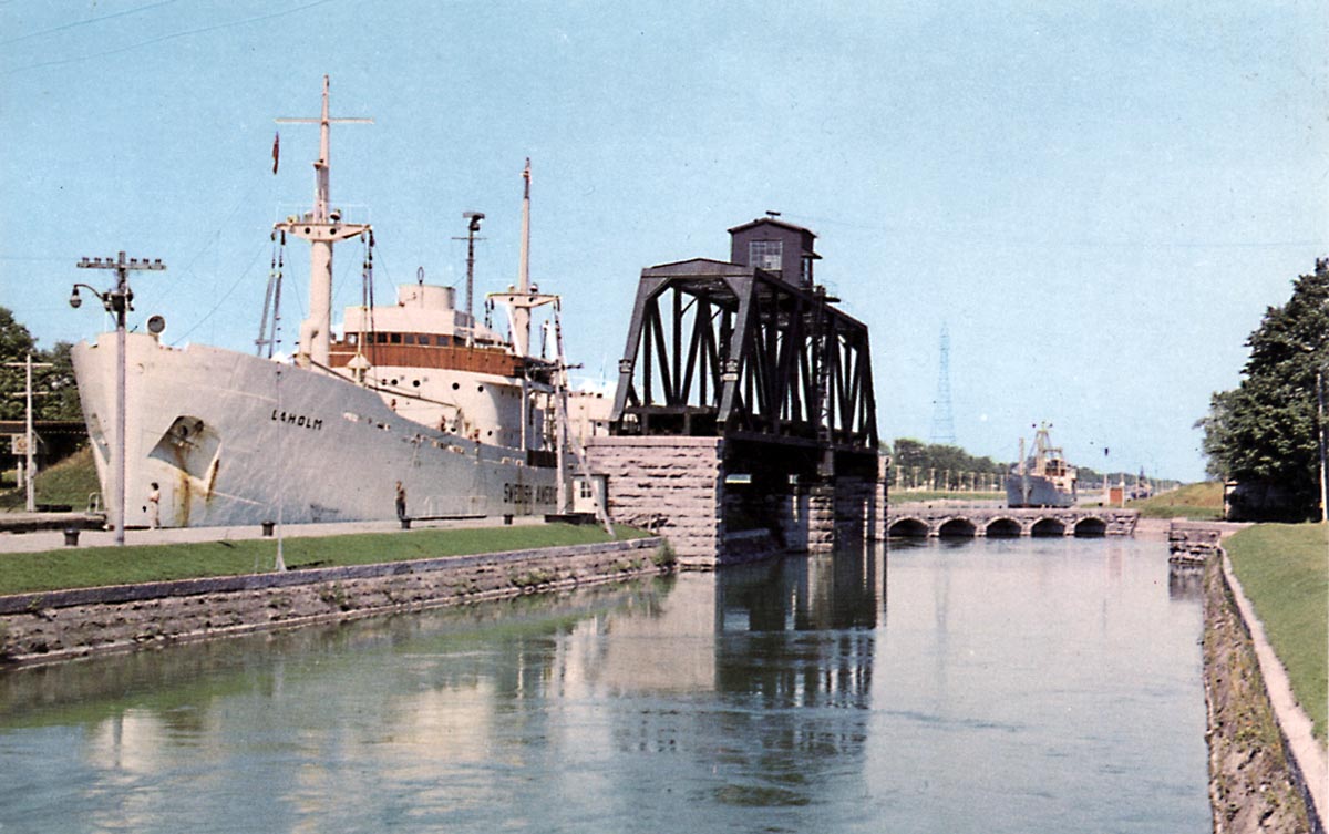
SHSC023: CNR bridge in the open position to allow a ship to enter Lock 5.
The motorvessel LAHOLM was built in Denmark in 1947 for the Swedish American Line. She was one of several Swedish flag ships that came up to the Lakes via the old canals. Note the aqueduct below Lock 5 that fed water into the canal.
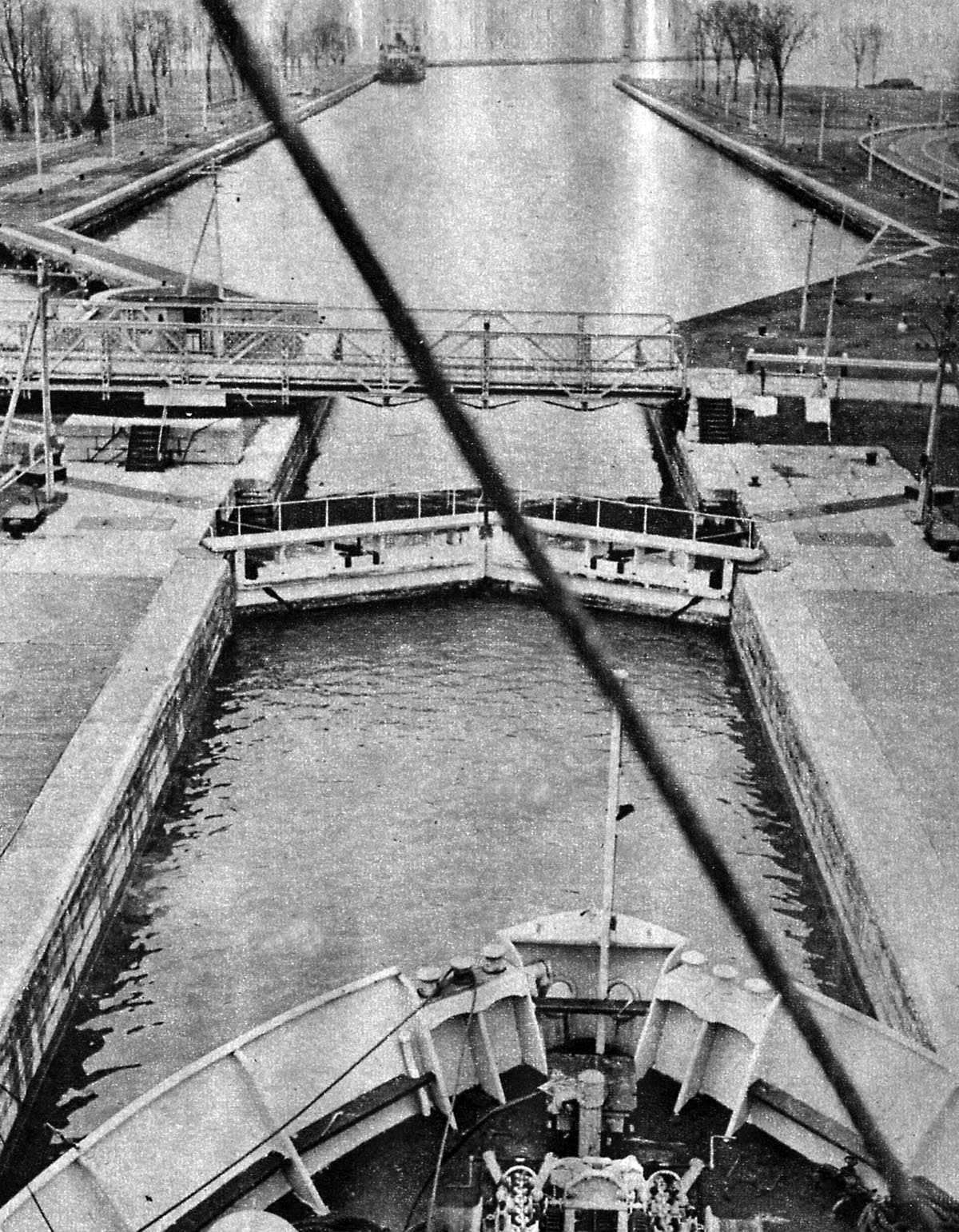
SHSC024: Looking down into Lock 5 and the CNR swing bridge.
The Coteau Landing road bridge is open.
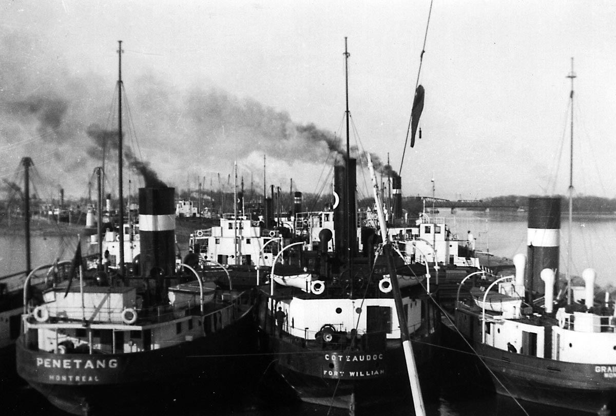
SHSC025: Coteau Landing entrance to the Soulanges Canal.
Canallers are packed into the upper entrance of the Soulanges Canal at Coteau Landing in the spring of 1940. Written on the back of the photo: “Waiting for the (icebreaker) LADY GREY.”