Old Morrisburg Waterfront
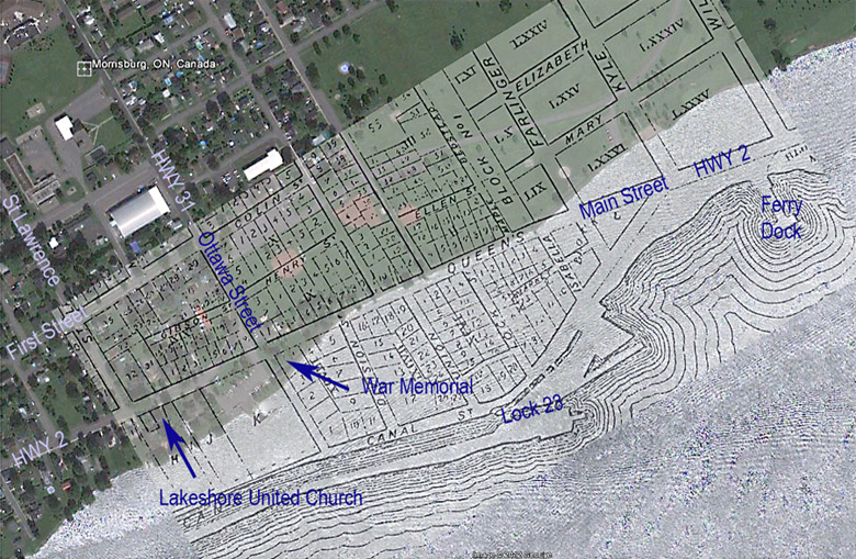
Map of Old Morrisburg with the Flooded Waterfront
Click on any picture to get an enlarged view.
If you wish to purchase a print of one of these original photographs, please select the "History Purchase" menu item at the top of the page.
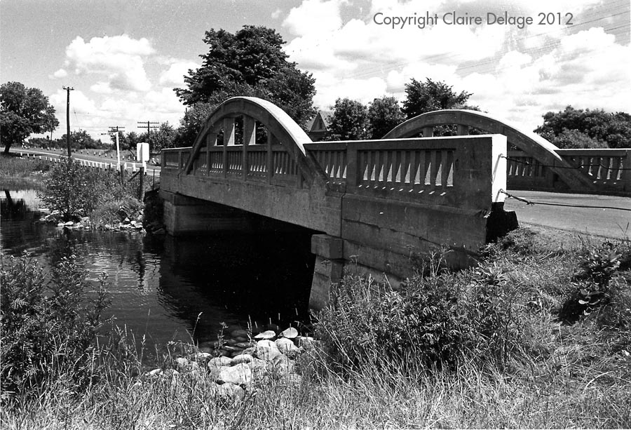
HP207-25: Nash Creek Bridge
The old Nash Creek Bridge on Highway 2 leaving the East end of the old town.
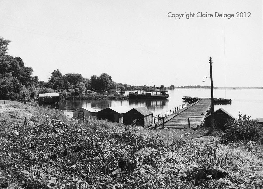
HP202-71: East End Wooden Dock
HP202-71: East End Wooden Dock with the Morrisburg Waddington Ferry in the background.
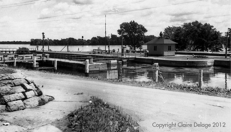
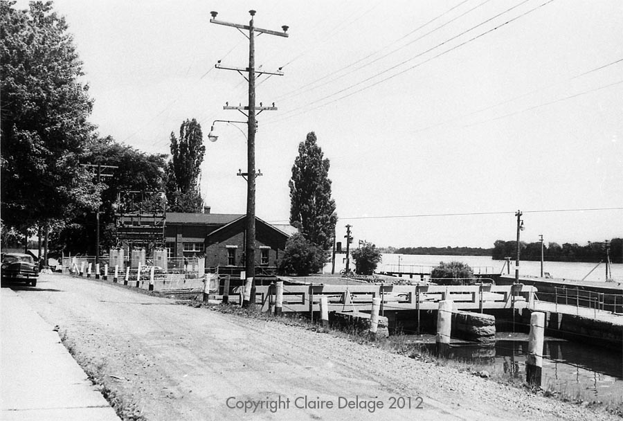
HP36-27-14: The Lock 23 Lock House
The East entrance to Lock 23 and the Lock House at the South end of Lock Street.
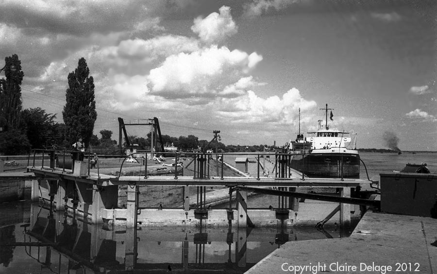
HP72-36: Lock 23 East Gate
HP72-36: Lock 23 East Gates with the "Blue River" (owned at the time by Upper Lakes Shipping) coming upstream, waiting to enter the lock.
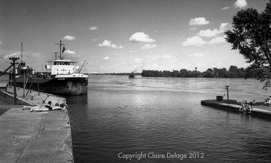
HP206: East End Canal Entrance
East End Canal Entrance with the youngsters watching the entrance of the "Blue River" on a hot summer day.
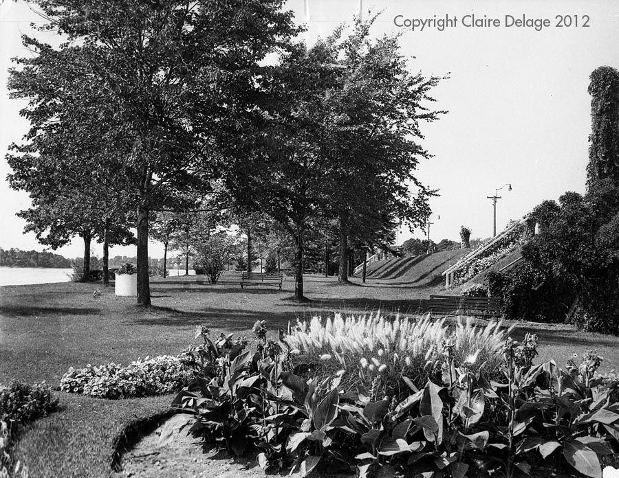
HP238: Lock 23 South Shore Park
Park on the South side of Lock 23 looking West, with the gardens proudly maintained by the Lock 23 workers. It was a popular summer recreation spot for Morrisburgers.
HP038: Lock 23 Footbridge and Powerhouse
Lock 23 Footbridge and Powerhouse, viewed looking East from the South end of Union Street.
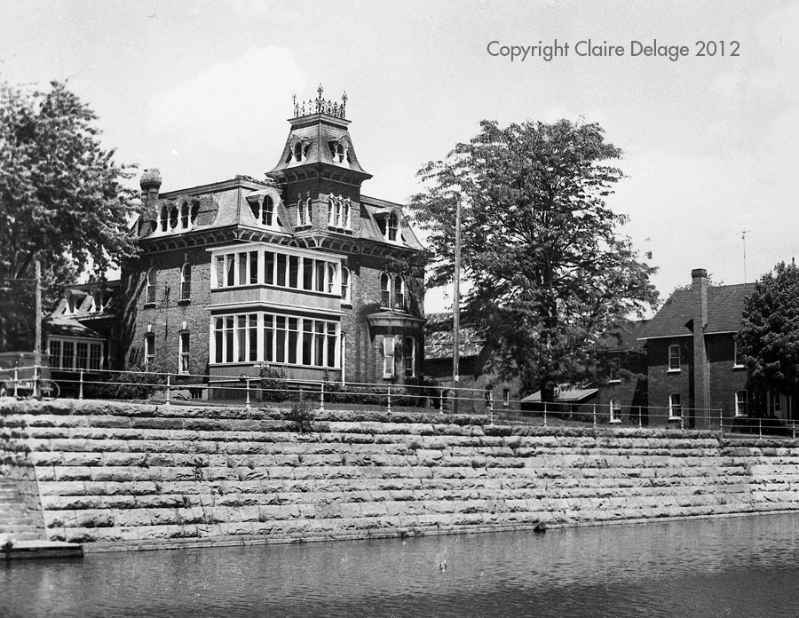
HP025: Arthur Flyn House on the Canal Bank
The Arthur Flyn House on the Canal Bank at the South end of Augusta Street. You can see the public swimming platform at the lower left of the picture.
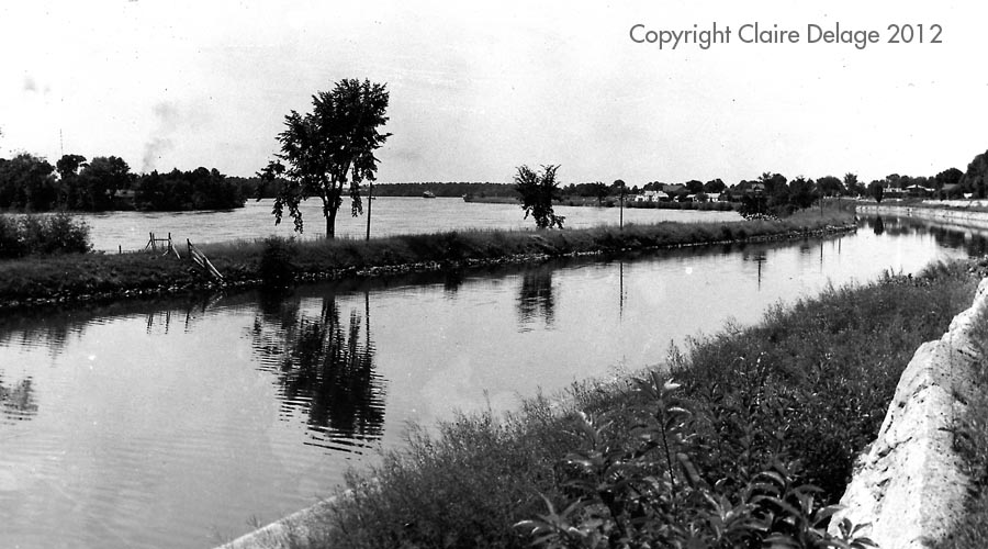
HP219: Williamsburg Canal West of Morrisburg
West looking view of the Willamsburg Canal, West of Morrisburg, with Broder Island on the left and the Government Shipyards at Sturt Creek in the distance.
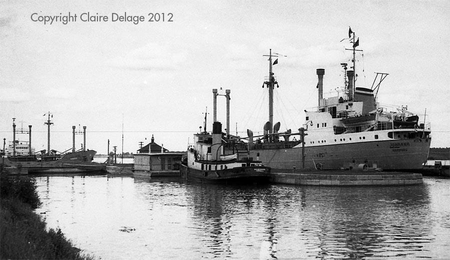
HP139: The Western Head of the Morrisburg Locks.
The Western Head of the Morrisburg Locks at Flagg Bay where Flagg Creek enters the St. Lawrence River.
If you wish to purchase a print of one of these original photographs, please select the "History Purchase" menu item at the top of the page.