The First Canals
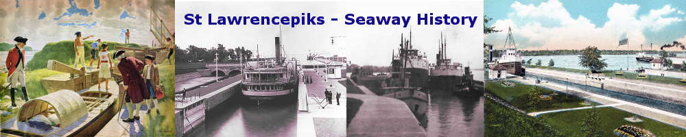
The bateau was a long, flat-bottomed boat, usually 40 feet in length and about 6 to 8 feet wide in the middle. It was made of either pine or cedar. The great advantage of this boat over the bark canoe was its carrying capacity - 5 tons - and the near impossibility of capsizing it in the rapids, although it could be smashed to pieces on the rocks of the more dangerous rapids. In fact, in 1760 Colonel Frederick Haldimand, who was later to become Governor of Quebec, describes witnessing the wrecking of 46 boats carrying supplies and military stores on rapids in the St Lawrence. Some 84 men were lost at the time and this was a lesson he never forgot, for upon returning to Quebec as Governor in 1778 he immediately suggested the construction of canals.
|
Nevertheless, the bateau had other advantages over the bark canoe. It had a shallow draught, so that it could move in very close to shore. It usually carried masts and sails, an anchor, four men and a pilot as crew. On traveling upstream bateaux were usually dragged over rapids by ropes or men, or unloaded and dragged across portages. Beginning in 1779 Colonel Haldiman oversaw the construction of the first canal along the St. Lawrence. Located at Coteau du Lac, this canal was 900 feet long, 7 feet wide and had three locks. Each lock was less than 40 feet long and was 2.5 feet deep. Just enough to float partially loaded bateaux and bypass the Cascades Rapids. Twenty years later these locks were enlarged to permit a brigade of six bateaux to pass at once. |
SHFC001- An Illustration of the Haldiman Canals - Rex Woods
.jpg)
SHFC001A: A Map of the St. Lawrence River showing the locks that existed in 1831.
This 1831 map of the river, from Coteau Du Lac on the extreme upper left to the village of Beauharnois on the upper right, shows the location of two of the locks from the Military Canals era. There is one to the right of the village of St. Joseph. The other is up river from Point au Diable at Coteau Landing.
Also note the 'Raft Channel' on the river near the Coteau Lock. The timber rafts were assembled in the 1000 islands near Kingston and they were towed down the river by paddle tugs to above Prescott. There, with a crew aboard to guide them, they were set loose to run down the river to Quebec City. In a bay near that city they were taken apart and each square timber was loaded onto sailing ships that took the timber to Europe.
The map also shows a projected canal to connect Lake St. Frances to River St. Louis. The actual location of the canal that opened in 1845 was north of here, running in parallel to the Beauharnois Channel
CASCADES TO COTEAU SECTION
1779
Frederick Haldimand,(Governor 1778-1786) began construction of the "Haldimand Canals" at Cascades Point, Split Rock and Coteau du Lac, completing them in 1783.
1806
The Canal at Cascades Point was replaced this year. This canal was built across the Point between the Ottawa and the St.Lawrence,a distance of 1,600 feet and had two locks measuring 120 x 20 x 4' and having a total lift of 13 feet. This canal served until 1845 when the Beauharnois Canal was opened. The locks accomodated Durham boats of 3 tons capacity.
1817
The Canal at Coteau du Lac was replaced this year. This canal • was built across the Point, a distance of 400 feet and had one lock measuring 104 x 123 x 4'. The lift was 7 feet. This canal was abandoned in 1845.
1842
The Beauharnois Canal was begun in June of this year and opened for traffic in October 1845. This canal by-passed the entire group of rapids between Cascades Point and Coteau du Lac by following a land line on the south side of the St.Lawrence. The mileage was 11.25, the total lift was 82' 6" and 9 locks were built(numbert 6 to 14 incl.), measuring 200 x 45 x 9'. The first vessel to transit the canal was the ALBION, Capt.Chambers.
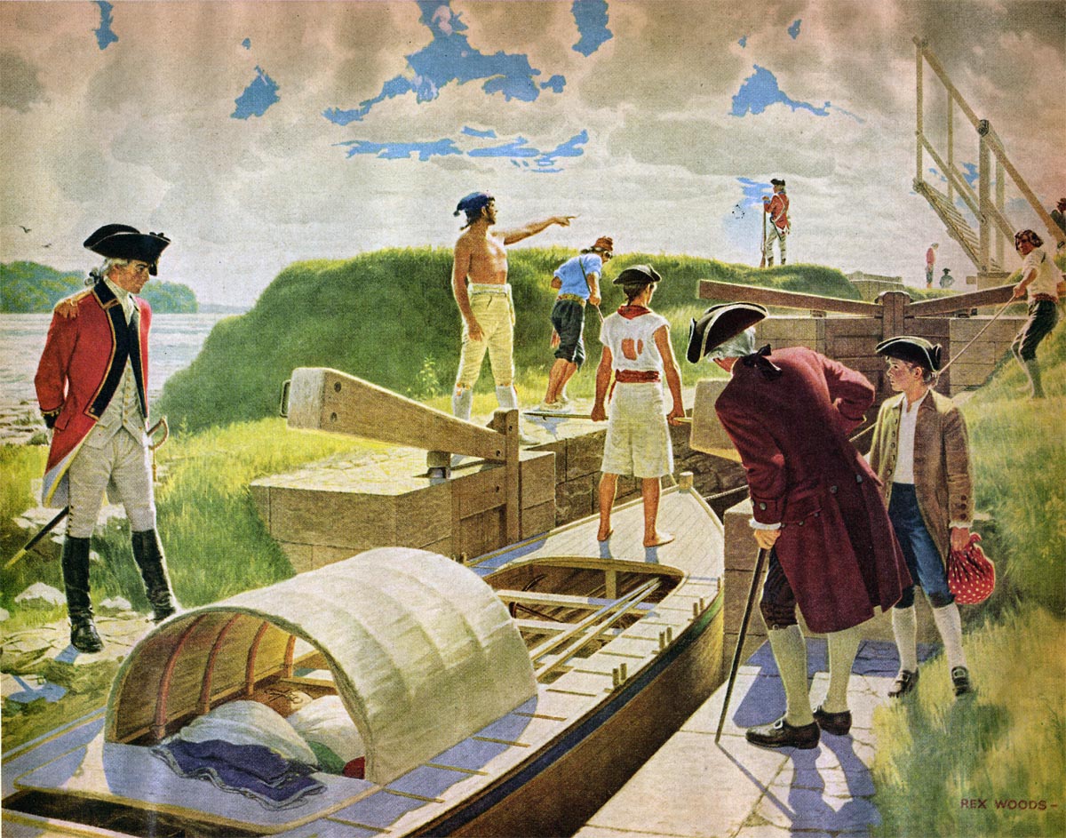
SHFC002 - CORNWALL CANAL
Looking up the old locks 15, 16 & 17. The pier on the left marks the lower end of the second Cornwall Canal -1939 photo.
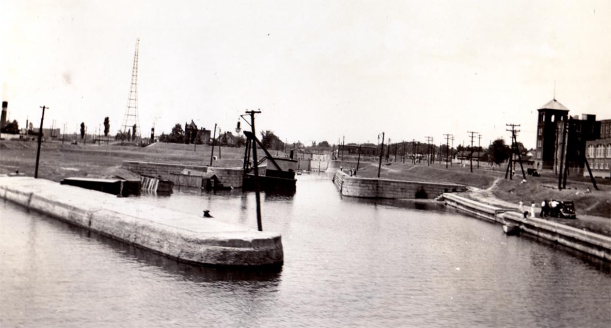
SHFC003 - Old Lock 16
This photo shows old Look 16. At the upper end of the lock appear the valves of the Dry Dock under the concrete wall which replaced upper gates. The dry dock consists of the former pond between Locks 16 and 17; the latter lock was an entrance channel to the dry dock. Photo Sept. 1st 1947.
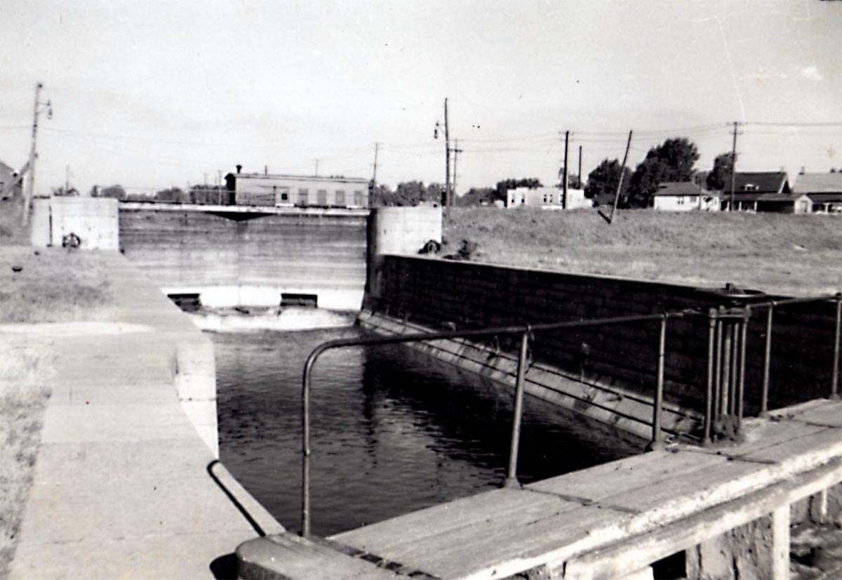
SHFC004 - Old Lock 17
CORNWALL CANAL - This photo shows the upper gates of old Lock 17 and the pontoon bridge. This lock is now used as the entry channel to the dry dock.
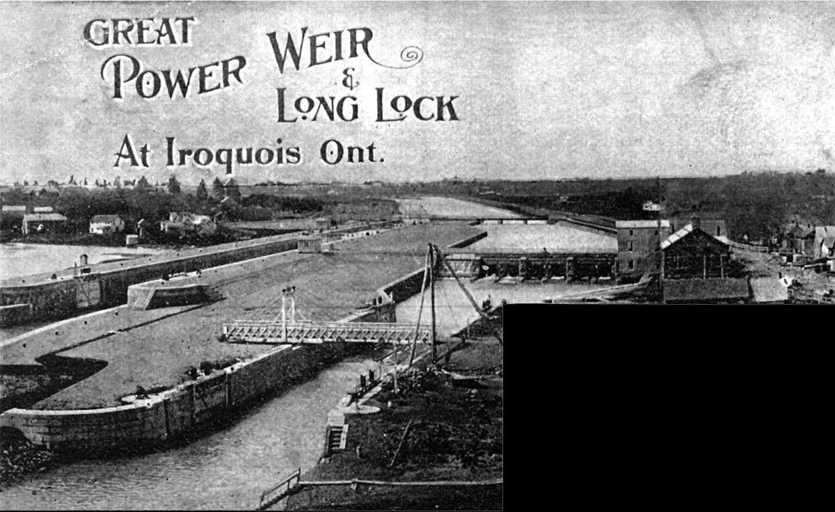
SHFC006 - Lock 25 at Iroquois
Lock 25 at Iroquois was completed in 1846. The mills located immediately above the lock would later be expropriated to build the much larger second canal.
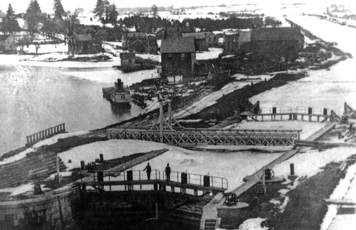
SHFC007 - Lock 25 at Iroquois After 2nd Canal Opened in 1901.
Lock 25 at Iroquois shortly after the second canal was opened in 1901. The old canal has been blocked by a weir and the two hydraulic power generating stations are in service to the right of the waterfall.
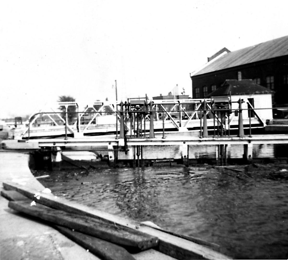
SHFC008 - Old Lock 25 - "Point Iroquois Canal"
Iroquois, Ontario
This photo, taken July llth,1951, shows old lock 25, which was completed in November 1846, as the "Point Iroquois Canal" and was abandoned when the new Lock 25 was built. The old lock was 200 x 45 x 9' and was spanned by a road swing bridge which had its turntable in the depressed section of the south wall (under the first tree on the left of the picture). The control weir in the background was built for the new lock. The arches were the tail race openings of a small power plant which burnt down in 1950.
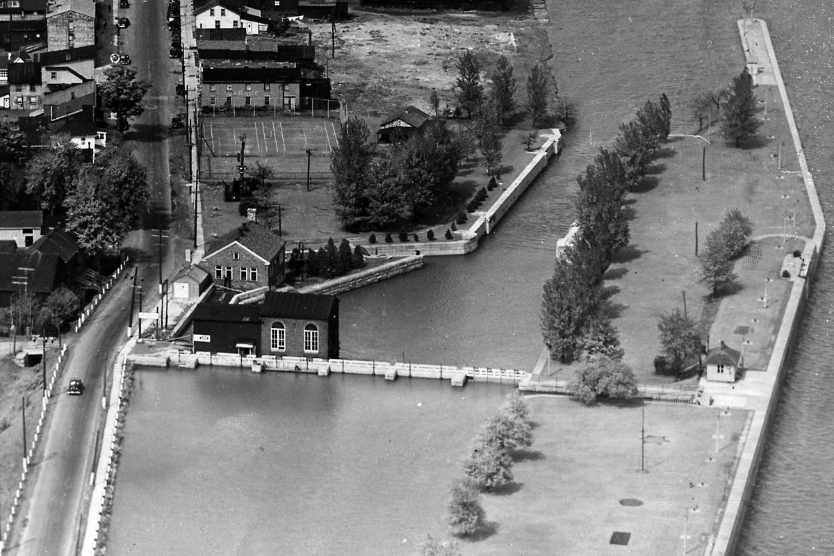
SHFC009 - Aerial View of Old Lock 25
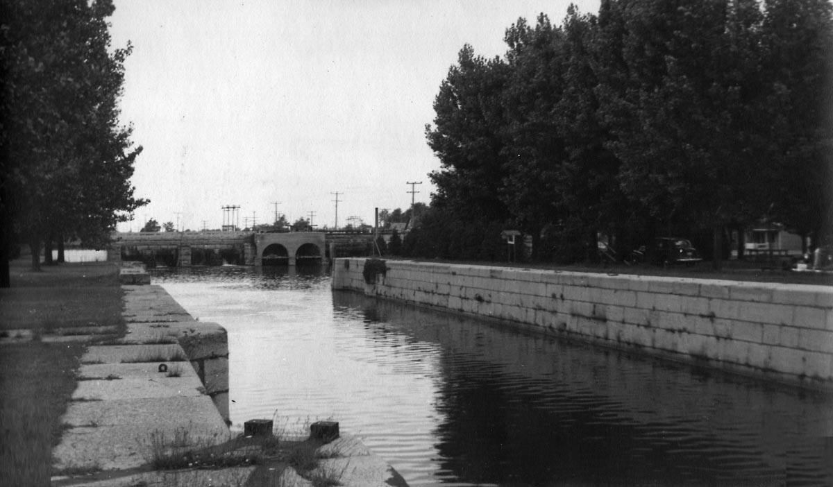
An aerial view of old Lock 25 and the two power plants located above this lock. The road to the left of the canal is old Highway 2.
SHFC010 - Looking Down Through Old Lock 25
Looking down through old Lock 25 from the weir.
1847 Old Canal Construction
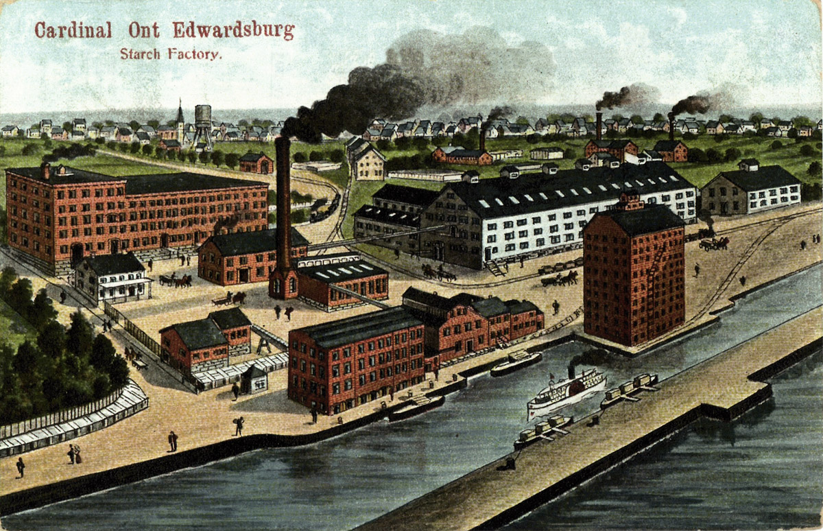
SHFC011: An artist's impression of the waterfront at Cardinal.
The Canada Starch Works began operating in 1860 with waterwheels grinding corn. The water came down a man made channel, or flume, from beside Lock 26 which was completed in 1846. This view shows one of the early versions of the grain elevator located on the Junction Canal which ran along the north shore of the river from Lock 25 at Iroquois to Lock 26 at Cardinal
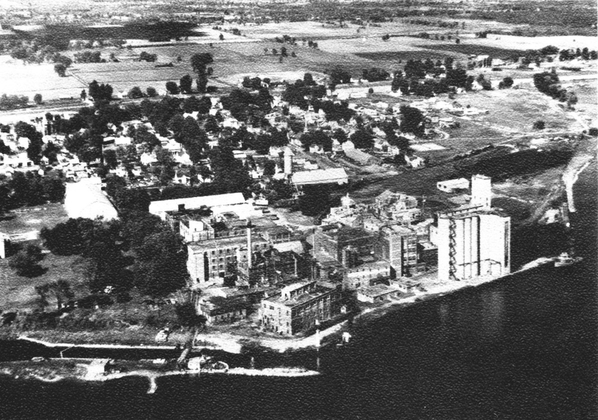
SHFC012: An aerial view of the Canada Starch elevator and Lock 26.
The canal bank was cut away after the big ditch was cut through the north side of the village of Cardinal. Once the freighters exceeded the length of Lock 26, there was no way for them to access the Canada Starch Elevator. Therefore the bank was taken away and canallers down bound for Cardinal would lock through Lock 28 above Cardinal and come to the elevator from the river. Old Lock 26 can be seen on the left foreground.