Galop Canal
The Galop Canal, which ran 7.5 miles from Iroquois to west of Cardinal, raised ships 15.5 feet and bypassed three sets of rapids. The rapids existed at Point Iroquois, Cardinal, and Galop Island where the main rapids ran by at 9 knots. The first canals were dug in two locations, the Iroquois Canal north of Point Iroquois up to Presque Isle, and the Galop Canal at Cardinal along the south and west side of that point. They were dug from 1844 through to 1846-47 with Iroquois being opened in October 1847 and Galop in November 1846. There was a mistake in the construction of the lock at Iroquois with only 8 feet of water over the sill instead of the required 9 feet. This was overcome by the extension during the years 1849-51 of the canal bank all the way up to Lock 26 at Cardinal from Presque Isle Island, west of Point Iroquois. This was called the Junction Canal and once completed there was enough water at Iroquois to ensure ships loaded to 9 feet could clear the upper sill.
|
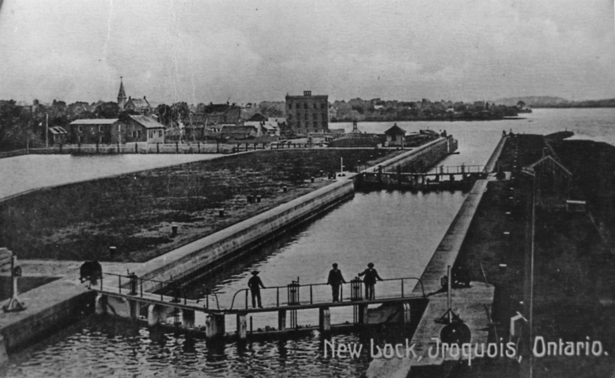
The original locks, Lock 25 at Iroquois and Lock 26 at Cardinal, 200 feet in length were bypassed with the construction of larger locks beginning in 1888 and opened in 1901. New Lock 25 at Iroquois was another “Fleet Lock” the same as Farran’s Point, being 800 feet long and able to take three full size canallers in one lift. At Cardinal, when the new enlarged canal was built, a deep ditch was dug straight through the hill. This proved to be very difficult as the rock became harder to drill the deeper the trench was dug. The first contractor went bankrupt due to the fixed price contract he had signed. However, once completed up to the new Lock 27, located 1 1/4 miles west of the swing bridge, the entire lift was transferred to Lock 25. Lock 28 was alongside and south of Lock 27 and called the “River Lock”. All downbound ships went back out into the main stream of the river here. The bank of the old canal where it passed by the Cardinal Starch plant was removed so that ships transiting down through Lock 28 could sail into the dock located at the plant. |
ST. LAWRENCE WATERWAY
- GALOP CANAL
Mile |
Description |
Dimensions |
Lift |
| 0.00 | Iroquois Village | ||
| 0.21 | Lock 25 - Iroquois | 800 x 50 x 16' 6" | 15.46' |
| 0.34 | Road Swing Bridge | ||
| 5.25 | C.N.R Swing Bridge | ||
| 5.83 | Gates Bay | ||
| 6.42 | Lock 27 - Guard Lock | 270 x 45 x 14' | 0.00' |
| 6.42 | Lock 28 - River Lock | 303 x 45 x 14' | 6.00' |
| 7.36 | West Entrance |
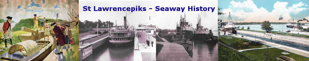
SHGC001: Map of St. Lawrence River from below Iroquois to the North Channel west of Cardinal
showing the location of the Galop Canal.
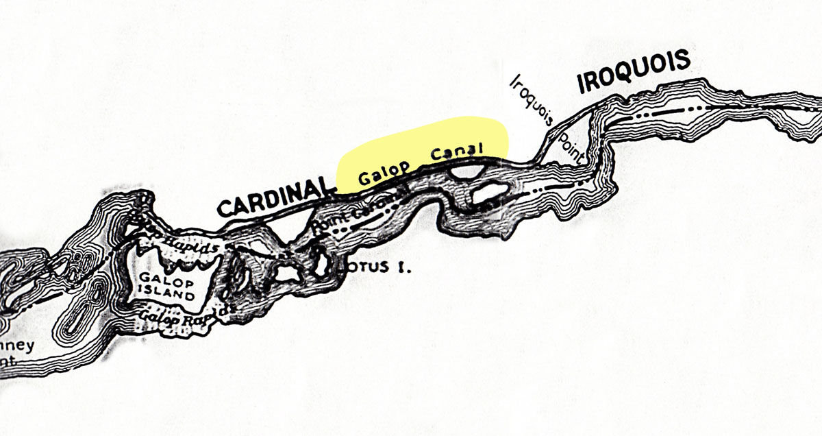
SHGC001a: 1920 Aerial view of Iroquois.
Looking east over the village of Iroquois. Lock 25 at the entrance to the Galop Canal is on the right.
National Archives photo.
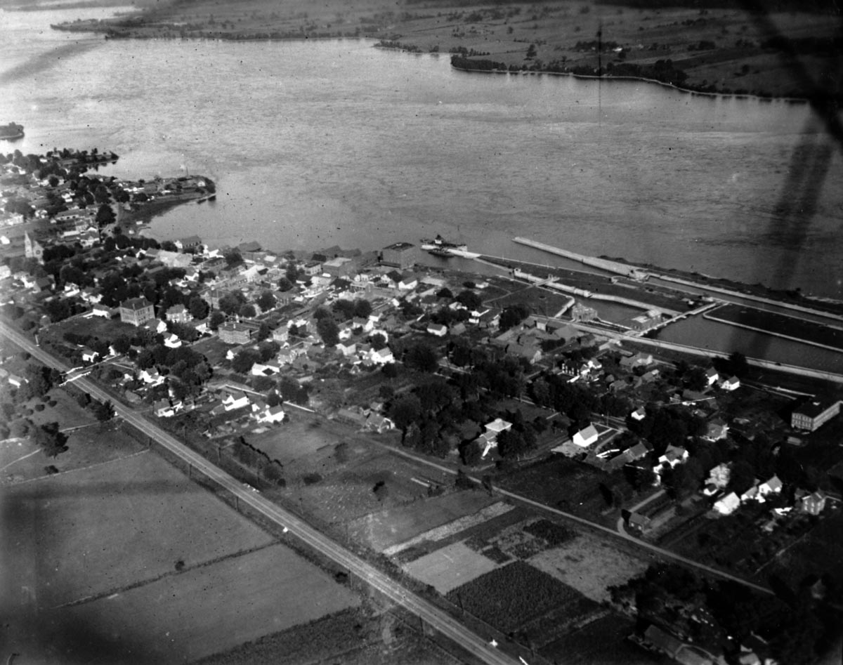
SHGC001b: 1920 Aerial view of Iroquois.
Looking west over Iroquois Point and Lock 25. Note the vessels out in the channel south of the lock. This is the summer of 1920 and salvagers are hard at work raising the wreck of the canaller T.P. PHELAN. A tug and barge secured at the east end of the approach wall of Lock 25 will also be used to take away wet grain from the wreck. The old lock 25 can be seen to the right of these vessels.
A weir was built above this lock along with two power houses, one of which opened in 1901. Of all the homes standing on Iroquois Point, there is only one left in 2012.
National Archives photo.
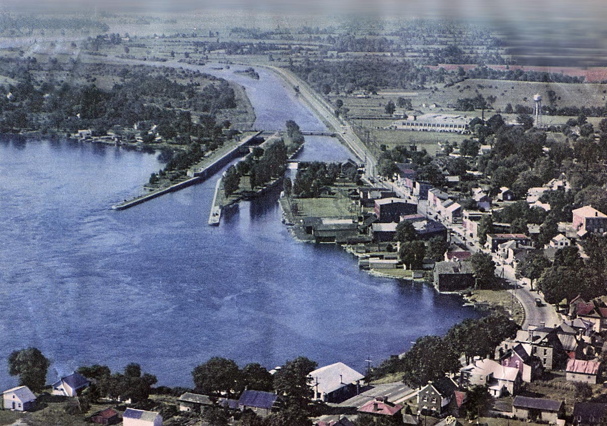
SHGC002: Aerial view of Iroquois in 1954.
The main street of the old village of Iroquois is on the right with Highway No. 2 running through it. The white water above old Lock 25 is water cascading over the weir. The 800 foot length of the new Lock 25 is quite evident in this view. It was divided into two chambers. If only one ship was going up, the chamber furthest up the lock would be used.
Photo: Toronto Star
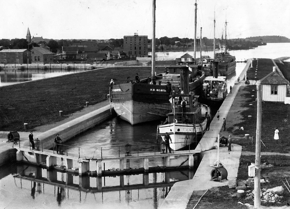
SHGC004: A fleet of vessels in Lock 25 at Iroquois.
The center set of gates in the lock are open to allow several vessels to be raised in the lock at one time. From the left the barge H.B. (H. Buckley) of the Ogdensburg Coal & Towing Co., tug GEO. D. SEYMOUR, a steam yacht, the barge FRED CARNEY, also of the O.C. & T. Co., and another unidentified barge. A steam barge waits below the lock. To the extreme left can be seen the two hydro-electric power plants. Photo taken from the swing bridge above the lock.
National Archives photo.

SHGC004a: Wooden steamer PERSIA departing Lock 25.
This vessel is typical of the wooden ships from the 19th century. At 144 feet long by 23 feet wide she was built for the passenger and freight trade. She would carry all manner of manufactured goods, livestock, produce from farms and occasionally grain in bulk. This is the early 1900’s.
SHGC005: Package freighter WINNIPEG at Iroquois.
The CSL canaller WINNIPEG is up bound at Iroquois and approaching the entrance to Lock 25. She was on the package freight trade from Montreal to Port Arthur.
Photo by R. W. Martin.
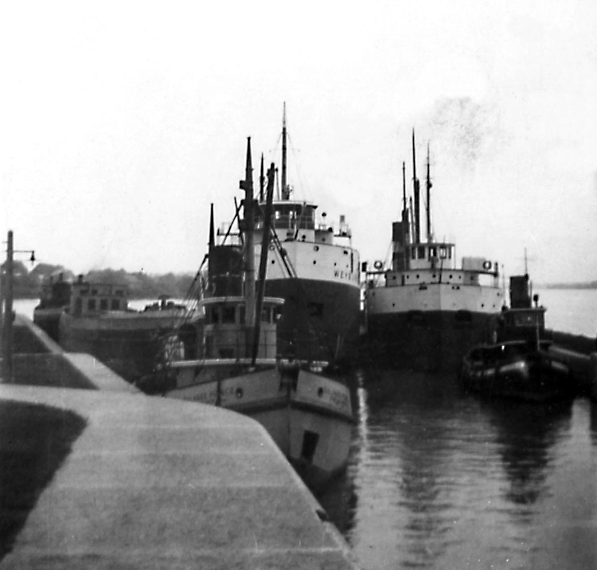
SHGC006: Ships waiting for Lock 25 to open.
An unknown blockade is holding up traffic in the Galop Canal. From the left is tug SALVAGE PRINCE in the foreground, canallers WEYBURN and ACADIAN, and unknown tug on the right.
Photo by Keith Beaupre.
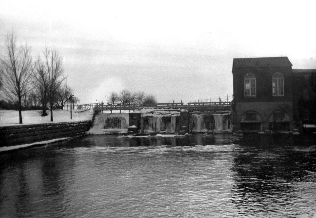
SHGC007: Weir and power house at Iroquois.
Built across the old canal is the weir for the hydro-electric power house. Just behind the photographer is the old Lock 25.
Photo by R. W. Martin.
SHGC008: Weir and waterfall at Iroquois.
A close-up of the weir that was built across the old canal at Iroquois. Today the water level is 3 to 4 feet over the wall the photographer is standing on.
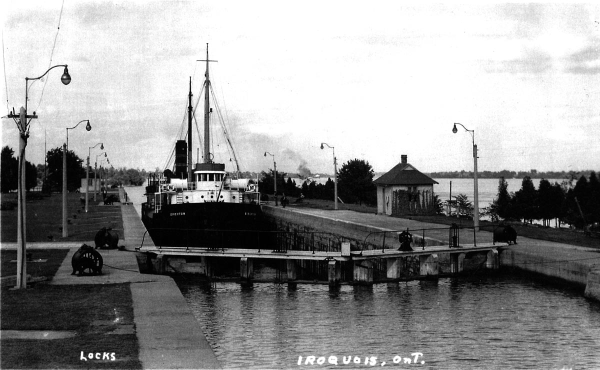
SHGC009: BIRCHTON in Lock 25.
The Gulf & Lake Navigation Co. canaller BIRCHTON is entering Lock 25. She will proceed up until her bow is only a few feet from the wooden gates.
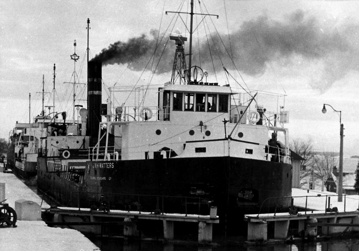
SHGC010: Three ships in Lock 25.
At the back of the line is GEORGE HINDMAN. The tanker COASTAL CARRIER is in the middle and the Misener canaller J.N. McWATTERS will lead the way out of the lock.
Photo by R. W. Martin.
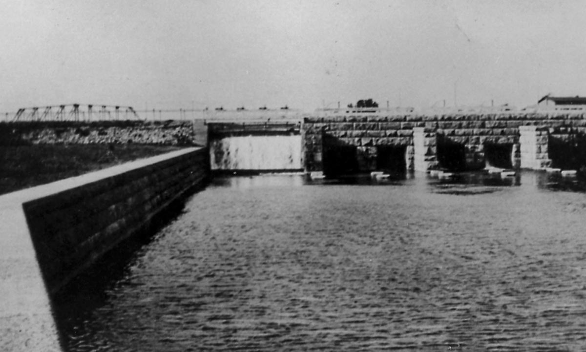
SHGC011: Lock 25 just completed.
With the first set of gates at the lower end of the lock open and the center set of gates closed, this view illustrates the difference in level from Iroquois to Cardinal. The lock chamber full of water is at the same level as the river west of Cardinal at Lock 27.
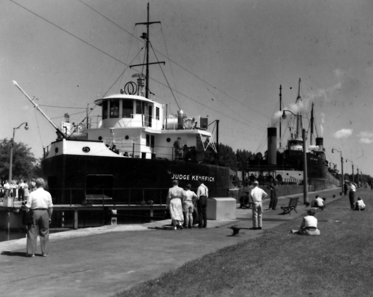
SHGC011a: Sunday afternoon at the canal.
The residents of Iroquois spend a pleasant Sunday afternoon watching the JUDGE KENEFICK and KEYBAR lock through the canal at Iroquois. Many sailors from the area worked on board canallers. It was a great adventure for a young man to go out sailing on one of these ships.
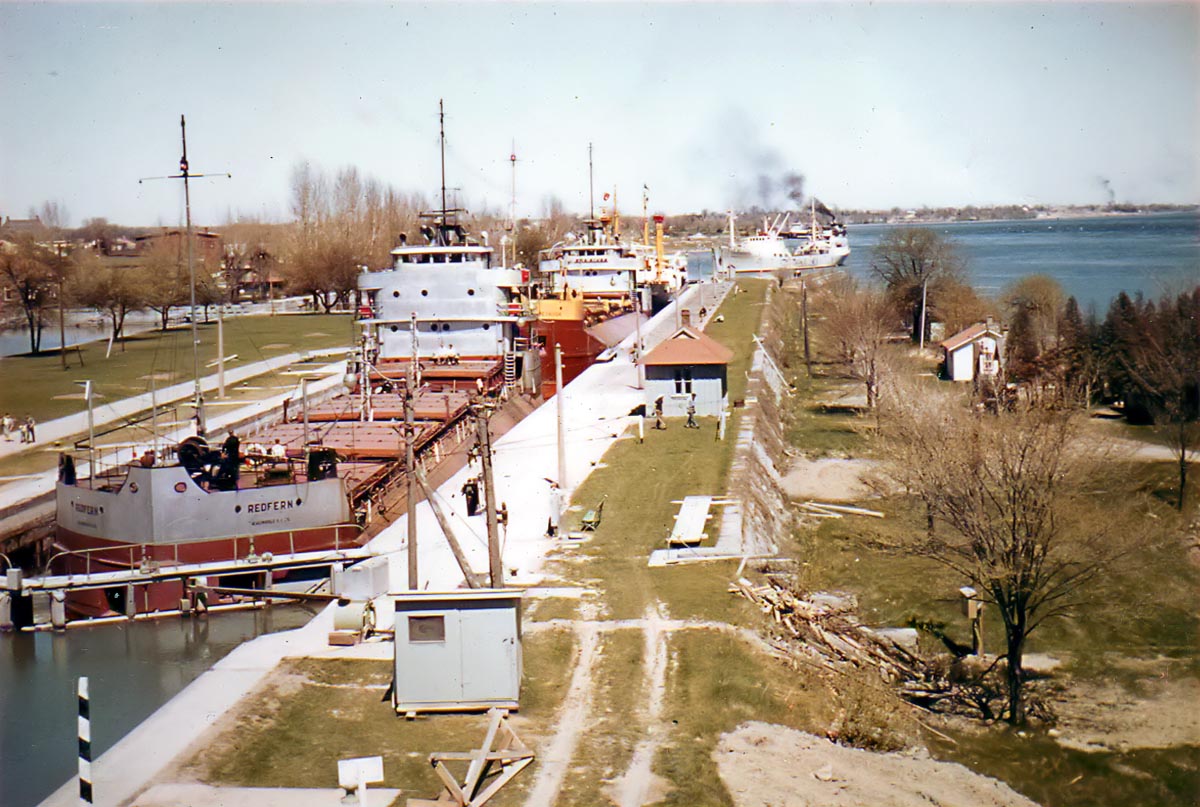
SHGC012: Freighters in Lock 25.
From the left Beconsfield Steamship Co. canallers REDFERN and REDRIVER, a salty behind them, the Norwegian Olsen & Ugelstad Fjell Line SVANEFJELL approaching the lower pier, and a Paterson canaller ashore in the background. This is 1958 and the village of Iroquois is being moved out of the way in preparation for the flooding for the Seaway.
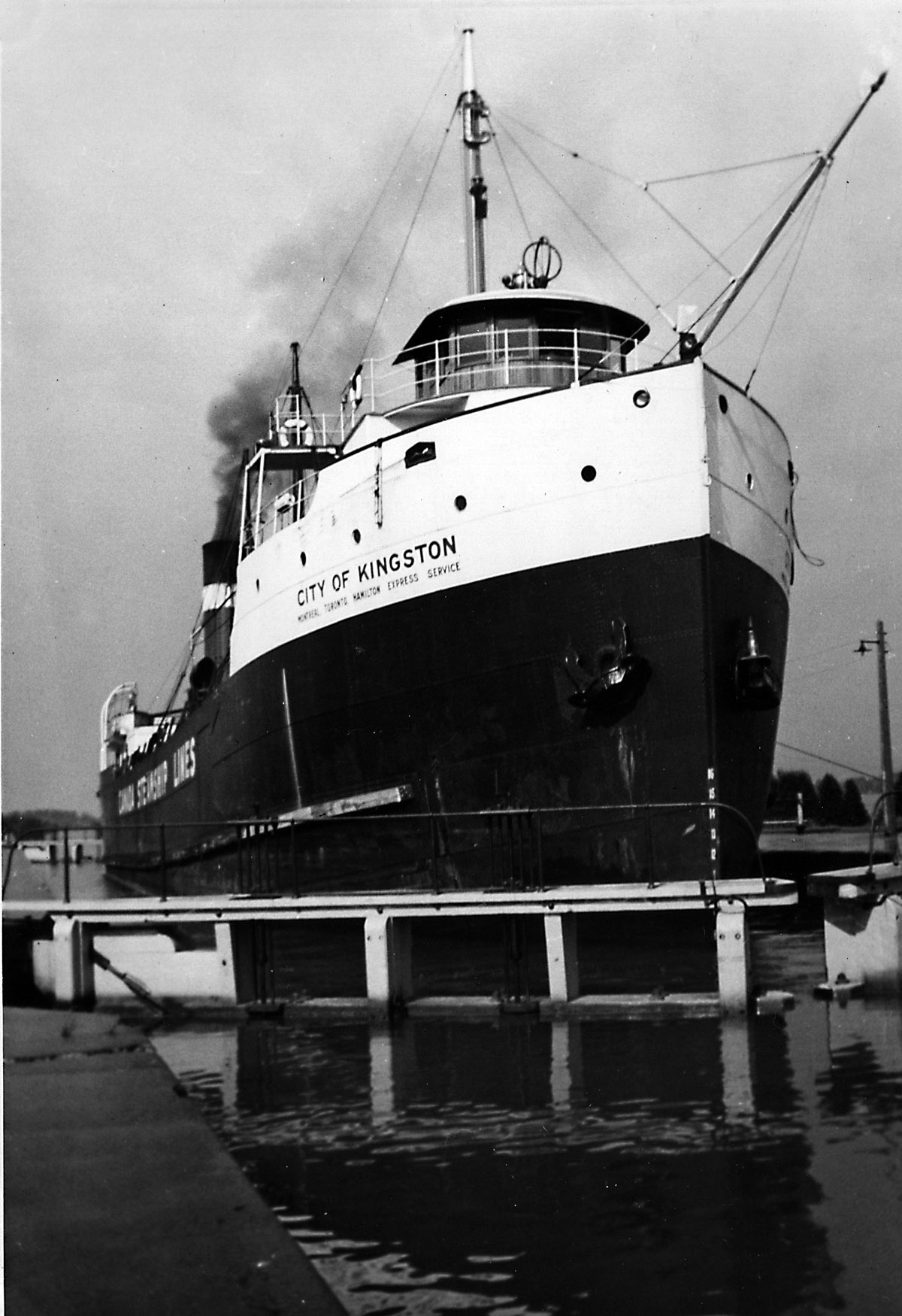
SHGC012a: CITY OF KINGSTON in Iroquois Lock.
There were four small CITY class ships (and even the later and slightly larger WINDSOR) built for Canada Steamship Lines in the 1920's solely for the Montreal-Toronto-Hamilton express service and they did not normally run above Lake Ontario. That's why they were built to the smaller dimensions (In this photo you can see the space between the hull and the wall.) - to ensure continuously fast turn-around on that scheduled and very time-sensitive service.
It was only in later years (the 1950s) that they ran farther up, and even then usually only as far as Windsor and sometimes Sarnia. It was only on very rare occasions that they went into Lake Superior, and then only if they had a special cargo commitment or if they were subbing when another of the regular upper lake package freighters was out of service for some reason. It was only KAMLOOPS, LETHBRIDGE, FERNIE, SASKATOON, WEYBURN, SELKIRK and WINNIPEG that were built to run through from Montreal to the Lakehead.
Jay Bascom; Photo by R. W. Martin.
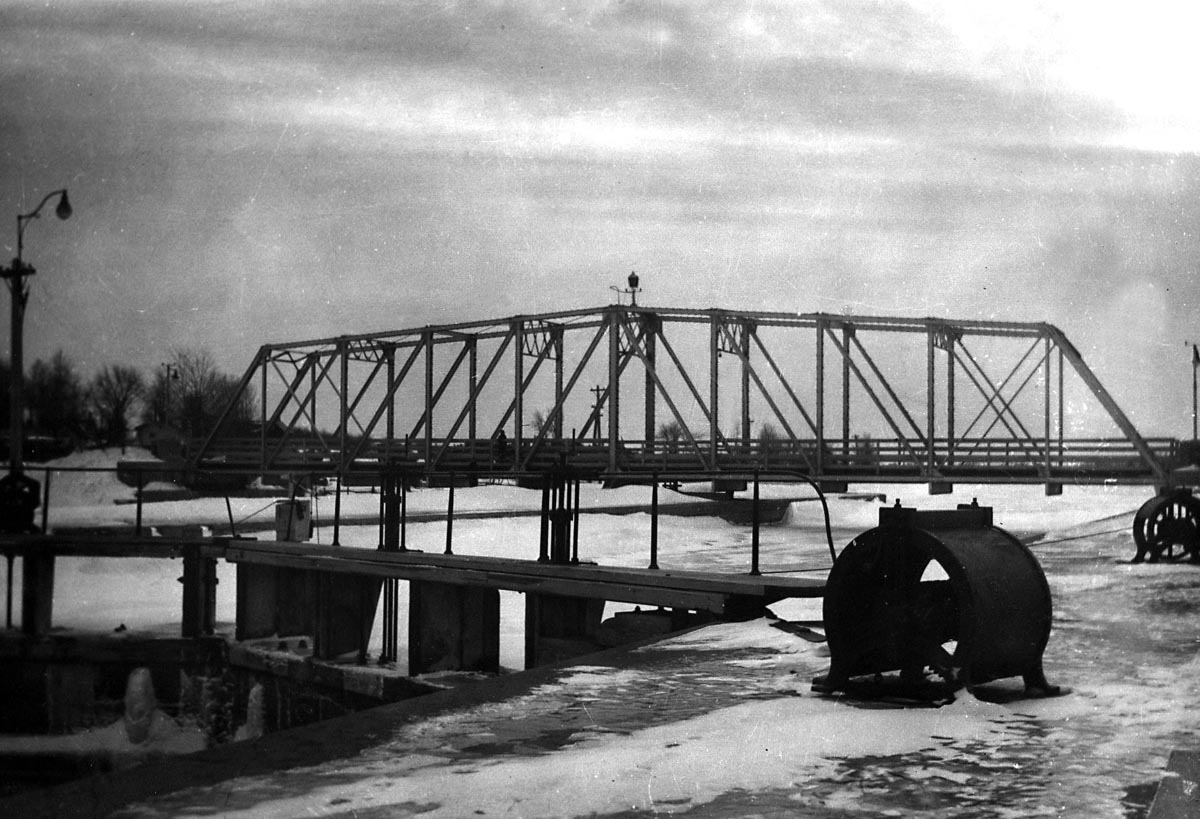
SHGC013: Swing bridge above Lock 25.
This bridge provided residents of the area access to Point Iroquois.
Photo by R. W. Martin.
SHGC014: Hand Operated Swing Bridge.
This view shows the hand operated road swing bridge at mile 0.34 immediately above Lock 25.
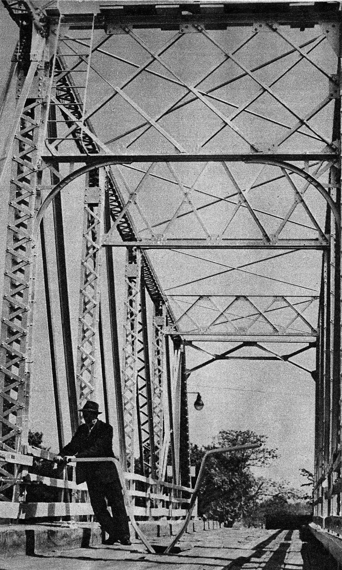
SHGC016: Passing Through the Draw of the Point Iroquois Bridge.
The Keystone canaller KEYVIVE is up bound out of Lock 25 on her way to the next lock above Cardinal.
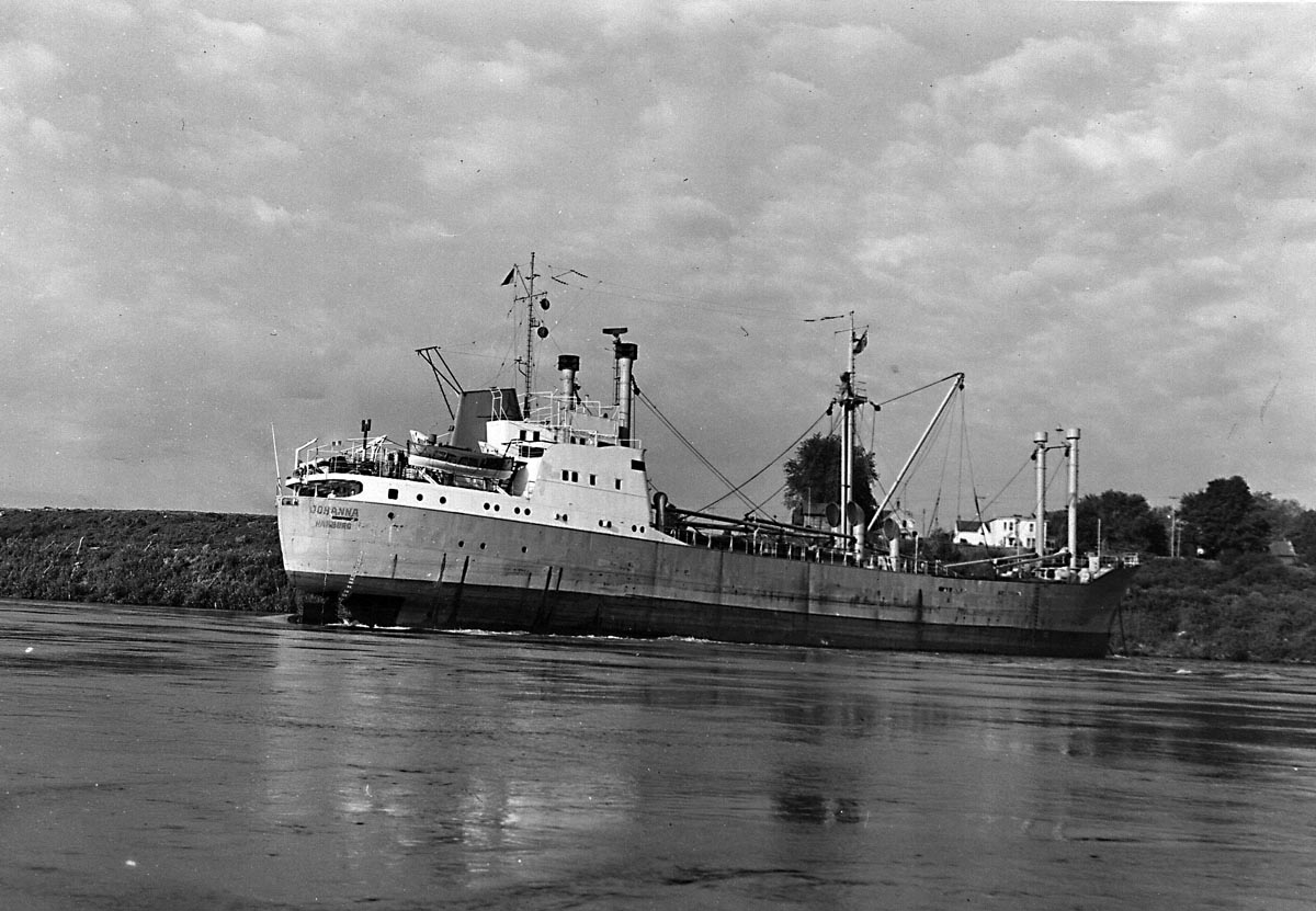
SHGC021: JOHANNA Ashore on Point Iroquois.
On August 26, 1955 the German freighter JOHANNA attempted to run up the rapids and go around Point Iroquois instead of taking the trip up the Galop Canal. She sheered out of the channel and ran hard aground. In the background to the left the area cleared for the construction of Lock 7 can be seen. To the right a few homes await removal which will take place in the near future. R. W. Martin photo.
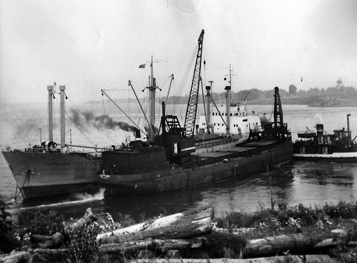
SHGC021a: Salvage of the JOHANNA.
The cargo lighter COBURG was brought to the scene to take off cargo. On September 3, 1955, the grounded ship was hauled off Point Iroquois and taken to the dry dock at Kingston for repairs.
The construction site of the future control dam can be seen in the background.
Photo by R. W. Martin.
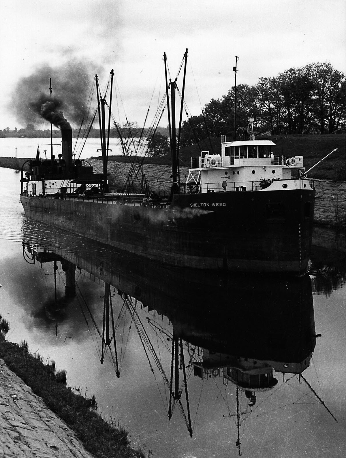
SHGC100: Canaller entering the deep cut at Cardinal.
The Upper Lakes & St. Lawrence Transportation Co. canaller SHELTON WEED gliding through the east entrance to the deep cut at Cardinal.
Photo by Gord Macaulay.
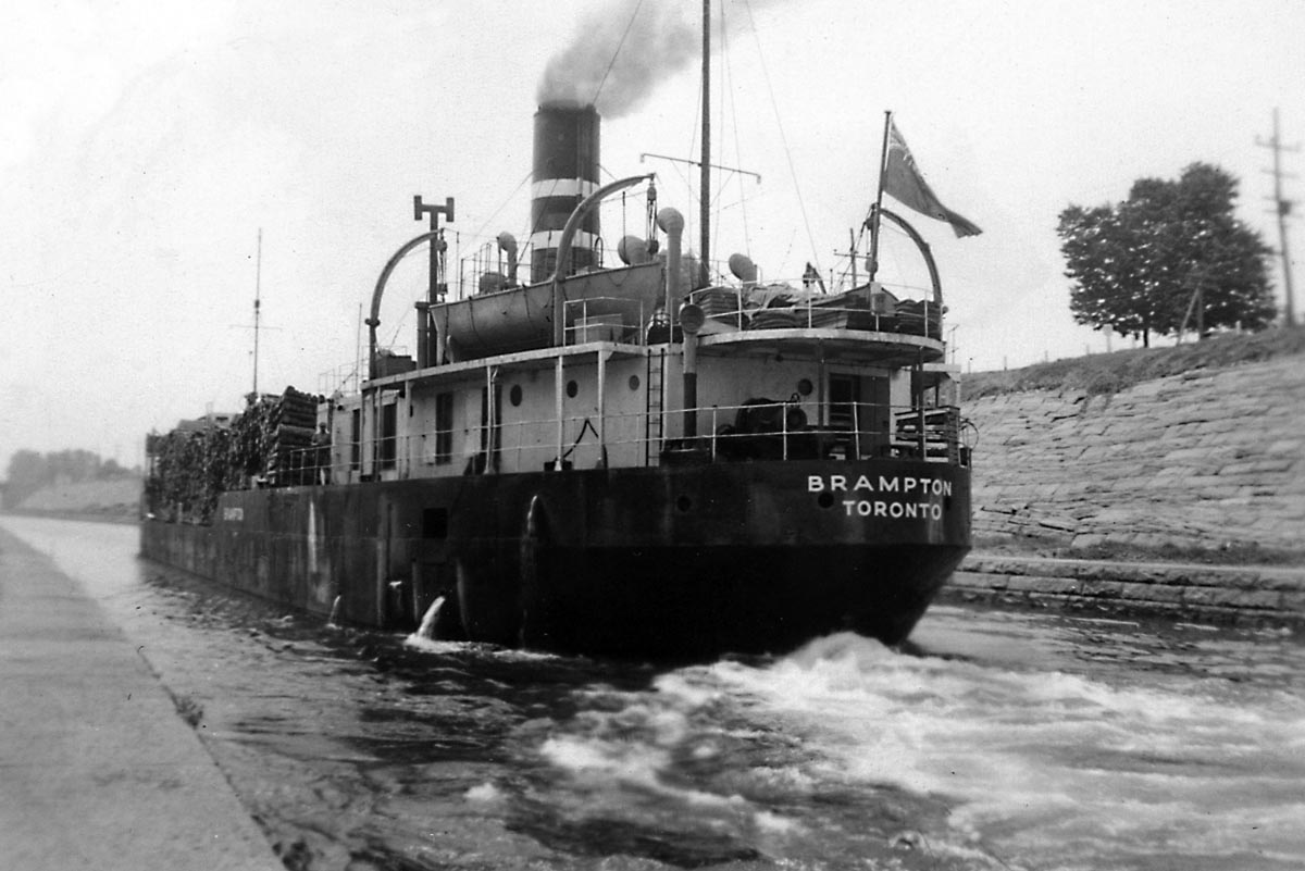
SHGC101: Sailing up the Cardinal Cut.
The Colonial Steamships canaller BRAMPTON is loaded with pulpwood on this trip up the Galop Canal.
Photo by Keith Beaupre.
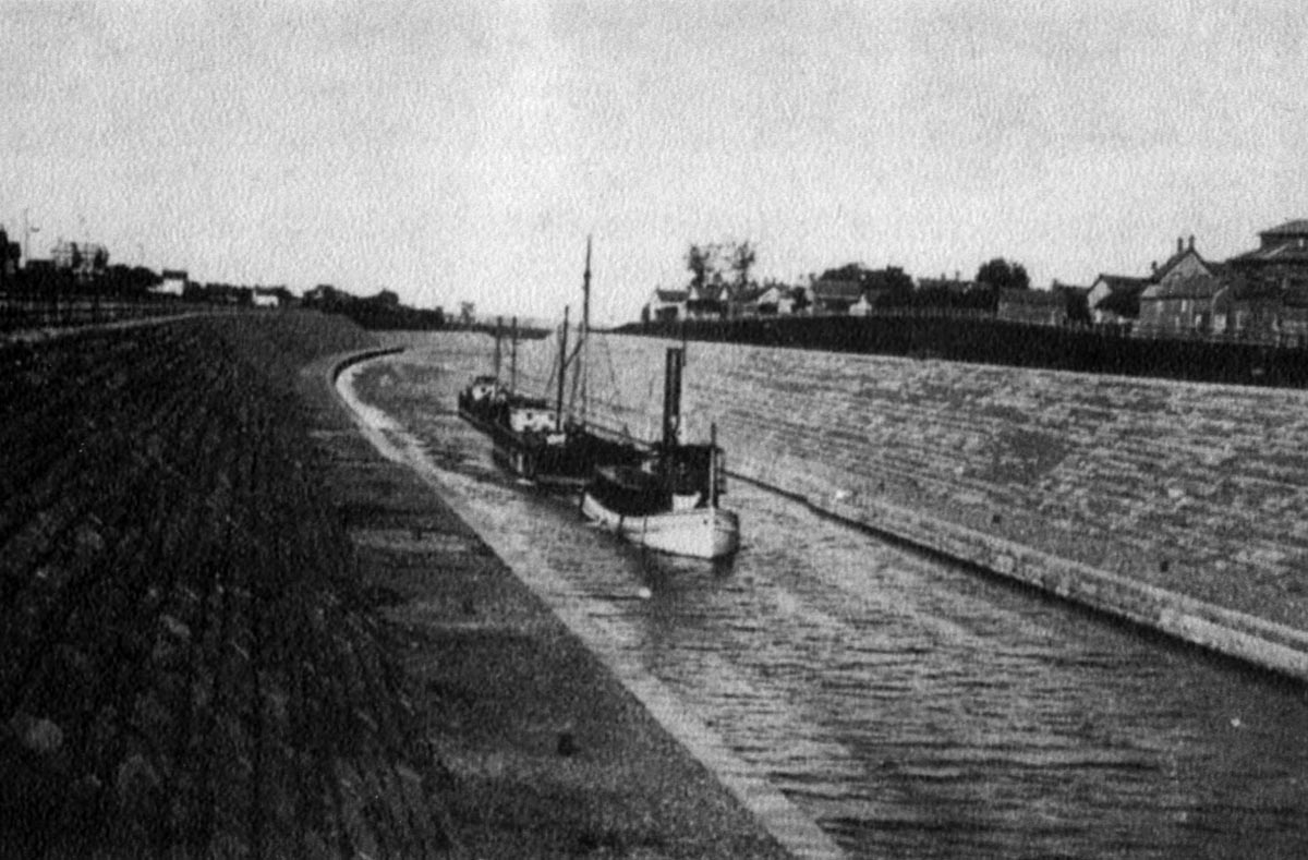
SHGC102: Towing barges in the Cardinal Cut.
A tug brings two barges up the canal. Note the neat stone walls. Today they are collapsing down into the abandoned canal.
SHGC103: Nearing the Bridge in the Cardinal Cut.
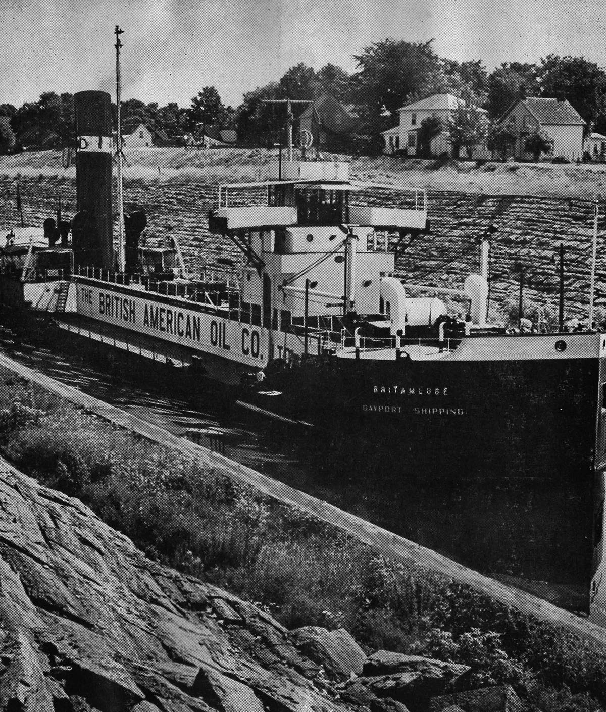
Tanker BRITAMLUBE upbound at Cardinal. This is referred to as the "Cardinal Cut".
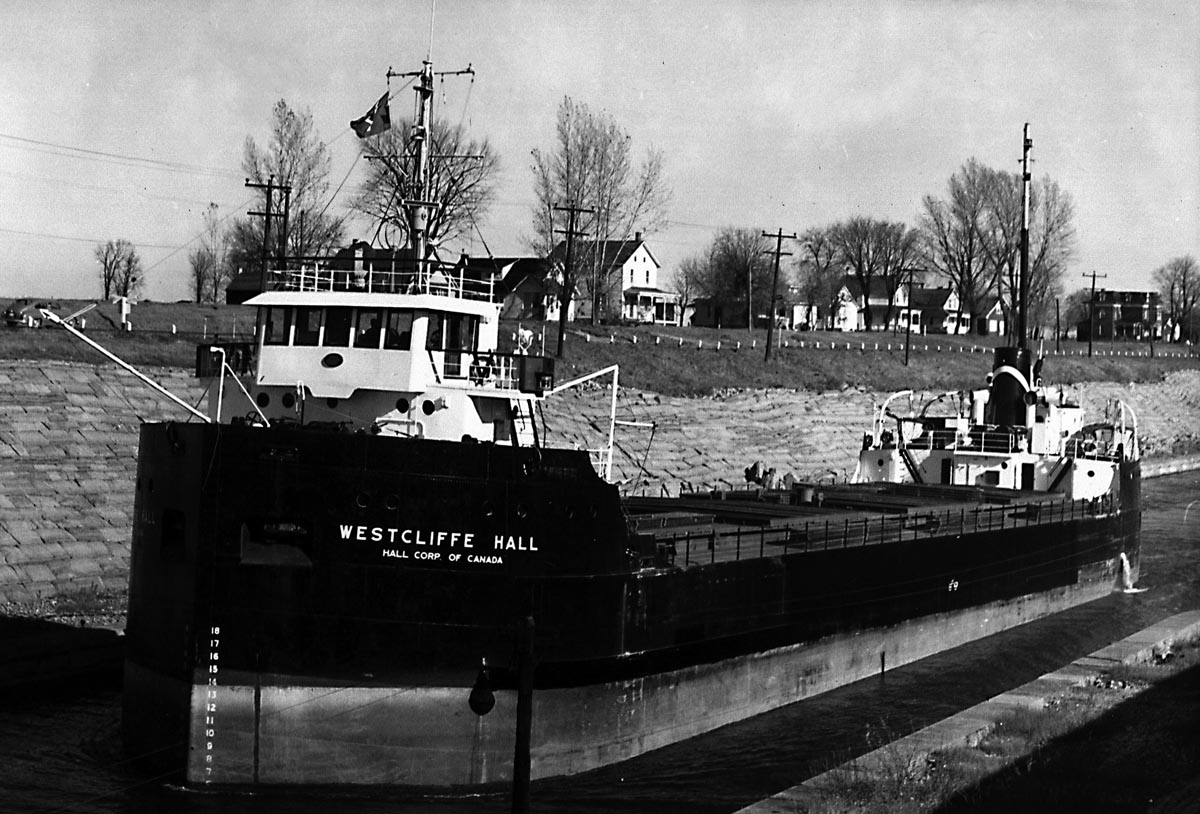
SHGC104: WESTCLIFFE HALL approaching the bridge.
The diesel powered Hall Corporation canaller had an all welded hull. There were several canallers lost to enemy action out on the Atlantic during the war. Even though it was known the Seaway would be built, the demand for additional tonnage could only be satisfied by building new ships in the early 1950’s.
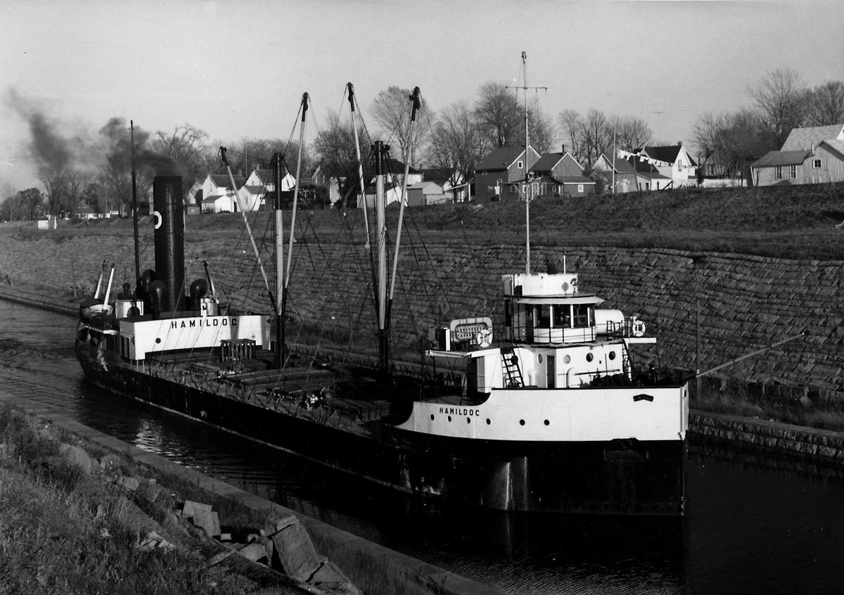
SHGC105: Steam canaller HAMILDOC approaching the draw of the bridge.
The Paterson Steamships canaller HAMILDOC dates from 1928. Within one year after the opening of the Seaway, she was retired. Sold for scrap in 1961, she joined a parade of steam powered canallers which suffered this fate at that time.
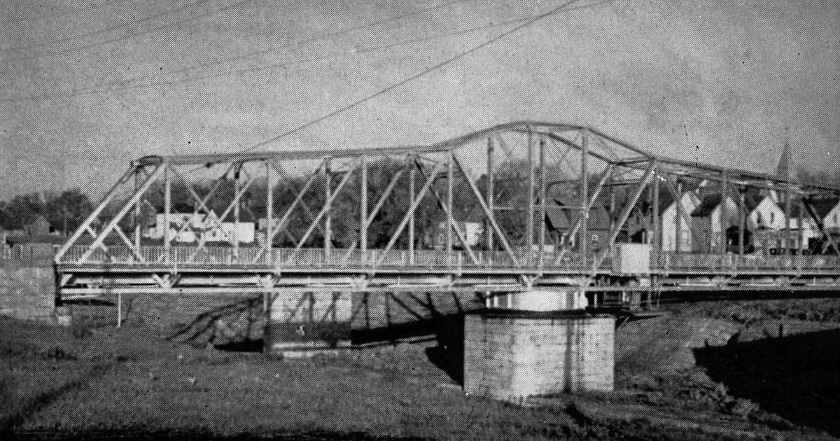
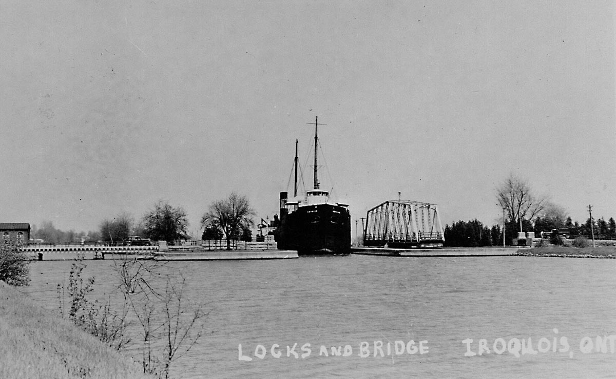
SHGC106: Cardinal’s Swing Bridge.
Cardinal Swing Bridge - Mileage 5.25. This bridge carries both road and a C.N.R. freight line to Cardinal. Looking east from the north side.
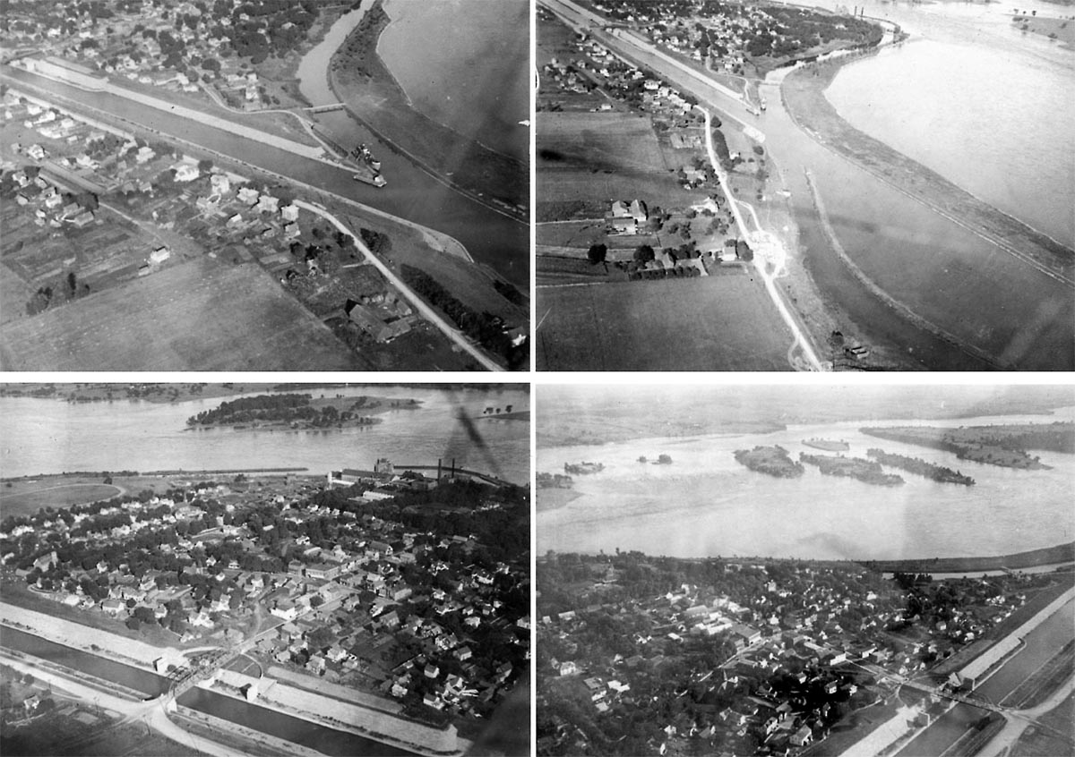
SHGC109: Aerial views of Cardinal in 1920.
Top left: the junction of the first and second Galop Canals can be seen at the west end of Cardinal. From where the bridge crosses the old canal the street now runs almost straight north across the new canal as it has been filled in to this area.
Bottom left: The swing bridge over the new canal and along the river the old canal bank follows the river around the south side of the town. To the right of the twin smokestacks the entrance to Lock 26 can be seen.
Bottom right: Looking south over the west end of Cardinal. The new Seaway shipping channel will be dug right through the middle of the group of islands out in the river.
Top Right: Another view of the junction of the old and new canals at the west side of Cardinal. The old canal bank is cut through by the new canal which continues west to Lock 27. Old Lock 26 is to the right of the twin smokestacks at the top center of the photo. It is now completely buried under a gas fired co-generation plant.
National Archives photos.
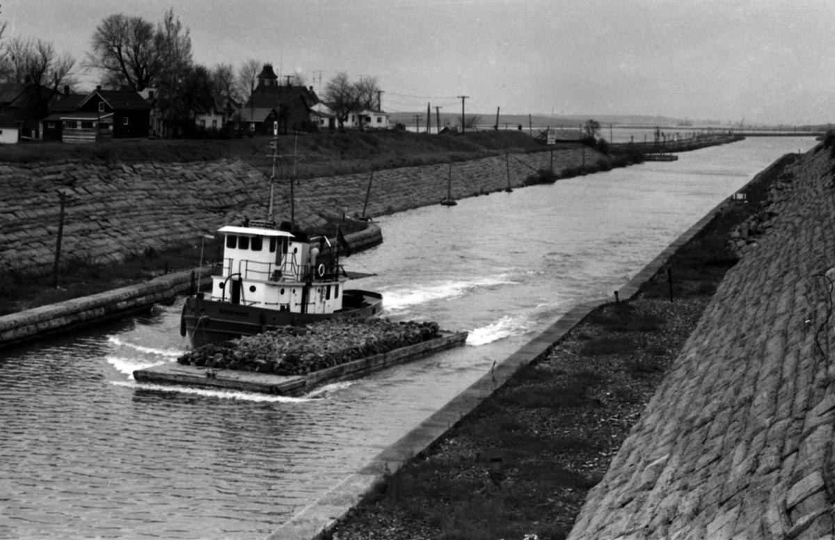
SHGC110: West End of the Cardinal Cut.
The tug STORMONT pushing a barge loaded with rock heading down the Galop Canal. This area of the Cardinal Cut is now filled in.
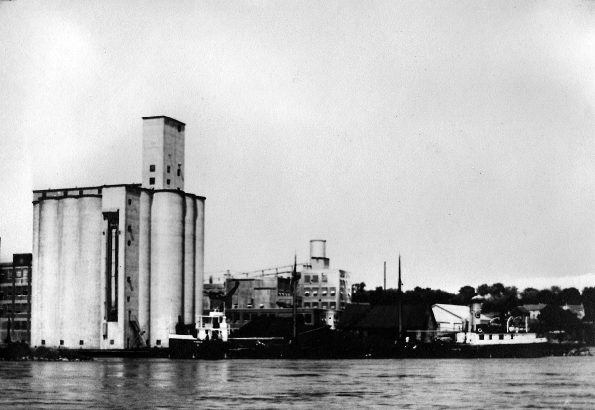
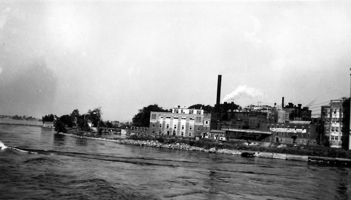
SHGC111: Canada Starch Co. Dock and Mill.
This photo shows the plant and elevator of the Canada Starch Co. This elevator fronts on the old Cardinal Canal which followed the river shore around the town. A section of the dyke has been removed to enable vessels to approach the dock from the river. Steamer CASCO berthed.
Ivan Brookes photo, July 1939.
SHGC112: Old Lock 26 and the Canada Starch Co. Mill.
This photo shows the lower gates of Lock 26 on the abandoned section of the canal. The Canada Starch Co. elevator appears at the extreme right of the photo.
Ivan Brookes photo.
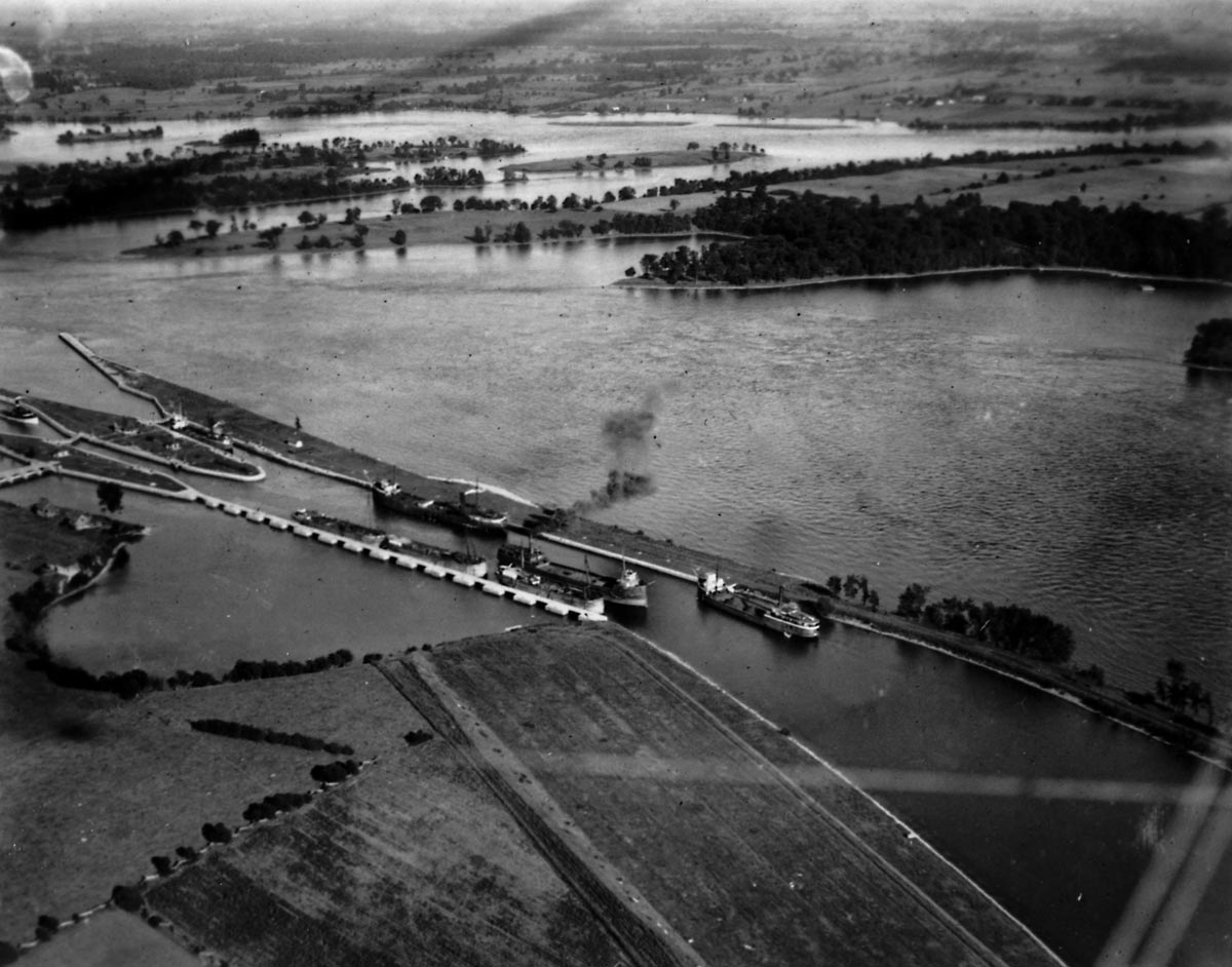
SHGC113: Aerial view of Locks 27 & 28 in 1920.
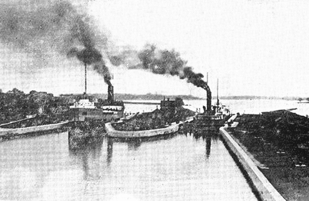
From the left: The weir which allows water to flow freely into the Galop Canal, a tug waits below Lock 27 for her turn, Lock 27 sits empty as the upper gates are in the process of closing, a ship has just entered Lock 28 down bound. There are two more ships waiting above Lock 28 for their turn to lock down into the “River Lock”. Also above Lock 27 can be seen a CSL steamer passing up bound past a fleet of three barges secured above the lock and waiting for a tow up the river.
National Archives photo.
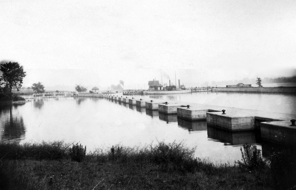
SHGC114: Locks west of Cardinal.
From the left: The weir, Lock 27, the freighter CARROLLTON in the River Lock (Lock 28).
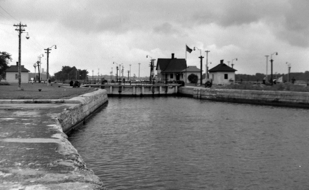
SHGC117: Lock 27 upper entrance.
Galop CANAL - Guard Lock 27 - This Lock measures 270 x 45 x 14' and has no lift. It is situated 6.42 miles above Iroquois - Photo taken Aug 4, 1954.
Ivan Brookes photo.

SHGC118: Lock 27 and Lock 28 looking east from above.
The upper entrance to the Galop Canal with Guard Lock 27 on the left and River Lock 28 on the right as seen from above. Downbound ships would use Lock 28 to exit the canal back into the river.
SHGC119: Ships in the Locks 27 & 28.
An upbound ship on the left is departing Lock 27 and the down bound ship on the right is lowering in Lock 28.
SHGC120: Canaller departing the River Lock.
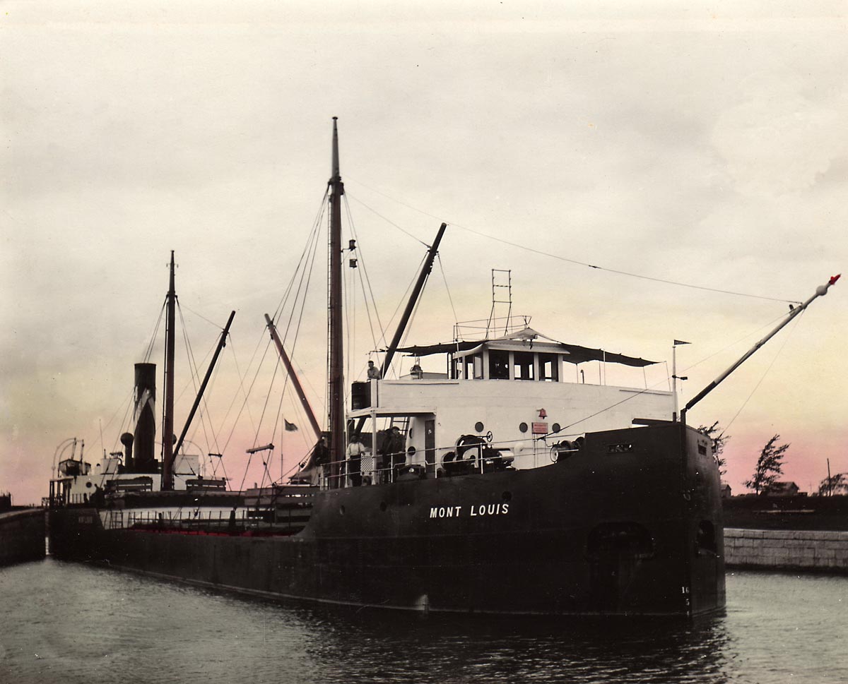
The Halco canaller MONT LOUIS is heading back out into the river after using the North Channel and Lock 28 to bypass the first stage of the Galop Rapids. She became a war loss on May 8, 1942 when torpedoed by U-162 in the Caribbean off the coast of Guyana, South America.
George Deno photo.
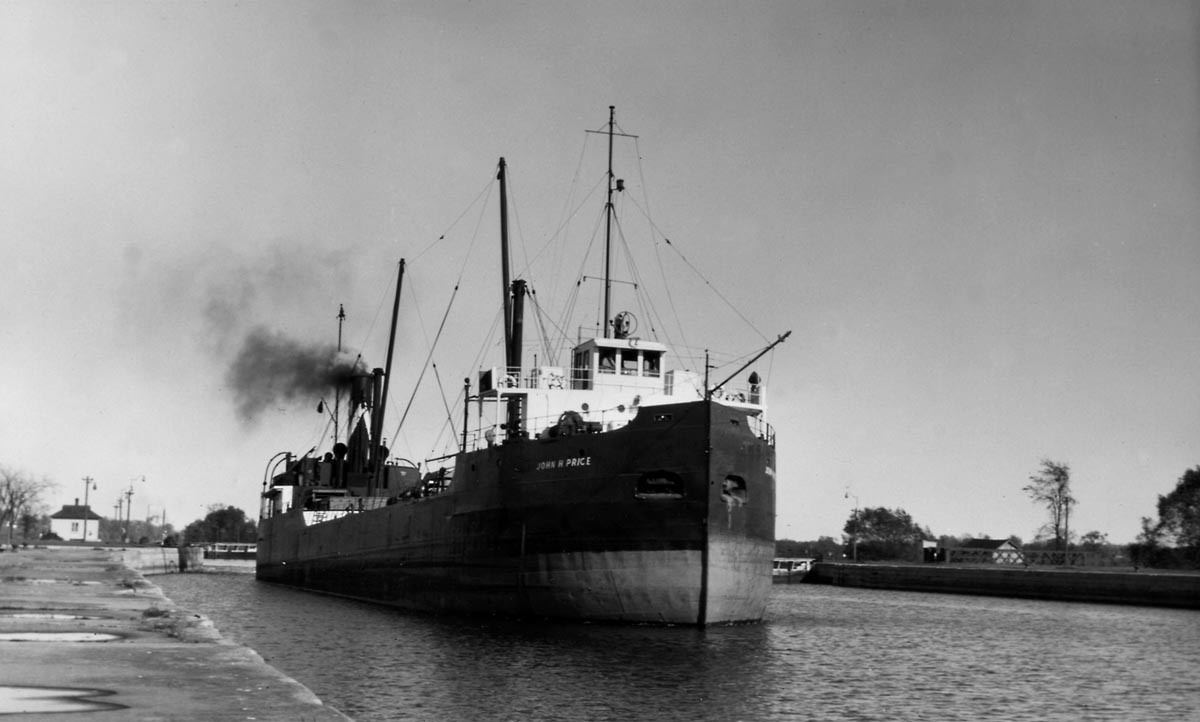
SHGC121: JOHN H PRICE up bound out of Lock 27.
The Halco canaller JOHN H PRICE is riding light out of Lock 27 as she heads up the river. On May 1, 1956, she had the honor of carrying the first load of cement to the site of the construction of the Moses Saunders power dam at Cornwall.
Jim Kidd photo.
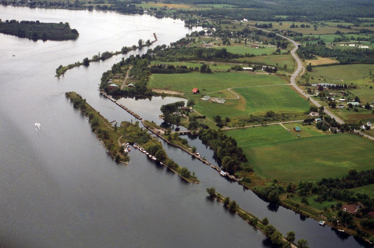
SHGC122: Aerial view of Lock 27 and Lock 28 – post seaway.
Yachts are gathered at the lower entrance to Lock 28. It has been filled in after the canal was abandoned. To the right is Lock 27 with a foot bridge across it. The canal banks above and below the locks have been breeched to allow flow of water through the old canal and give access for pleasure craft.
Photo by Ron Beaupre.
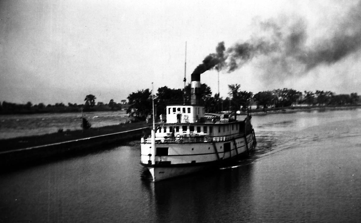
SHGC124: BRITANNIC down bound into Lock 28.
Steamer BRITANNIC downbound into Lock 28. The paddlewheeler BRITANNIC was on a run up and down the canal carrying passengers and package freight from town to town along the way. The fast running Galop Rapids can be seen on the left.
SHGC125: Meeting a ship in the canal.
Tanker BRITAMLUBE downbound above Locks 27 & 28. Galops Island to the left.
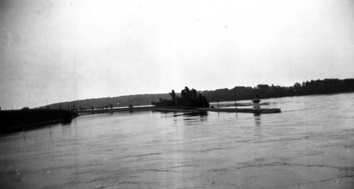
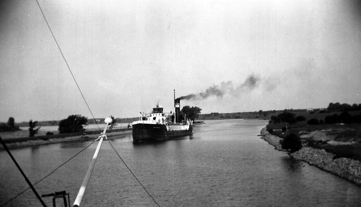
SHGC126: West Entrance to Galop Canal.
The light on the south pier guided ships at night to the entrance of the Galop Canal. Adams Island is seen to the right.
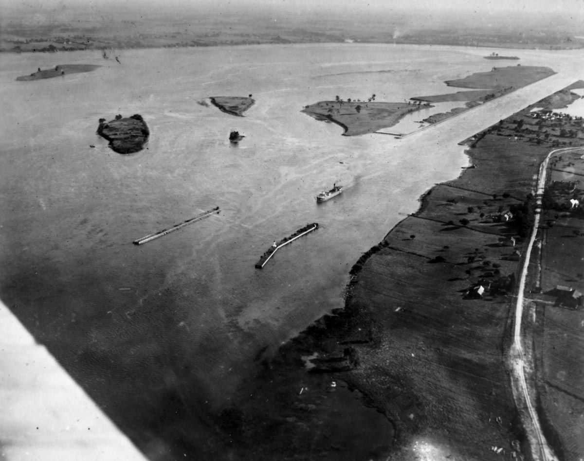
SHGC127: The North Channel.
The North Channel as viewed from the air in 1920. It was built during the time of the construction of the new Galop Canal that opened in 1901. It was 300 feet wide and 16 feet deep with limestone walls on both sides. Ships travelled 2 1/3 miles from the entrance, seen at the top right, to the two dykes being approached by the down bound ship.
National Archives photo.