Lachine Canal
The need of a canal to bypass the rapids which ran from Lake St. Louis 46 feet down to Montreal Harbour was realized by early settlers and merchants in Montreal. Sir George Prevost, the new Governor, created and passed an Act in 1815 for the work of building a canal to begin. The first few attempts failed. In 1821 the government of Lower Canada arranged for contractors to begin construction of the Lachine Canal. The first sod was turned on July 17, 1821 and it is believed that some vessels were able to transit the new canal in 1824. There were six locks, dimensions being 100 feet by 20 feet with 5 feet over the sills. After the union of the two Canadas in 1841 and the establishment of the first Board of Public Works, the first of two reconstructions began in 1843. Of course the traffic through the canal could not be interfered with and this slowed the rebuilding process.
|
Therefore it was not until 1848 that five new 200 foot locks were opened. They were 45 feet wide and provided 9 feet of water over the sills. The canal between the locks was also widened and deepened in sections with stone walls lining both sides of the canal. No sooner had this new set of locks and canals been completed were they also declared obsolete. It was difficult for the canal planners to keep up with the constant change and development of shipping on the oceans of the world and the Great Lakes. The Lachine Canal was the first to be rebuilt with the work beginning in 1863 and continuing with many interruptions until 1884. Then the old Locks 1 & 2 of 1848 were enlarged and deepened so that they were twins of the new locks. This set the standard for the next set of canals as the dimensions of 270 feet by 45 feet by 14 foot draft were duplicated throughout the entire system including the Welland Canal. During this time period a Canals Commission was established and it produced a report in 1871. This report recommended that a complete new system be built to the dimensions of the new Lachine Canal. |
ST. LAWRENCE WATERWAY
LACHINE CANAL - Mileage - 8.74 - Total Lift - 46.24 ft.
Mile |
Description |
Dimensions |
Lift |
| 0.00 | Montreal Harbour | ||
| 0.04 | Locks No. 1 (South Lock) | 270 x 45 x 17'6" | 12.96' |
| .................... (North Lock) | 270 x 45 x 15'10" | ||
| 0.10 | Basin No. 1 | ||
| 0.21 | Locks No. 2 (South Lock) | 270 x 45 x 17' | 13.50' |
| ..................... (North Lock) | 270 x 45 x 15'10" | ||
| 0.28 | Blacks Bridge - Swing - Prince St. | ||
| 0.47 | Basin No. 2 | ||
| 0.62 | C.N.R. Vertical Lift | ||
| 0.67 | Wellington St.Tunnel | ||
| 0.76 | Water Works Tunnel | ||
| 1.16 | Locks No.3 (North Lock) | 270 x 45 x 14' | 9.02' |
| "St. Gabriel" (South Lock) | 200 x 45 x 9' | ||
| 1.23 | Seigneurs St. Swing Br. | ||
| 1.70 | Charlevois St. Swing Br. | ||
| 1.85 | Atwater Ave. Swing Br. | ||
| 2.07 | C.N.R Swing Br. | ||
| 2.39 | St. Pierre River Culvert | ||
| 2.99 | Locks No.4 (North Lock) | 270 x 45 x 14' | 9.26' |
| "Cote St. Paul" (South Lock) | 200 x 45 x 9' | ||
| 3.27 | Cote St.Paul Rd. Swing Br. | ||
| 6.27 | Rockfield Hyway Bascule | ||
| 6.85 | Rockfield C.P.R. | ||
| 7.50 | Locks No. 5 (South Lock) | 270 x 45 x 14' | 1.50' |
| "Lachine" (North Lock) | 200 x 45 x 9' | ||
| 7.56 | Lower Lachine Rd. Swing Br. | ||
| 8.74 | Lake St. Louis |
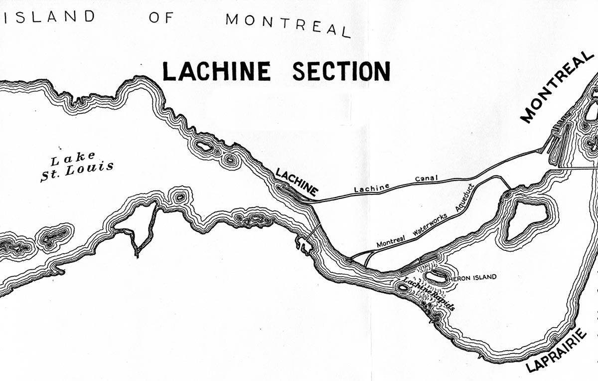
SHLC001: Lachine Canal Map
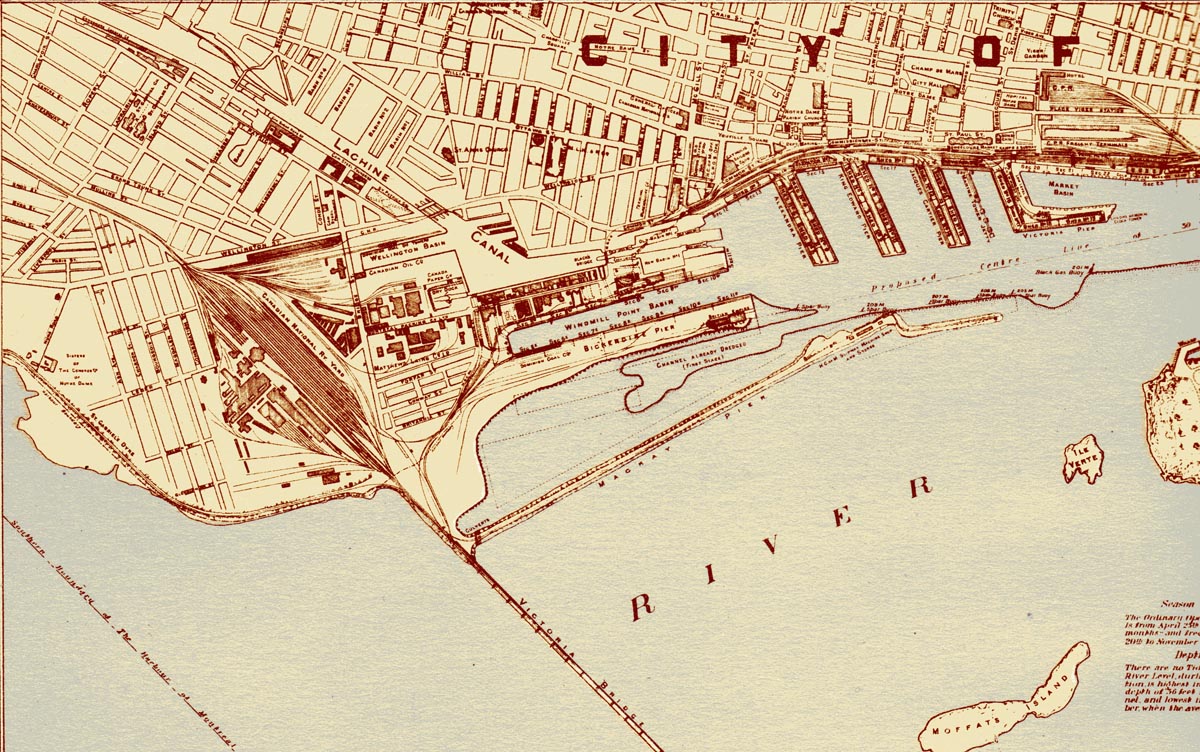
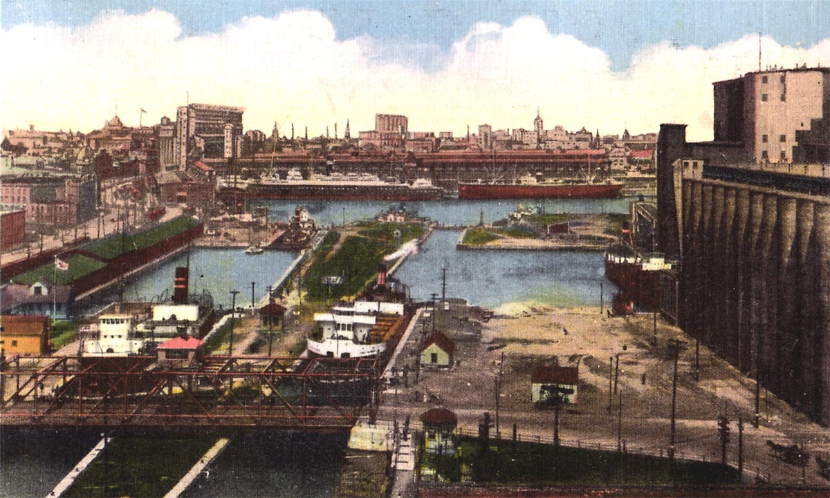
SHLC002: General Plan of the entrance to the Lachine Canal drawn in 1909
In the center of the drawing, above the Windmill Point Basin, are the twin locks 1 & 2. To the left of these locks can be seen the bridge where the CN Rail line crosses the canal. Further to the left up the canal is Lock 3 at St. Gabriel.
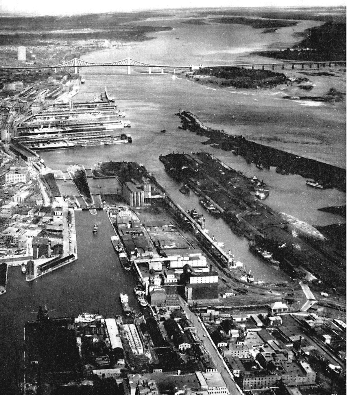
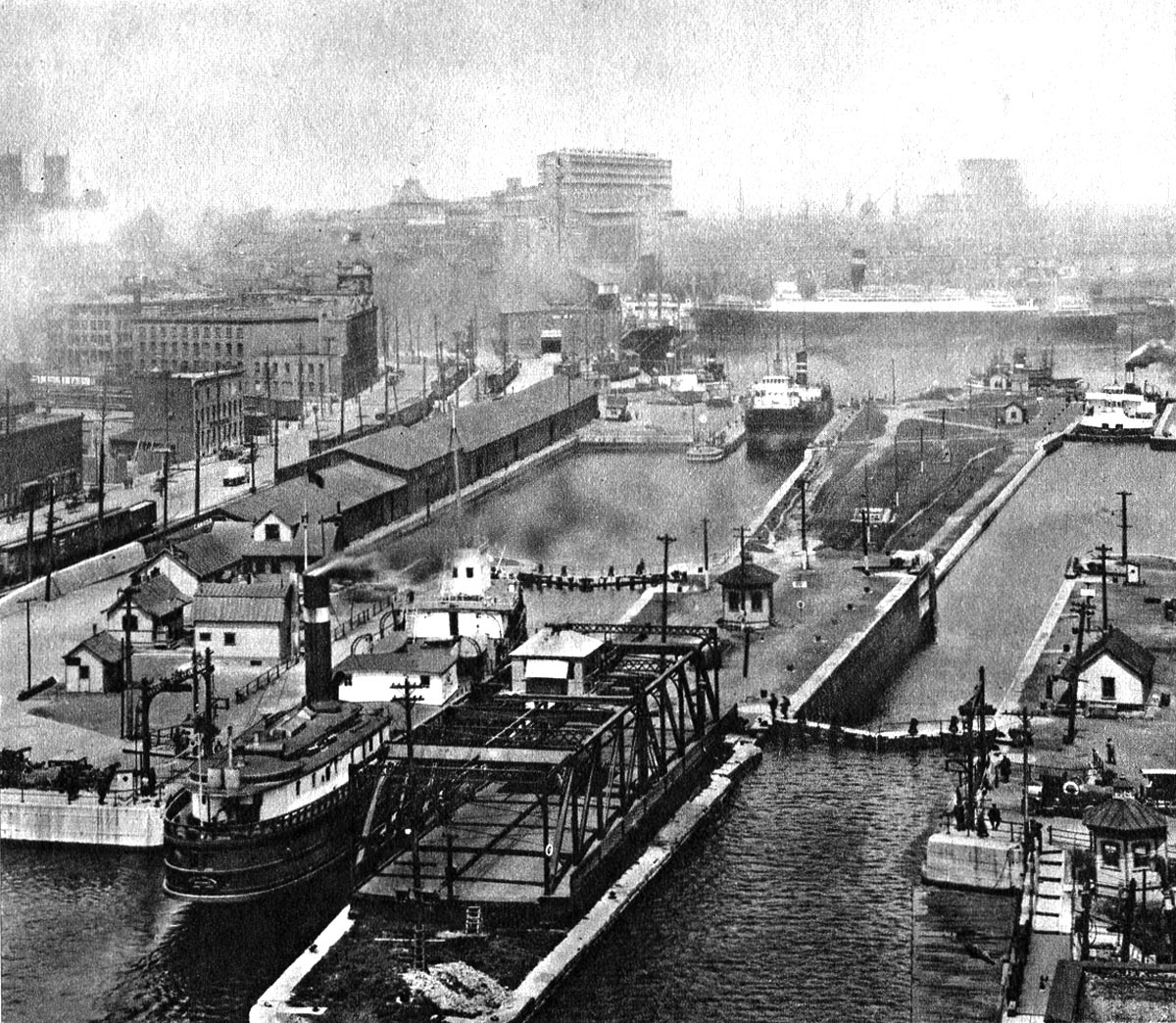
SHLC003: An aerial view of the Lachine Canal at the point where it exits into Montreal Harbour.
Locks 1 & 2 are seen center left with grain elevators to the right of the basins 1 & 2. Windmill Point Basin to the center right is flanked by the loading dock for grain on the left and the huge coal yard located on Bickerdike Pier to the right. A drydock and shipyard is located in the south west corner of Basin No. 2.
Date: 1931
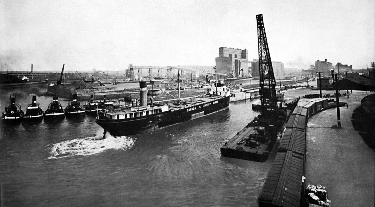
SHLC004: The Canada Steamship Line package freighter entering Lock 1
is either SELKIRK or her twin sister WINNIPEG.
The fleet of tugs are some of the Sincennes McNaughton Line. In the background there is a salt water ship in the south Lock 1 and an Eastern Steamships canaller is docked at Elevator B in Basin No. 1.
Photo from “The Growth of a Great Port 1927.”
SHLC005: Basin No. 1 with a Misener canaller unloading grain at Elevator B.
The Dutch freighter PRINS WILLEM V is seen entering Lock 1 South. She had the misfortune of sinking in Lake Michigan after a collision off Milwaukee in October 1954. The CSL canaller on the left is GRAINMOTOR.
Gord Macaulay photo.

SHLC006: CHEMONG of the Carter Wood company
passing the CSL canaller OXFORD unloading grain at Elevator B.
The CHEMONG is transiting Basin No. 1 on her way from Lock 1 South to Lock 2 South.
LACHINE CANAL - South side of Basin No. 1 with OXFORD unloading at Elevator B and the CHEMONG, of the Carter Wood company, approaching Lock 2.
Date is from 1926 to 1934 time period.
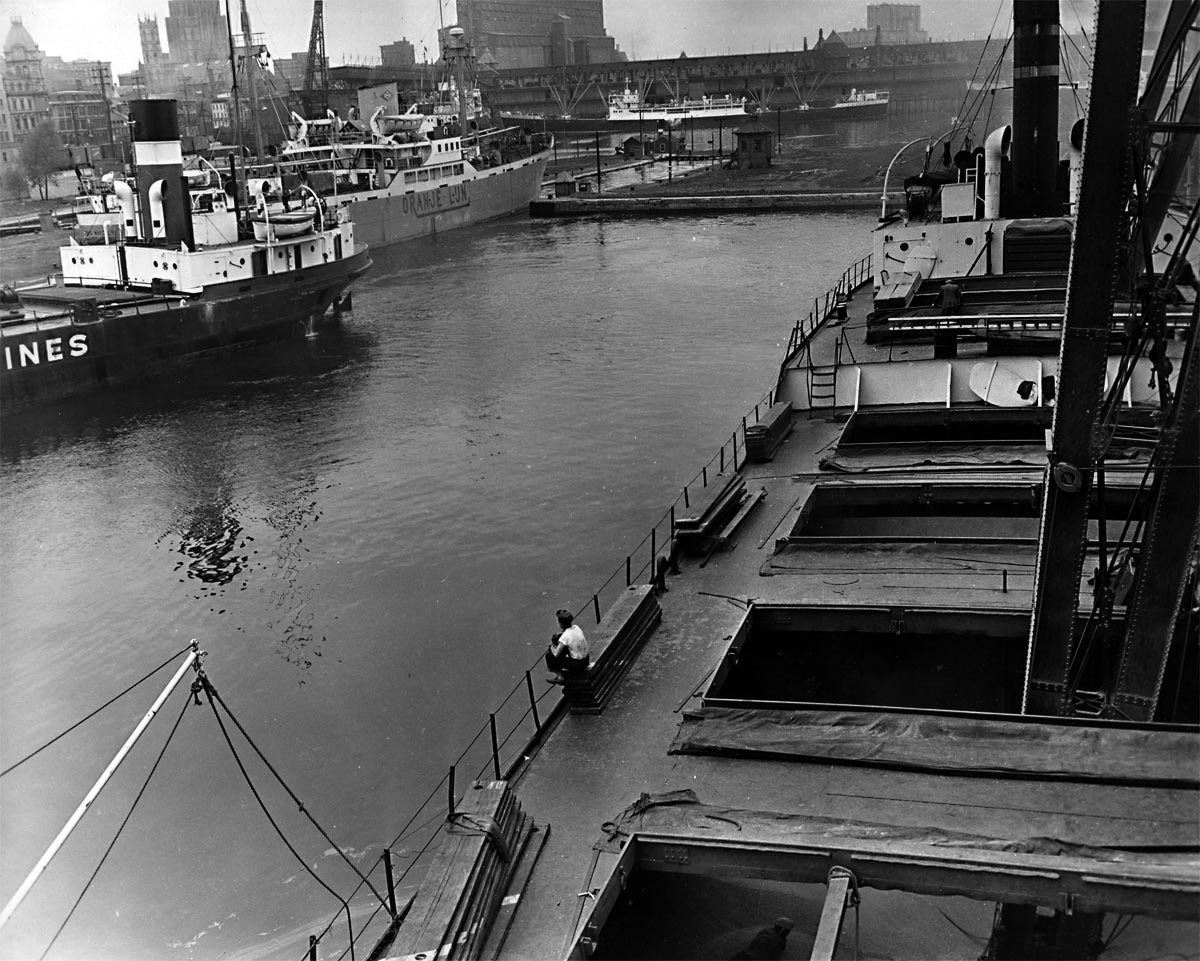
SHLC007: Lock 2 South
The PRINS WILLEM VAN ORANGE enters Lock 2 while an observer waits on the swing bridge. Basin No. 1 and Elevator B is in the background.
SHLC008: Lachine Canal from Basin No. 2.
This view, from Basin No. 2, shows Black's Bridge at the right and a steamer upbound in Lock 2. Another sidewheeler is berthed in Basin No. 1.
SHLC009: Black’s Bridge is open for the CITY OF OTTAWA down bound into Lock 2 North.
She will meet the Mathews steamer WIARTON in the basin between Locks 1 & 2. An Eastern Steamships canaller is entering Lock 1 South.
SHLC010: WIARTON in Lock 2 North and the Eastern Steamships canaller
ROBERT W. POMEROY in Lock 2 South.
Another canaller is at Elevator B in Basin No. 1 to the right.
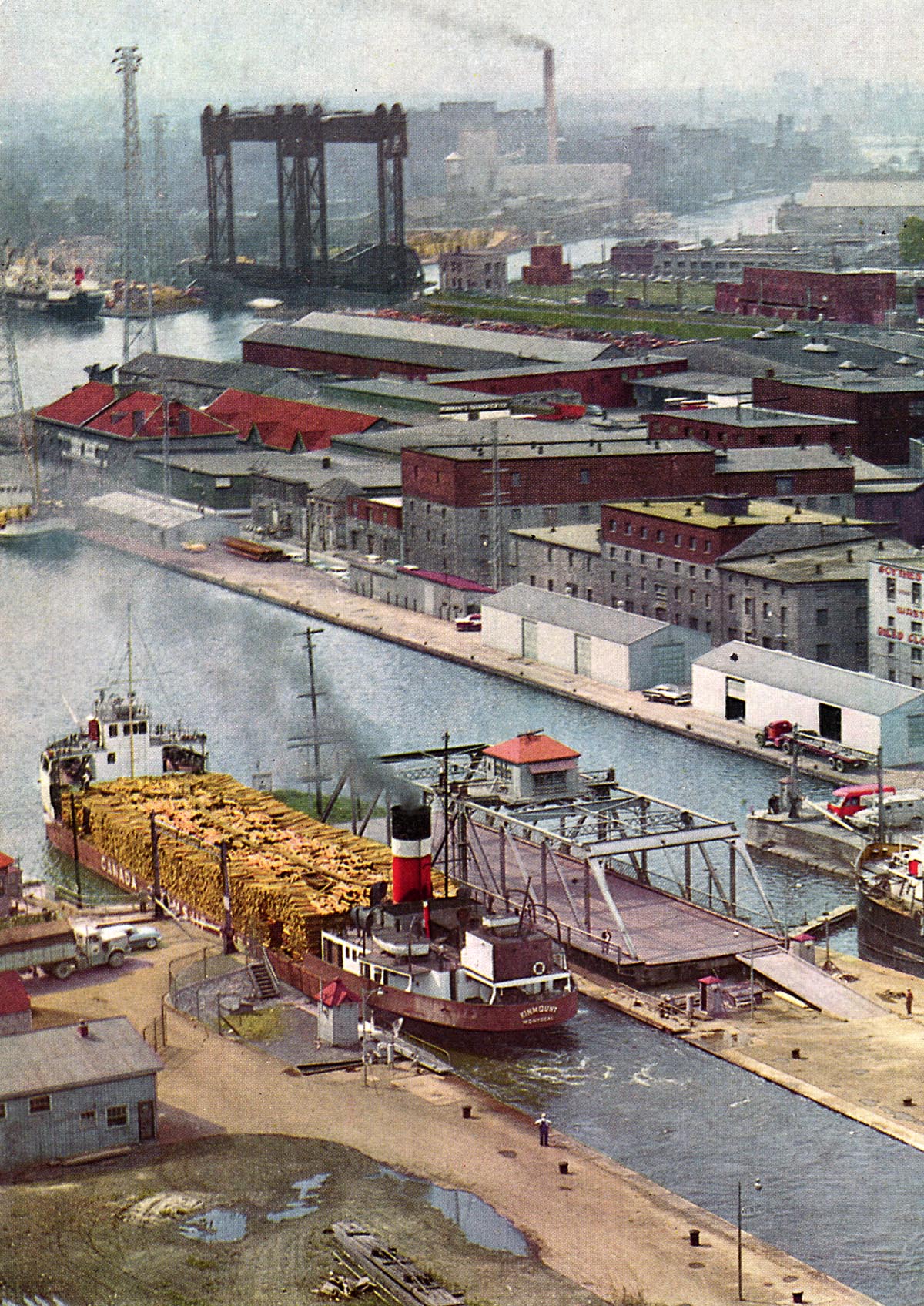
SHLC011: KINMOUNT, loaded with pulpwood, is exiting Lock 2 South into Basin No. 2.
The vertical lift bridge in the background is the CN Rail bridge located at Mile 0.62 between Locks 2 and 3.
National Geographic photo.
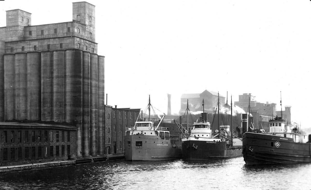
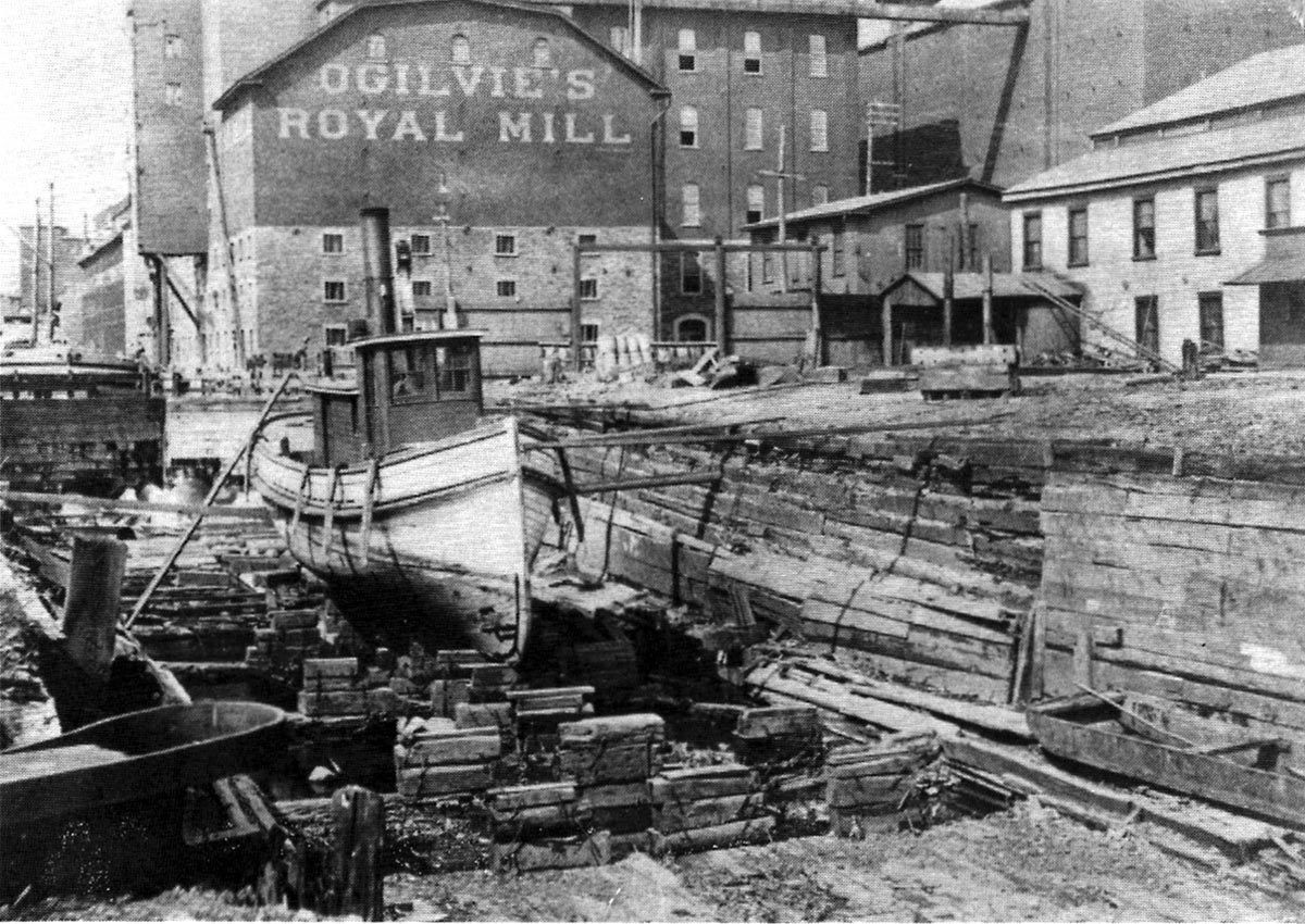
SHLC012: Looking up the canal from Black’s Bridge into Basin No. 2.
The elevator on the left is the Dominion Seed. On the far right behind the ships is the Olgivie Elevator. The ships, left to right are EDWARD L. STRONG, BENMAPLE, and MAPLEBRANCH. Docked behind the STRONG is the IGNIFER.
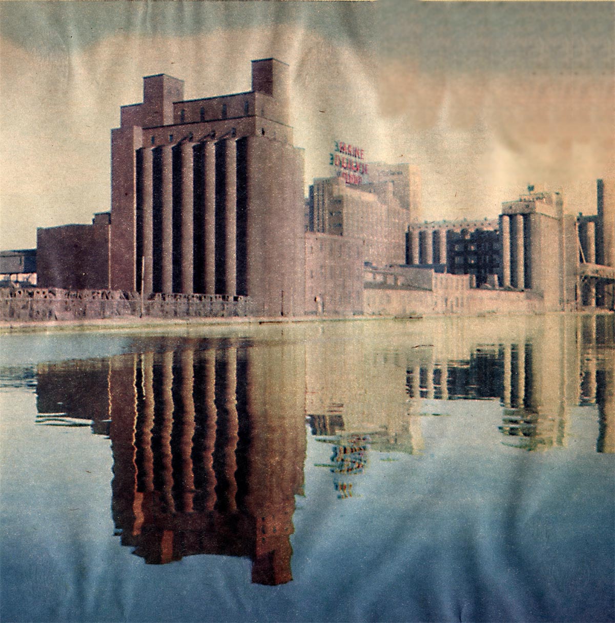
SHLC013: Looking up the canal from Black’s Bridge
: Looking up the canal from Black’s Bridge at the Dominion Seed elevator on the left and Ogilvie’s on the right.
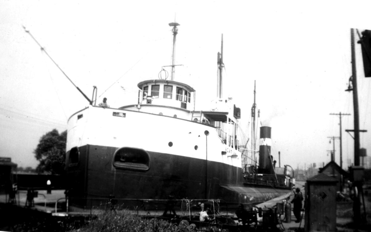
SHLC0014: Tate’s dry dock
Tate’s dry dock which was located in the south west corner of Basin No. 2 above Lock 2 of the Lachine Canal.
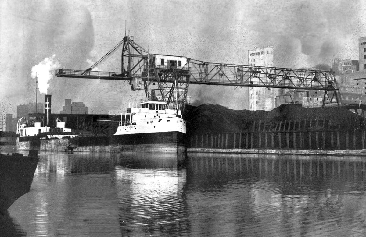
SHLC015: Coal Dock on Wellington Basin
This view shows part of the coal dock on Wellington Basin operated by the Rochester & Pittsburgh Coal Co. of Canada Ltd. The steamer SCOTT MISENER is being unloaded by an unloading and transfer bridge built by the Dominion Bridge Co. Ltd. and having a capacity of 225 tons per hour. The berthing space at this dock totals 1,106 feet.
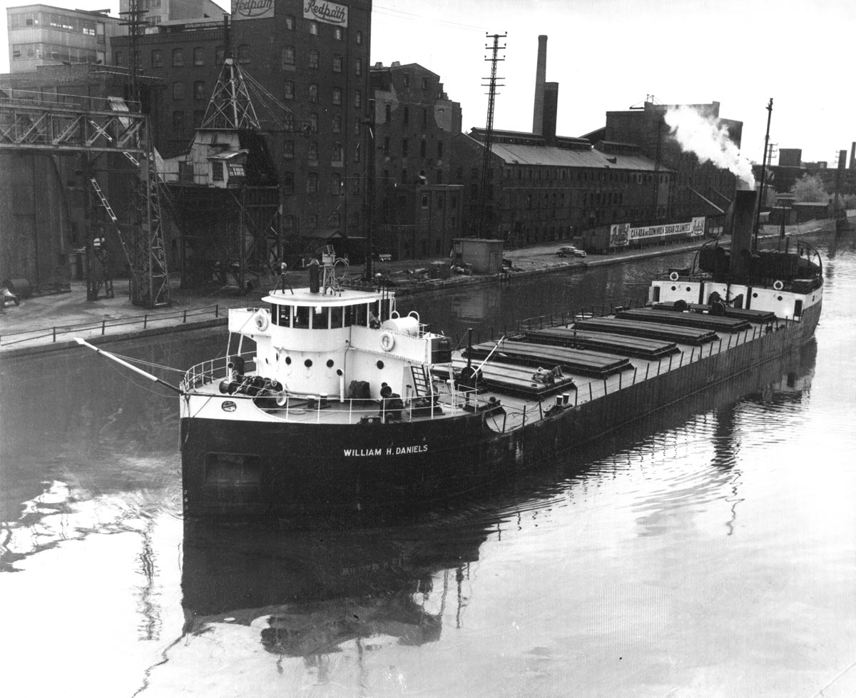
SHLC016: The Upper Lakes Canaller WILLIAM H. DANIELS
The Upper Lakes canaller WILLIAM H. DANIELS sailing down the Lachine Canal just below the St. Gabriel Lock. Redpath Sugar is viewed in the background.
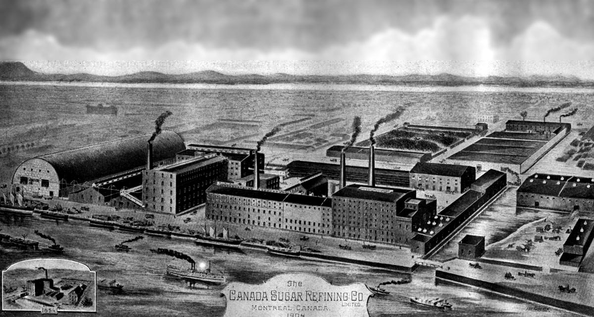
SHLC017: The plant of the Canada Sugar Refining Co. Ltd
The plant of the Canada Sugar Refining Co.Ltd., as it appeared in 1904. The location is on the south side of the canal just below St.Gabriel Lock. This company originated in 1854 as John Redpath's refinery and was re-organized and incorporated in 1879.
SHLC018: A wooden hulled Goelette loaded with wood
A wooden hulled Goelette loaded with wood product is about to be raised in Lock 3.
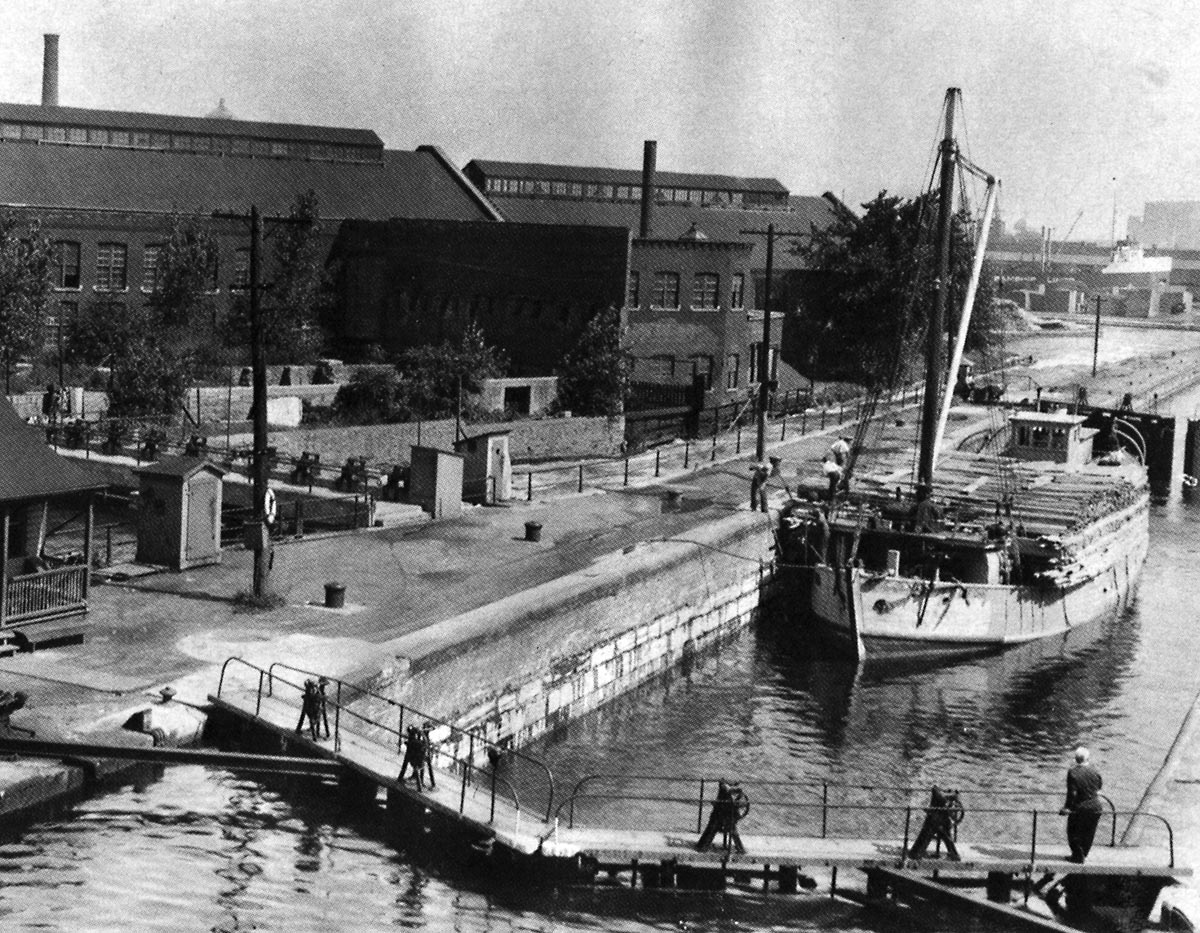
SHLC019: Fulford Street
The section of the canal from the slip at the foot of Fulford Street (right) to the western limit of the Steel Co. of Canada Ltd. Notrc Dame Works property.
This picture was taken in 1959.
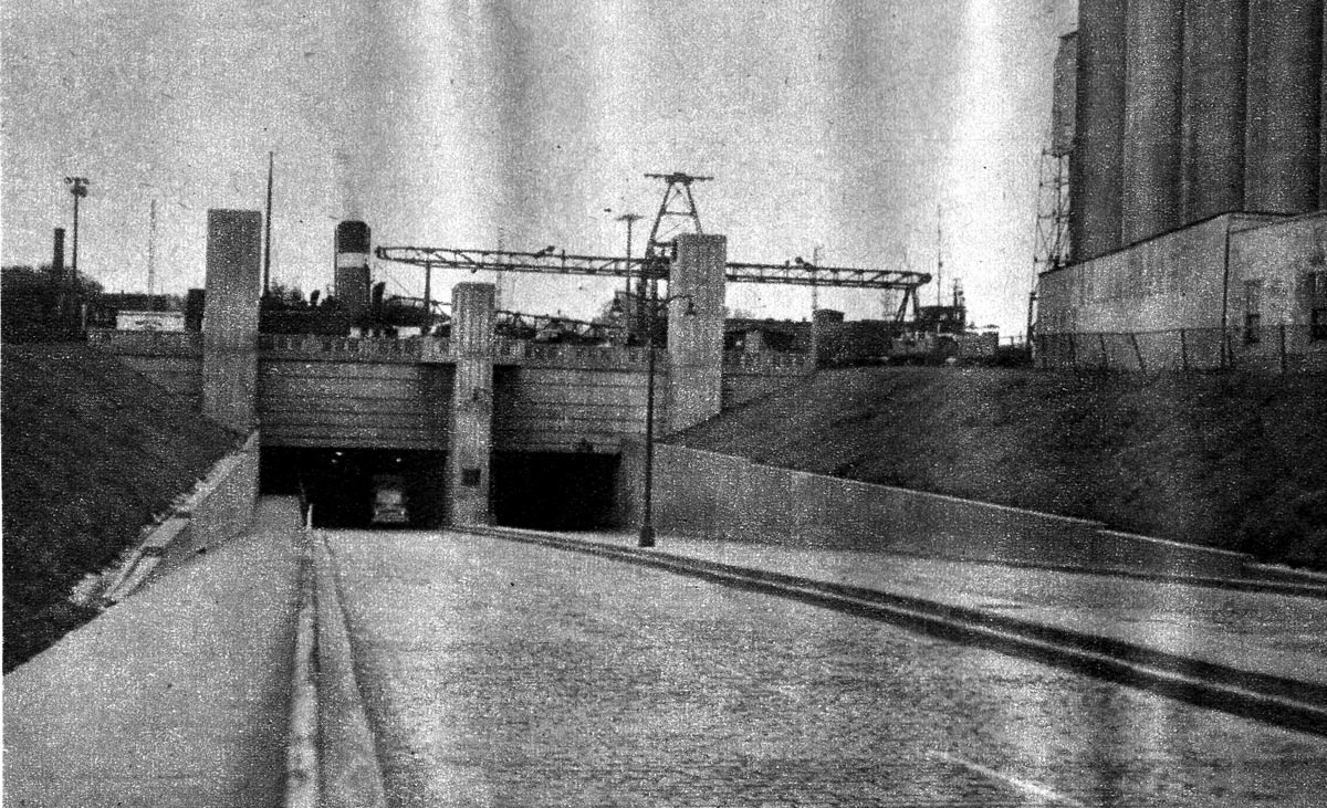
SHLC020: St. Remi Street Tunnel
St. Remi Street Tunnel, with the steamer COLLIER passing above.
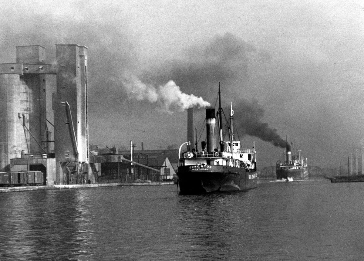
SHLC021: The CSL steamers EDMONTON and LETHBRIDGE
The CSL steamers EDMONTON and LETHBRIDGE passing the Canada Malting elevator on the left.
SHLC022: ACADIAN in Lock 4, Cote St. Paul
ACADIAN in Lock 4, Cote St. Paul,
August, 1947.
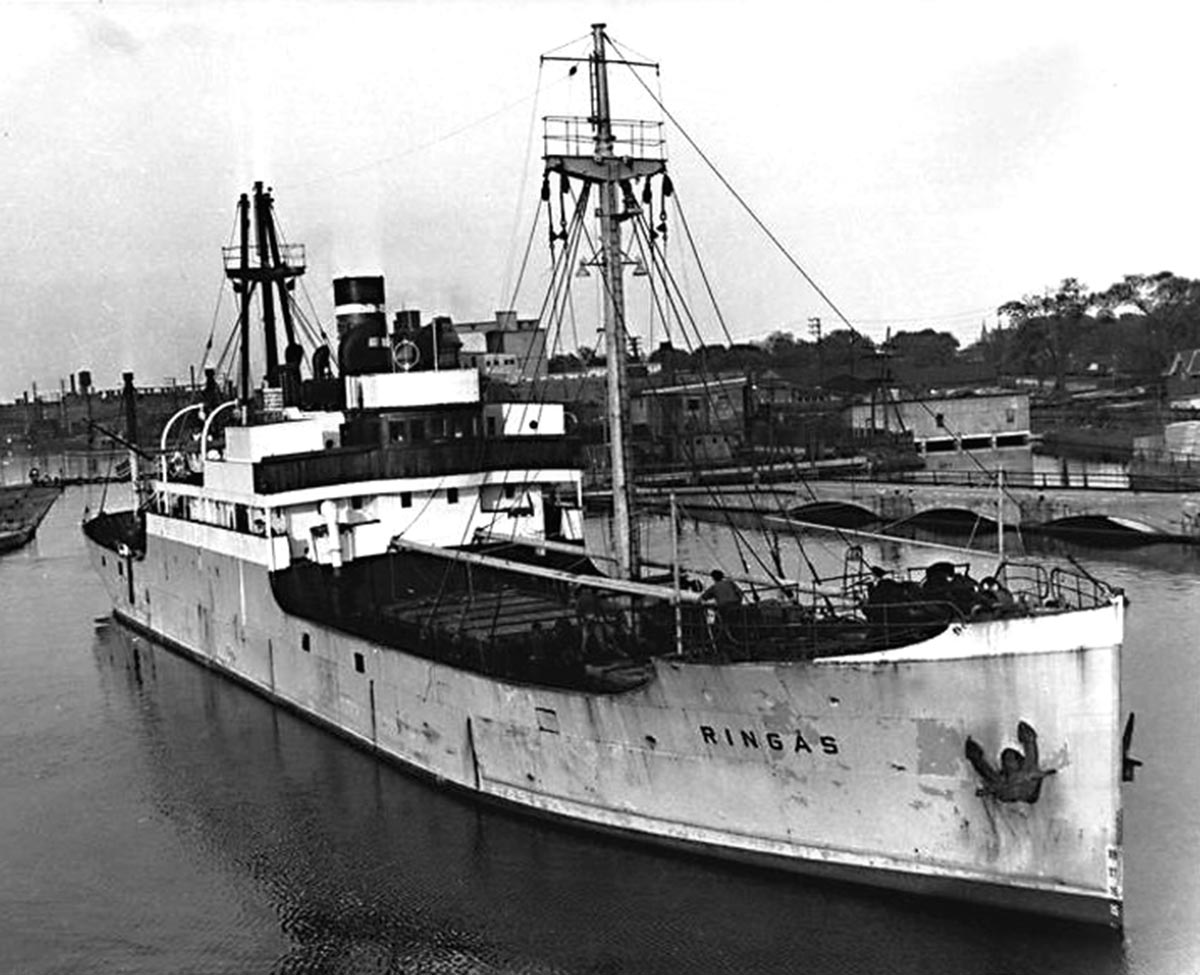
SHLC023: RINGAS Exiting Lock 4 of the Lachine Canal
Exiting Lock 4 of the Lachine Canal - RINGAS was wrecked as FRANCISCO MORAZAN on Lake Michgan, 29 November, 1960.
Gord Macualay Photo
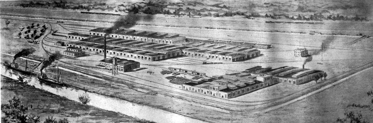
SHLC024: The Cote St. Paul works of the Canada Car Company
The Cote St. Paul works of the Canada Car Company which was completed in August 1905.
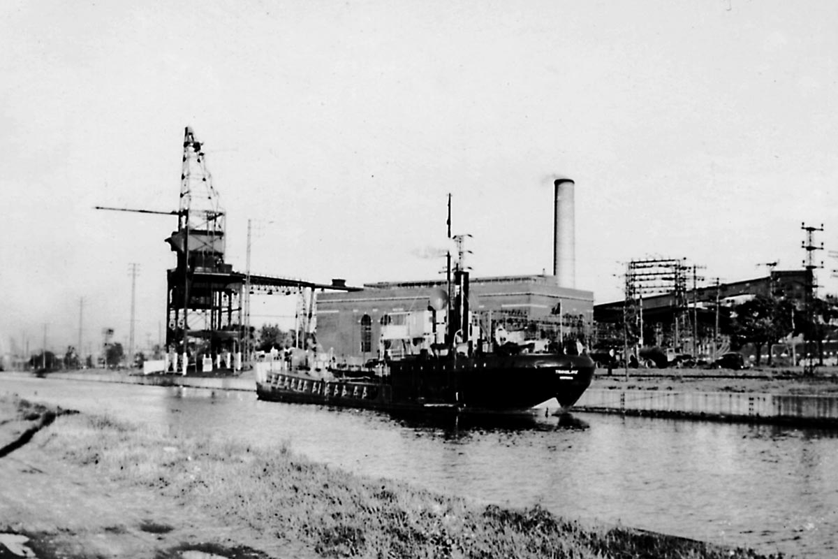
SHLC025: Canal at Ville LaSalle
View of the canal at Ville LaSalle showing the tanker TRANSLAKE discharging at the LaSalle Coke Co.’s pipe line. The power housed and coal tower in the background are owned by the Montreal Light, Heat and Power Consolidated.
Date: 1939.
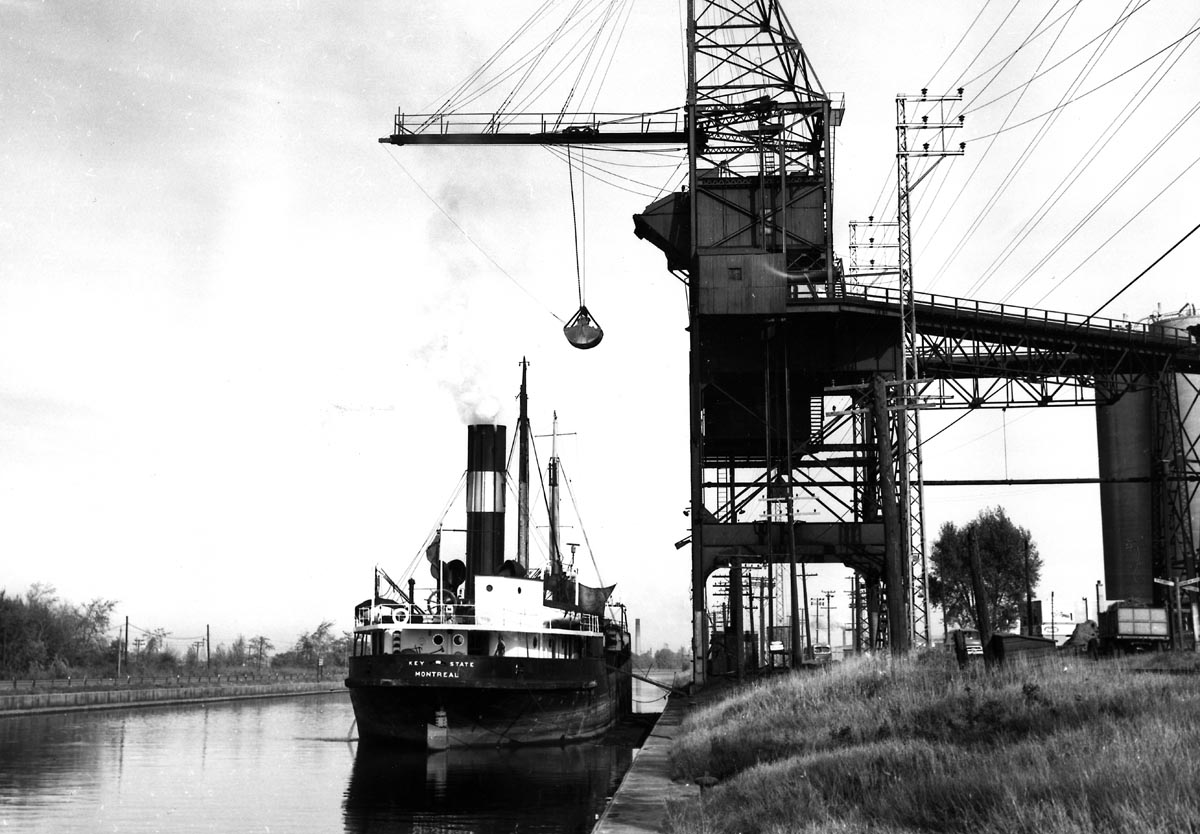
SHLC026: KEYSTATE Discharging Coal
KEYSTATE discharging coal at the Montreal Light, Heat and Power Co. dock.
Date: 22 Oct. 1959. Photo by John H. Bascom.
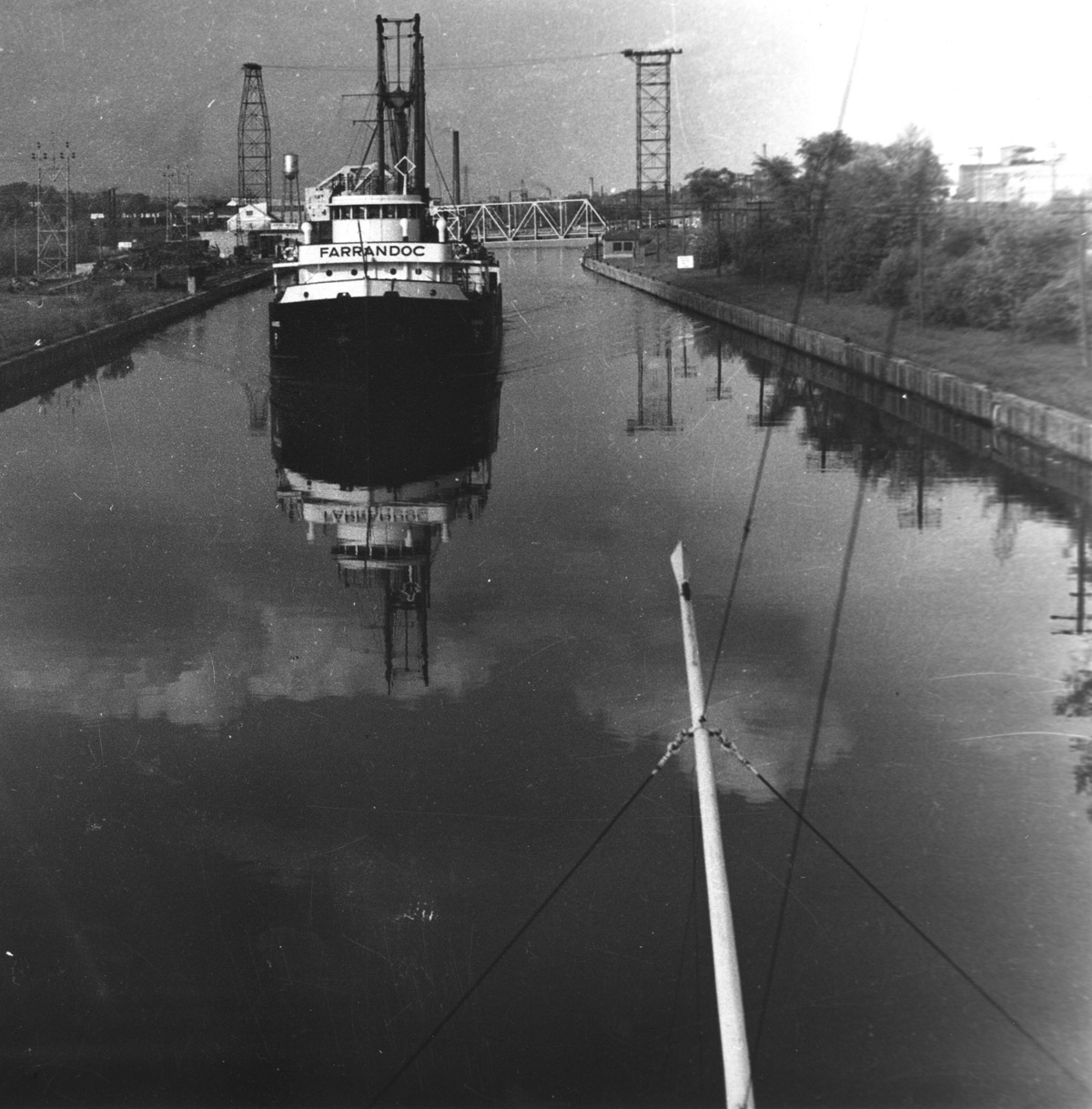
SHLC026a: Paterson canaller FARRANDOC up bound in the Lachine Canal near Rockfield.
FARRANDOC meeting another canaller above the Gauron Bridge. The Gauron bridge is located at Ville St Pierre. It was built according to a design created by the Strauss Company of Chcago and licensed to Dominion Bridge. It was a dawbridge or jacknife style and this bridge is now flanked by another drawbridge built in 1959 by Dominion Bridge according to a different design. The photo is facing east. - Kent Malo.
Photo by Gord Macaulay.
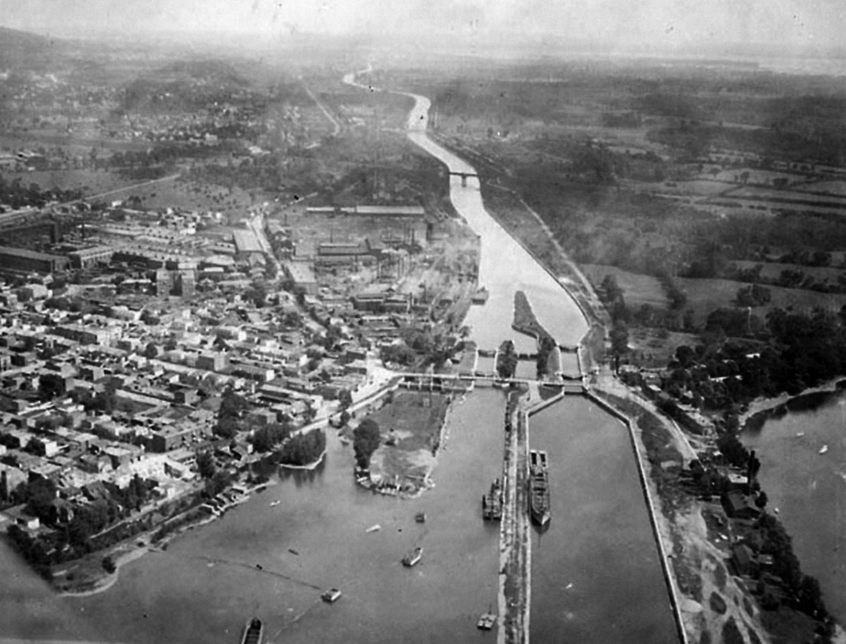
SHLC027: Icebreaker LADY GREY Up Bound
Icebreaker LADY GREY up bound in the Rockfield stretch of the Lachine Canal. The CPR bridge in the background is located at Mile 6.85 of the canal.
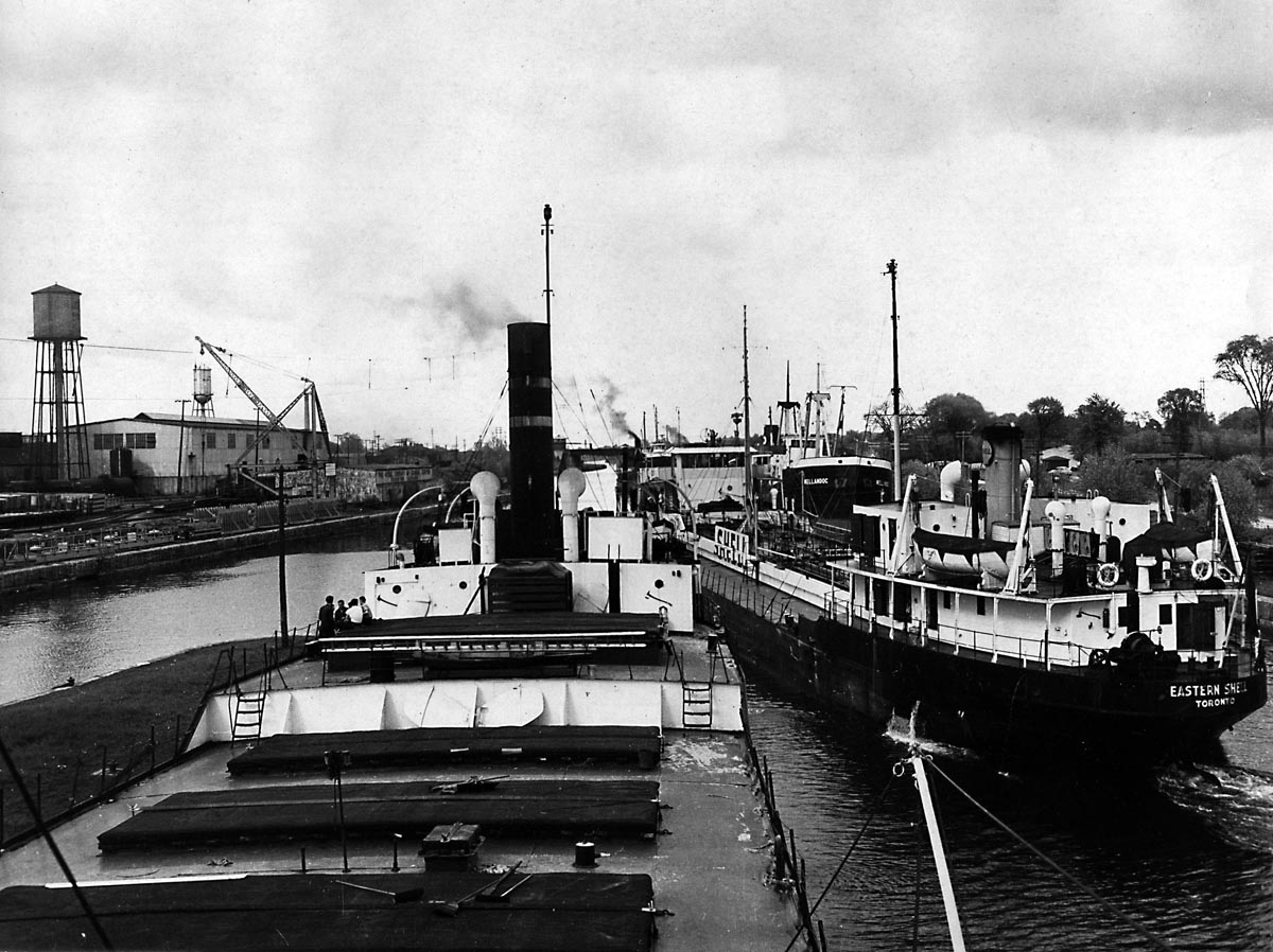
SHLC028: The tanker EASTERN SHELL departs Lock 5
SHLC028: The tanker EASTERN SHELL departs Lock 5 of the Lachine Canal as WELLANDOC to the right and a Misener canaller wait for their turn to enter the lock. Just above the CPR bridge is another Halco canaller up bound. The Dominion Bridge Co. works is on the north canal bank.
Gord Macaulay photo.
SHLC029: Vessels downbound out of Lock 5
An old view of vessels downbound out of Lock 5 - Str. VICTORIA, built 1901 at Sorel - Broken up there in the 1920s.
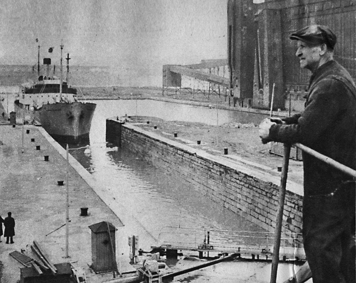
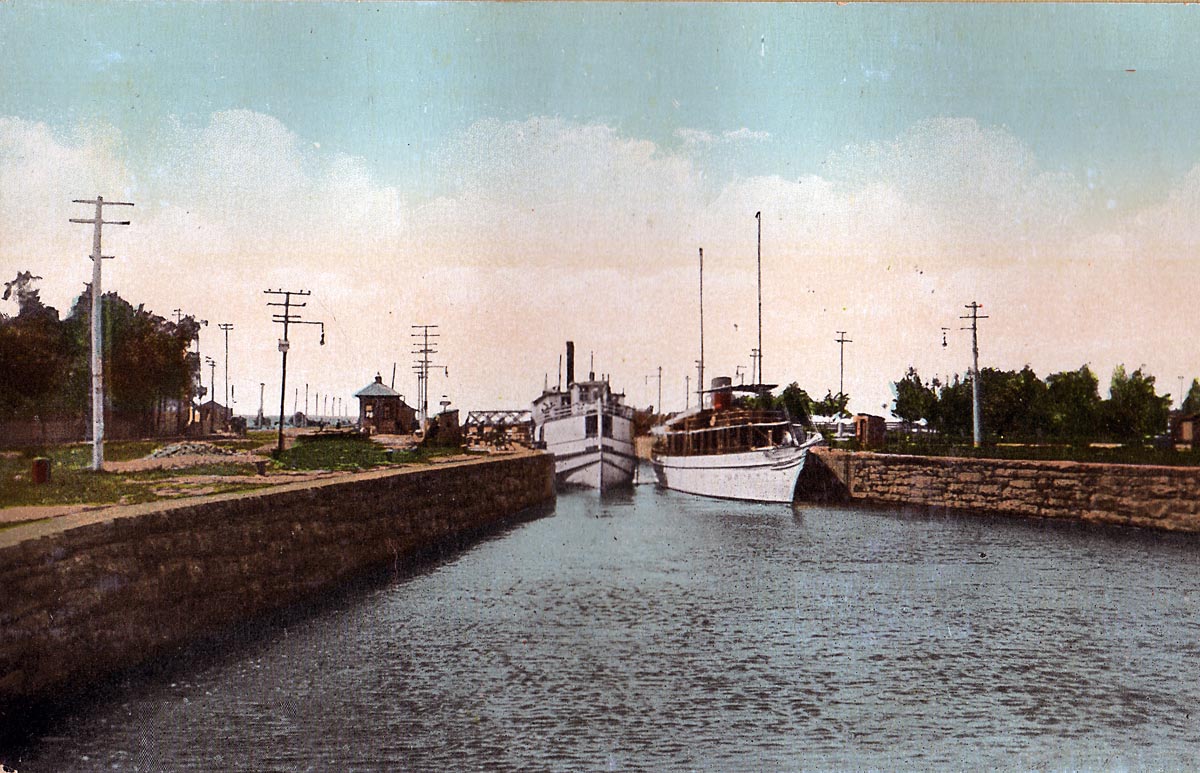
SHLC030: The steamer YORKTON is entering Lock 5
The steamer YORKTON is entering Lock 5 of the Lachine Canal in this 1920 photo. This lock was built during the 1863-1884 reconstruction phase. To the right of this lock is a weir for level and flow control into the long reach below Lachine. Looking to the right of the weir we can see the 200 foot lock that was opened in 1848. To the right of this lock we see another channel which follows the main street of Lachine up to the left. This was the original canal, 45 feet wide, which had a lock where another weir is located. This lock opened in 1825 and its dimensions were 100 feet long, 20 feet wide, with 5 feet of water over the sills.
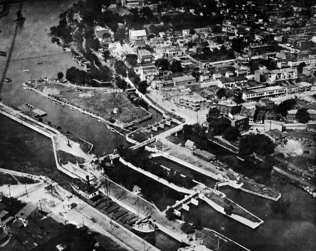
SHLC031: Another view of the western entrance to the Lachine Canal
Another view of the western entrance to the Lachine Canal, which was taken in 1920. The canal structures from left to right are as follows;
The first canal which opened in 1825.
The subsequent rebuild from 1848, a 200 foot lock with 9 feet of water over the sills.
The weir for regulating the water let into the canal.
The 270 foot lock with 14 feet of water over the sills which opened in 1884.
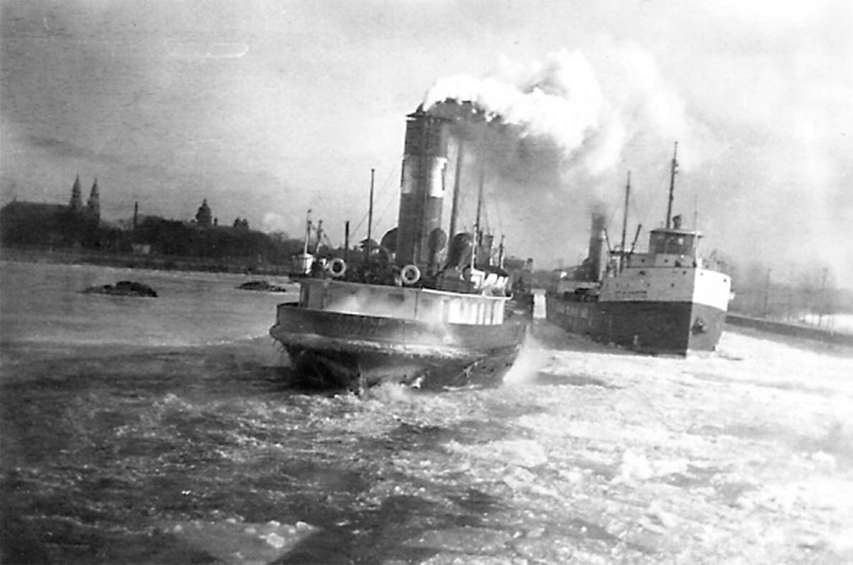
SHLC032: KEYBELL, a Keystone Transports Ltd. Canaller
KEYBELL, a Keystone Transports Ltd. canaller passing one of the `CITY’ class CSL canallers in slush ice at the entrance to the Lachine Canal. The church steeples of Lachine are seen to the left.