In 1929 the Beauharnois Light, Heat and Power Company began excavating a 16 mile long, 3300 foot wide power canal. The Federal Government stepped in to ensure the new canal would be dug deep enough (30 foot draught) to accommodate a future shipping channel. The Saint Lawrence Seaway wouldn't be built for another 25 years yet. |
When the Beauharnois Canal and Powerhouse were completed in 1932, this part of the Saint Lawrence River would never be the same. Most of the river's flow was diverted away from its original course, resulting in the Soulanges series of rapids almost drying up. Pictures and maps covering the construction of the Beauharnois Power and Seaway Canal are presented in this section. |
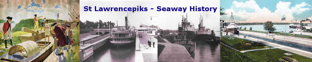
SHBC001: Map showing the location of the Beauharnois Power and Seaway Canal
This map illustrates three sets of canals that were built in this area between Lake St. Francis and Lake St. Louis. The old Beauharnois Canal that ran from Valleyfield to Melocheville, (not shown), the Soulanges Canal that bypassed the rapids by going north of the river and the Beauharnois Power and Seaway Canal.
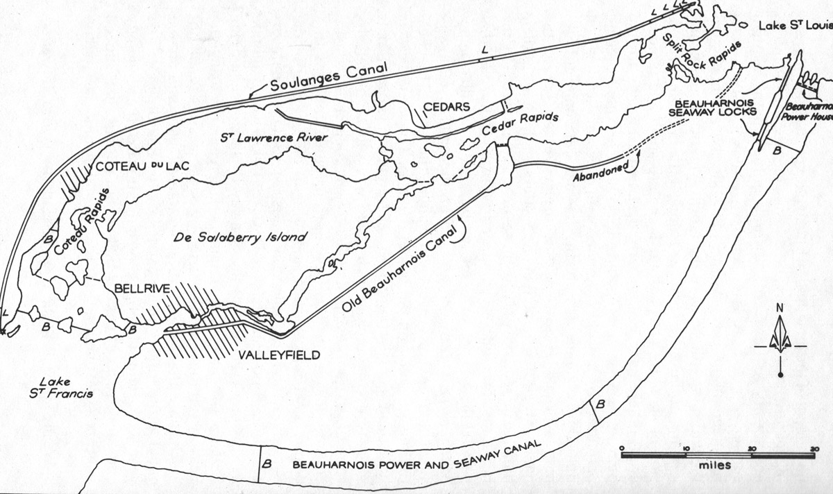
SHBC001A: A map of the Valleyfield to Beauharnois area.
This map also provides a diagram illustrating the power potential of the St. Lawrence River where the Seaway will be built.
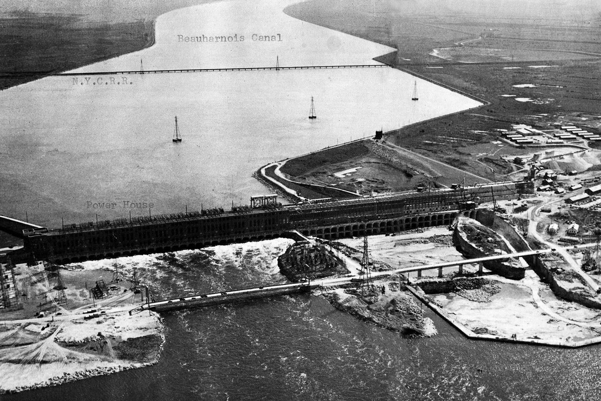
SHBC002: An aerial view of the Beauharnois Hydroelectric Power Station.
In 1929 the Beauharnois Light, Heat and Power Company began excavating a 16 mile long, 3300 foot wide power canal. The Federal Government stepped in to ensure the new canal would be dug deep enough (30 foot draught) to accommodate a future shipping channel.
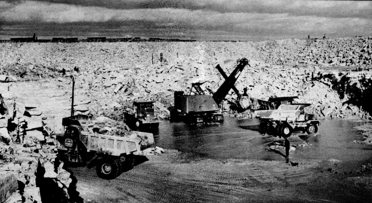
SHBC003: Digging out the rock for building the new locks at Beauharnois.
The area where the two lift locks and connecting shipping channel had to be cut out of solid sandstone.
SHBC004: Drilling and blasting rock went on for several months.
Looking across the site where the new Beauharnois Locks will soon stand. The construction crews had to drill and blast a large amount of rock.
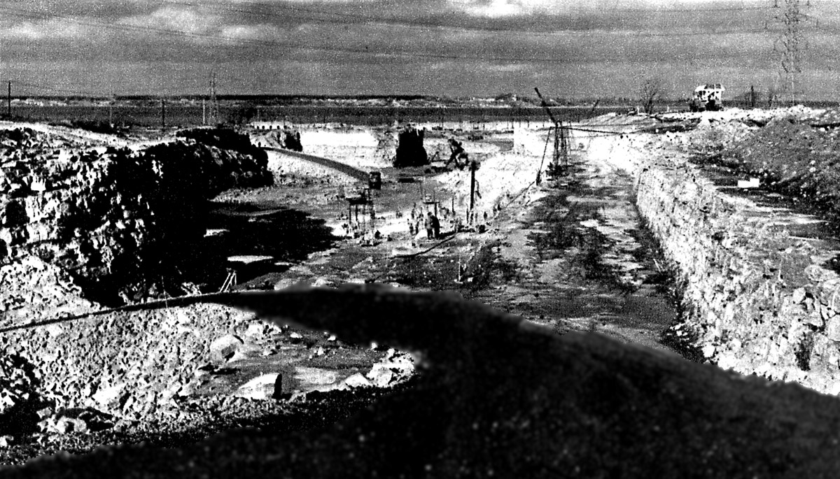
SHBC005: Aerial view of Beauharnois Locks construction site.
The concrete forms are being built for what will become Lock 3 of the St. Lawrence Seaway. The deep cut running from left to right just above the lock will become a highway tunnel which runs beneath the canal. The basin above this lock still has much rock to be removed.
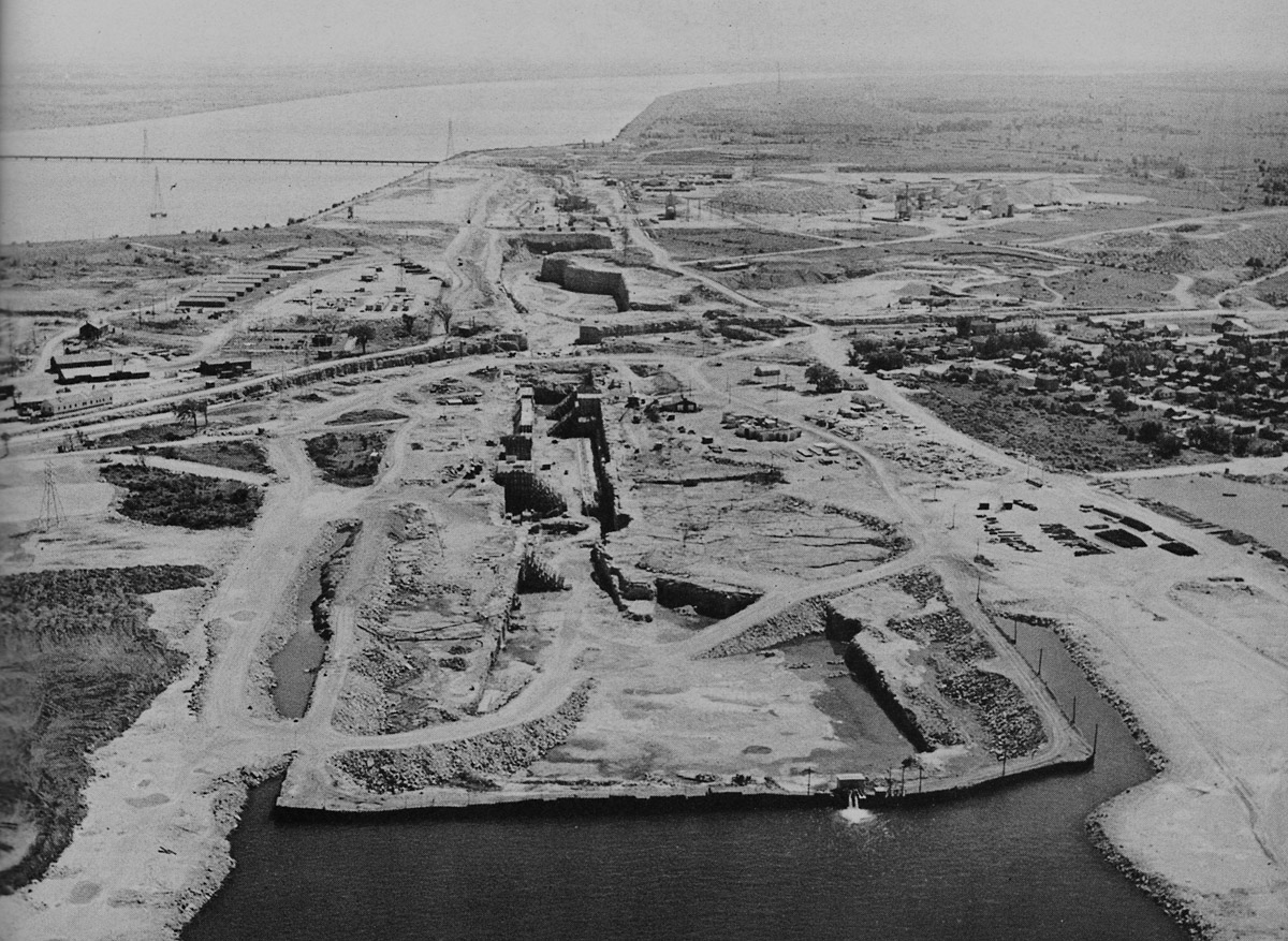
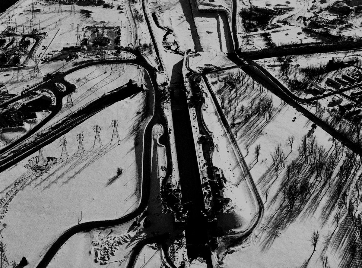
SHBC006: Aerial view of Beauharnois Locks and canal.
The lock nearest in this view is Seaway Lock 4. The railroad swing bridge is in place at the western end of the lock. Note the stop logs are still in place just above the bridge and the canal is still dry. The upper approach walls were built in floating sections and sunk into place. One section as about to be sunk into place while two more float in the basin above the lock.
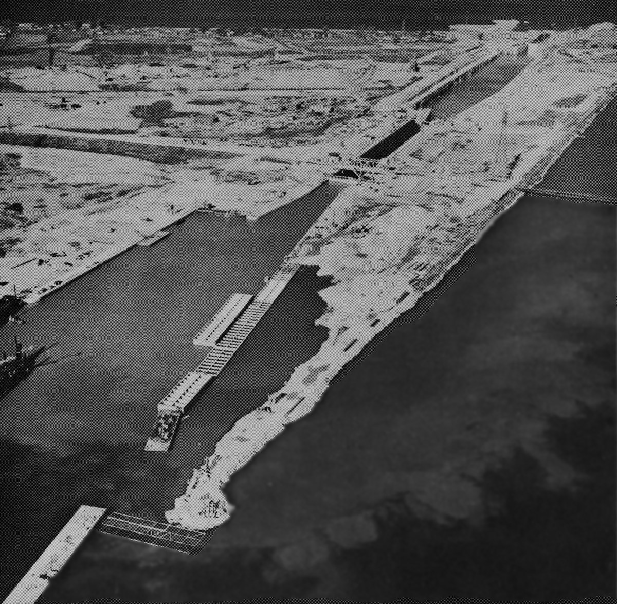
SHBC007: Beauharnois Lock 3 nearing completion.
In this aerial view Beauharnois Lock 3 is nearly completed. The basin above the lock where ships will pass between the two locks is still dry. To the right of the lock is a spillway which will control the level of the basin and also provide a place for ice to float out of the basin. The road and tunnel beneath the lock are now complete.
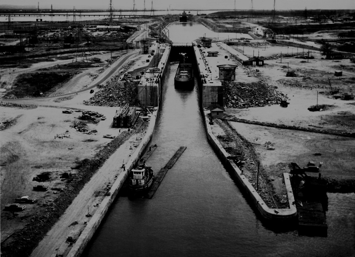
SHBC008: Lock 3 at Beauharnois.
A tug is towing rafts out of Lock 3 at Beauharnois and following the tug is the Canada Steamship Lines upper laker BURLINGTON. The latter is very small compared to present day Seaway ships but then she was built in 1899. The completion of the Seaway brought on a ship building boom whereby many new lakers were built to the maximum allowable dimensions. Old ships such as BURLINGTON were soon retired and sold for scrap. In the background another ship can be seen raised in Lock 4.
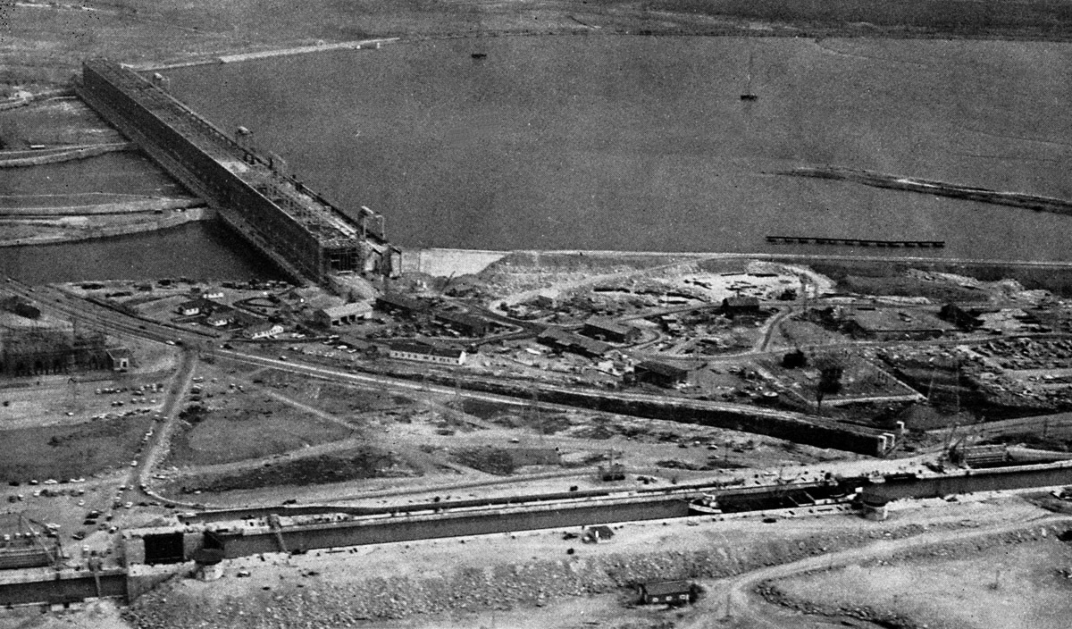
SHBC008A: Beauharnois Lock 3 and the Beauharnois Hydroelectric Power Station.
A solitary canaller slides into Lock 3 of the Beauharnois Canal while the massive expansion to the Beauharnois Hydroelectric Power Station continues but nears completion. To the right of the power dam the last remnants of the temporary coffer dam can be seen.
SHBC008B: Beauharnois Lock 4 and the N.Y. Central Railroad Bridge.
A pair of Canada Steamship Lines canallers are in the raised position in Lock 4 of the Beauharnois Canal. They may be waiting for a train to pass and clear the swing bridge before they open the gates to allow these ships to proceed up the canal.
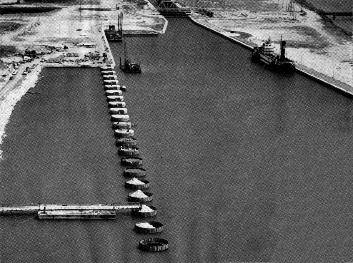
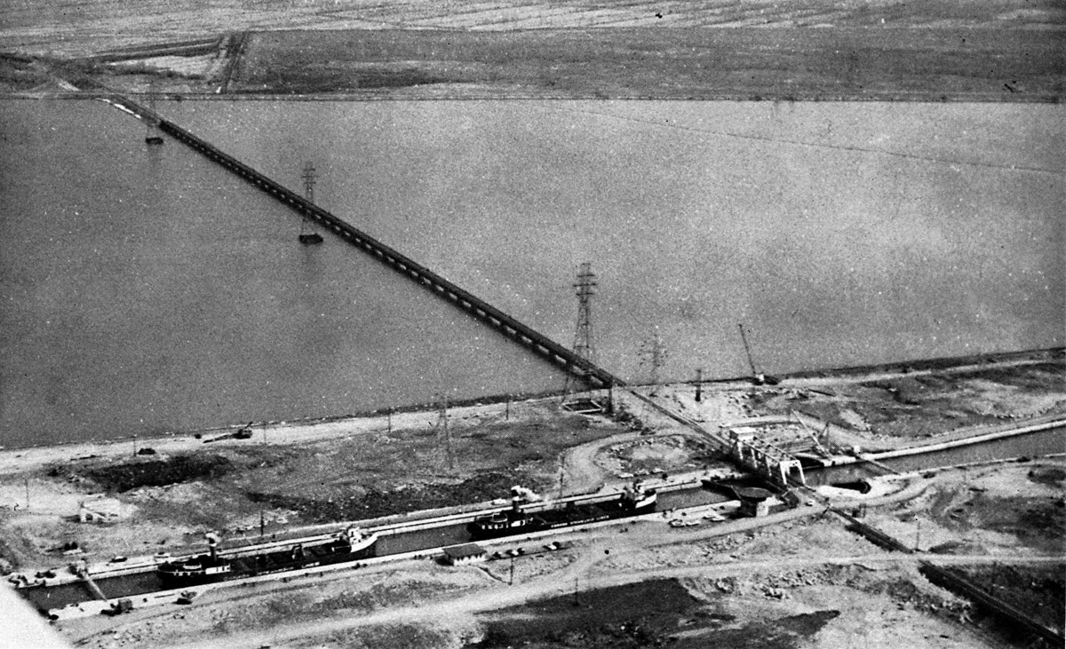
SHBC009: The entrance to Lock 4 at Beauharnois.
A canal sized tanker waits on the upper approach wall above Lock 4 at Beauharnois. On the left a new dock for ships is still under construction as the steel caisons are being filled with rock and capped with concrete.