There were two major projects undertaken near the village of Iroquois. First there was a new river control dam which was built across the river from Rockway Point, located on the north shore of New York State, directly across from the town, to Point Iroquois.
|
Secondly, there was a new lift lock built at Point Iroquois to bypass the control dam. Both projects were begun shortly after the legislation was signed in 1954. The other major associated project was to move the entire village back from the edge of the river (out of the flood area). |
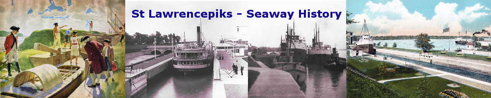
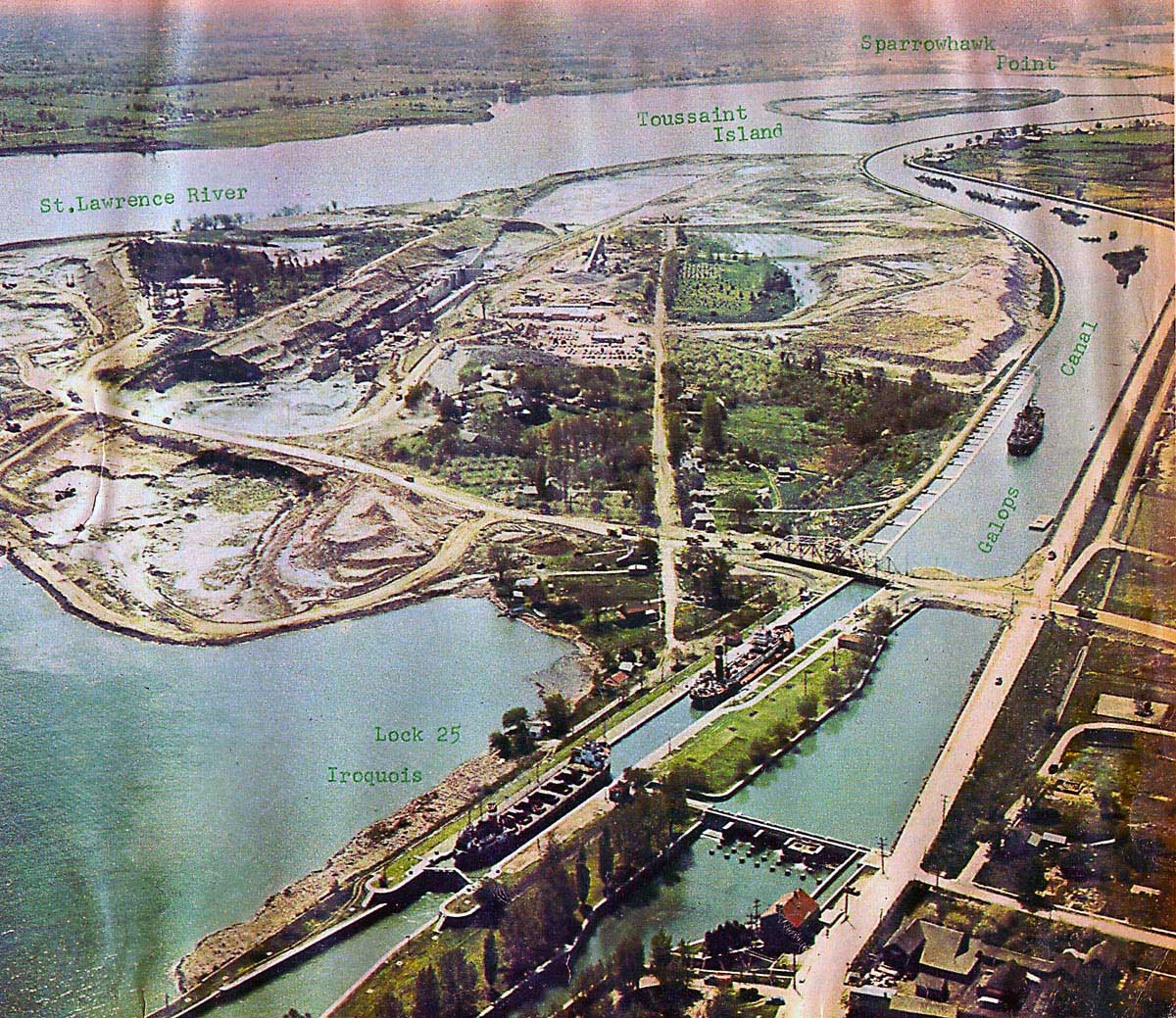
SHIL000: Google Earth Image of the Iroquois Section of the Seaway Today.
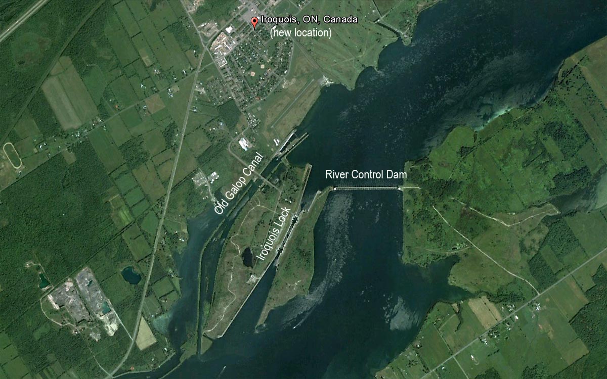
SHIL000A: Ontario Hydro Blueprint for the Morrisburg-Iroquois Section of the Seaway
July 1958
This map is the Ontario Hydro Blueprint plan for the Morrisburg - Iroquoius section of the Seaway.
It shows the original river boundaries (light blue), the flooded areas (dark blue) and the cuts/dredging areas (light & dark brown).
To see the complete Ontario Hydro Blueprint (from Prescott to Cornwall):- Click Here.
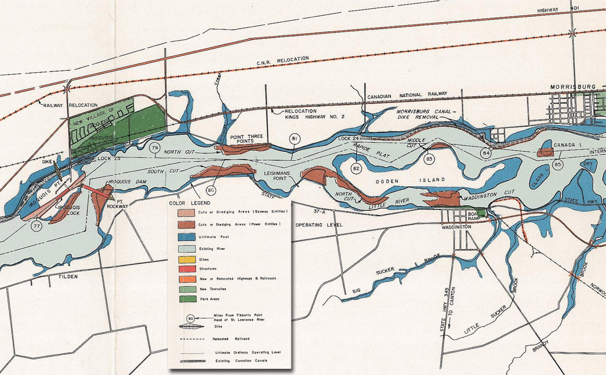
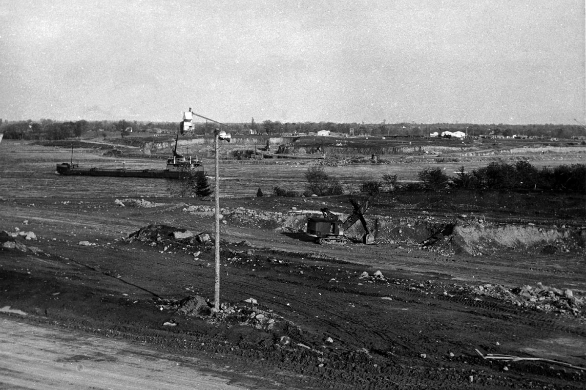
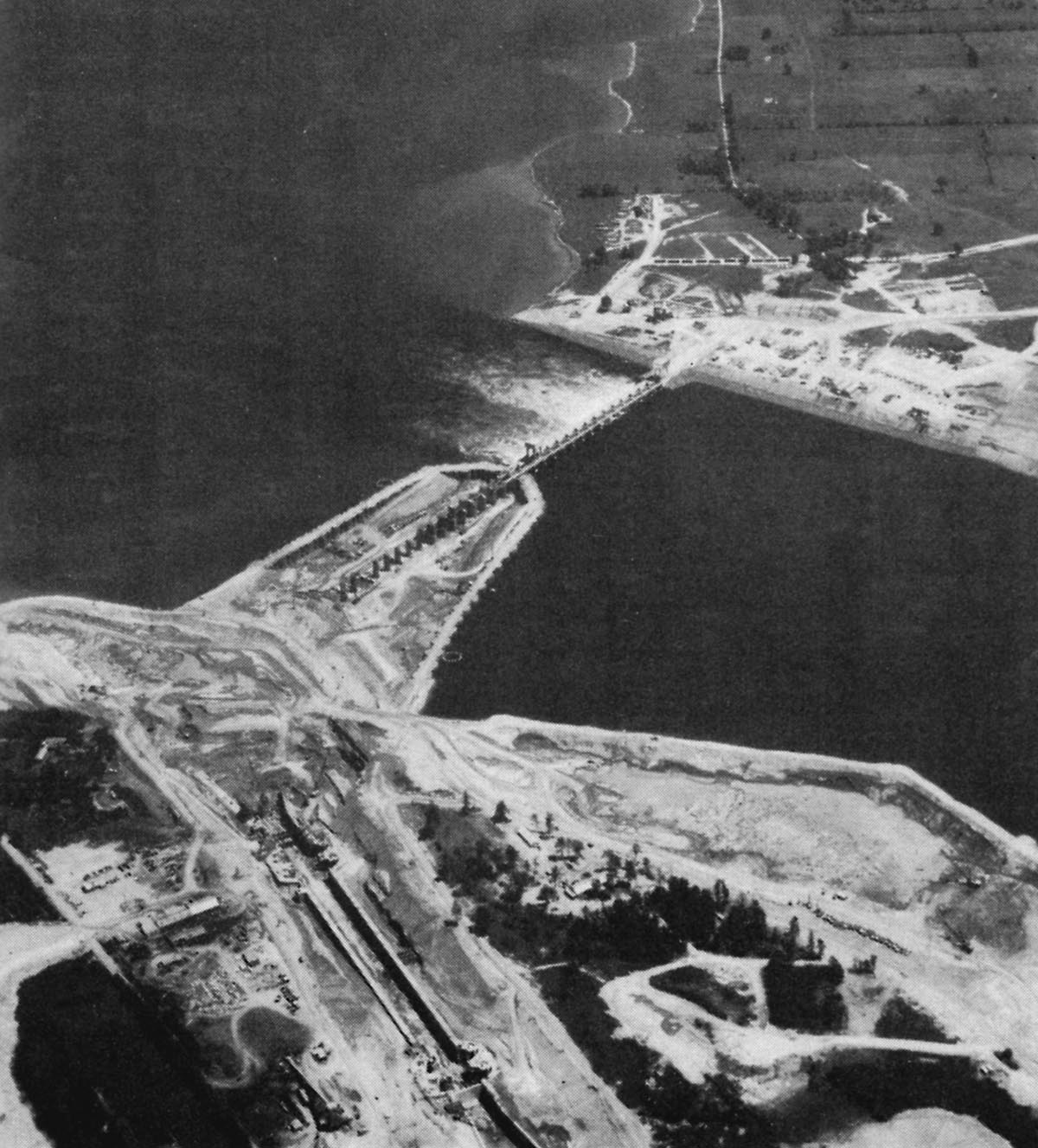
SHIL001: Iroquois and Point Iroquois, Summer 1955.
This is an aerial view of the village of Iroquois and Point Iroquois taken from the north east during the summer of 1955. It reveals many changes are taking place.
A canaller is shooting the rapids down bound. The channel has been restricted by the construction of a cofferdam out from Rockway Point on the upper left. This is the beginning of the construction of the "Regulating Dam" on the New York side of the project.
The area where the new lift lock will be built is cleared across the top of Point Iroquois. A temporary cofferdam can be seen out in the river above the Point. Note Toussaint Island, upstream from the Point is untouched as is Sparrowhawk Point seen beyond Toussaint.
In the lower center of the photograph there is a house mover on a temporary road. It is a box shaped vehicle with the rear frame open so that it can back onto a property in the old village and surround the house on three sides with its lifting frame. Cutting across the image from bottom left to right is the CNR main railroad line. Highway 2 also runs through the town, the only paved road running directly from Montreal to Toronto at the time.
SHIL001A: Looking East From Point Iroquois 1955
A canaller shoots down the Galops Rapids between two construction sites in 1955.
On the far side of the river a huge excavation is taking place. They are preparing the site for the construction of the control dam on Point Rockway. The tall structure with the sloped conveyor on Rockway Point is the concrete plant. Excavation is also taking place right across the middle of Point Iroquois. They will have to dig a lot deeper to reach bottom where the footings for the new lock will be placed.
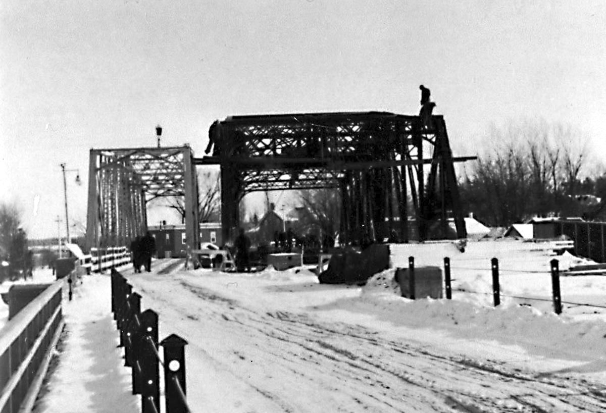
SHIL003: Swing Bridge Replacement at Iroquois, Winter 1955.
During the winter of 1954-55, a new and much stronger bridge was built alongside the old swing bridge. The new bridge was built to carry the heavy loads of truck traffic to and from the construction site.
SHIL005: Point Iroquois, Summer 1955.
An aerial view looking east across Point Iroquois. The cofferdam seen in the lower center area will enable the work to go on "in the dry" where the upper approach wall above the lift lock will be built. Off to the upper right can be seen the construction site on Point Rockway where the U.S. half of the control dam will be built.
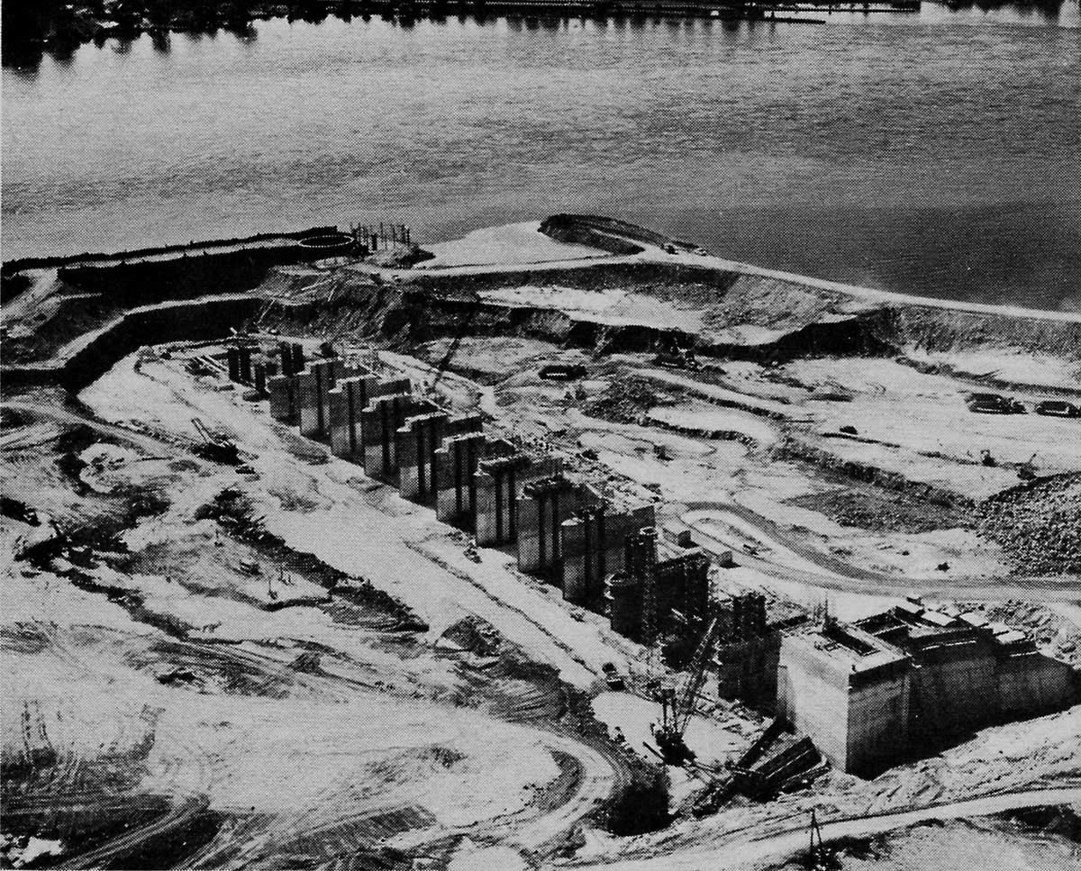
SHIL006: Iroquois Control Dam.
The row of concrete pillars rising from the pit will eventually hold movable gates between each of them. The first concrete pour took place on November 11, 1955. In the extreme upper right corner of this image can be seen the entrance to the old canal at Iroquois.
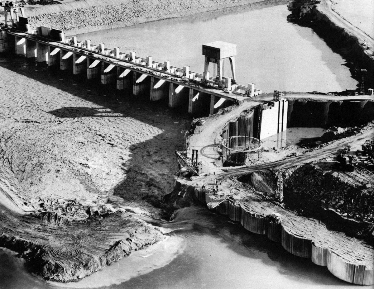
SHIL008: Iroquois Control Dam Construction on the U.S. side.
The construction of the Iroquois Control Dam has progressed with the addition of the deck across the top of the pillars. The deck, 67 feet above the river bottom, will provide a roadway right across the dam and also support for the travelling cranes that will raise and lower the gates which control water flow through the dam.
To the right of the partially built dam is a stockpile of crushed stone. This will be used to build a stone embankment along the riverbank above and below the dam to control erosion.
SHIL010: Aerial view of the Iroquois Control Dam construction site, looking east and down the river.
The east half of the Iroquois Control Dam is apparently nearly finished in this aerial view. The first of two traveling cranes is now in service and several of the gates are in place. The stone embankment is now in place along the shoreline. In the middle of the river, at the west end of the new dam, work is underway to build a cofferdam behind which will be built the west half of the dam. This is the beginning of two rows of steel caissons which were built to form a cofferdam across to Point Iroquois.
In the background, down the river, a large excavation can be seen in progress at Waddell Point. There were three of these excavations between Iroquois and Waddington, N.Y.
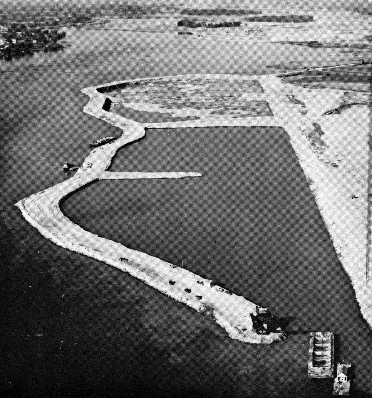
SHIL012: Aerial view of Waddell Point, west of Waddington, N.Y.
This massive excavation is necessary to reduce restrictions to water flow and therefore reduce current in the new waterway. There were three excavations of this type in this area, the other two being Pine Tree Point, east of Iroquois, and Leishman Point seen in the distance down river from Waddell Point.
Off to the top left of this image is the Flagg Bay Lock, or the entrance to the Rapide Plat canal. Ogden Island is top center of this image.
SHIL014: Iroquois Control Dam Flooding.
The coffer dam has just been breached to allow water to flood the east section of the Iroquois Control Dam. Once this area reaches the level of the river, the entire upper and lower sections of this coffer dam will be completely removed. Meanwhile, off to the right, the next cofferdam, cell after cell, is being built across the river towards Point Iroquois.
SHIL016: Coffer Dam for West Section of Iroquois Control Dam.
In this aerial view of Point Iroquois, the coffer dams are complete from the newly opened U.S. section of the Iroquois Control Dam to the shore of the Point. The excavation to bedrock is underway inside the coffer dam.
SHIL018: Point Iroquois Excavation.
The south east area of the old Point Iroquois is being cut away to allow the water to flow evenly into the Iroquois Control dam, half of which has yet to be built. In the background can be seen the cofferdam surrounding the area where the west half of the Iroquois Control Dam will be built.
SHIL020: East section of the Iroquois Control Dam and village of Iroquois.
The first section of the Iroquois Control Dam is now regulating the flow of the river. Nine of the sluiceway gates are in the fully raised position, while the remainder are down and holding back water.
In the background can be seen what remains of the old village of Iroquois after most of the homes have been moved to their new location, which can be seen at the very top of this image. The old business district, and all the large buildings in the old village, will soon be razed to the ground.
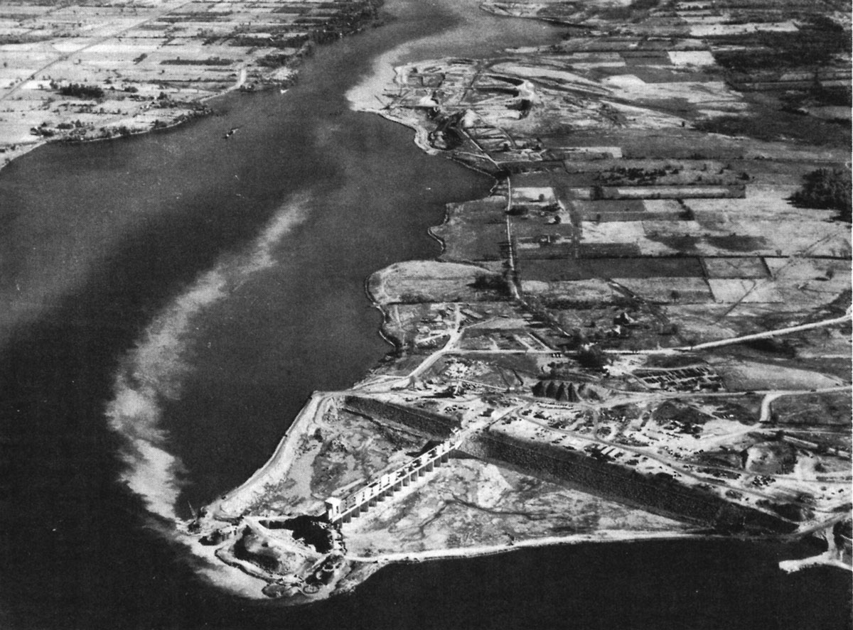
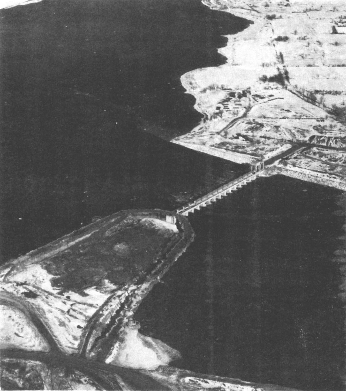
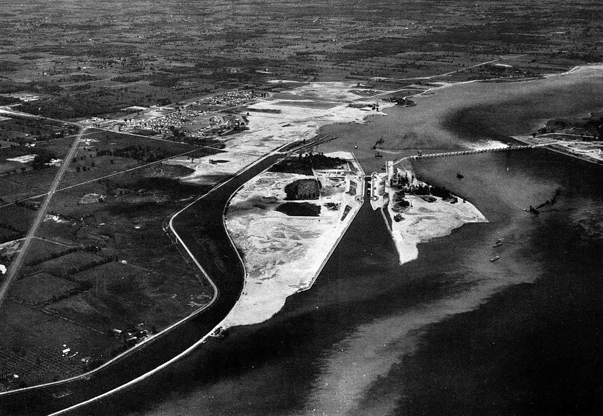
SHIL022: Aerial view looking west at the Iroquois Control Dam and Point Iroquois.
The work of building the west section of the Iroquois Control Dam goes on within the cofferdam surrounding it. A row of forms can be seen rising up from the bottom of the pit. In the background work is underway to build the new lift lock through the middle of Point Iroquois.
Also, looking up river, the excavation of Toussaint Island and Sparrowhawk Point can be seen taking place. To the right there are five canallers lined up above the old Lock 25, waiting their turn to go down through the lock. Because Lock 25 is 800 feet long, they can be taken down three at a time.
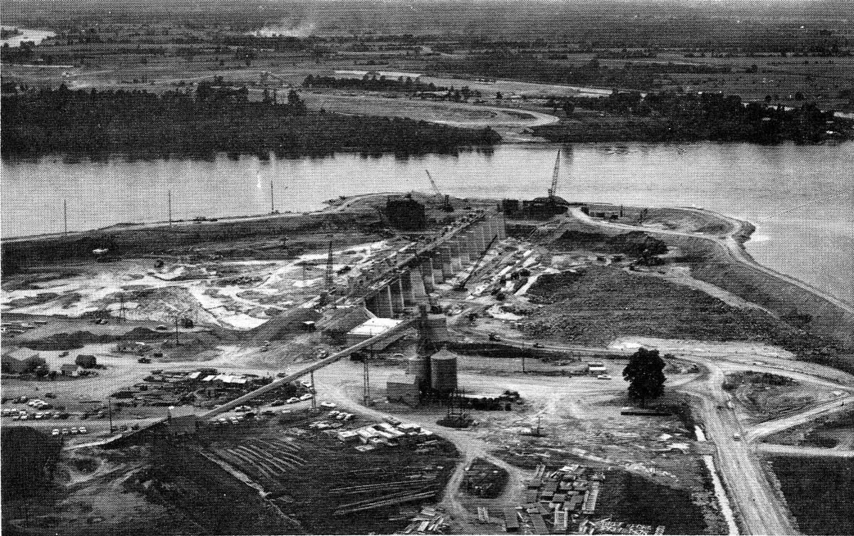
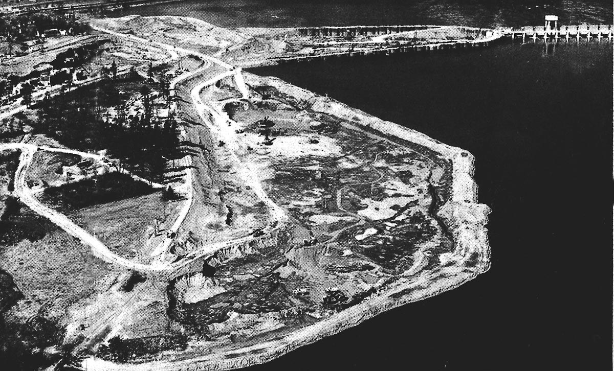
SHIL024: Aerial view of Point Iroquois and the Iroquois Control Dam construction site.
The row of pillars is now taking shape in the west end of the Iroquois Control Dam. Also in this view can be seen the huge excavation that carved away the southeast portion of the point. The new lift lock is rapidly nearing completion in this view, with only the east approach walls remaining to be built. The time period should be Fall of 1956.
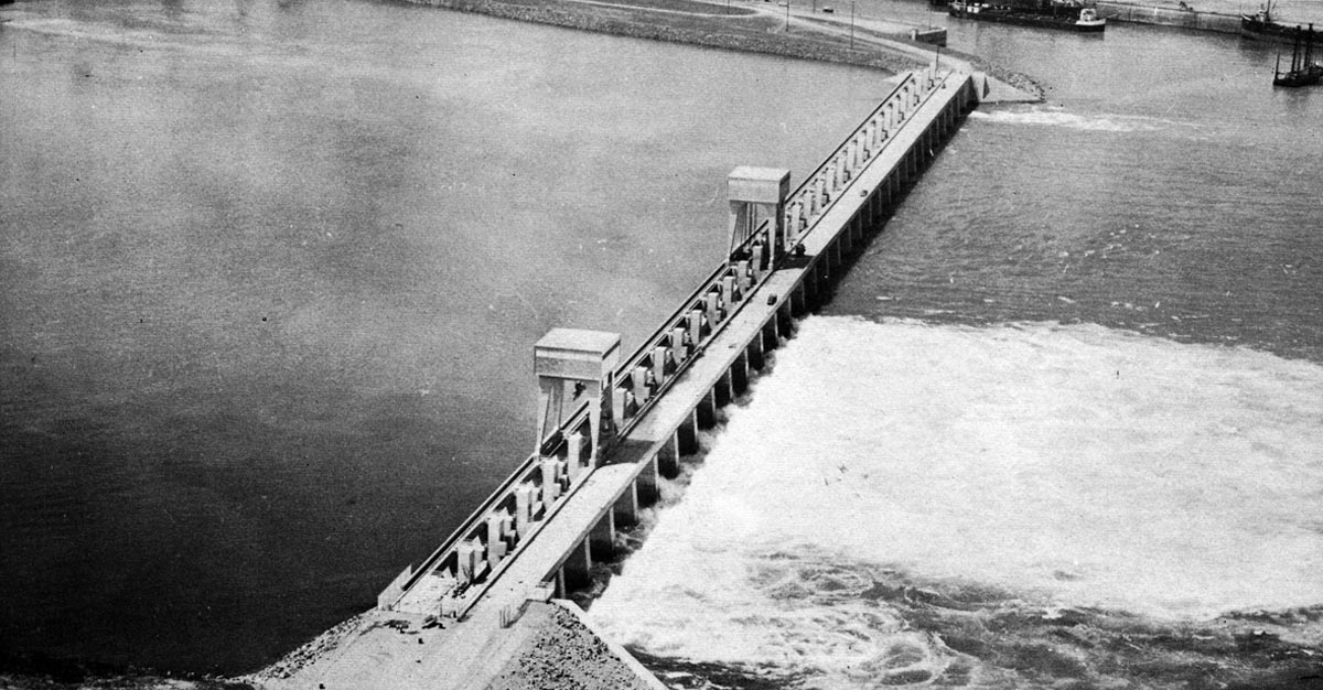
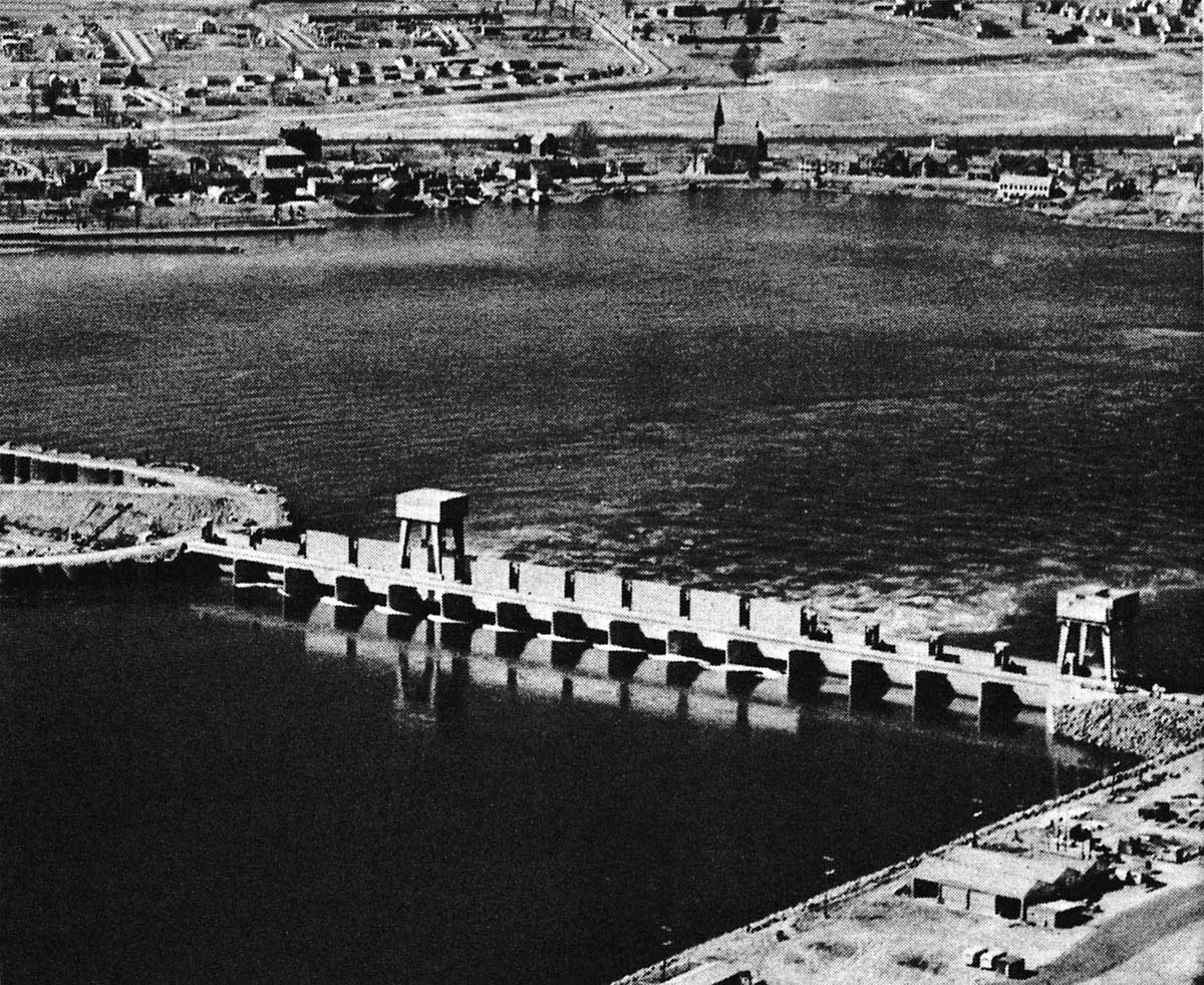
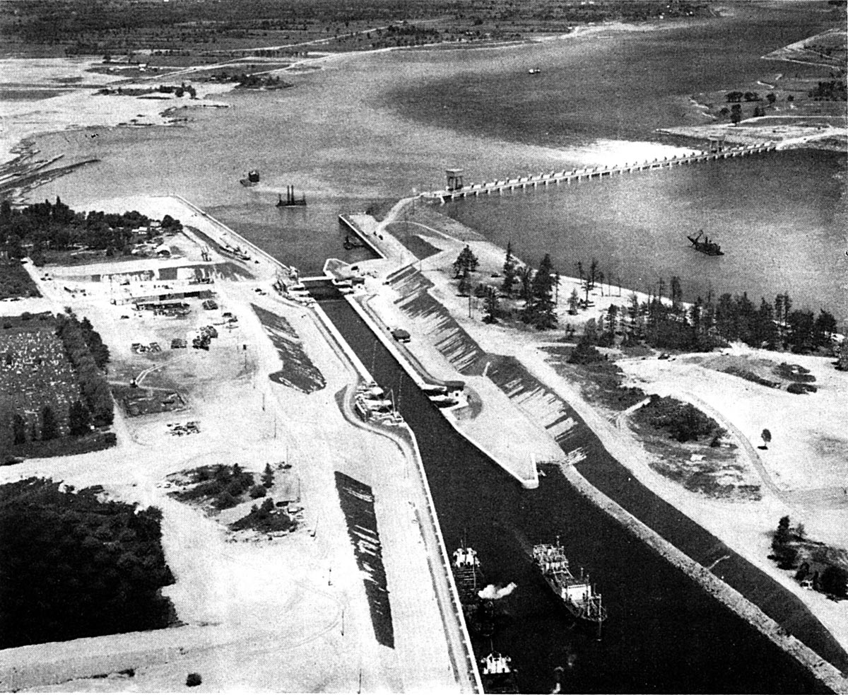
SHIL026: Aerial view of Point Iroquois and the Iroquois Control Dam - Spring 1958.
The new Iroquois Control Dam has two gantry cranes, each capable of lifting 350 tons. It is 2,540 feet long with 32 spillways, each fitted with a fixed roller vertical lift gate used to regulate the flow of water through the dam. This may be used to control the water level in Lake Ontario. In one instance since the Seaway opened, the ships were all put to anchor and the flow of the river was allowed to run free for several hours to bring the level ofLake Ontario down to a more acceptable level.
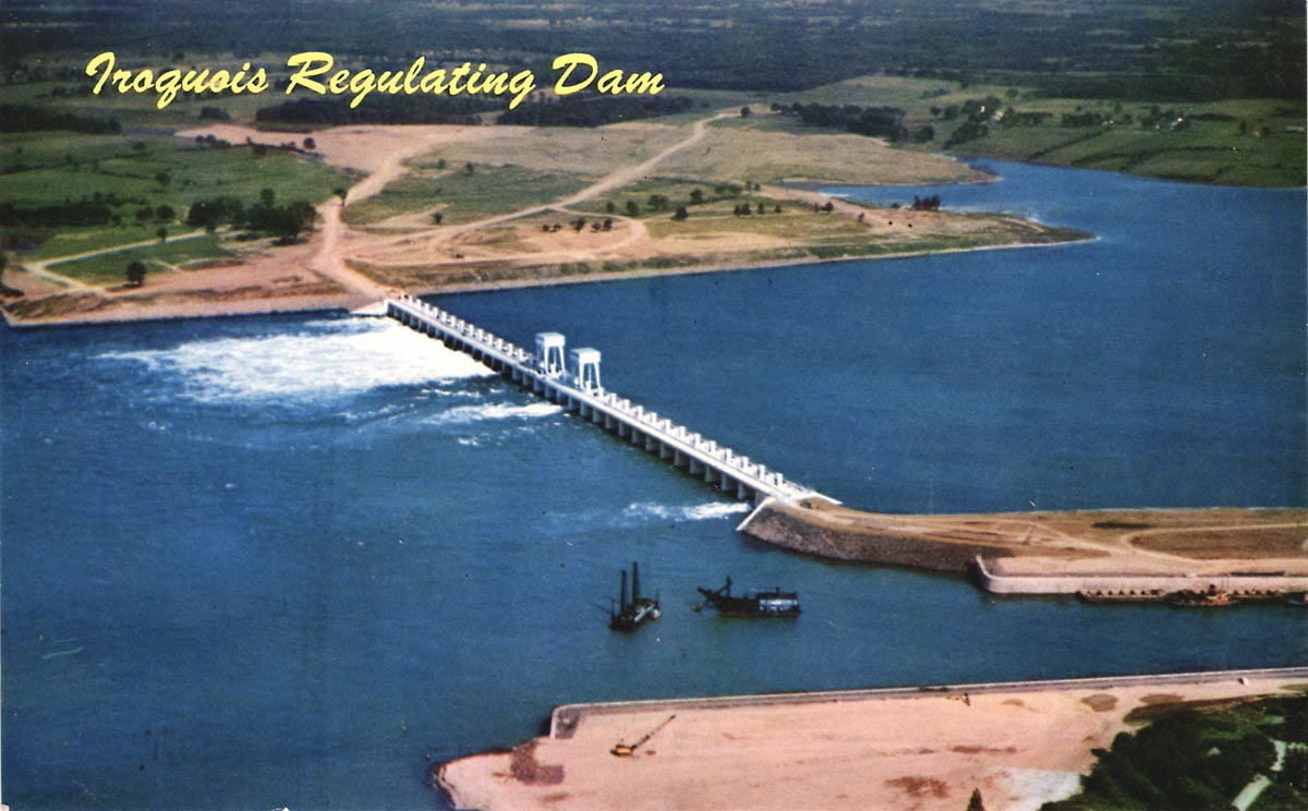
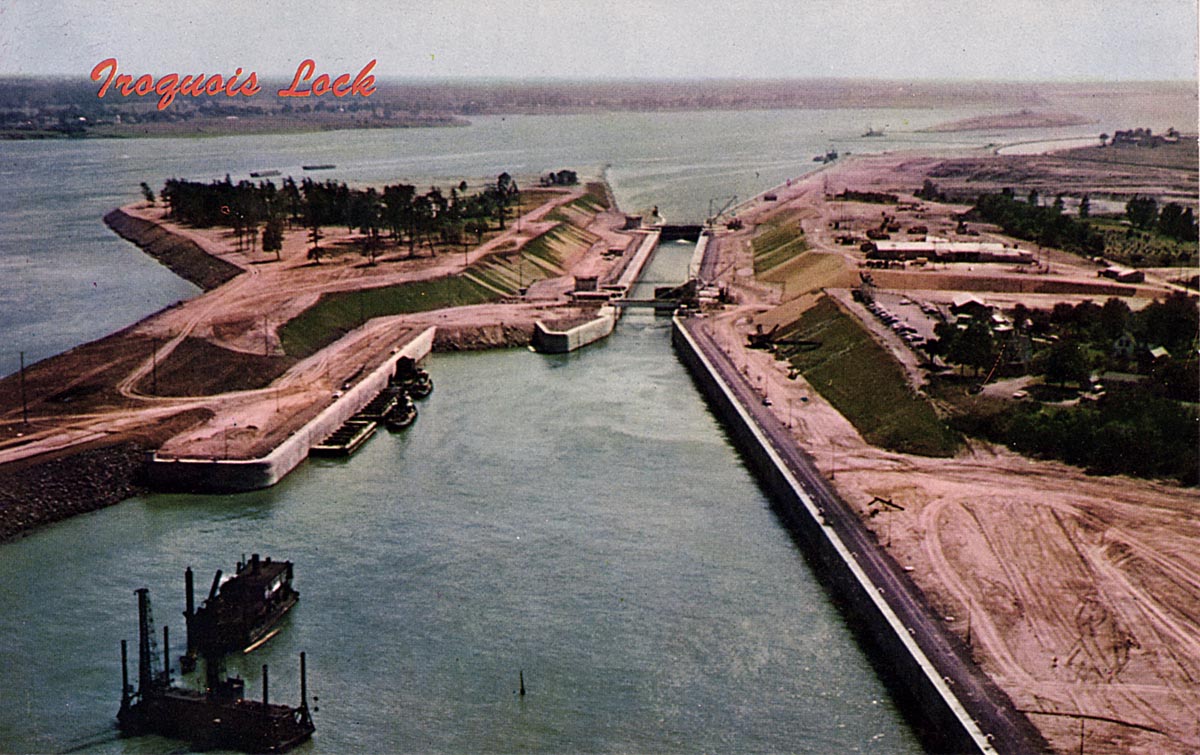
SHIL028: Aerial view of the Iroquois Control Dam.
This colour post card view of the Iroquois Control Dam and entrance to the new Iroquois Lock was taken before the flooding of Lake St. Lawrence. The drill scow and dredge are clearing a shoal from below the lock.
There was an explosion aboard the drill scow, the ROCK KING, that claimed the life of a worker in March of 1958. The memorial to him is located in the park at Iroquois Lock. To the right of the ROCK KING is the dredge MAJOR.
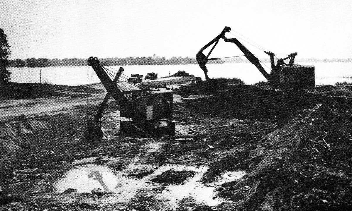
SHIL030: Iroquois Lock Excavation 1955.
This view of two shovels cutting away the earth is where the western approaches to the new canal and lock will be located. The equipment is light weight because they had to cross the old bridge over Lock 25 of the oldGalops Canal to reach this side of Point Iroquois. The dump trucks are moving the earth to the beginning of the coffer dam which ran far out into the river.
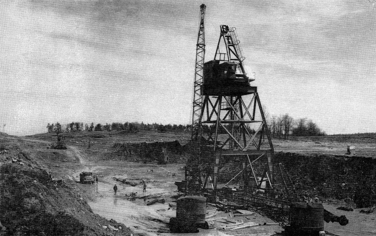
SHIL032: Iroquois Lock Construction.
Two small cranes were used to assemble a much larger crane on Point Iroquois. This large crane was needed to lift large buckets of concrete and help assemble and move the traveling form which was used to build the upper, or western, approach wall to Iroquois Lock.
SHIL034: Iroquois Lock Excavation.
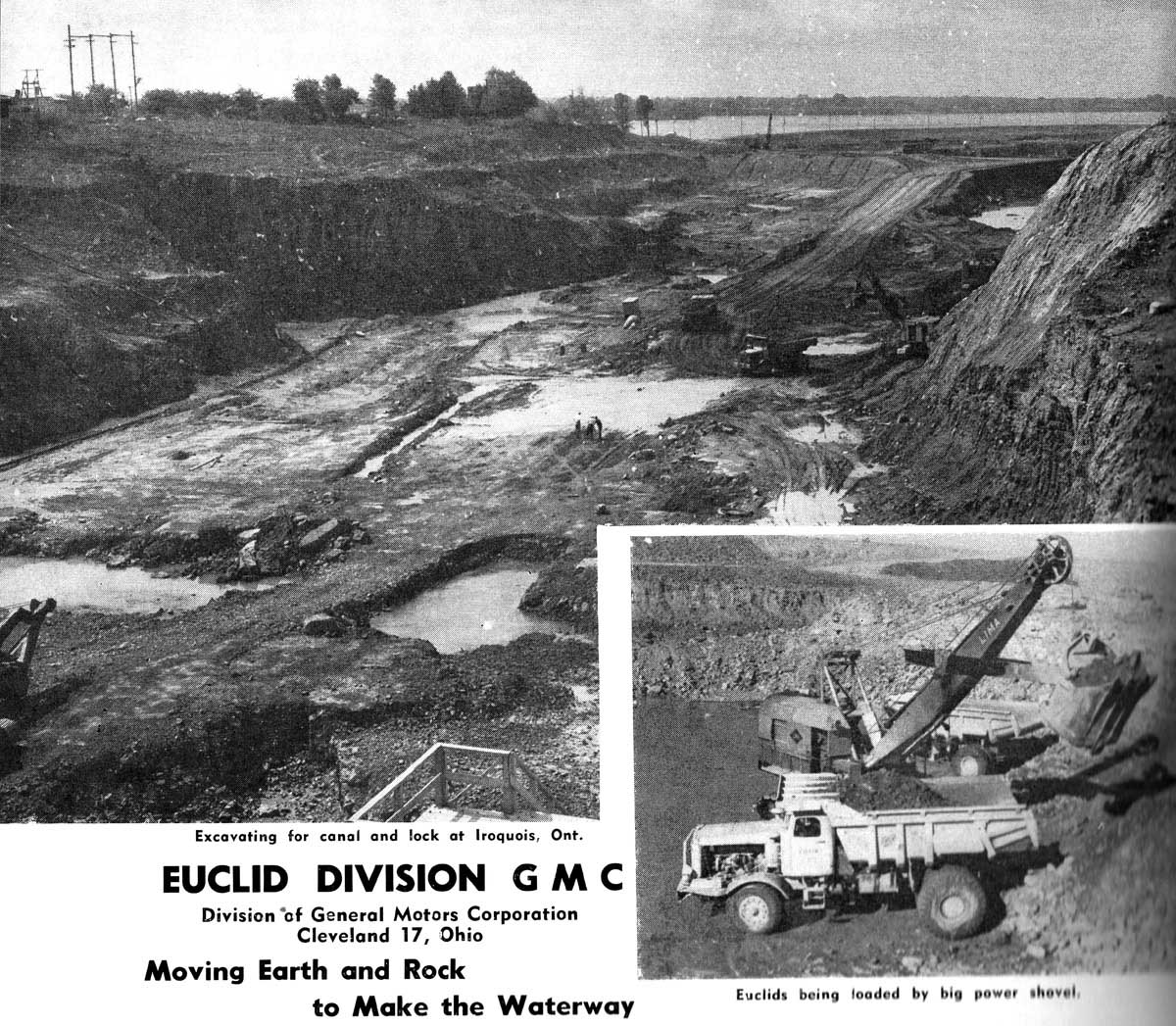
An advertisement from the Euclid company illustrates the size and depth of the cut made through Point Iroquois. The photographer is looking east towards the lower end of the new canal. The earth was piled up on the northern side of Iroquois Point and, as soon as the old village of Iroquois was moved or razed, this material was used to bury the old town site.
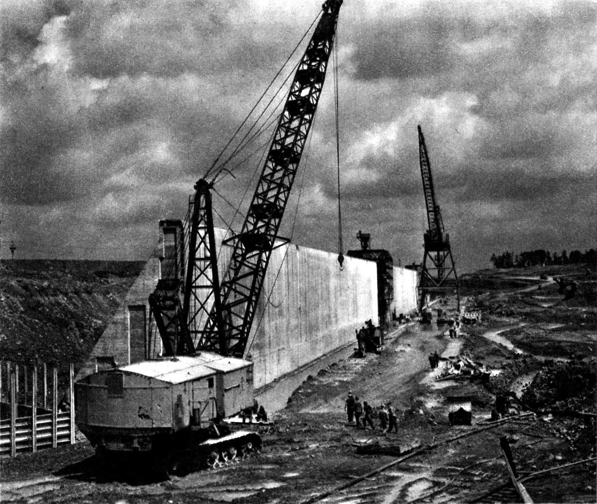
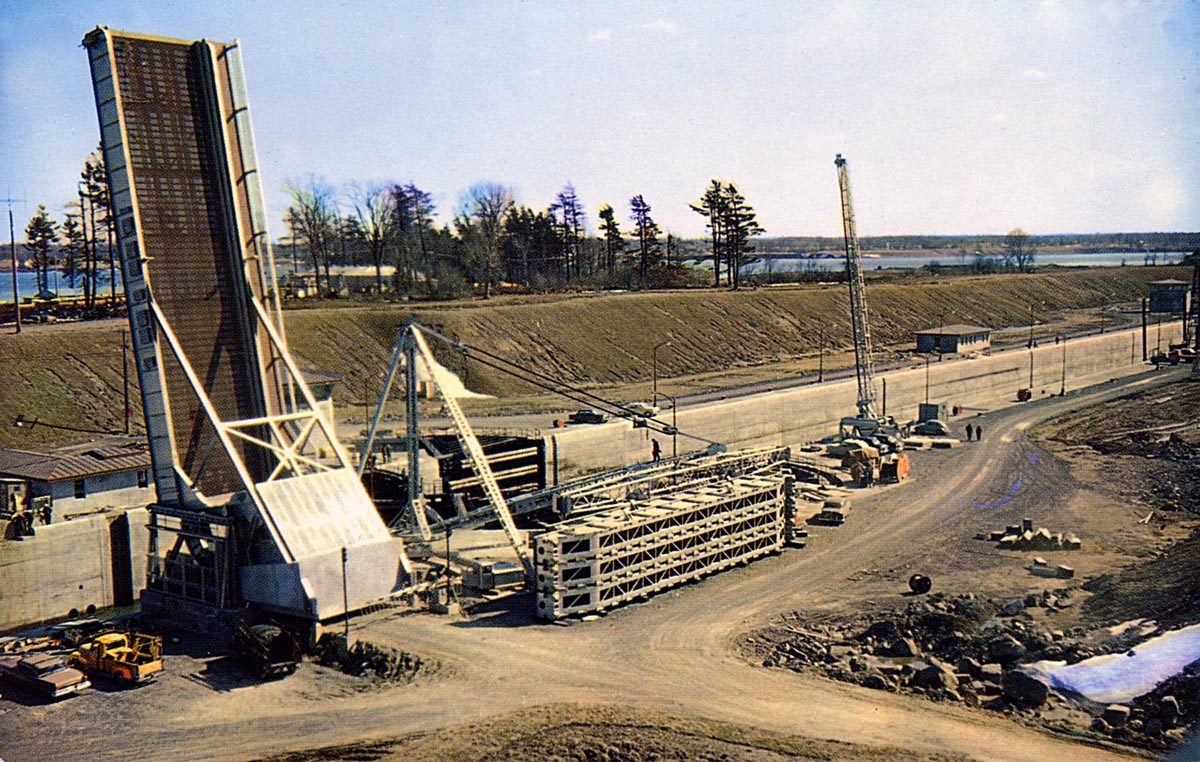
SHIL036: Upper approach wall under construction at Point Iroquois.
In this view the photographer is looking east along the new upper approach wall. The tall traveling crane stands next to the traveling form. The crane will dump large buckets of fresh concrete into the top of the form. When completed the wall will be 3,200 feet long. In the background the excavation through Point Iroquois can be seen. This is where the lock chamber will be built.
SHIL038: Aerial View of Point Iroquois, Spring 1957.
The old canal has two up bound ships waiting for the bridge to open before they can proceed up to Cardinal. The floating docks above the lock were for the down bound ships to have a dock to tie up to while waiting for their turn to lock down. The traffic through the Galops Canal was one way only at this time. This was because the river was now completely blocked with the construction of the Iroquois Control Dam between Point Iroquois and Rockway Point on the U.S. side.
The building of the new lock is nearing completion, with the upper approach walls and the lock chamber concrete in place. The lower approach walls will be completed later this year. To the left can be seen large excavations in progress, with lines of large dump trucks waiting to cross the bridge over the old canal. This material is being taken into the area where the village once stood and used to bury the old foundations.
SHIL040: Iroquois Lock Chamber 1957.
The Iroquois Lock chamber is nearly complete in this image. We are looking east into the chamber and the new bascule bridge is now installed. A man can be seen standing on the rock bottom. The walls are 80 feet apart. Ships built to pass through this lock will eventually be 78 feet wide and 740 feet long. The steel post located in the lower right corner of the image is for the ship arrestor to be secured to when in the down position.
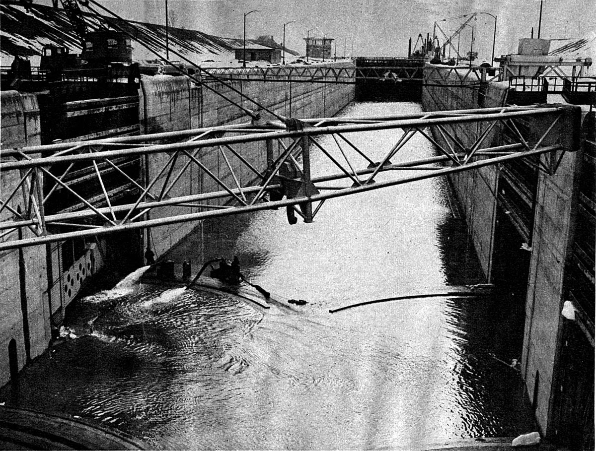
SHIL042: Flooding Iroquois Lock Chamber 1957.
Water is being allowed into the chamber of the Iroquois Lock in the fall of 1957. The last concrete pour had taken place on August 26. The steel frame in the foreground is the lifting beam for installing and removing stop logs. Behind it straddling the lock is a ship arrestor boom. Below it is a black cable which is the actual ship arrestor. The boom is just for lifting and lowering the cable. At the bottom of the lock are arc shaped rails upon which the sector gates will ride as the travel open and closed.
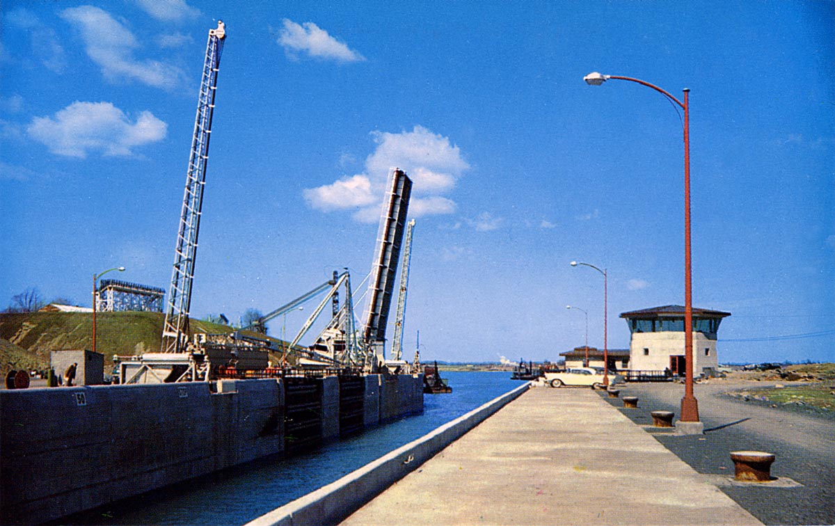
SHIL044: Iroquois Lock is ready for service.
The stop logs have been removed and stacked to the right of the bridge. There is very little water in the entrance to the lock, which would indicate that the flooding of Lake St. Lawrence has yet to take place. However, all indications are that this lock is complete and ready for vessel traffic.
Note how the bridge still hangs out over the lock somewhat even though it is in the open position. This would lead to several collisions with the bridge by ships passing through the lock. On one occasion a ship nearly toppled the bridge by striking it with the bow as it came up into the lock.
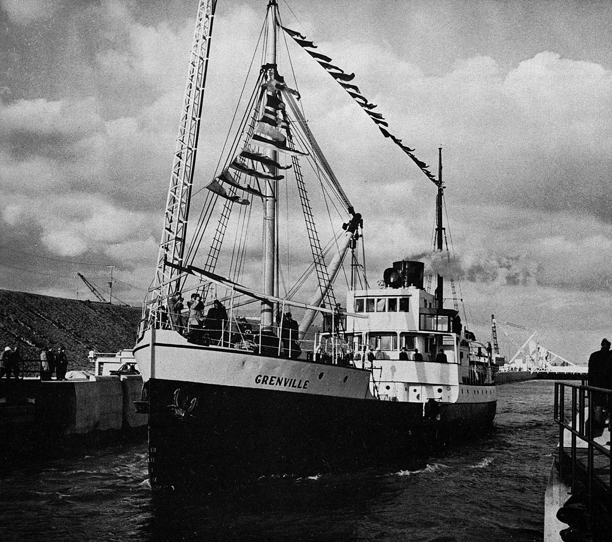
SHIL046: Coast Guard ship GRENVILLE - first ship to transit Iroquois Lock.
At 2 pm, November 23, 1957, the Canadian Coast Guard ship GRENVILLE became the first ship to pass through the new Iroquois Lock. Many politicians, businessmen, and busloads of school children attended this event. This was a test run of the facility.
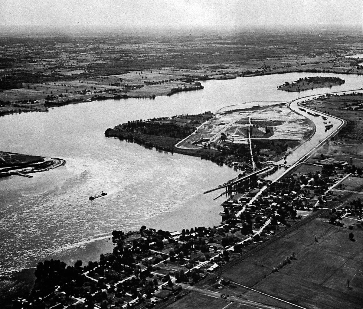
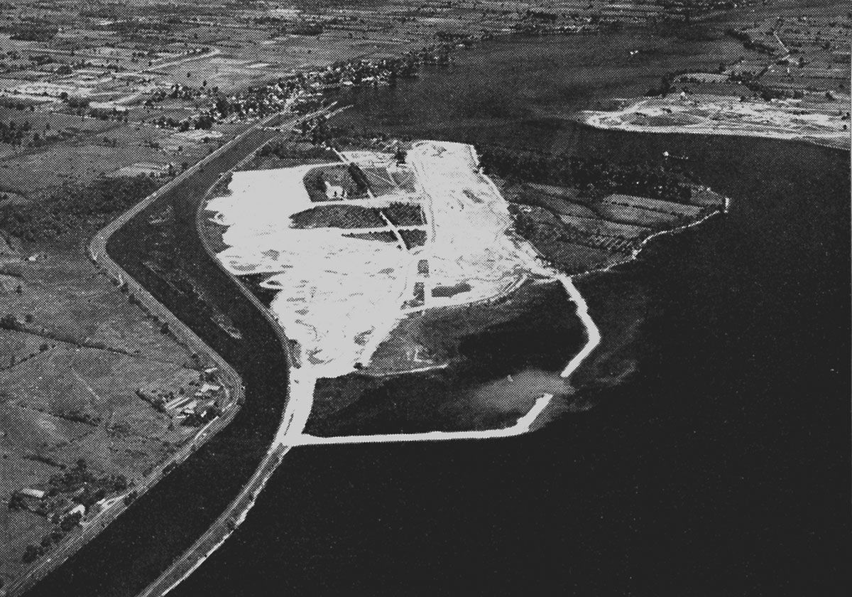
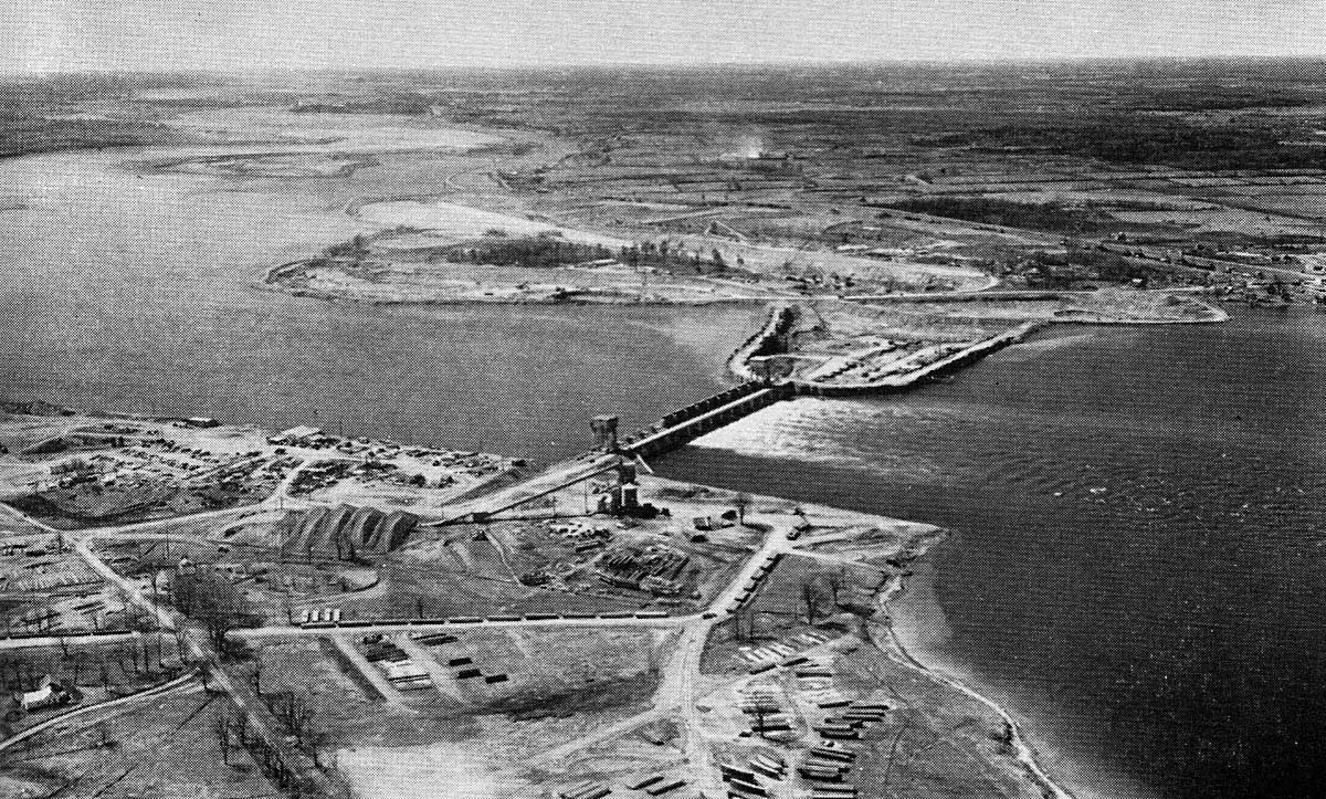
SHIL048: Point Iroquois before the flood looking east in 1958.
An aerial view of Point Iroquois and the village of Iroquois in the Spring of 1958. The old canal is no longer in use and we can see canallers using the new lock. Down the river the up bound ships must use the Rapide Plat canal at Morrisburg. At Cornwall all ships transiting the river must use the old canals until the flood takes place in July. The area where the village of Iroquois once stood is now just barren ground. Eventually the area once occupied by the town will become an air strip and golf course with a public swimming area in between.
SHIL050: Point Iroquois before the flood looking west in 1958.
The village of Iroquois has been completely removed from it's old location. The foundations and piles of rubble from demolished buildings has been buried under a layer of earth from the excavations at Point Iroquois. The old canal has been closed off by a dike built across it west of Point Iroquois, leaving it dry above Lock 25. The bridge across this lock is still in use, but later a causeway will be built across the old canal and it will have a paved road on it leading up to the new lock.
The flooding that will soon take place will cover the old Lock 25 dating from 1847, seen in the lower right side of the image. Also the lower approach walls to the 1901 version of Lock 25 will be covered with water. Dredges continue to work clearing away high areas of the river bottom above and below the new lock at Point Iroquois.
SHIL052: The new Iroquois Lock looking east before the flood in 1958.
A salt water ship can be seen departing the new Iroquois Lock up bound while two old canallers wait on the upper approach wall for their turn to lock through down bound. Dredges and a drill scow are at work clearing away underwater obstructions. To the left of the lock is an area that will be developed into a park and visitors viewing area. To the extreme upper left can be seen the lower approach walls of the old canal. When the flood takes place these two stone walls will disappear under water. This will take place early in July, 1958.
SHIL054: Aerial View of Iroquois Lock early summer, 1958.
The new lock at Iroquois early in the summer of 1958. Crews are placing sod on the new hillsides near the lock. Seen in the lower left of this view are the drill scow ROCK KING and the dredge MAJOR, still at work blasting and excavating rock from the bottom of the river. Other dump scows, tugs to move them, and dredges are still working to clear the shipping channels.
The flooding of Lake St. Lawrence below the lock will take place early in July.
SHIL056: Iroquois Lock and Control Dam early summer, 1958.
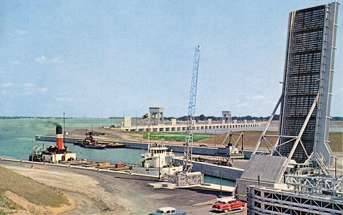
The Canada Steamships Lines canaller MAPLEHEATH slides into the new lock at Iroquois early in the summer of 1958. The ship arrestor seen standing in the open position right at the bow of the ship was knocked into the lock from this position so many times it was eventually decided to remove it permanently. This was because the flared bows of ships sliding up the approach wall to enter the lock would make contact with this apparatus, causing it to collapse into the lock.
The bascule bridge, standing to the right, was also modified so that it would not overhang the canal when in the open position. The barge at the wall between the ship arrestor and the bridge is an old gate lifter which, if needed, could lift a lock gate up out of the water. This type of gate lifter was soon declared not fit for the job and sold for scrap or other purposes.
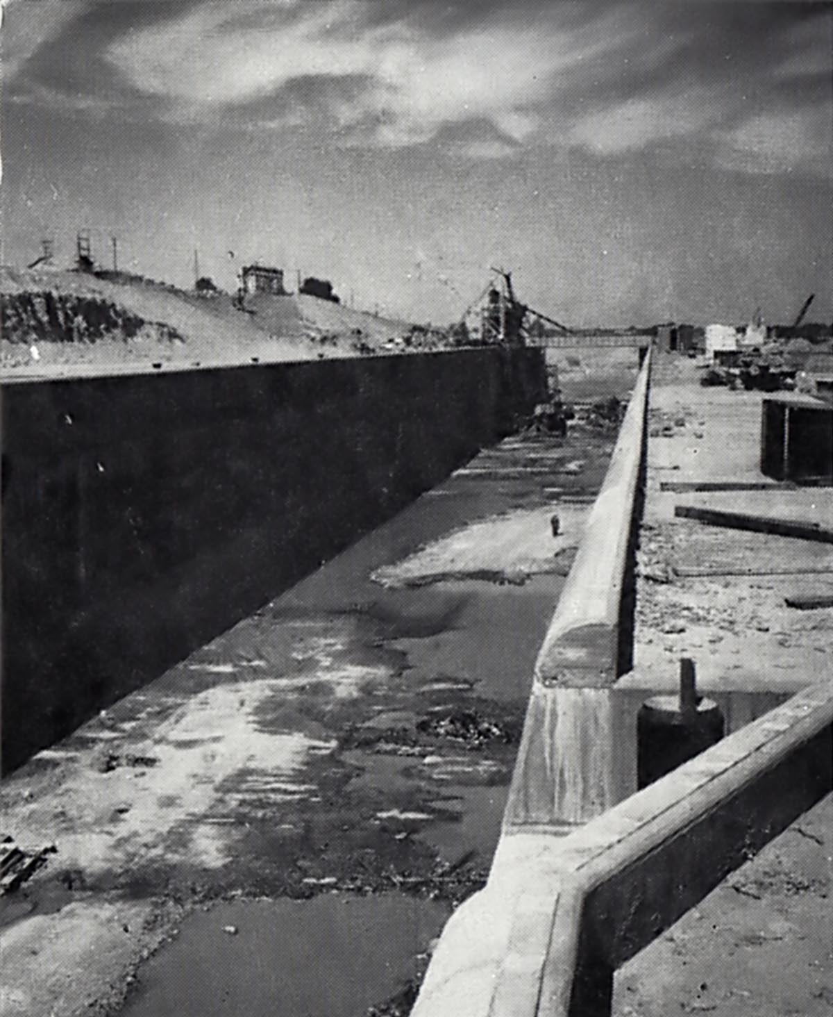
SHIL058: Iroquois Lock - early summer, 1958.
Looking east down the lock chamber past the open bascule bridge and ship arrestors. The overhang of this equipment out over the side of the lock is very apparent in this view. This led to problems with ships making contact with the lower ship arrestor and also the bridge. The depth of water in the lock indicates that the flooding of Lake St. Lawrence has yet to take place.
To the upper left can be seen the visitors look out platform. When the new park and visitors area is ready for use, the old platform was removed.
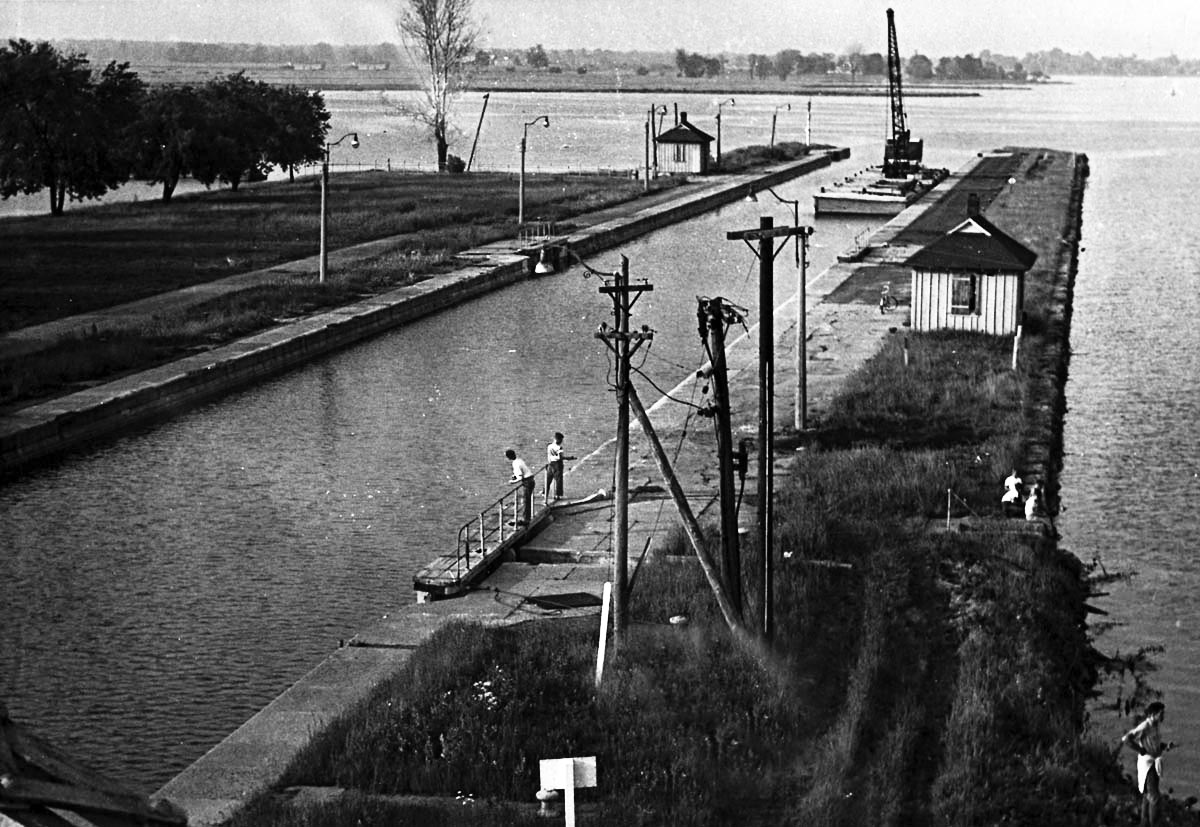
SHIL060: Lock 25 after flooding.
What once was a busy thoroughfare for shipping is now abandoned and now used as a quiet place for fishing. Eventually a group of volunteers cleaned up this area and it became a beautiful park and marina. To the left behind the dead tree is the location of the first Lock 25, completed in 1847. It is now hidden under water.
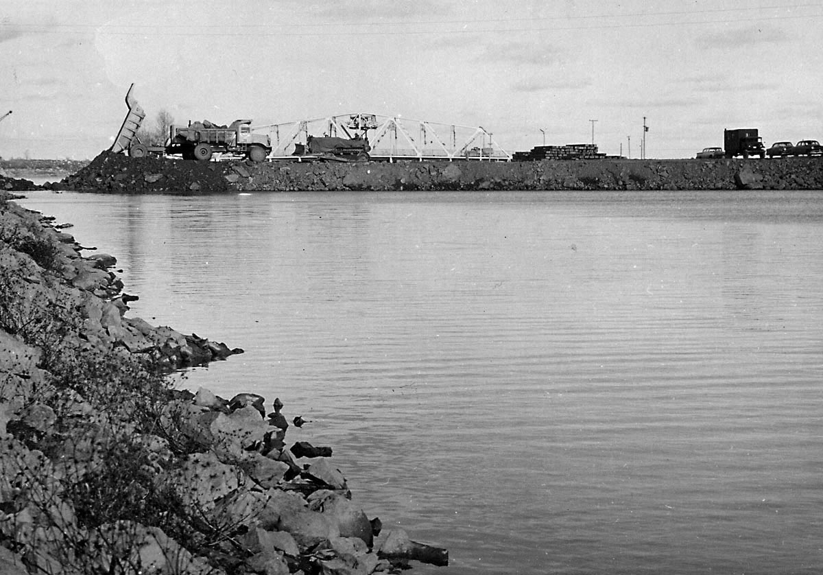
SHIL062: New causeway crossing the old Galops Canal.
Construction crews are filling in the old Galops Canal to make a roadway up to Point Iroquois. When completed the old bridge seen in the background will be cut up for scrap.