St. Lambert Lock
The Lachine section of the St Lawrence Seaway includes the 33 km South Shore Canal, with the St Lambert and Côte Ste Catherine locks, bypassing the Lachine Rapids. |
The 2 locks provide a total lift of 13.7 m to the level of Lake St Louis. Pictures covering the construction of the St. Lambert Lock are presented in this section. |
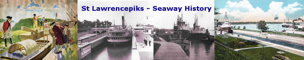
SHSL001: Map of the St. Lawrence River at Montreal showing the planned sites of the new canal and locks.
The channel shown in the drawing, that runs south of the Lachine Rapids, will become the South Shore Canal. The site of the new St. Lambert Lock is shown to the right of Nun's Island. The new Cote Ste. Catherine Lock is located on the south shore at the village of the same name. Note the Lachine Canal running through Montreal Island from Lachine to the main harbour.
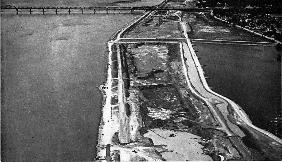
SHSL002: Looking up river showing excavations along the south shore of the river across from Montreal Harbour
The digging of the new South Shore Canal is done as much as possible "in the dry" as it was much more practical to excavate in that manner. Dredges shown at bottom left are digging the new channel that would later connect to the existing shipping channel in Montreal Harbour. The Jacques Cartier Bridge is in the center of this view and the Victoria railway bridge is in the background. Where the Victoria Bridge crosses the canal is where the St. Lambert Lock will be built.
SHSL003: St. Lambert Lock Spring 1956. Looking west up the river.
The location of the St. Lambert Lock is still flooded in this view. It will be located above the Victoria Bridge, seen in the background crossing the river to the Montreal. The Jacques Cartier Bridge will be raised several feet to clear the masts of the ships transiting the Seaway. The entrance to the Lachine Canal can be seen on the extreme right.
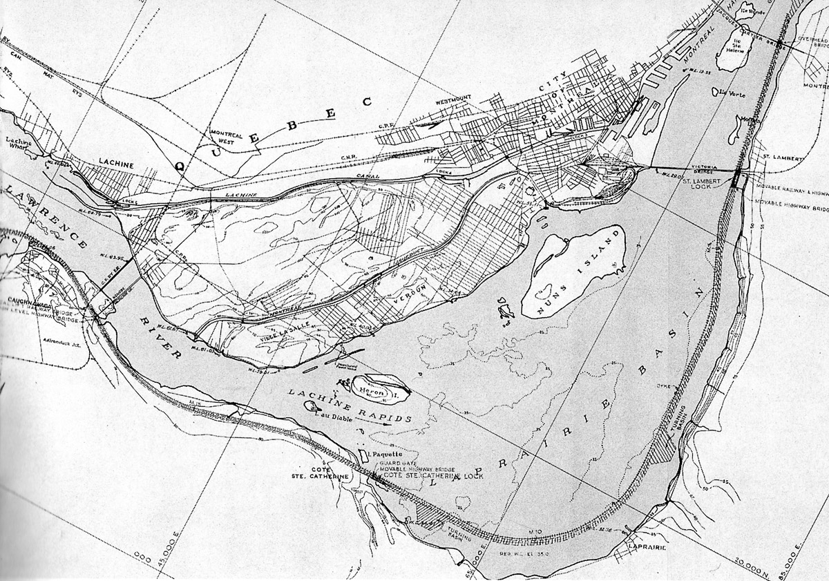
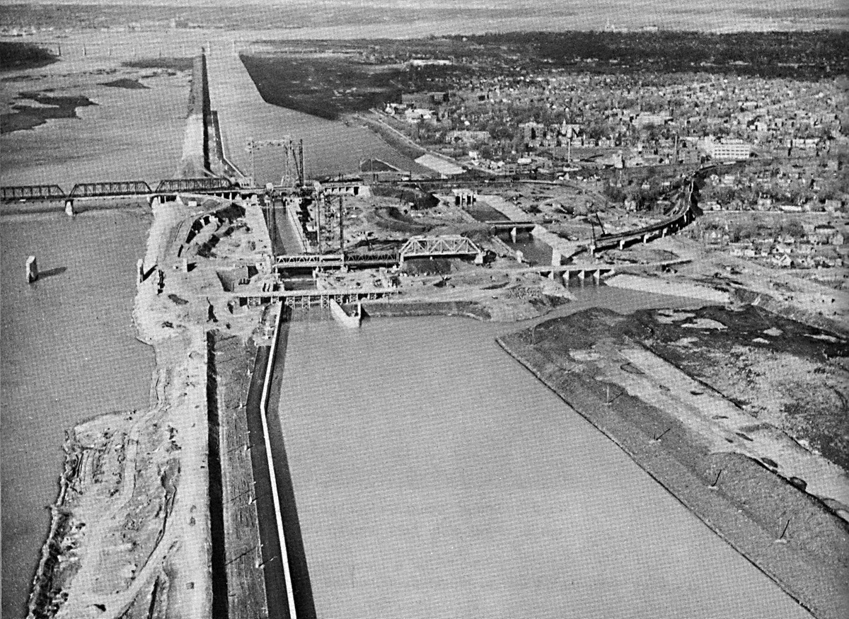
SHSL004: Looking east down the river at the South Shore Canal and Victoria Bridge.
The excavation of the South Shore Canal west of the Victoria Bridge can be seen in this view. The St. Lambert Lock site is just above the bridge. No forms for placing of concrete can be seen.
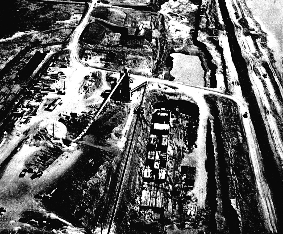
SHSL005: Site of St. Lambert Lock with concrete plant nearby
The forms for pouring concrete are now being built. The lock walls were built in sections.
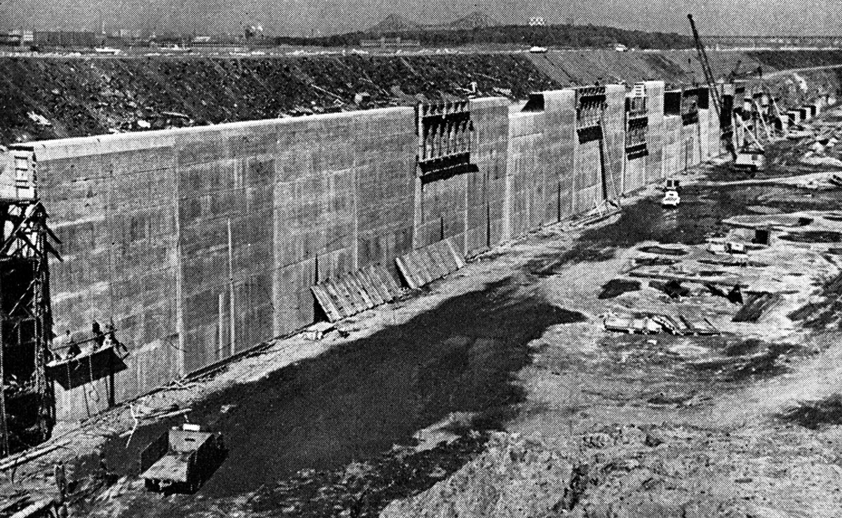
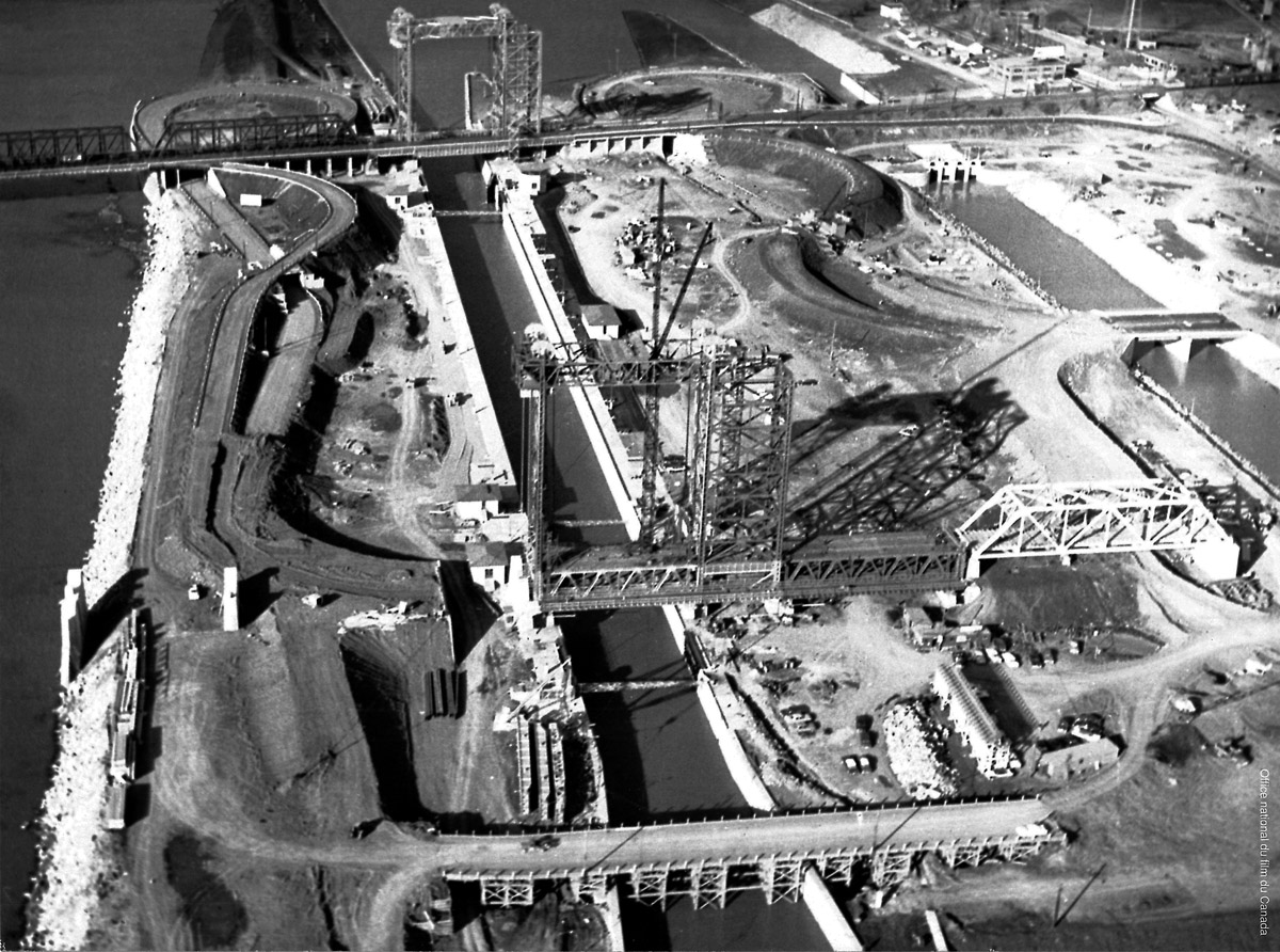
SHSL006: St Lambert Lock being built next to the Victoria Bridge.
Another view of the construction site of the St. Lambert Lock. Excavation of the shipping channel goes on above and below the site of the new lock. Also a water diversion channel and weir will be built south of the lock.
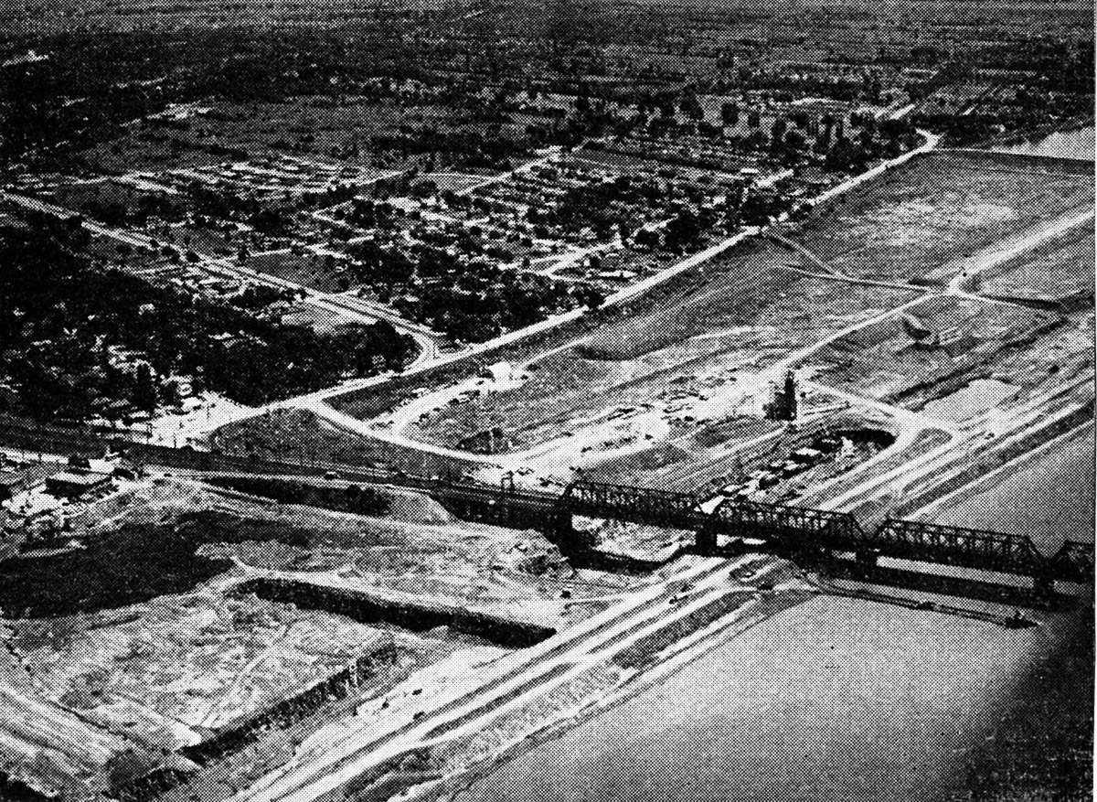
SHSL007: Approach wall below St. Lambert Lock under construction.
This concrete wall is located a short distance below the Victoria Bridge. After the flooding takes place, ships will tie up to this wall while they wait for their turn to enter the St. Lambert Lock. The Jacques Cartier Bridge can be seen in the distance.
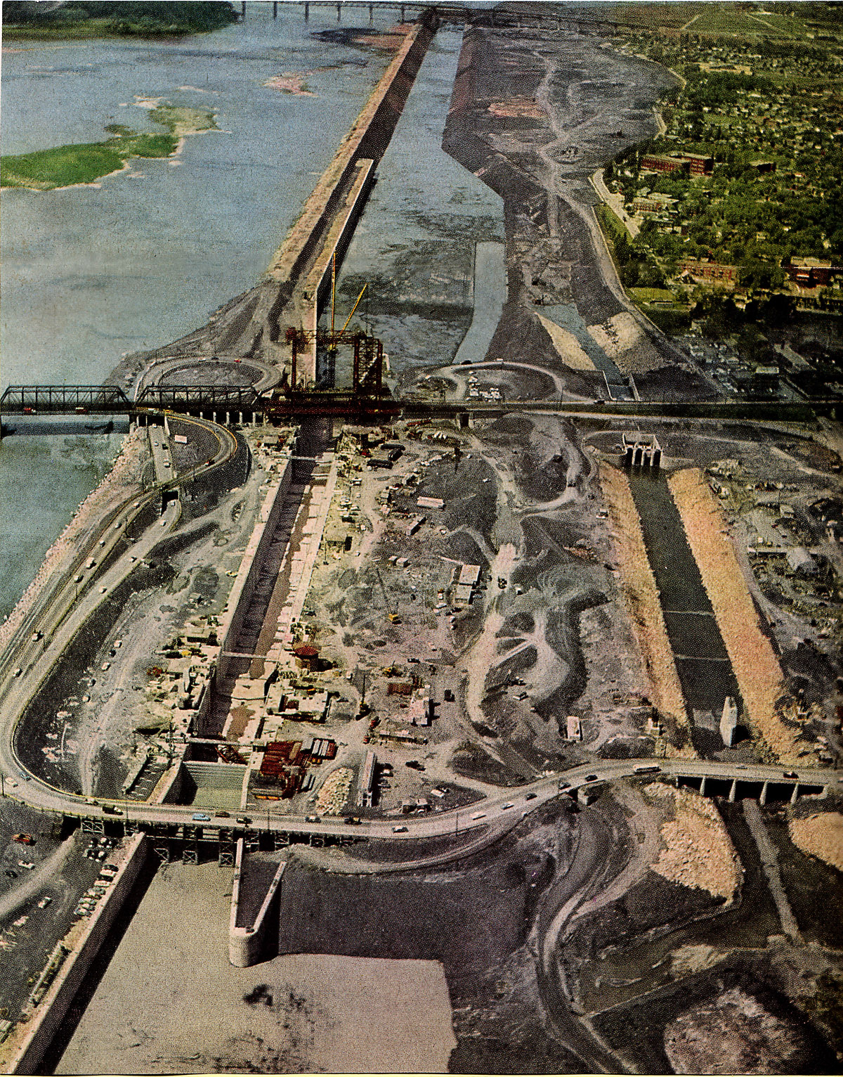
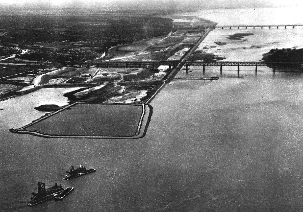
SHSL008: Aerial view of St. Lambert Lock during construction
The concrete walls for St. Lambert Lock are complete. Work is underway to rebuild the Victoria Bridge to include a lift span across the canal. A new lift bridge will be built near where you see traffic crossing the lock on a temporary bridge at the west end. On the right side of this photo there is a channel for water to bypass the lock and go through a weir. This will control the level of the water in the South Shore Canal. Note the canal is still dry.
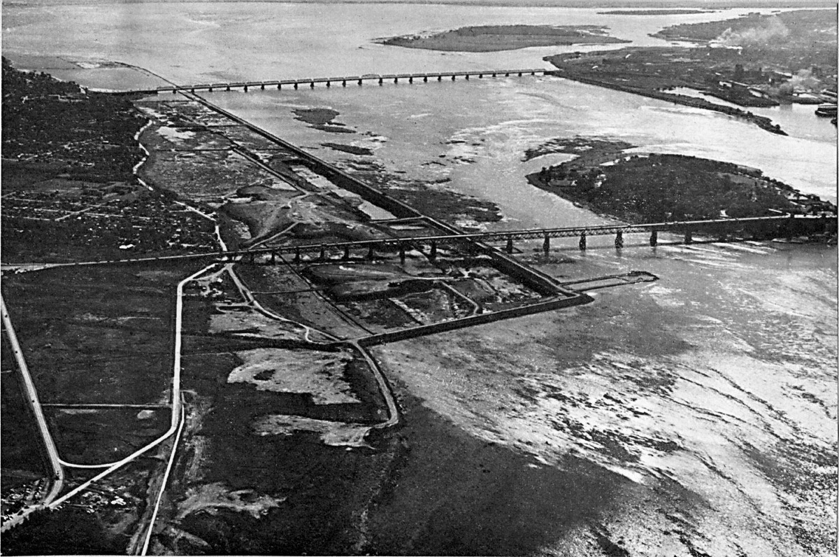
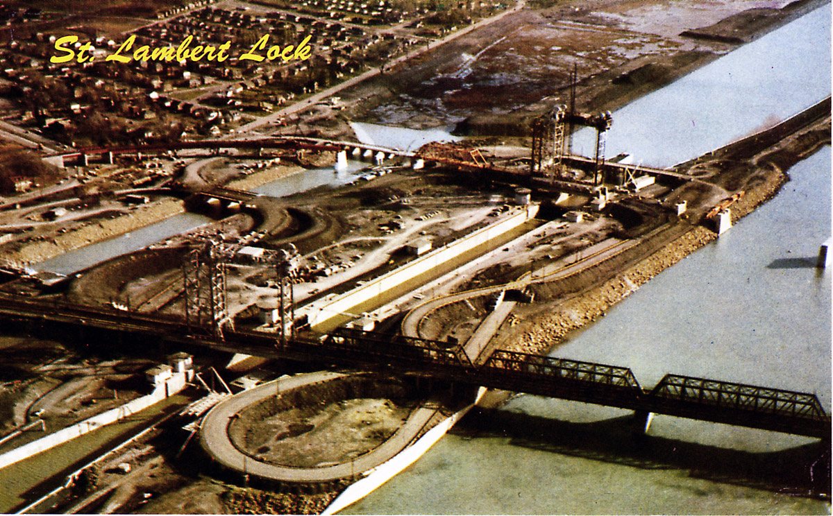
SHSL009: St. Lambert Lock flooded and the west bridge under construction.
The west bridge will carry both rail and road traffic when completed. Water from the lower end of the canal has been permitted to flood into the area.
SHSL010: St. Lambert Lock and the channel down to Montreal Harbour.
The channel below the St. Lambert Lock continues to a point below the Jacques Cartier Bridge, where it meets the St. Lawrence River in the middle of Montreal Harbour. Note the Jacques Cartier Bridge has now been elevated to provide enough clearance under it for ships to pass. To the right of the lock a new approach ramp is under construction to connect with the west bridge.
SHSL011: St. Lambert Lock looking south west.
The new west bypass bridge is still under construction but now the approach ramp to connect the road traffic to it is nearly complete. Eventually both road and rail traffic will use the west bridge when the east bridge is open for a ship to pass through.
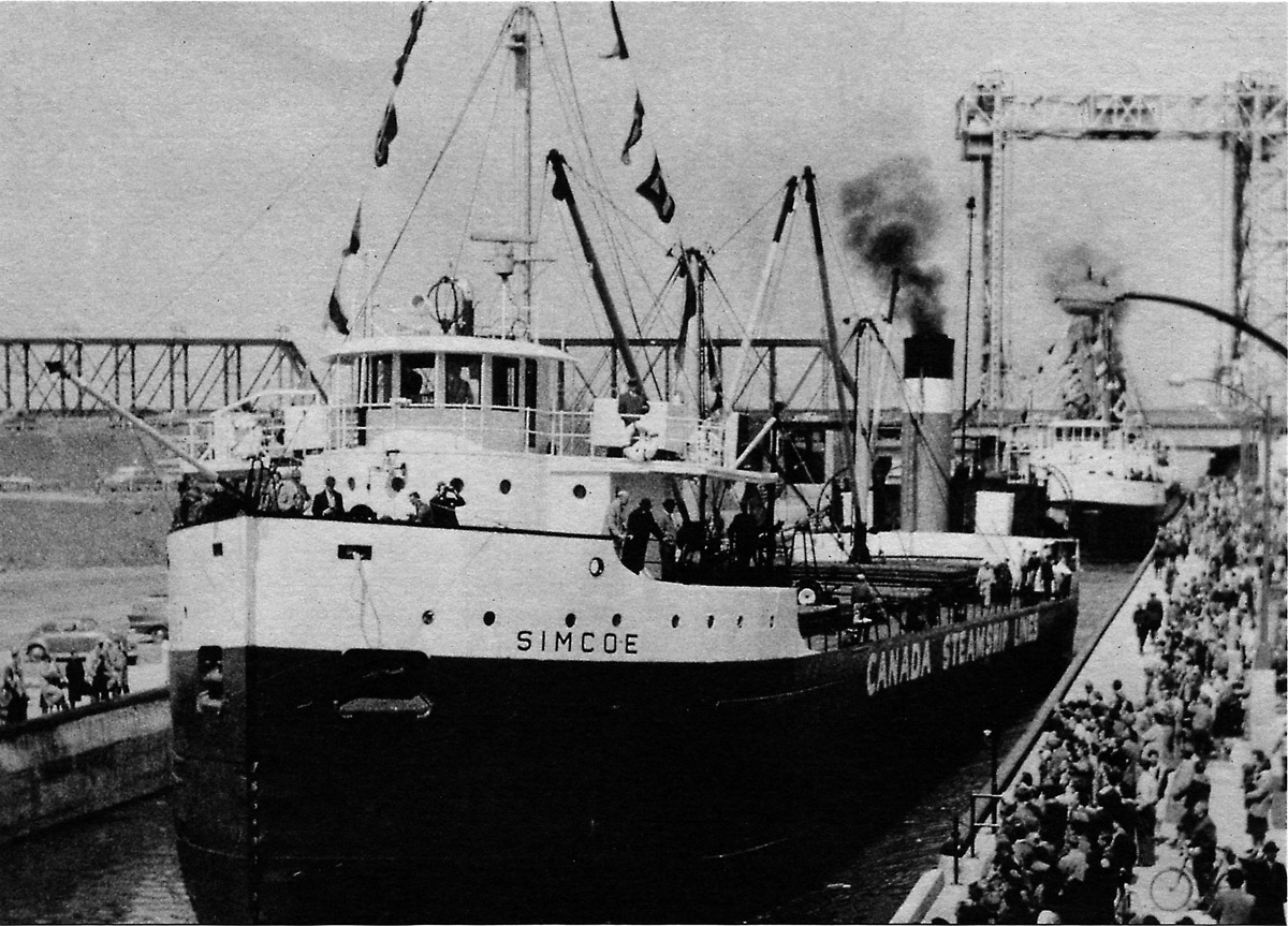
SHSL012: SIMCOE in St. Lambert Lock on opening day, 1959.
On April 25, 1959, CSL's canaller SIMCOE was the first commercial ship through the St. Lambert Lock. Later that year, due to the opening of the Seaway allowing upper lakers to transit down the river to deliver cargoes to the lower St. Lawrence ports, SIMCOE was retired and sold to be used as a gas drilling rig.
SHSL013: St. Lambert Lock on opening day, 1959.
Another view of the first lockage of commercial traffic through St. Lambert Lock on April 25, 1959.
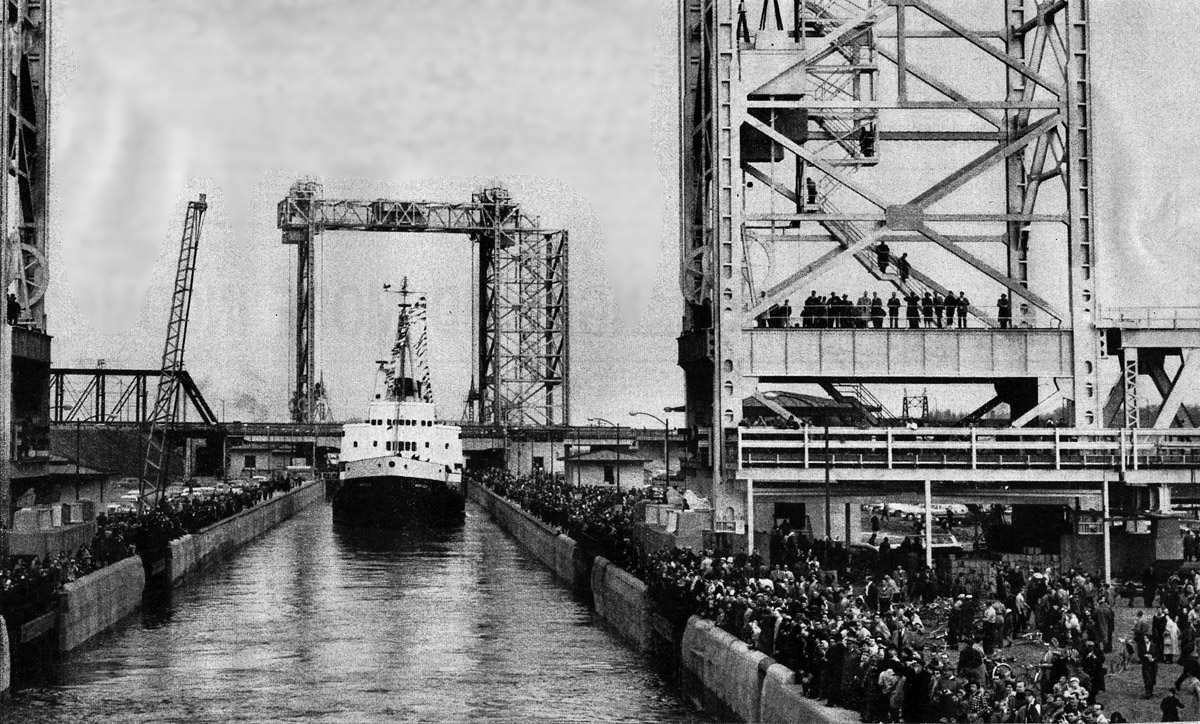
SHSL014: CCGS D'IBERVILLE approaching St. Lambert Lock, 25 April, 1959
The CCGS D'IBERVILLE, loaded with guests for the trip, is the very first ship to pass through St. Lambert Lock on April 25, 1959. The photographer is looking up the canal from the east.
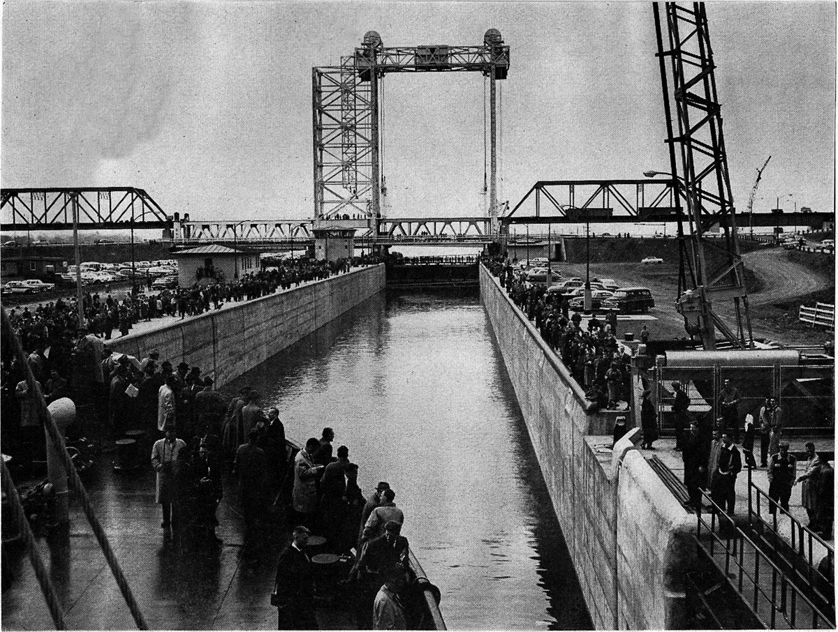
SHSL015: CCGS D'IBERVILLE entering St. Lambert Lock, 25 April, 1959.
A large crowd has gathered to witness the passage of the first ship through the St. Lambert Lock. The CCGS D'IBERVILLE has on board many distinguished guests from American and Canadian governments as well as businessmen and employees associated with the construction of the new Seaway
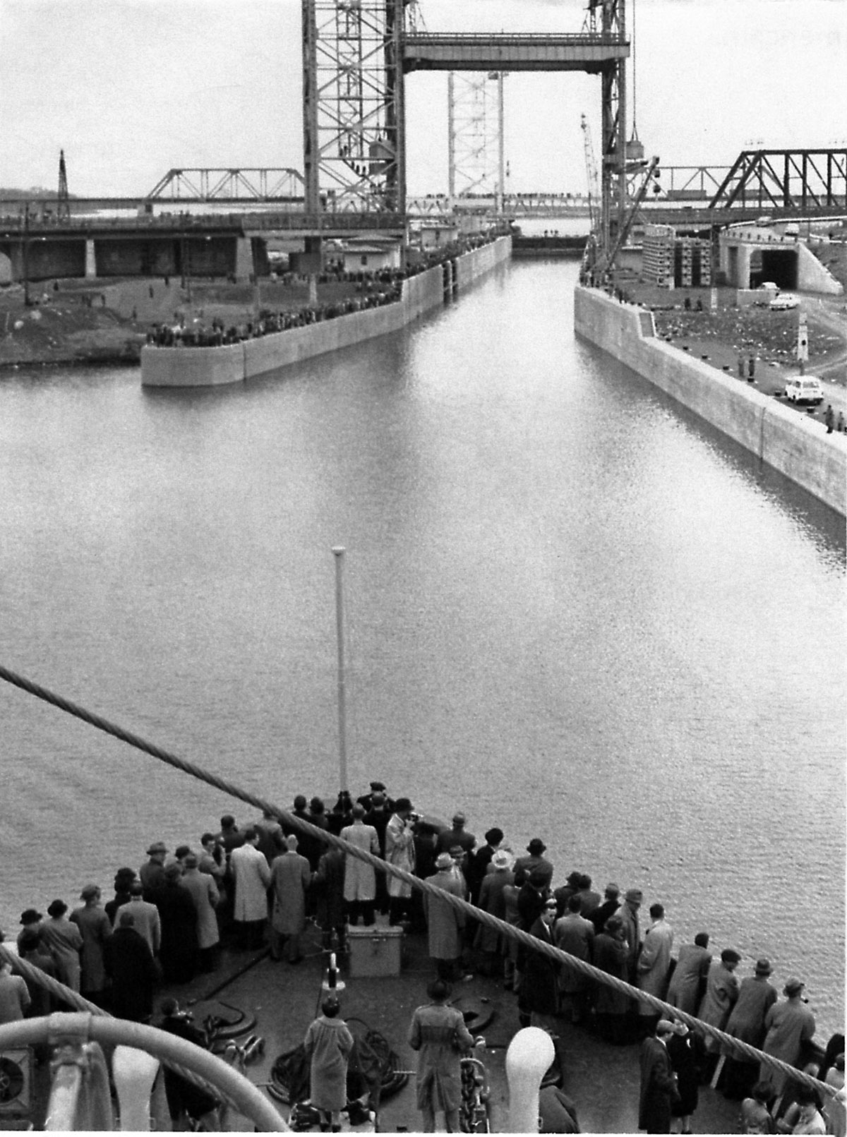
SHSL016: Looking aft from the D'IBERVILLE into St. Lambert Lock.
The icebreaker MONTCALM follows the D'IBERVILLE through the St. Lambert Lock on opening day, April 25, 1959,
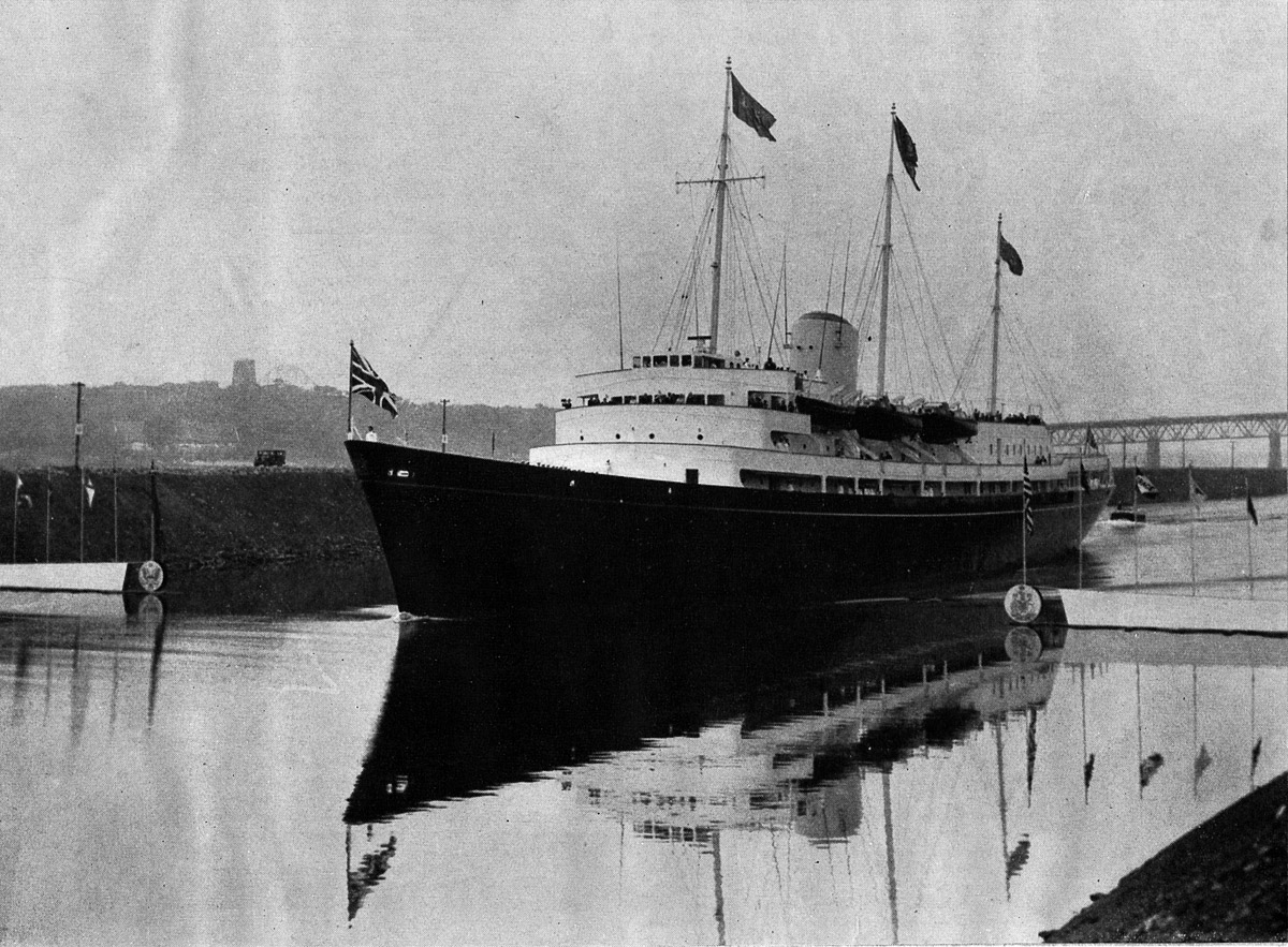
SHSL017: HMS BRITANNIA cuts the ribbon with her bow 26 June, 1959.
Balloons and fireworks were released when the ship's bow passed a symbolic gate at St Lambert Lock made of old timbers from the lock of the Lachine canal.
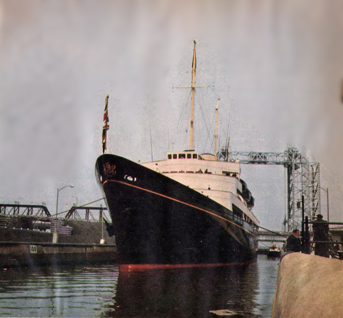
SHSL018: HMS BRITANNIA in St. Lambert Lock, 26 June, 1959.
This was the official opening of the St. Lawrence Seaway. Queen Elizabeth, President Eisenhower, and Prime Minister Diefenbaker sailed through the Seaway on the Royal Yacht BRITANNIA.
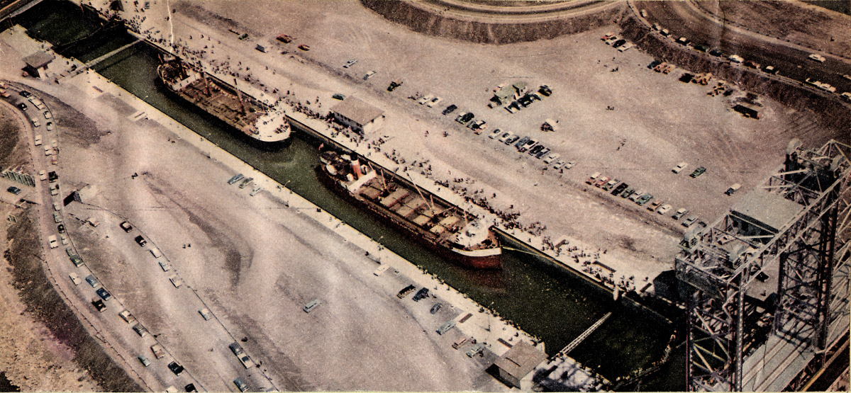
SHSL019: Aerial view of St. Lambert Lock.
The lock is now complete except for landscaping. A "salty" is in the lock down bound for the sea. Traffic is diverted from the east bridge to the west bridge to enable the opening of the east lift bridge.
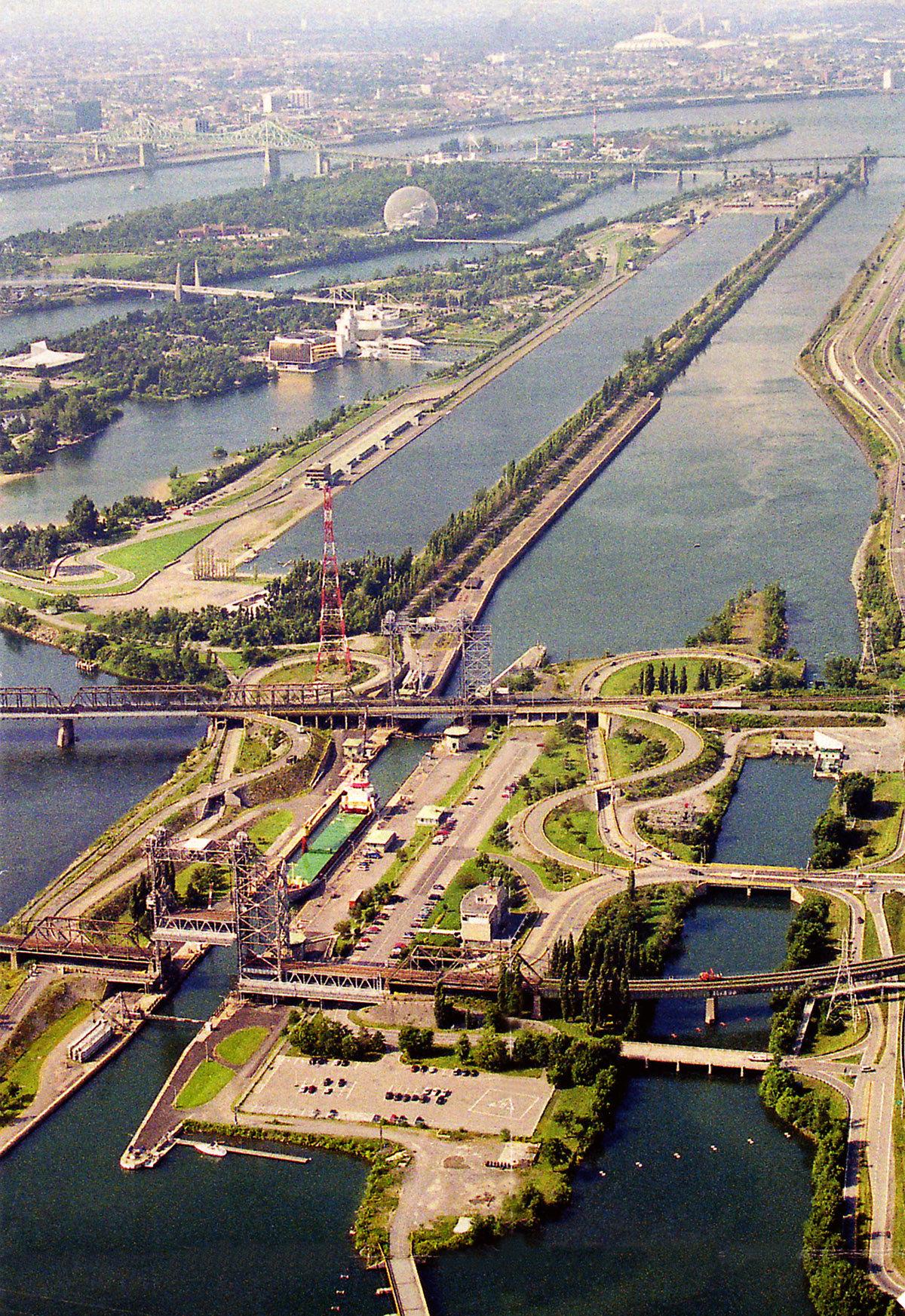
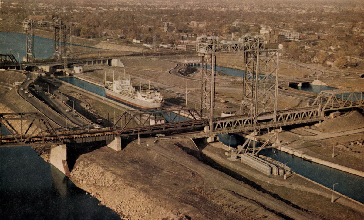
SHSL020: Aerial view of St. Lambert Lock.
The St Lambert Lock as it appears today. A new control center for the entire Canadian series of locks is located to the right of the lock. All radio traffic for the ships transiting the Canadian portion of the Seaway is managed by this office. The position of all ships in the Seaway is displayed on a large electronic screen.