
Seaway History in Colour - From Montreal to Cardinal
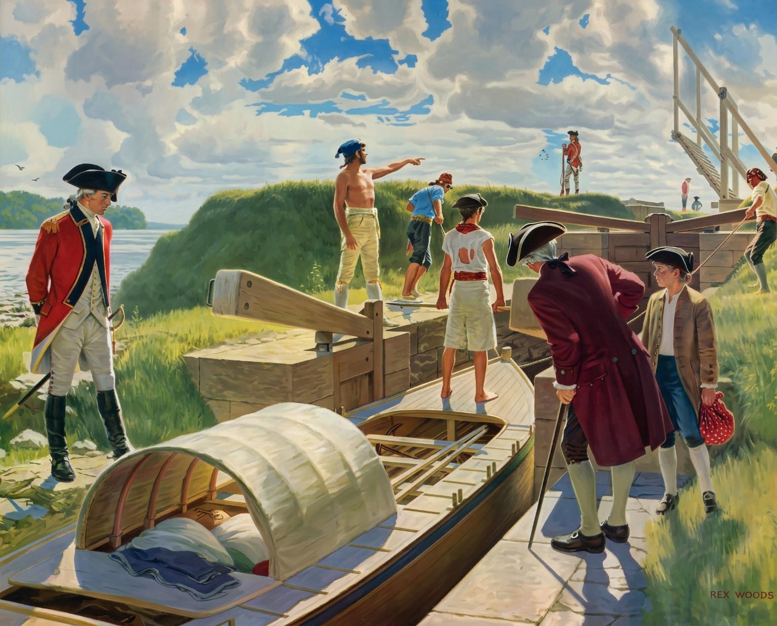
SHFC001- An Illustration of the Haldiman Canals - Rex Woods

SHCB300 - Canal Construction Next to Long Sault Rapid
Artists drawing of the construction of the canal bank leading up to Dickenson's Landing. The rapids seen here are the Long Sault Rapids. The date would be sometime in the late 1830's.
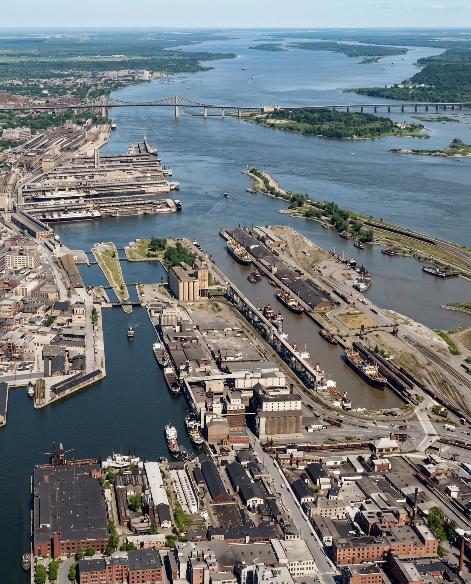
SHLC003: An aerial view of the Lachine Canal at the point where it exits into Montreal Harbour.
Locks 1 & 2 are seen center left with grain elevators to the right of the basins 1 & 2. Windmill Point Basin to the center right is flanked by the loading dock for grain on the left and the huge coal yard located on Bickerdike Pier to the right. A drydock and shipyard is located in the south west corner of Basin No. 2 - Date: 1931
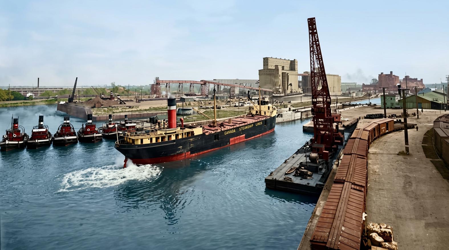
SHLC004: The Canada Steamship Line package freighter entering Lock 1
is either SELKIRK or her twin sister WINNIPEG.
The fleet of tugs are some of the Sincennes McNaughton Line. In the
background there is a salt water ship in the south Lock 1 and an Eastern
Steamships canaller is docked at Elevator B in Basin No. 1.
Photo from “The Growth of a Great Port 1927.”
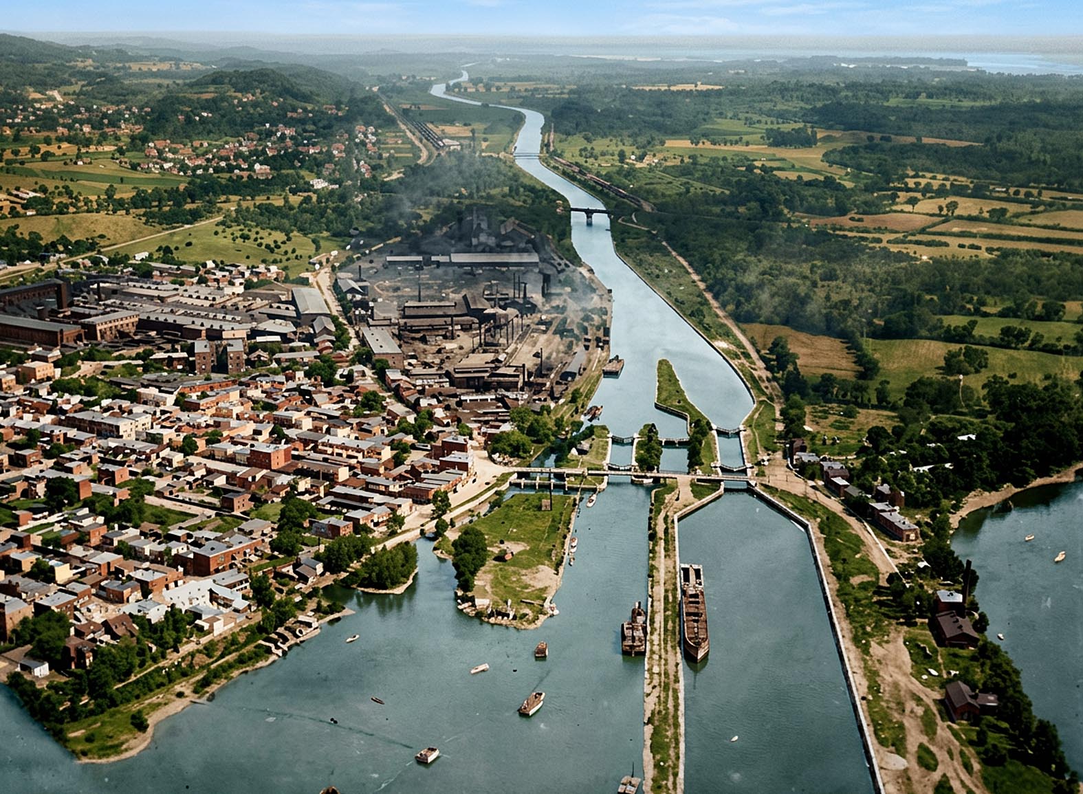
SHLC031: Another view of the western entrance to the Lachine Canal
Another view of the western entrance to the Lachine Canal, which was taken
in 1920. The canal structures from left to right are as follows;
The first canal which opened in 1825.
The subsequent rebuild from 1848, a 200 foot lock with 9 feet of water
over the sills.
The weir for regulating the water let into the canal.
The 270 foot lock with 14 feet of water over the sills which opened in
1884.
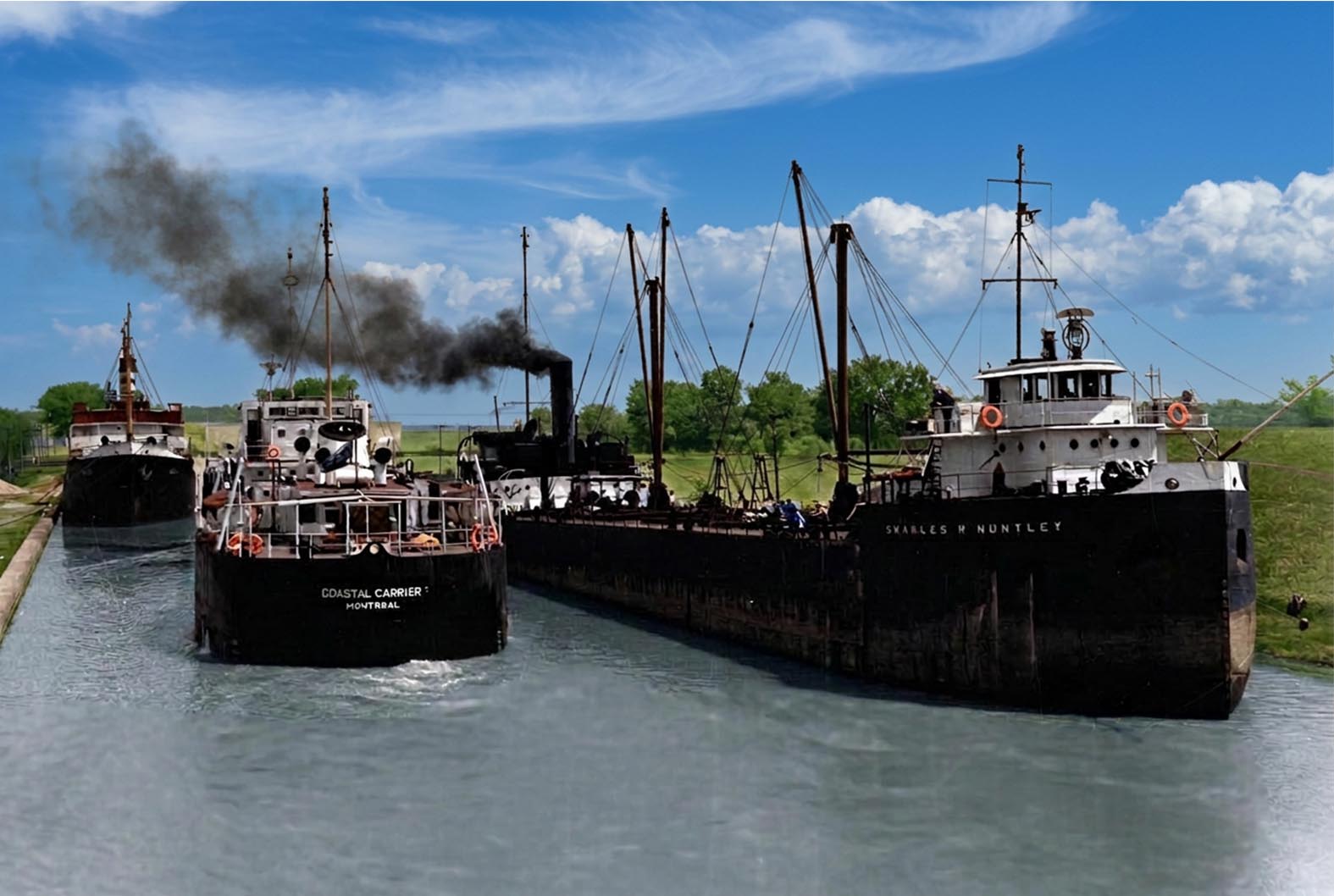
SHSC007: The basin between Locks 1 & 2 of the Soulanges Canal at Cascades Point.
The tanker COASTAL CARRIER slips between the canaller CHARLES R. HUNTLEY
and the Norwegian flag steamer DUX as she moves from Lock 2 down to Lock
1. The sailors who went ashore to handle the cables complained of having
to “Walk from Montreal to Cardinal.”
Gord Macaulay photo.
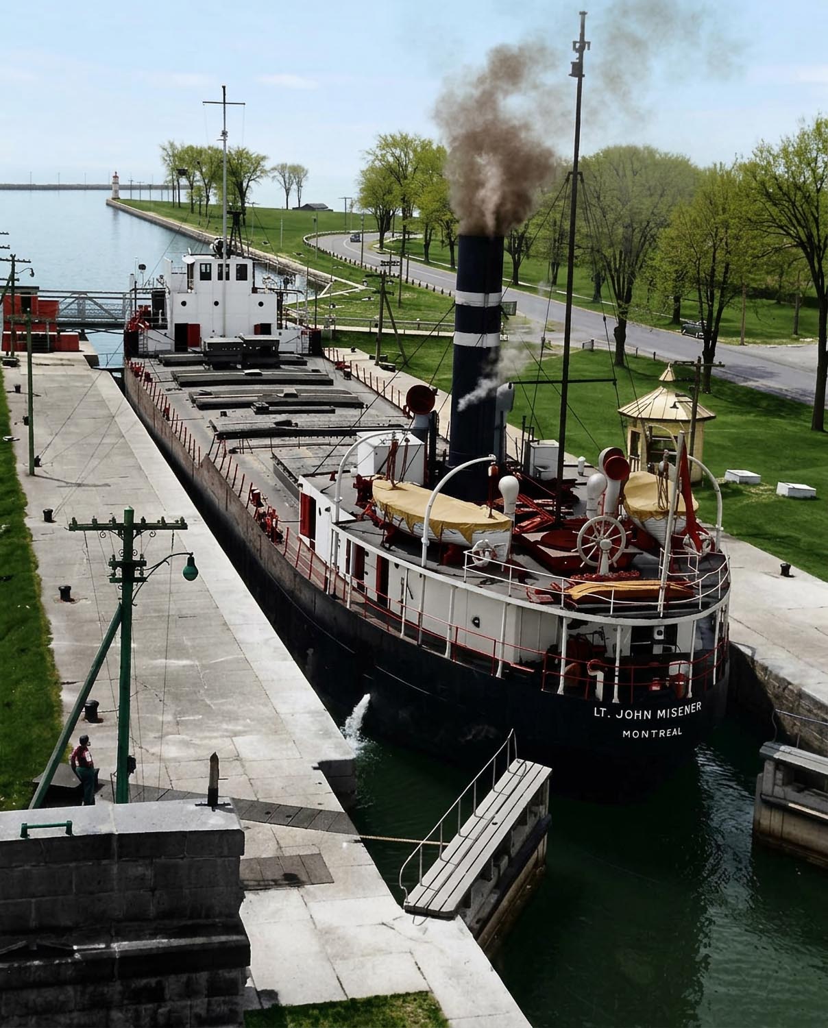
SHSC021: Lt. JOHN MISENER in Lock 5.
This classic canaller was built in England in 1929. She is sailing in
Scott Misener’s Colonial Steamship Co. colours. Photo taken from the CNR
railway bridge. The gates are now driven by electric motors.
Gord Macaulay photo.
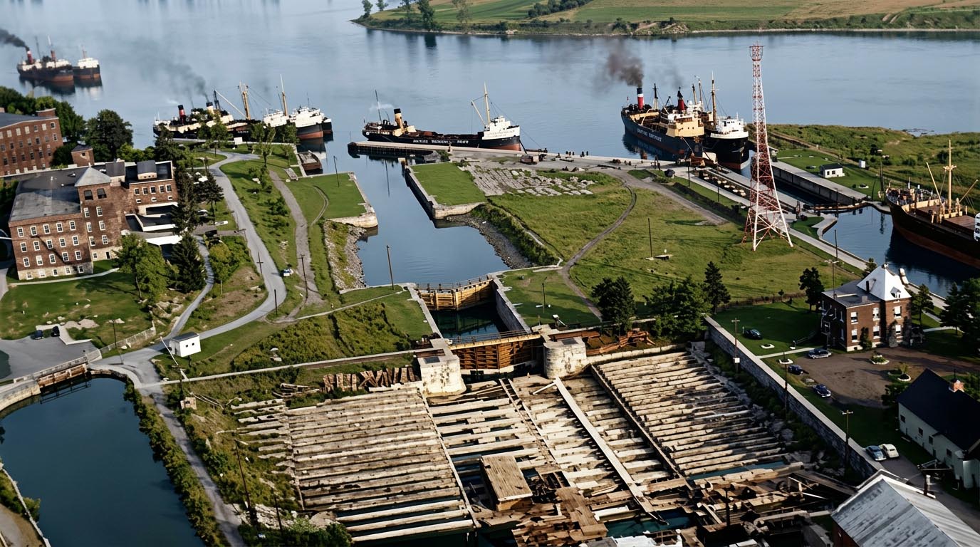
SHCC004 The Cornwall Dry Dock and entrance to the Cornwall Canal.
The dry dock was located between old Lock 16 and 17 with access through the latter. Draft into the dry dock was limited to 12 feet. An area of two acres was available for berthing ships. In the background are the old and new Locks 15 and eight canallers all waiting for a blockade of some sort to be cleared.
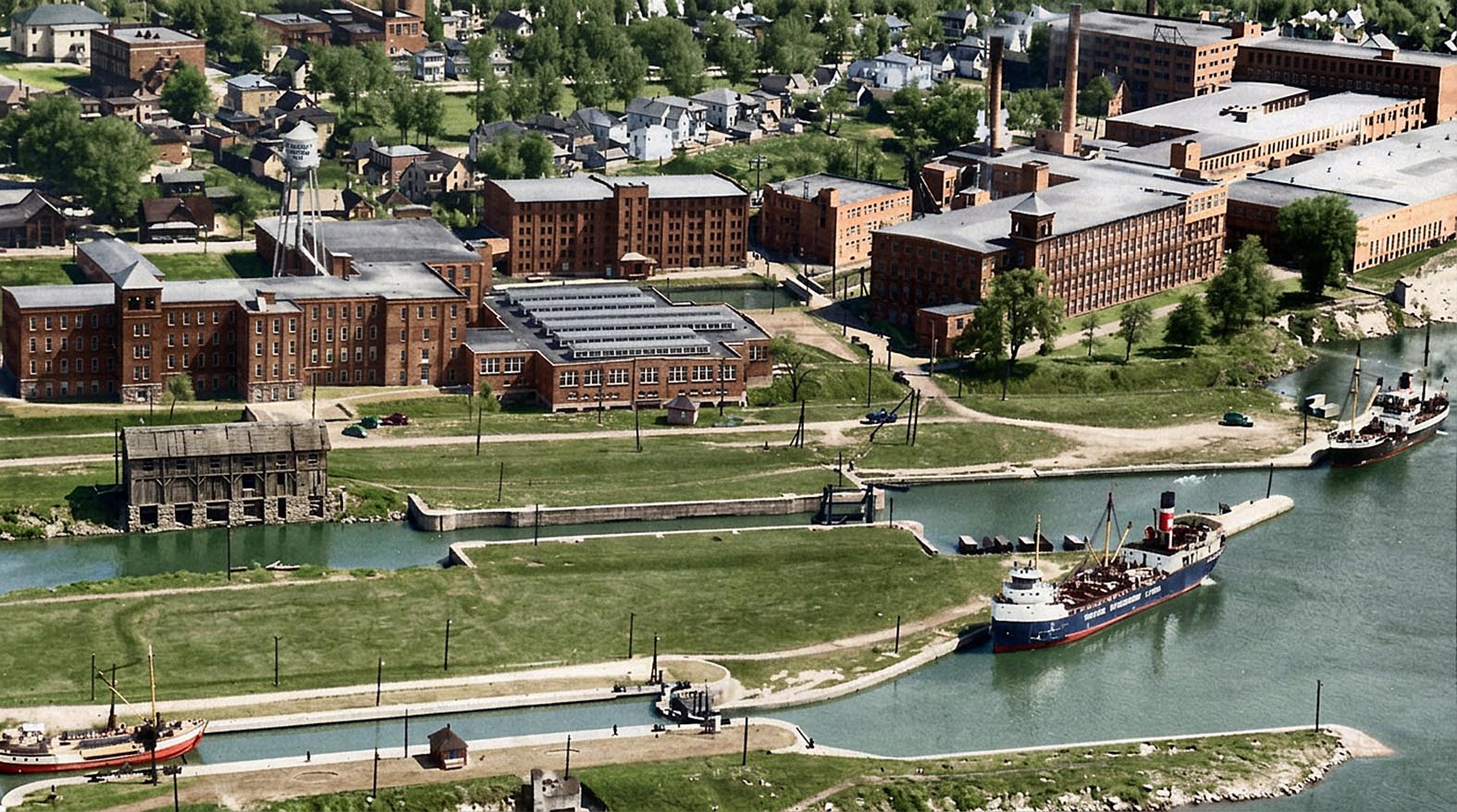
SHCC002: Lock 15 of the Cornwall Canal.
This view of the entrance to the Cornwall Canal shows both the first and second versions of Lock 15. A down bound goelette is entering the “new” Lock 15 while a CSL package freight canaller waits for her turn below the lock. The 1842 version of Lock 15 is in the background. To the right is the buoy tender GRENVILLE.
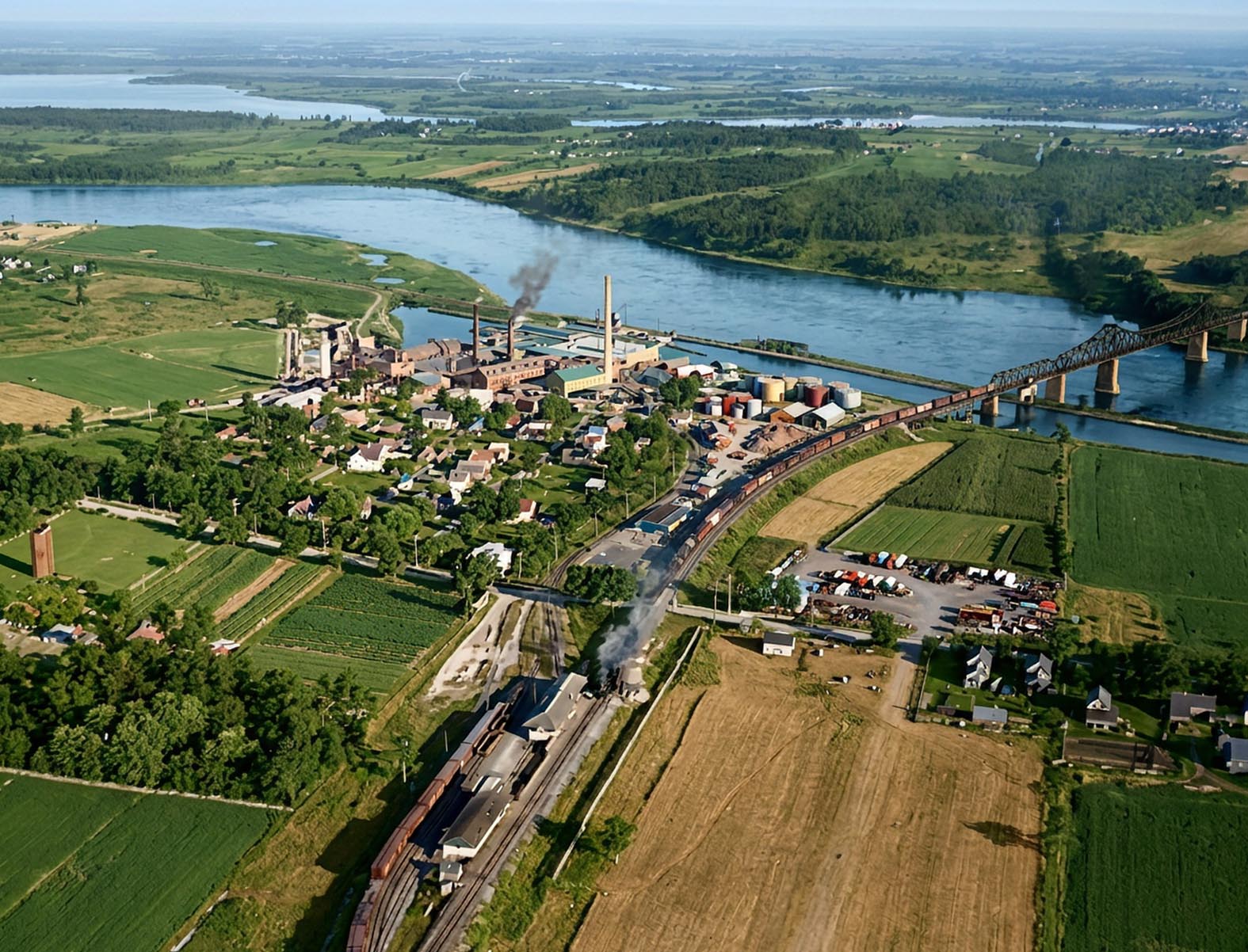
SHCC016a: Aerial View of Lock 18 area in 1920.
The Howard Smith Paper Co. and Lock 18 are centered in this 1920 aerial view. The NY Central Bridge over the canal and St. Lawrence River is to the right.
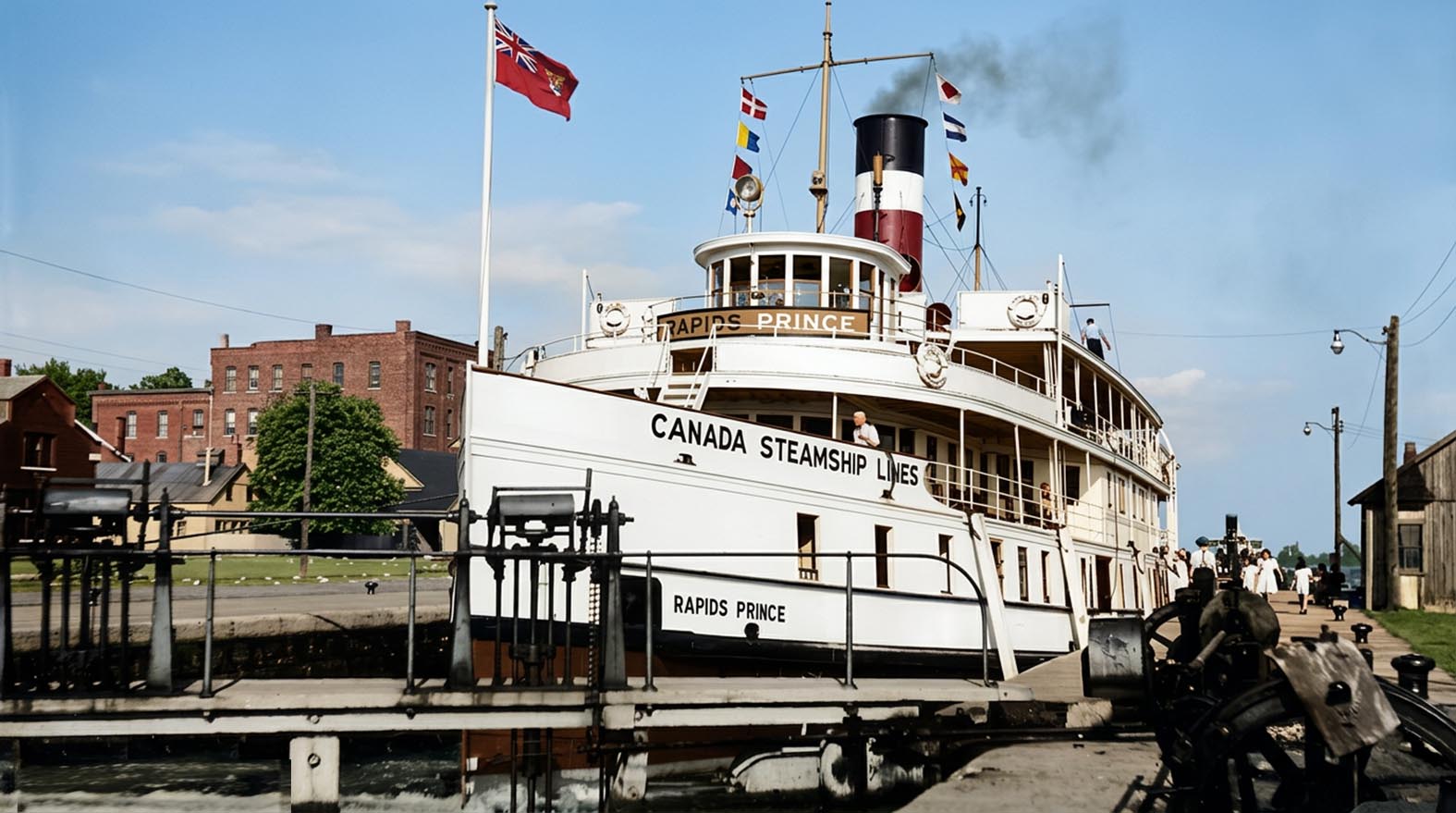
SHCC009: RAPIDS PRINCE upbound in Lock 17
Aptly named she was one of three CSL passenger ships that ran down the St. Lawrence River rapids from Prescott to Montreal. The other two were RAPIDS KING and RAPIDS QUEEN. At Prescott they connected with much larger ships that brought passengers down Lake Ontario from Toronto and other lake side communities
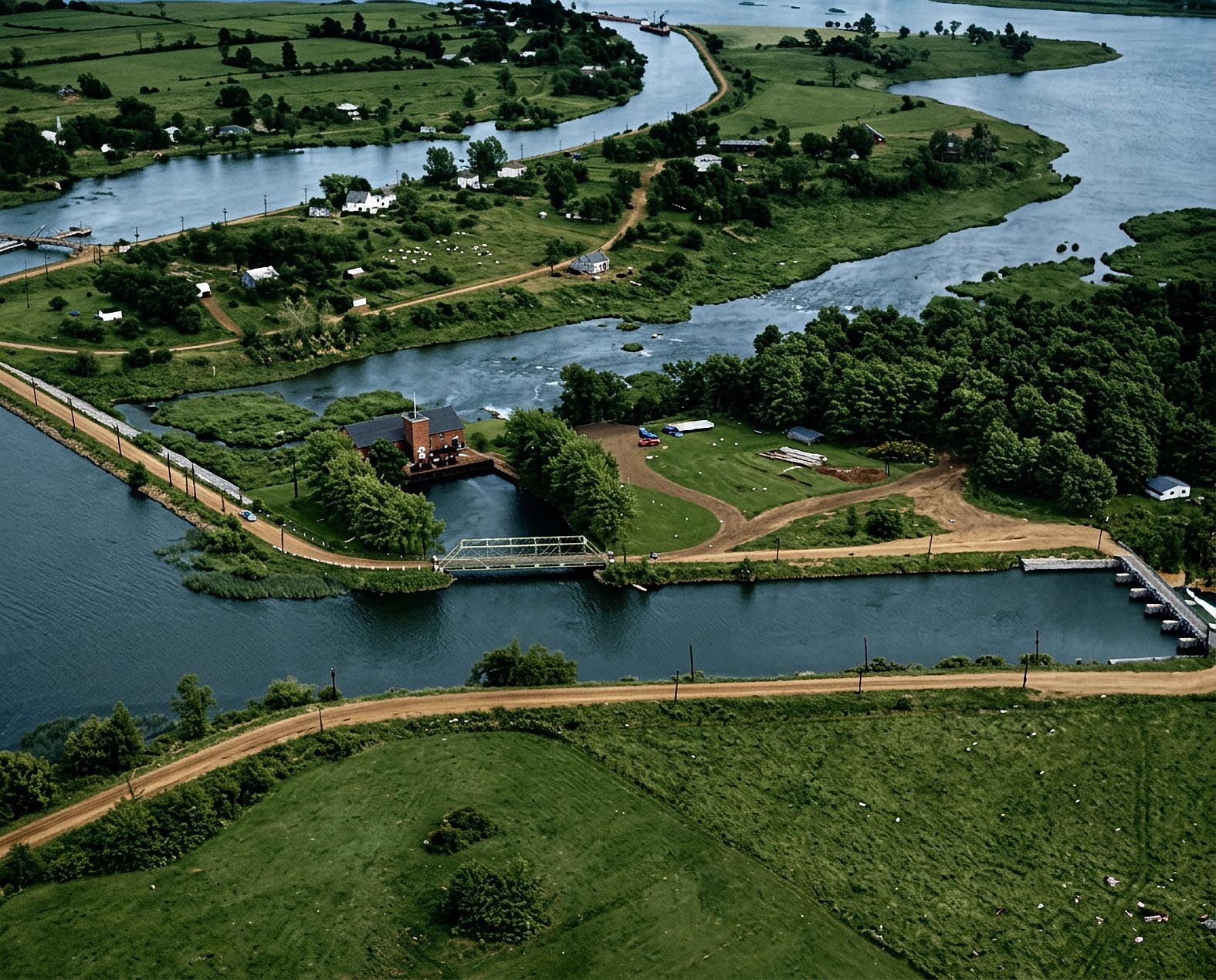
SHCC030: Mille Roches area.
This aerial view, taken over Sheek Island, which appears at the bottom, looks down the St.Lawrence River. The canal appears at the upper left. Mille Roches swing bridge is visible, but the guard gate is out of sight around the lower bend. The small power plant in the foreground belongs to the St.Lawrence Power Co.
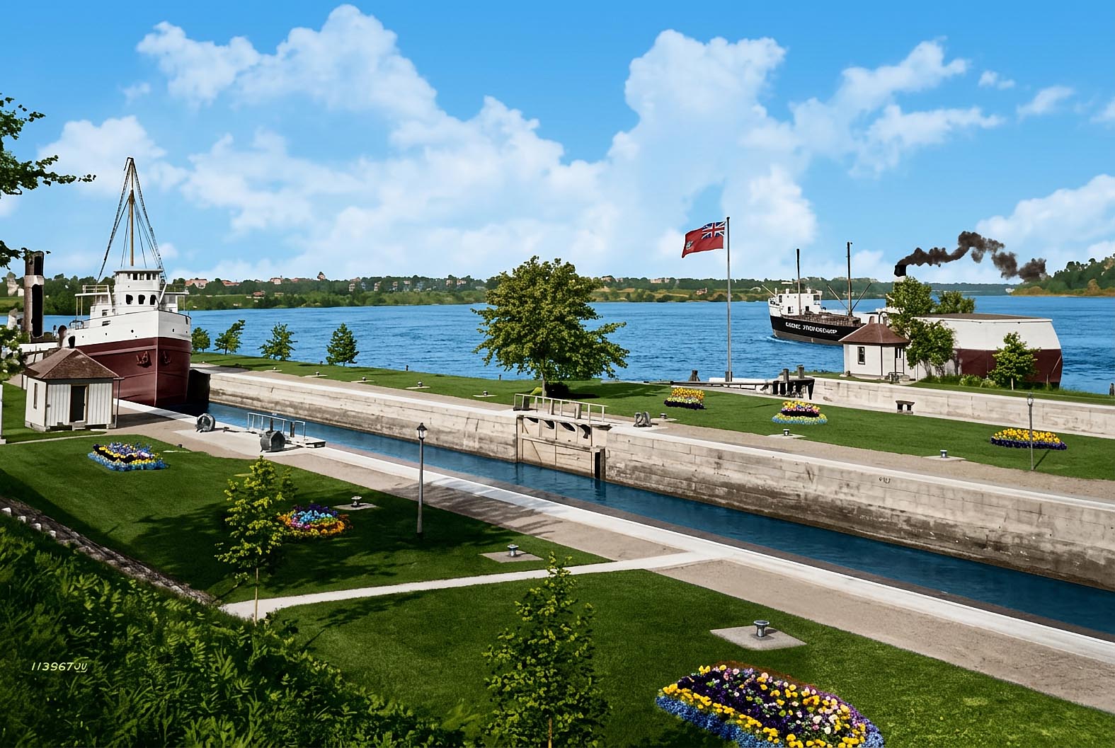
SHWC003: Ship entering Farran’s Point Lock
This view shows how the lock area grounds were kept by the men who worked there. A down bound canaller is seen beyond the canal running down the rapids.
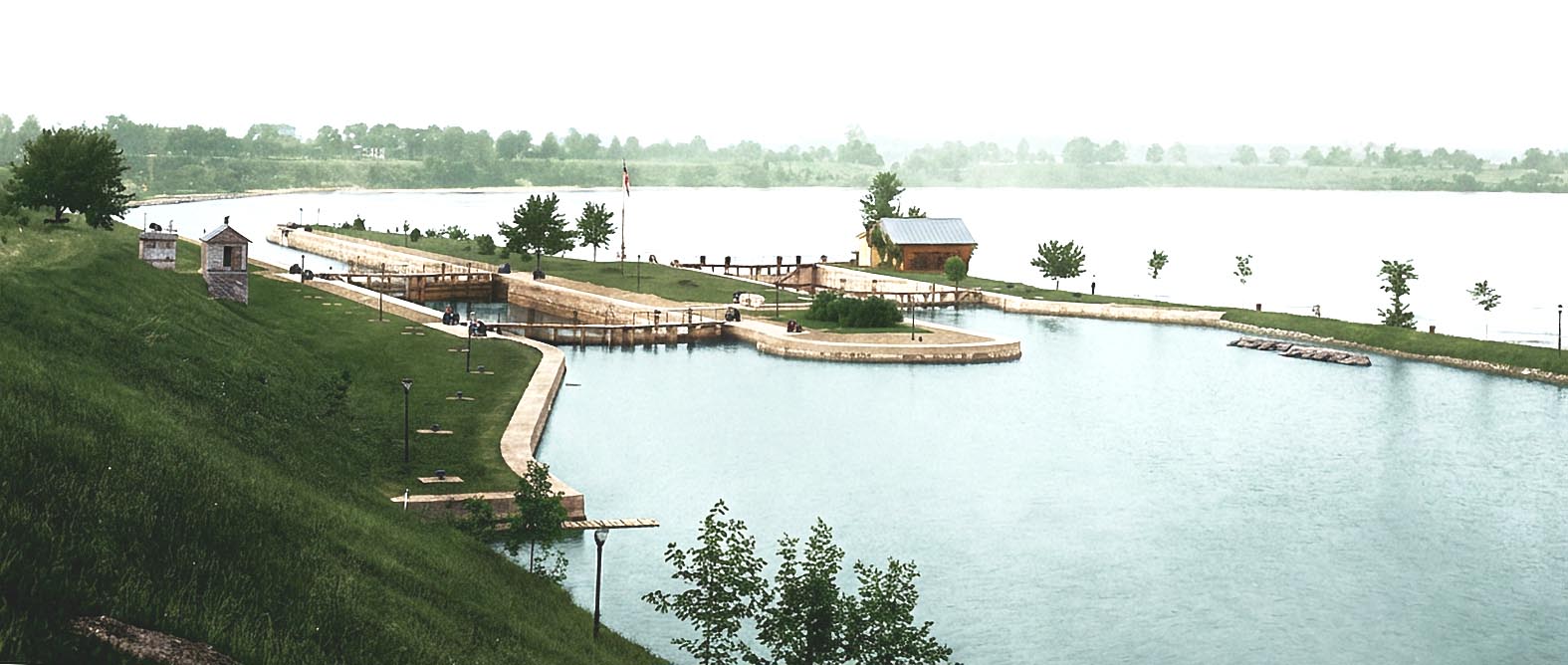
SHWC002: Lock 22 at Farran’s Point
From left to right are the 800 foot long “Fleet Lock”, the original 200 foot lock, a pair of spare wooden gates stored in the water above the locks, and the rapids where the down bound ships would sail.
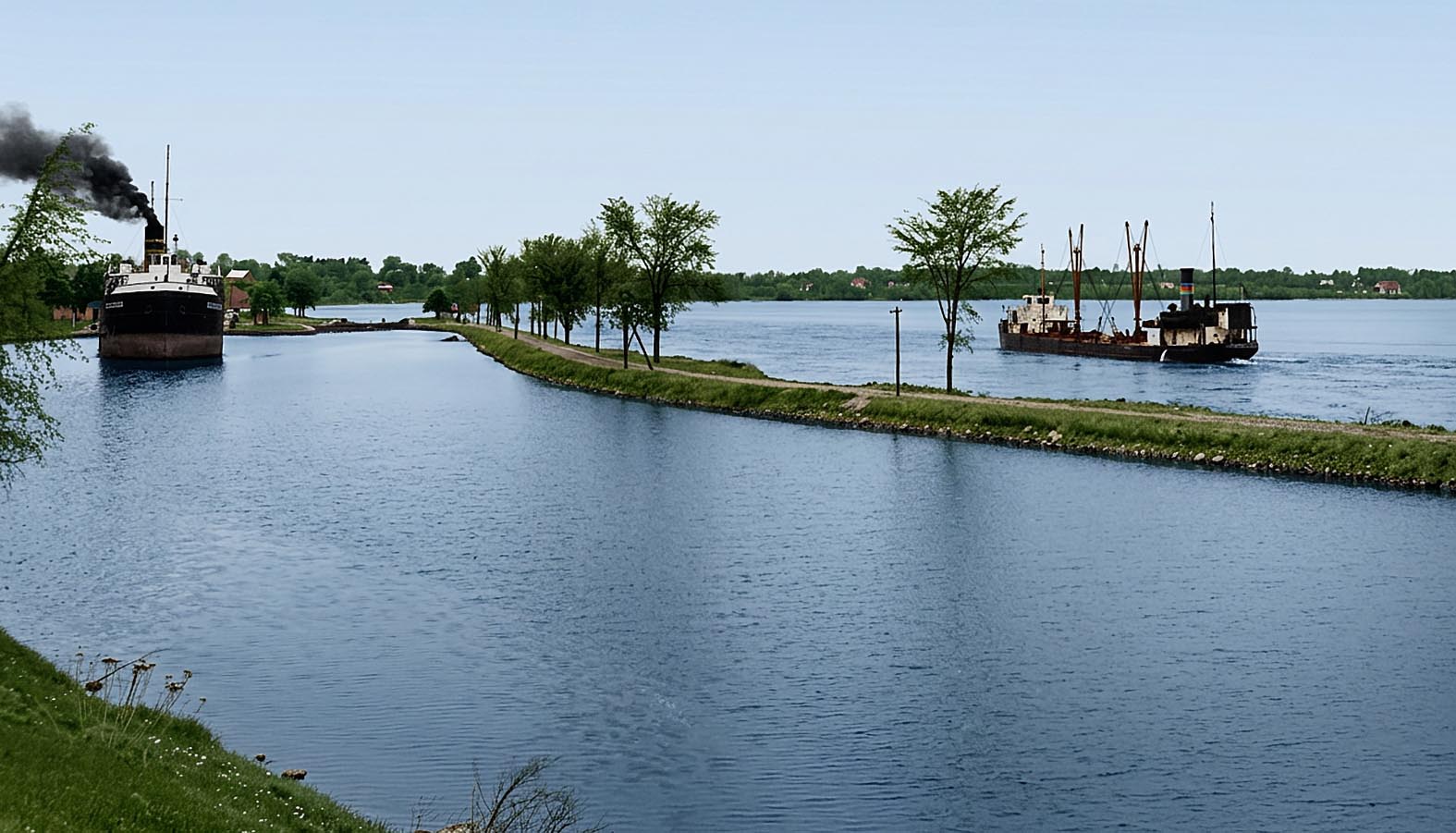
SHWC004: Looking down the Farran’s Point Canal.
The Misener canaller FRANK H BROWN is up bound out of Lock 22 while the Upper Lakes & St. Lawrence Transportation canaller SHELTON WEED runs down river in the rapids. Gord Macaulay, who took this photo, said he never saw a canaller go so fast in his life!

SHWC008a: Aerial view of St. Lawrence River from Morrisburg to west of Mariatown.
The entrance to the Rapide Plat or Morrisburg Canal can be seen at the top right hand corner. The Morrisburg Ferry dock is due south of Lock 23 and is located on Dry Island. To the lower left is a bridge across “The Little River” which is in reality a shallow part of the St. Lawrence which ran south of Ogden Island. Farms, now gone, can be seen on Ogden Island. The two islands to the right of center are Canada to the north and Clark to the south. The main Seaway shipping channel now runs between Ogden and Canada Islands. Clark Island has disappeared beneath the waters.
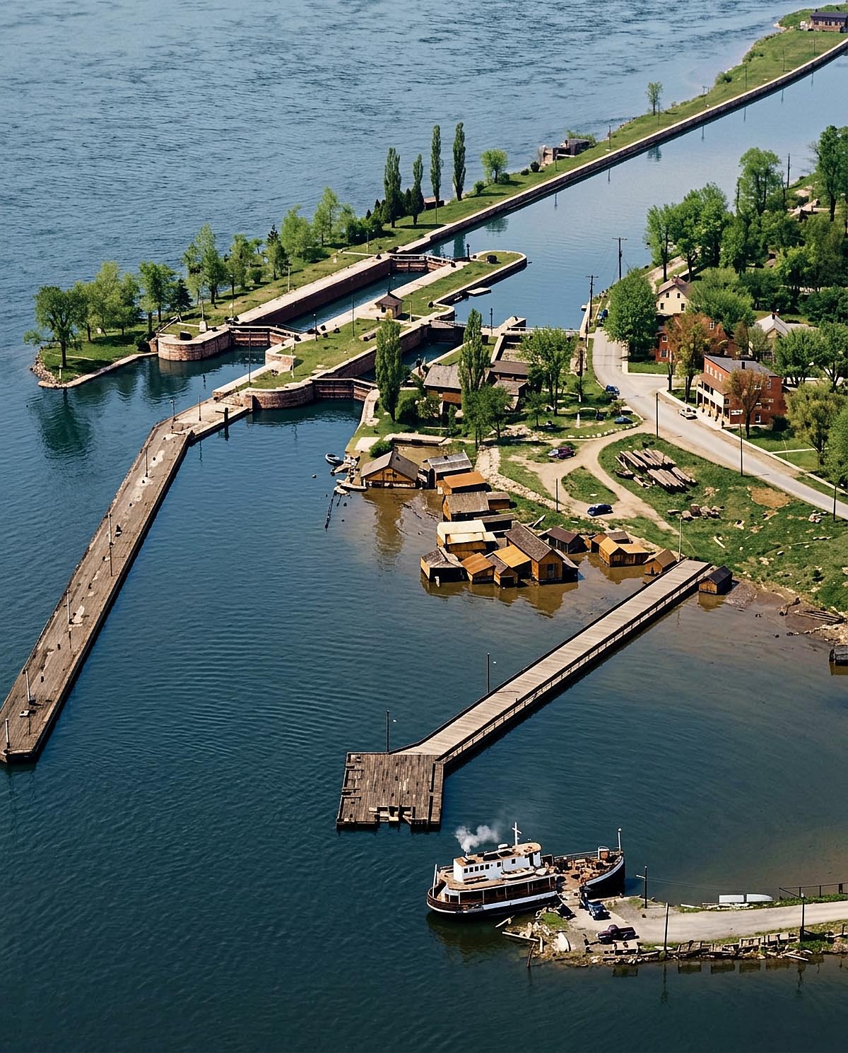
SHWC010: Looking west over the harbour at Morrisburg.
From left to right, the approach wall and Lock 23 completed in 1904, the old Lock 23, the power canal for the hydro electric plant hidden by trees, the municipal wharf, the motorvessel/ferry MORRISBURG at her dock unloading vehicles.
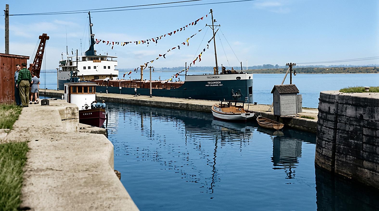
SHWC015: The last ship through Lock 23.
On June 29, 1958, the Becansfield motorvessel TECUMSEH up bound into Lock 23, the last merchant vessel to do so. The old canals closed for good this day and the flooding soon began. The view is through the entrance to the first lock built at Morrisburg in the 1840’s.
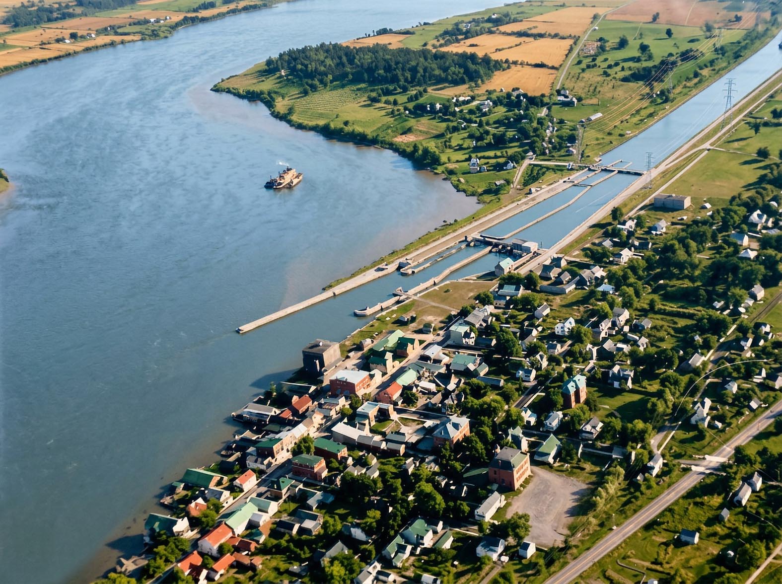
SHGC001b: 1920 Aerial view of Iroquois.
Looking west over Iroquois Point and Lock 25. Note the vessels out in the channel south of the lock. This is the summer of 1920 and salvagers are hard at work raising the wreck of the canaller T.P. PHELAN. A tug and barge secured at the east end of the approach wall of Lock 25 will also be used to take away wet grain from the wreck. The old lock 25 can be seen to the right of these vessels.
A weir was built above this lock along with two power houses, one of which opened in 1901. Of all the homes standing on Iroquois Point, there is only one left in 2012 - National Archives photo.
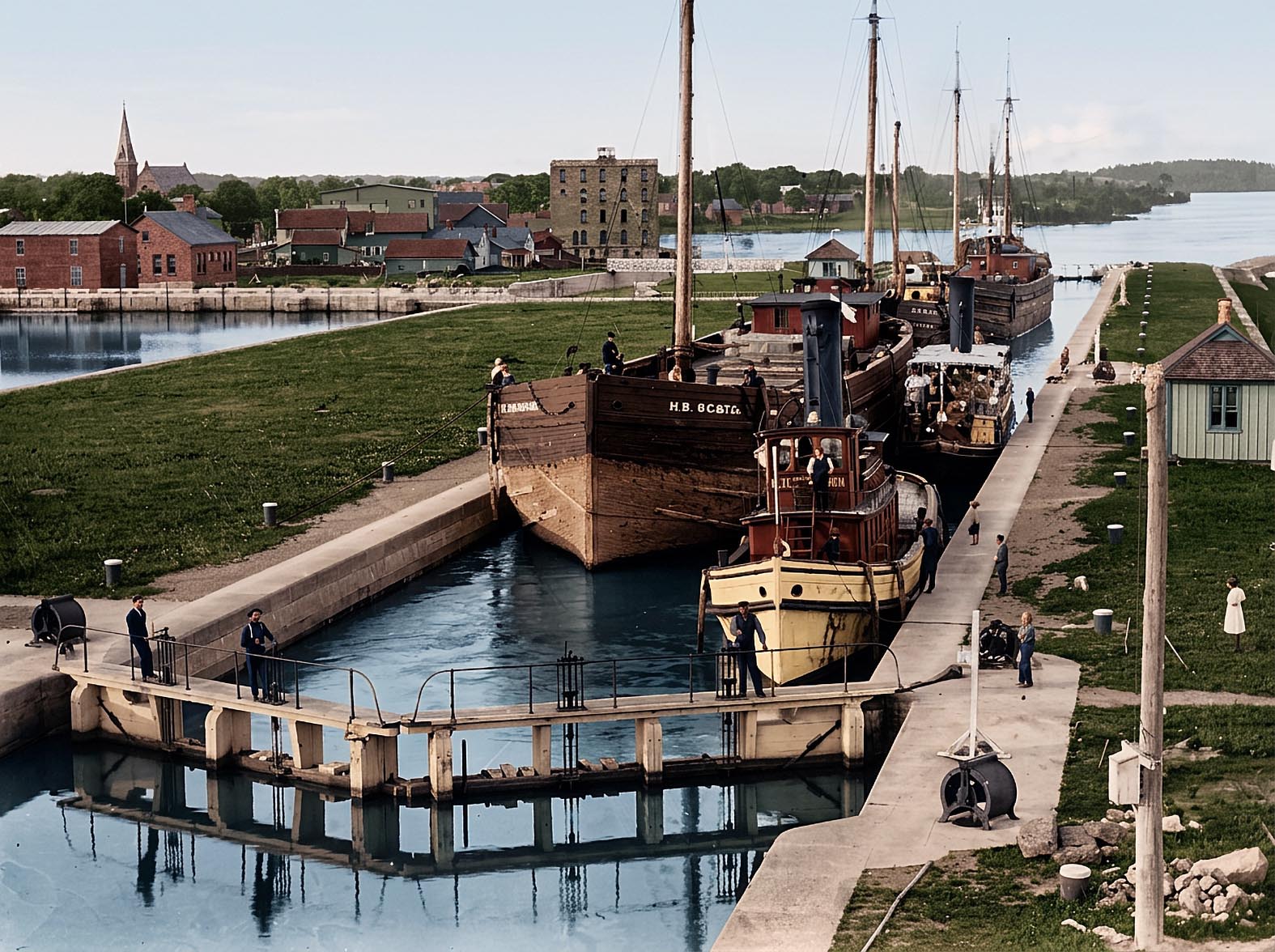
SHGC004: A fleet of vessels in Lock 25 at Iroquois.
The center set of gates in the lock are open to allow several vessels to
be raised in the lock at one time. From the left the barge H.B. (H.
Buckley) of the Ogdensburg Coal & Towing Co., tug GEO. D. SEYMOUR, a steam
yacht, the barge FRED CARNEY, also of the O.C. & T. Co., and another
unidentified barge. A steam barge waits below the lock. To the extreme
left can be seen the two hydro-electric power plants. Photo taken from the
swing bridge above the lock.
National Archives photo.
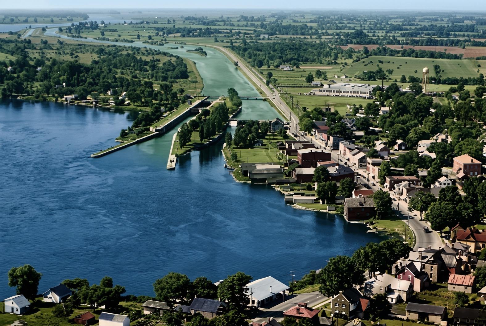
SHGC002: Aerial view of Iroquois in 1954.
The main street of the old village of Iroquois is on the right with
Highway No. 2 running through it. The white water above old Lock 25 is
water cascading over the weir. The 800 foot length of the new Lock 25 is
quite evident in this view. It was divided into two chambers. If only one
ship was going up, the chamber furthest up the lock would be used.
Photo: Toronto Star
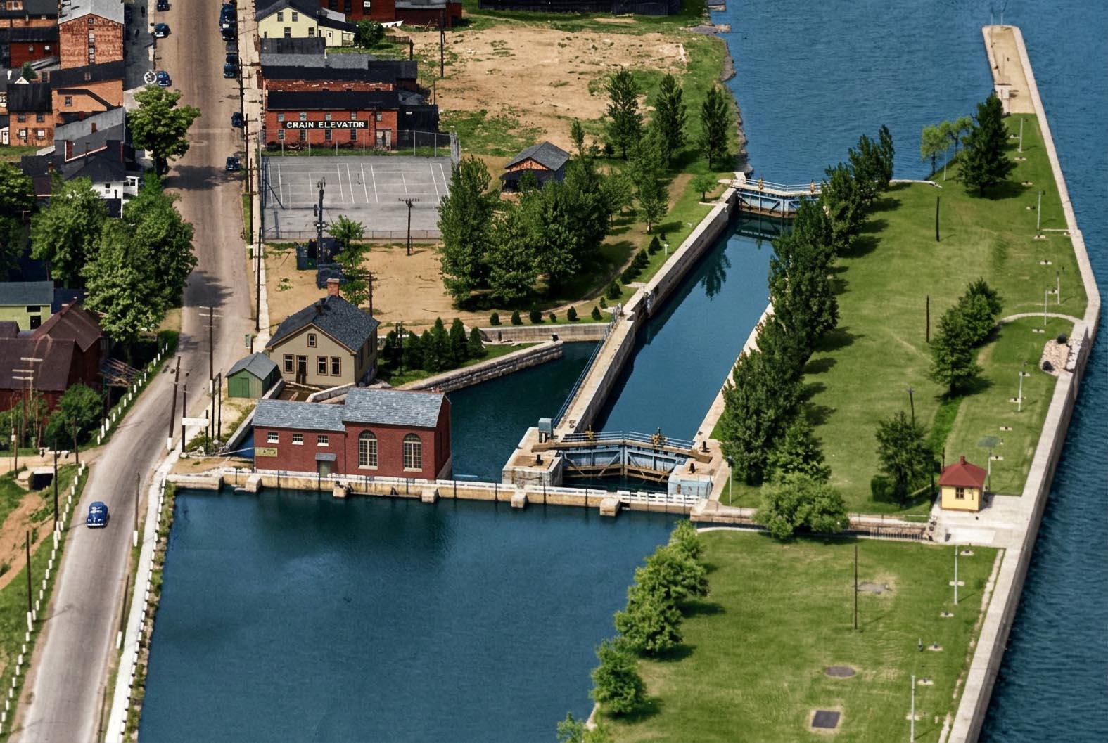
SHFC009 - Aerial View of Old Lock 25
An aerial view of old Lock 25 and the two power plants located above this lock. The road to the left of the canal is old Highway 2.
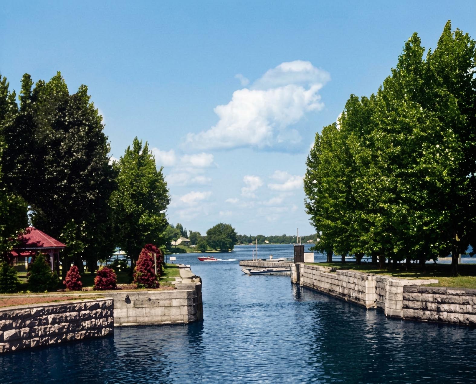
SHFC010 - Looking Down Through Old Lock 25
Looking down through old Lock 25 from the weir.
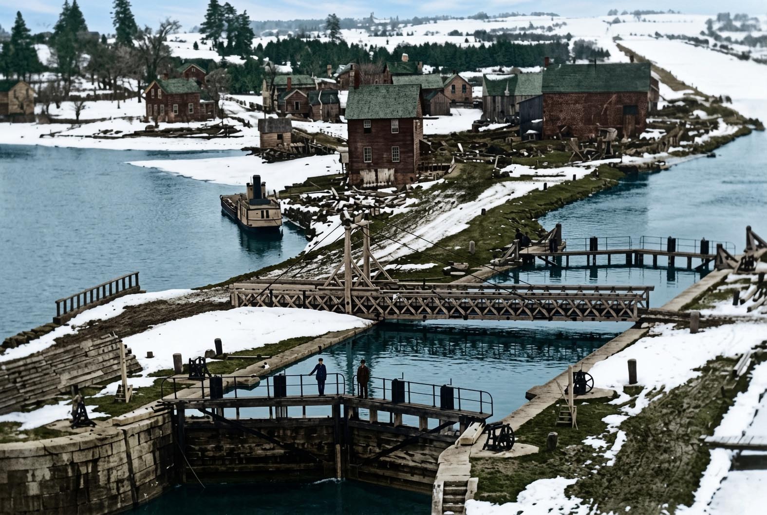
SHFC006 - Lock 25 at Iroquois
Lock 25 at Iroquois was completed in 1846. The mills located immediately above the lock would later be expropriated to build the much larger second canal
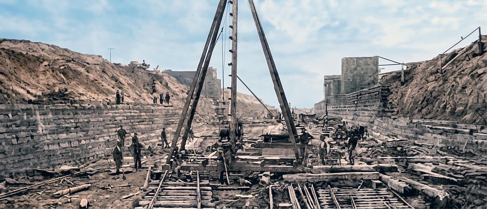
SHCB530: Looking east from the bottom of the Cardinal Cut.
The new canal was built with steam shovels, donkey engines and cranes. Work started on the canal in 1887 and was finished in 1901. At the time the canal was a masterpiece of engineeering with its lime-stone blocked walls and 14 foot draft.
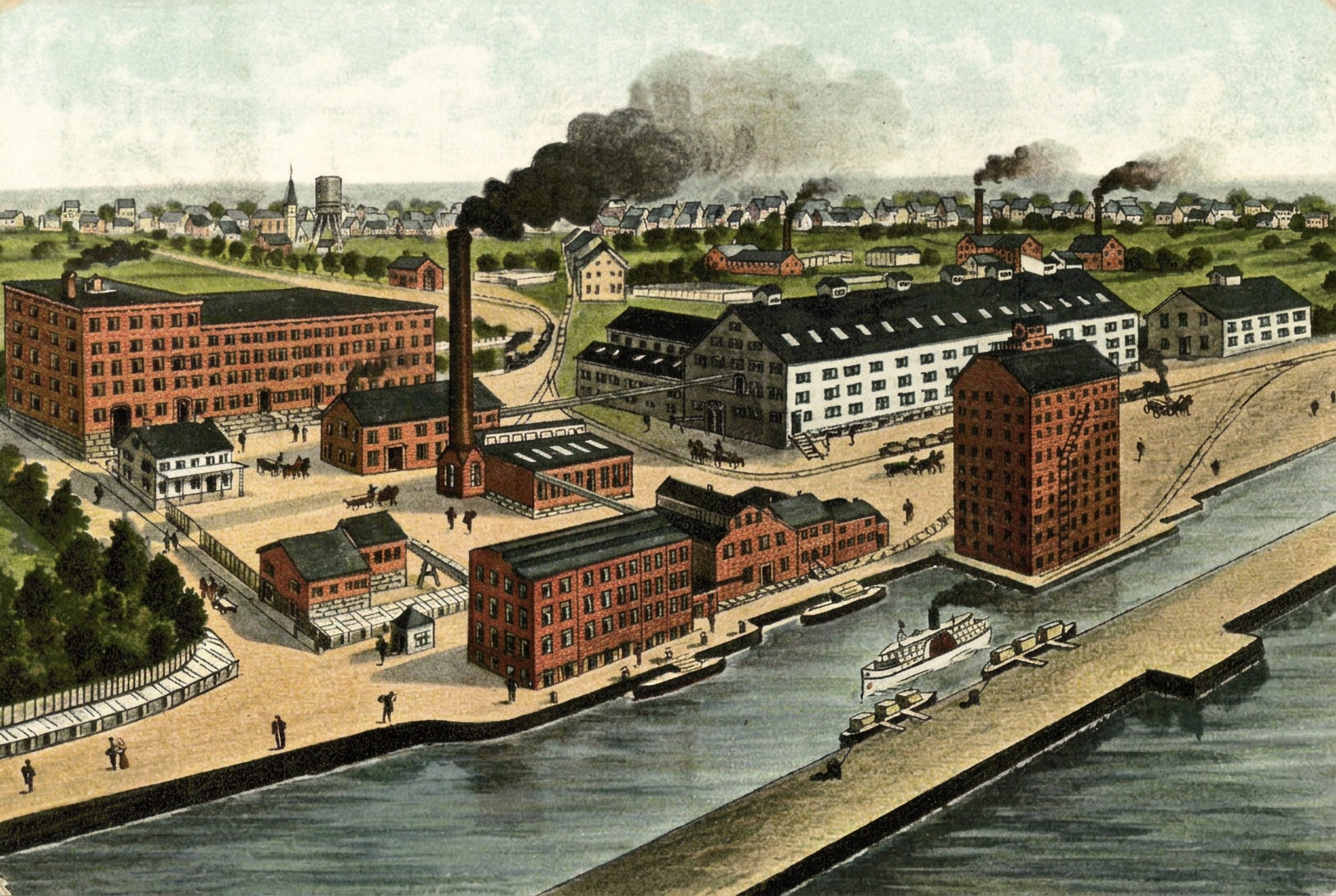
SHFC011: An artist's impression of the waterfront at Cardinal.
The Canada Starch Works began operating in 1860 with waterwheels grinding corn. The water came down a man made channel, or flume, from beside Lock 26 which was completed in 1846. This view shows one of the early versions of the grain elevator located on the Junction Canal which ran along the north shore of the river from Lock 25 at Iroquois to Lock 26 at Cardinal