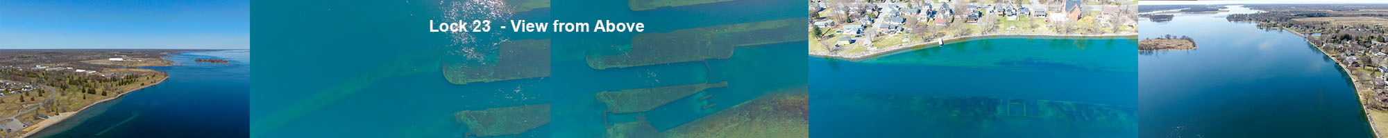
Lock 23 in Morrisburg From 80 metres above the river - 6 April, 2021
We took advantage of a beautiful early spring calm sunny day to do a drone flyover the old Lock 23 in Morrisburg. The water was very clear and it was too early in the season for the weeds to interfere with the view. We flew from the beach in the East to just past Augusta Street in the West.
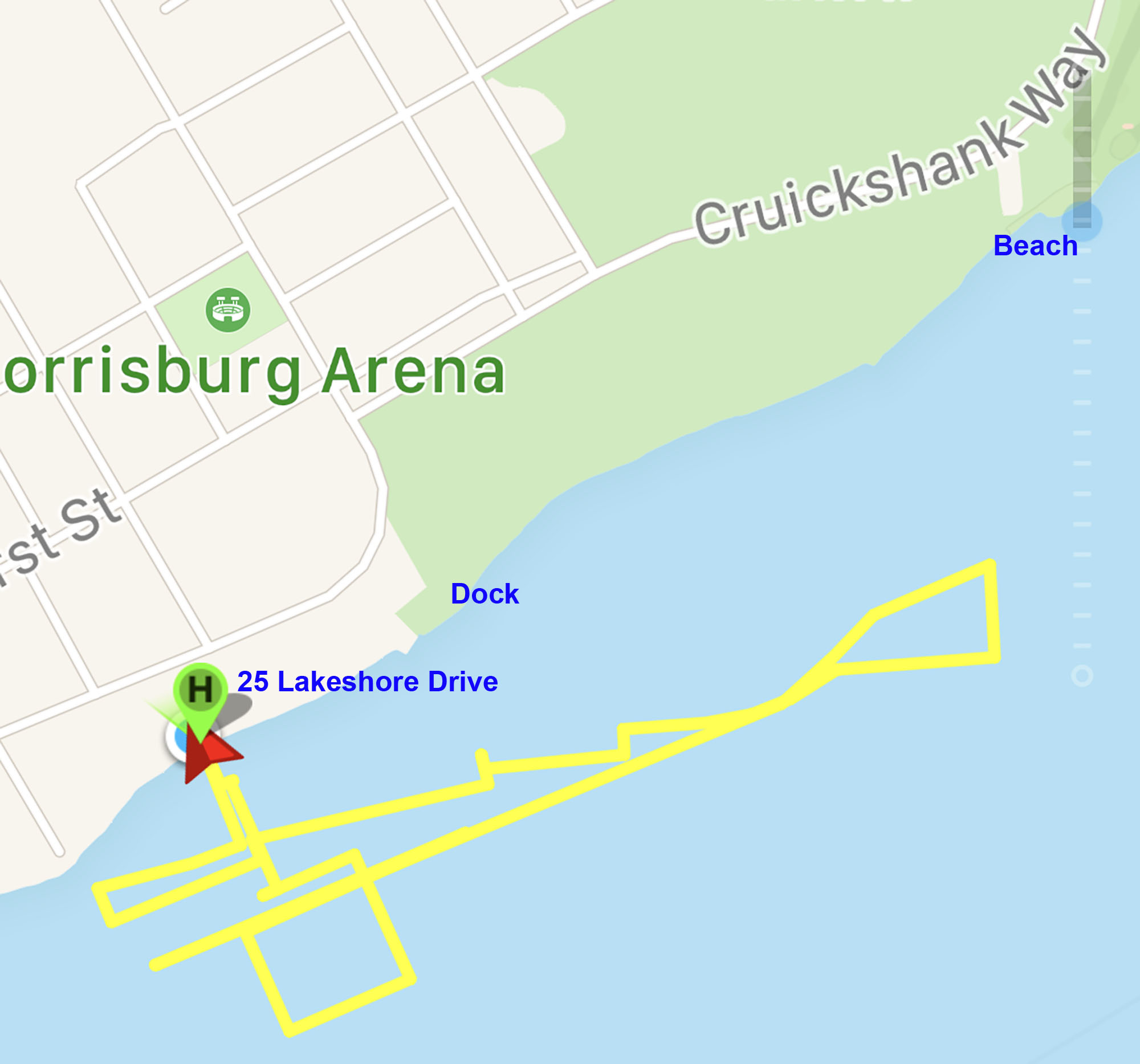
This is the Flight Map - starting at 25 Lakeshore, heading east nearly to the beach, heading west (passing the takeoff location at 25 Lakeshore) and reaching August Street then Back home.
.jpg)
First pic is from about 80 metres above the old Power House - in front of 25 Lakeshore, about 200 m from the current rive shore line.
.jpg)
.jpg)
.jpg)
.jpg)
Now heading East towards the Morrisburg Dock.
.jpg)
The West end of Lock 23.
.jpg)
.jpg)
.jpg)
East end of old Lock 23.
.jpg)
.jpg)
.jpg)
View East towards the Morrisburg Beach, Morrisburg Golf Club and beyond.
.jpg)
Looking back West towards our start point showing the Dock and Lakeshore United Church.
.jpg)
.jpg)
.jpg)
Passing Morrisburg Dock.
.jpg)
.jpg)
.jpg)
.jpg)
A different view of the Old Powerhouse.
.jpg)
.jpg)
To the end of Augusta Street.
.jpg)
.jpg)
.jpg)
.jpg)
Looking North along St Lawrence Street.
.jpg)
.jpg)
.jpg)
.jpg)
.jpg)
.jpg)
.jpg)
.jpg)
.jpg)
.jpg)
.jpg)
.jpg)
.jpg)
.jpg)
Heading back to our start point in front of 25 Lakeshore Drive.