Morrisburg Historic Maps
Extract from Ontario Hydro Seaway Construction Blueprint Iroquois to
Morrisburg
To see the full Blueprint (Iroquois to Cornwall)
Click Here (a large pdf file)
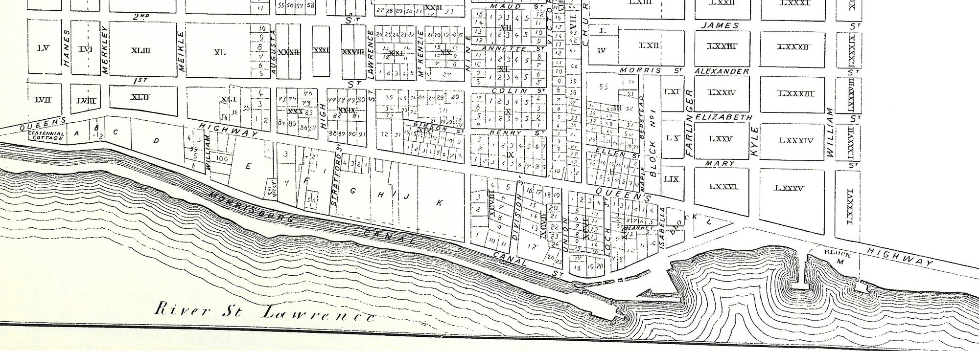
Morrisburg Village Plan - from the late 1800s
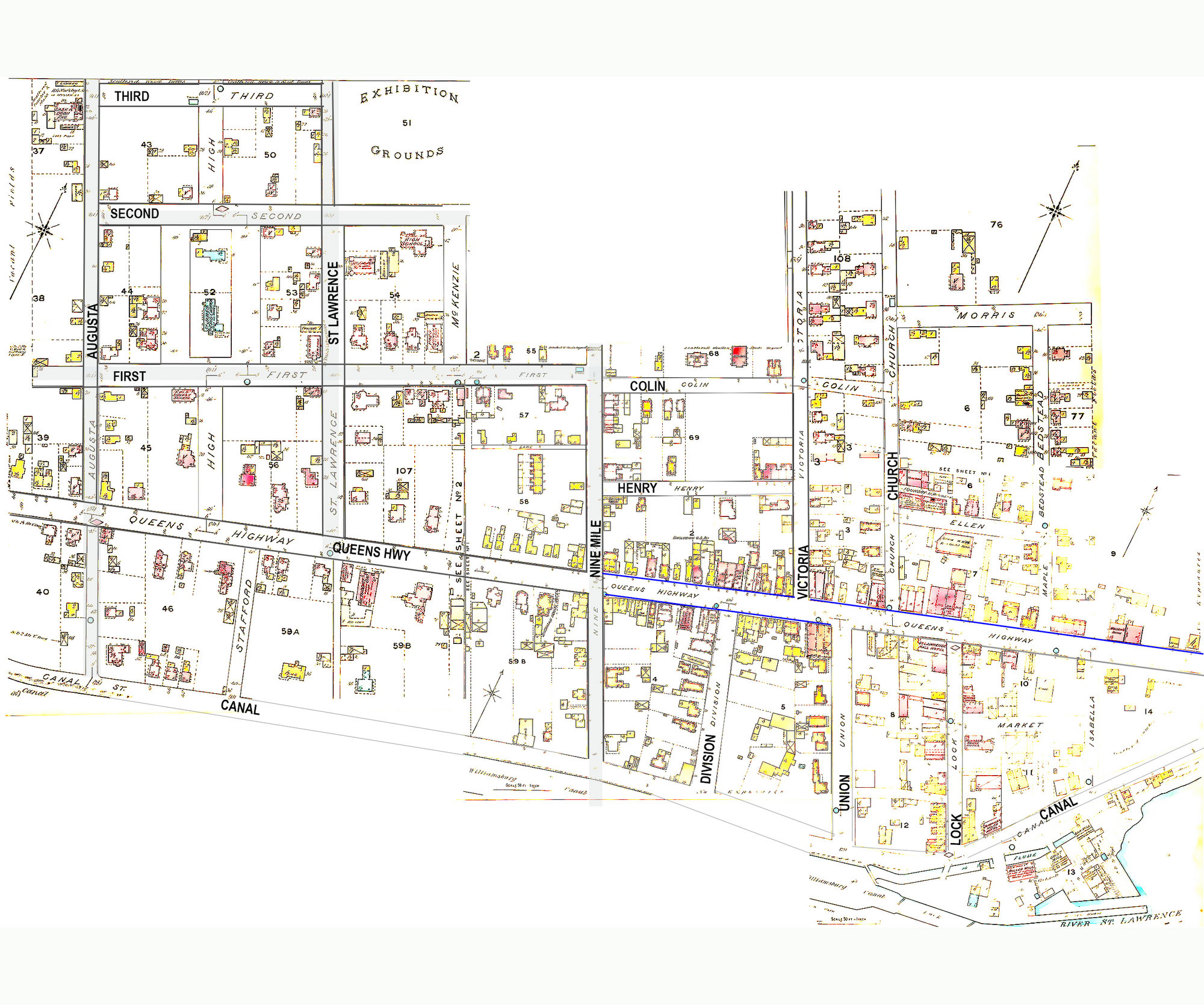
Fire Insurance Map from the 1930s
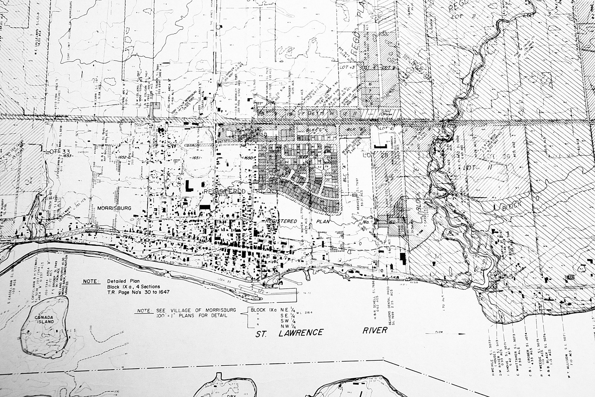
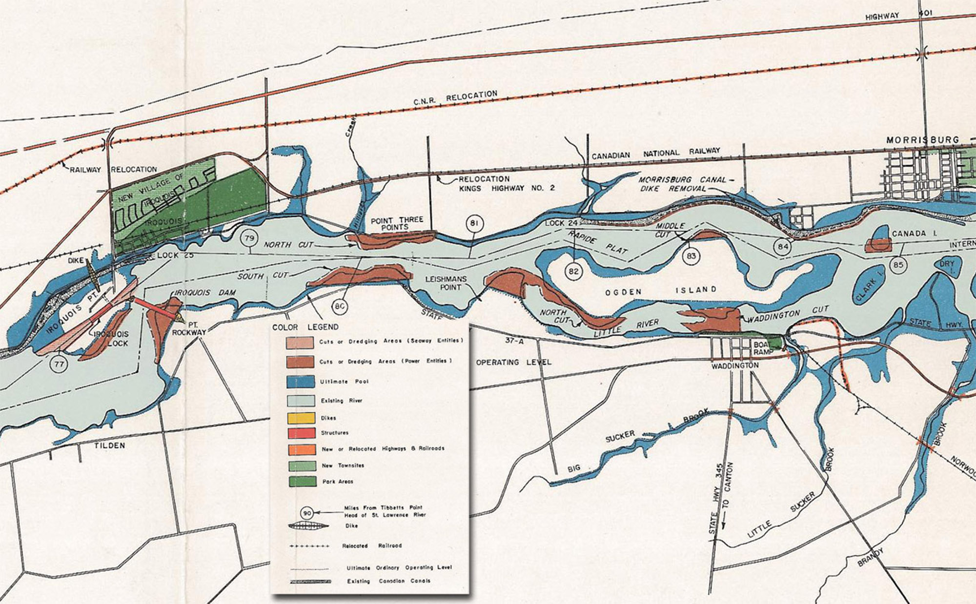
1954 Ontario Hydro Map of the Larger Morrisburg Area
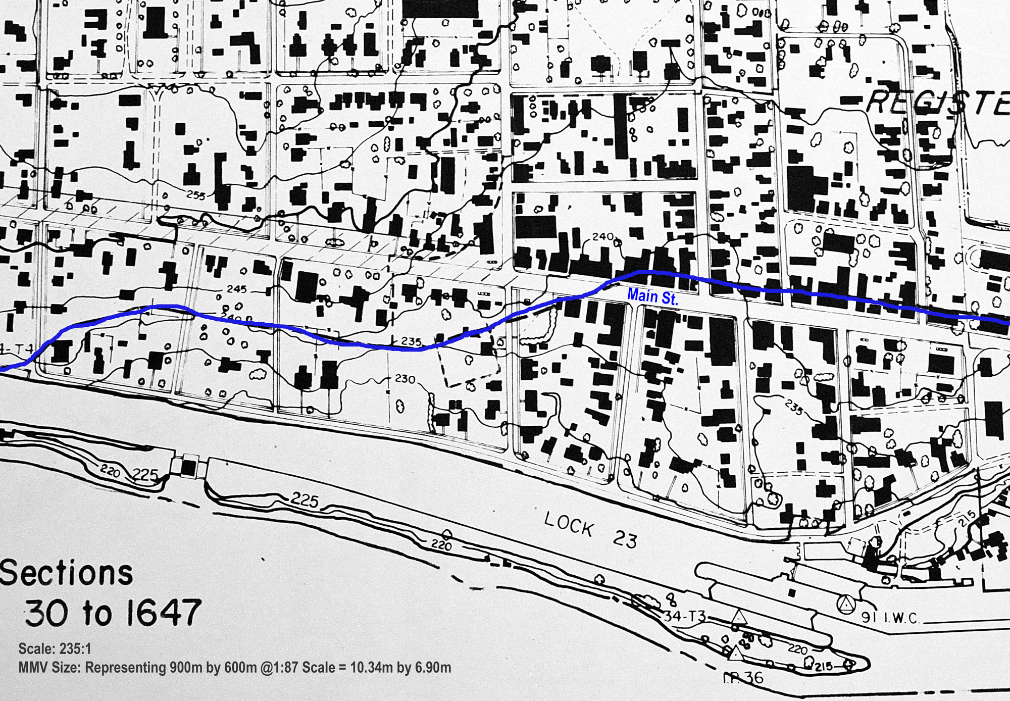
Hydro Map Covering the MMV Area (blue line shows where they projected flooding to reach)
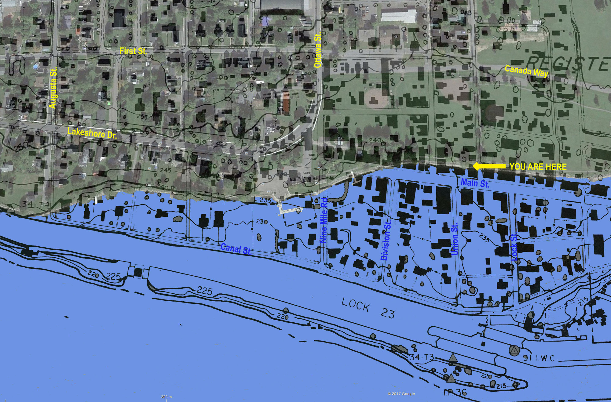
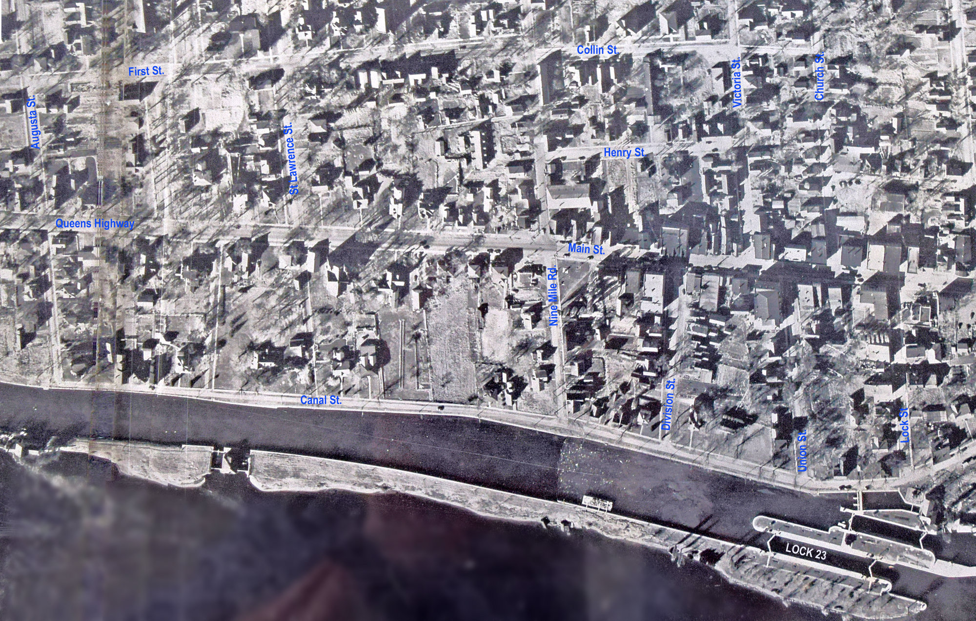
Hydro Map of MMV Area Overlaid with 2017 Googe Earth Image