Morrisburg Then and Now
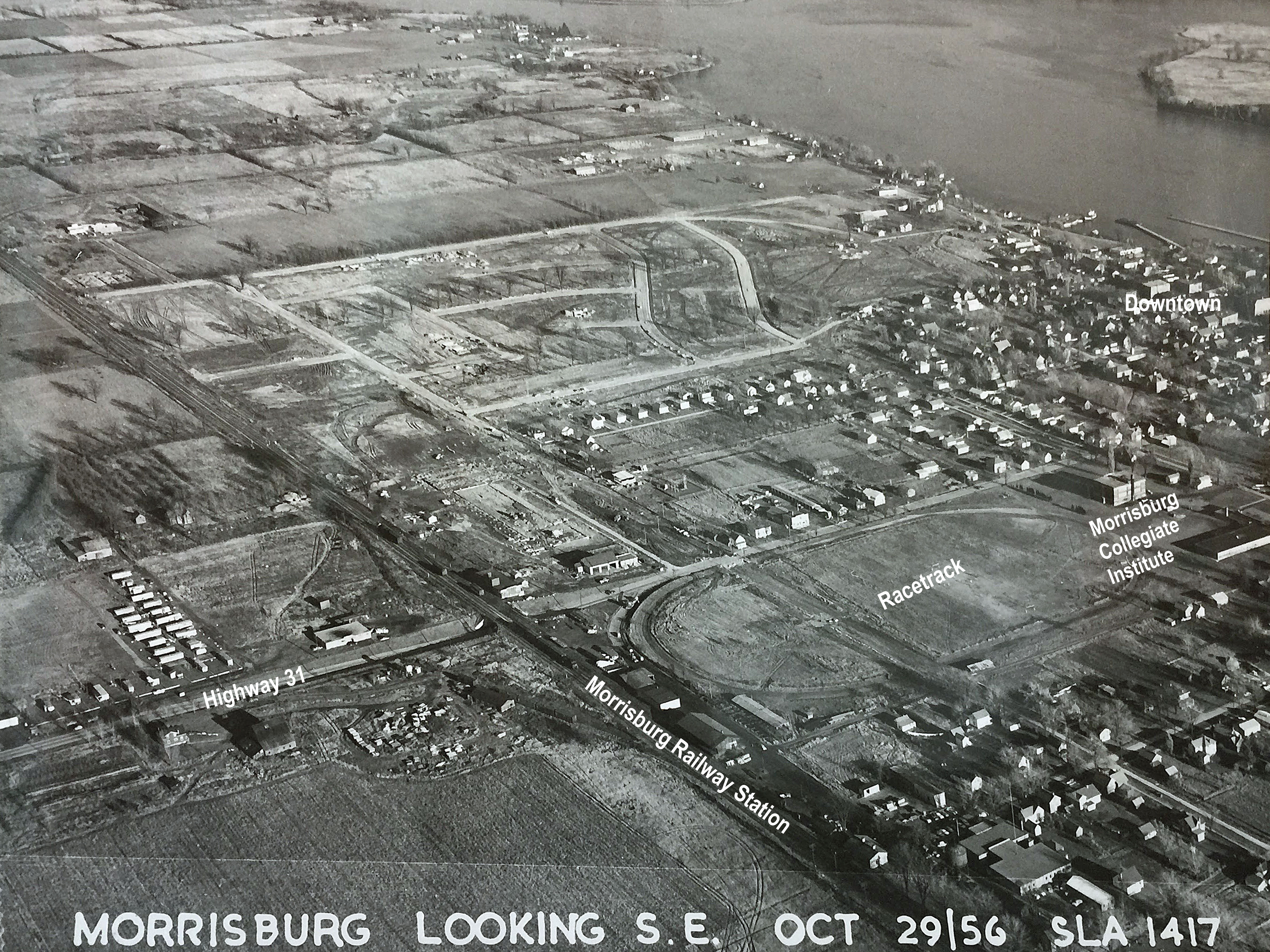
Morrisburg Looking South East - taken 29 October 1956
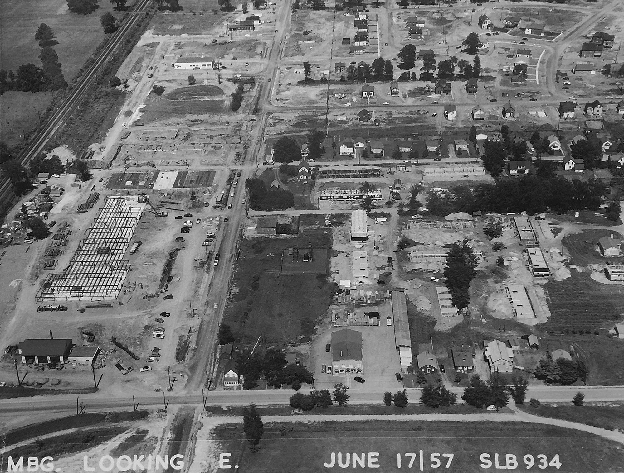
Aerial View of the Morrisburg Shopping Centre Under Construction in June 1957.
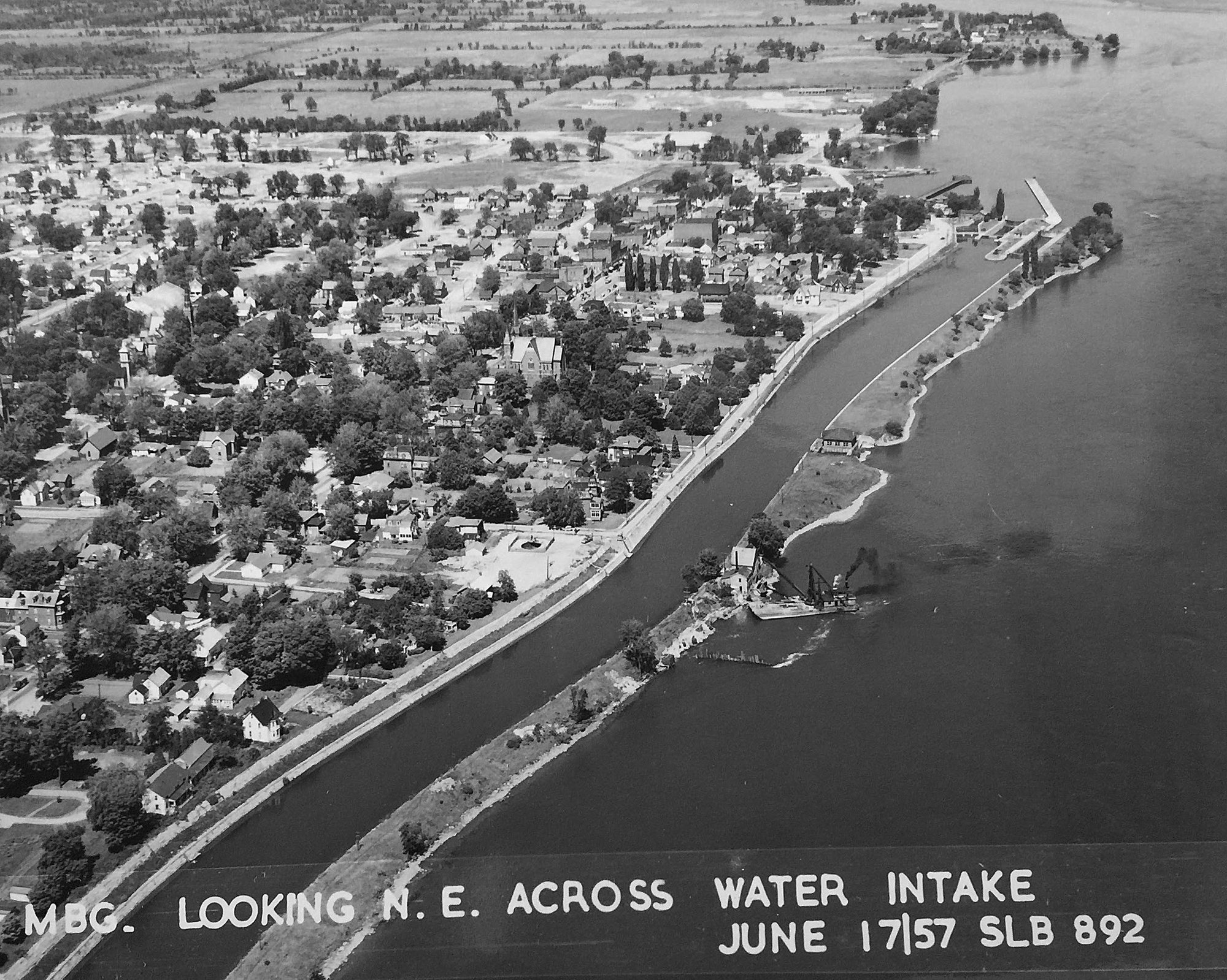
Aerial View of Morrisburg Waterfront in 1957 - Getting the new town water system ready.
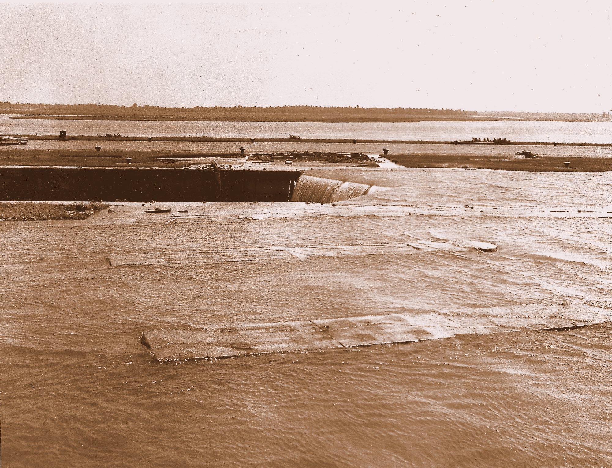
1 July, 1958 - Morrisburg Lock 23 Disappears Under the St Lawrence River.
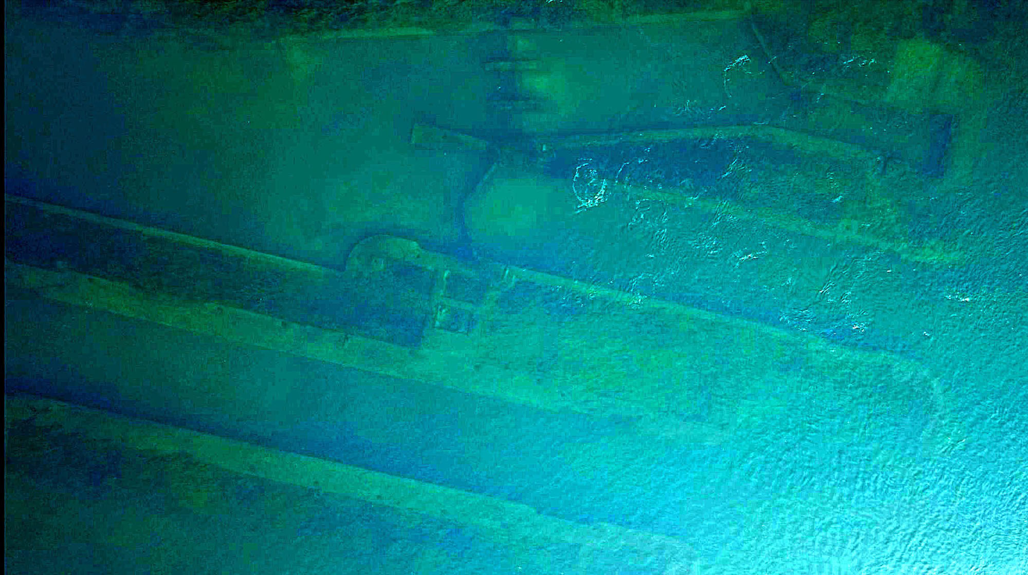
Lock 23 as it Looks Today - Under the Water.
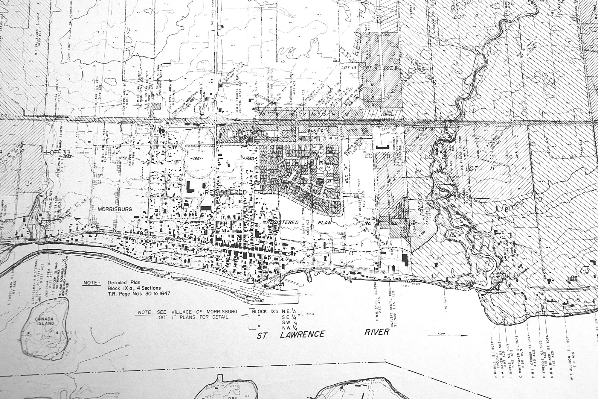
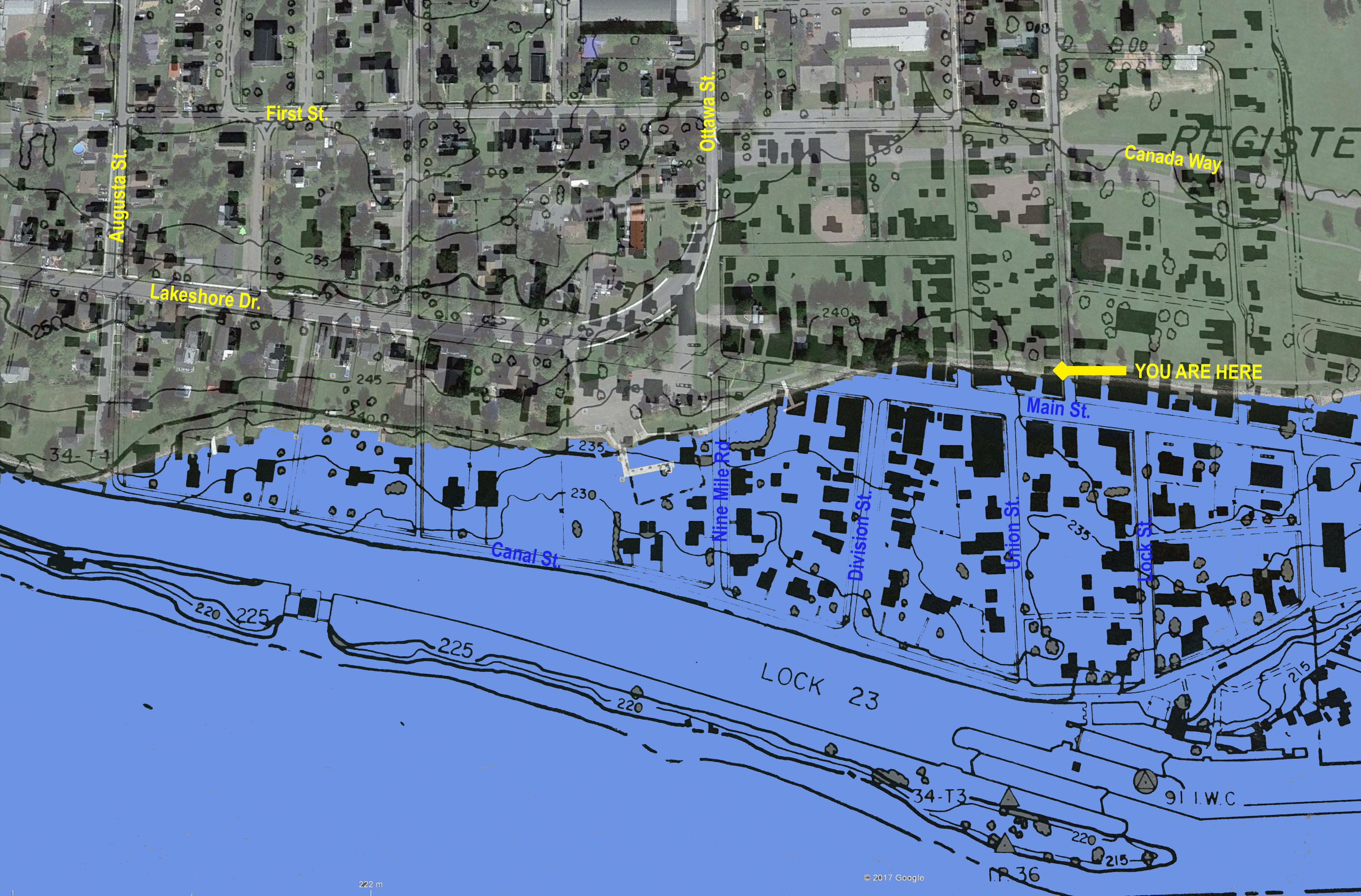
1950s Ontario Hydro Map of Morrisburg Before the Seaway.
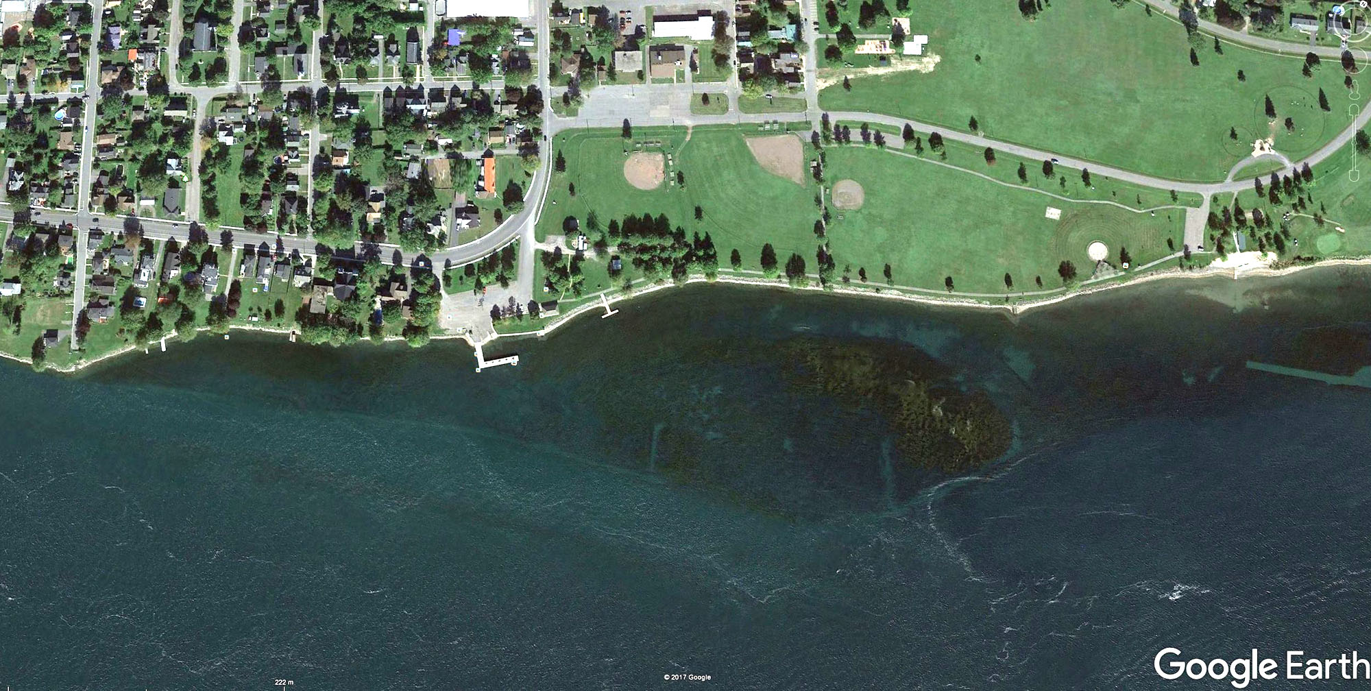
Google Earth Satellite Image From Today.
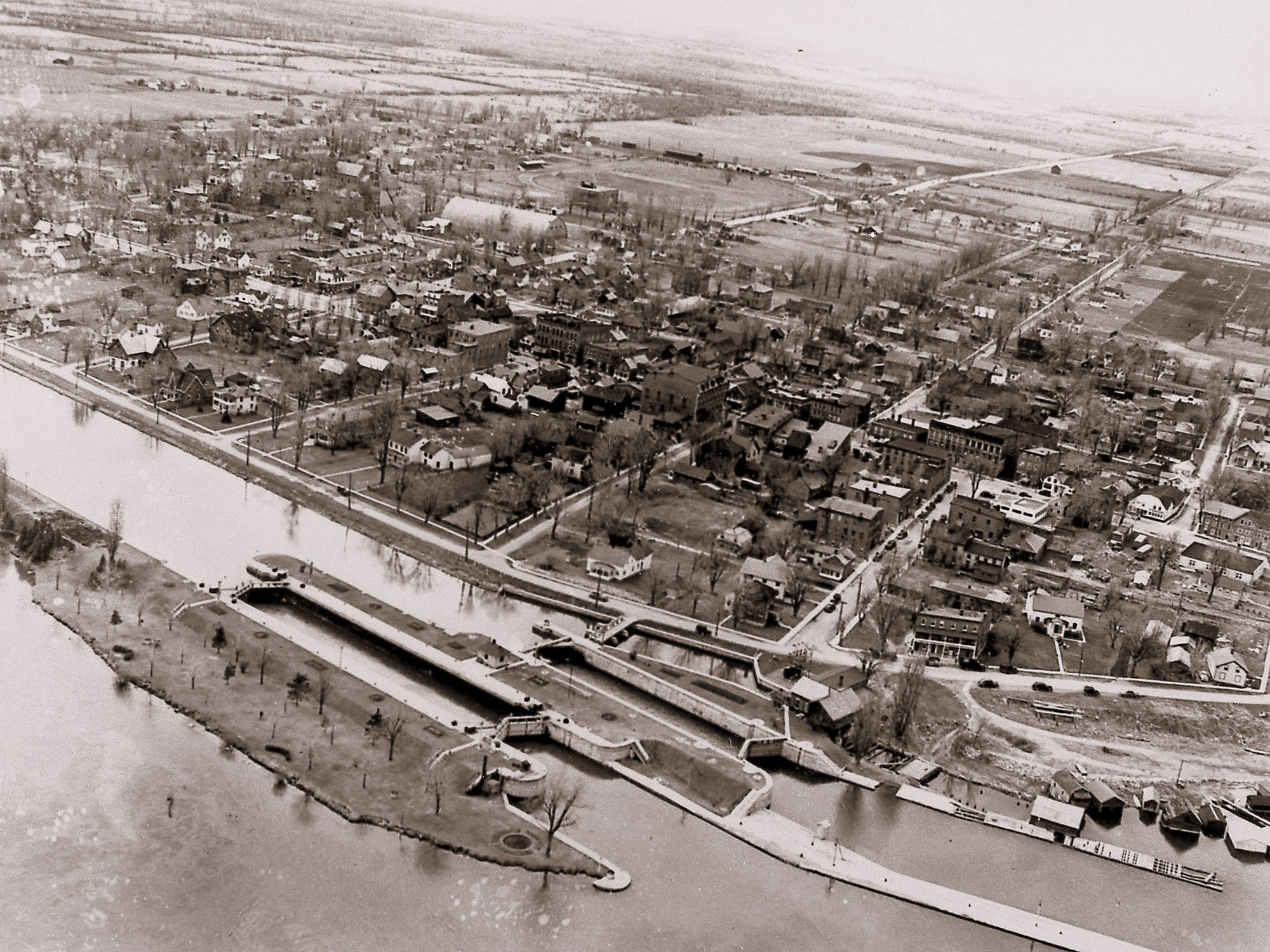 1950s Aerial Photograph of Old Morrisburg
- from South East.
1950s Aerial Photograph of Old Morrisburg
- from South East.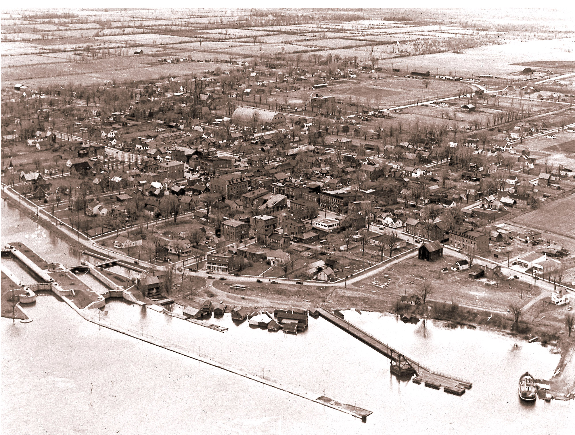 1950s Aerial Photograph of Old Morrisburg
- from East.
1950s Aerial Photograph of Old Morrisburg
- from East.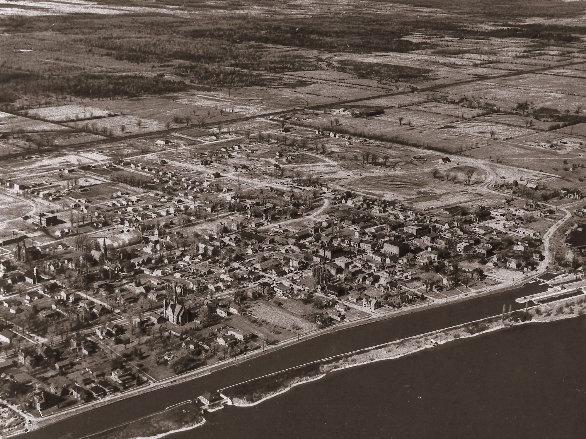 1950s Aerial Photograph of Old Morrisburg
- from South.
1950s Aerial Photograph of Old Morrisburg
- from South.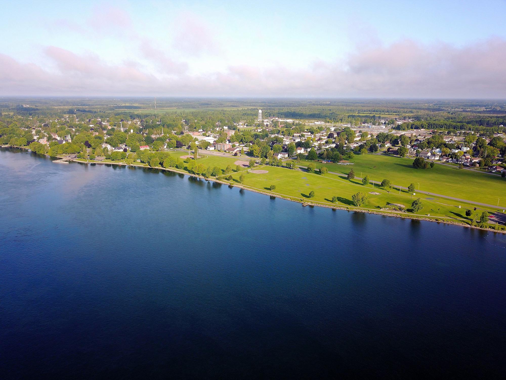 How it Looks Today.
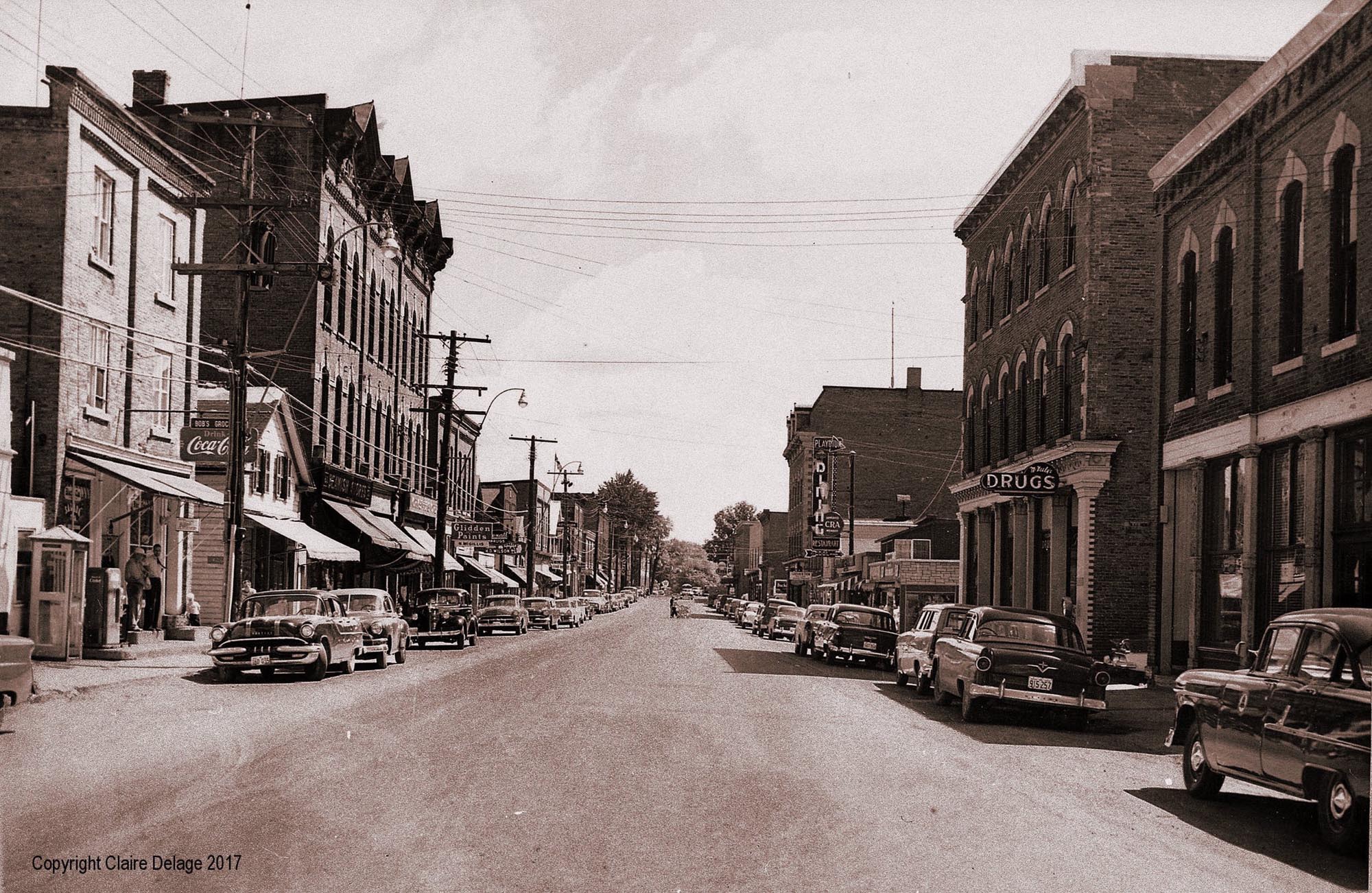 What Was Lost: View Down the Old Main Street.
 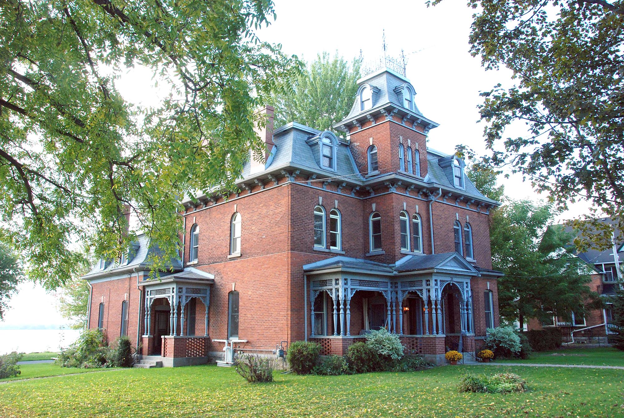 What Was Not Lost: Unlike Most of the St. Lawrence Seaway "Lost
Villages",
What Was Not Lost: Unlike Most of the St. Lawrence Seaway "Lost
Villages",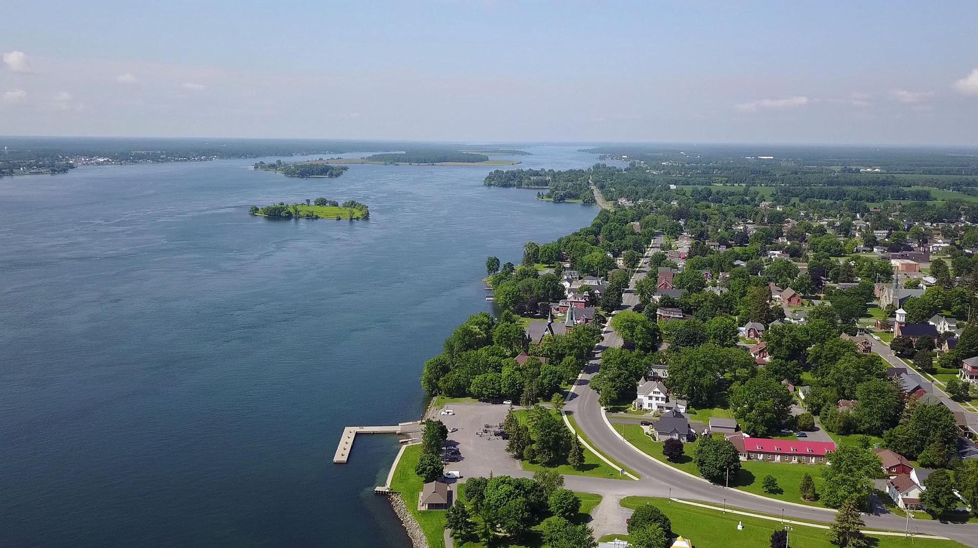 Today: Looking West Along Lakeshore Drive (The Old Queens Highway)
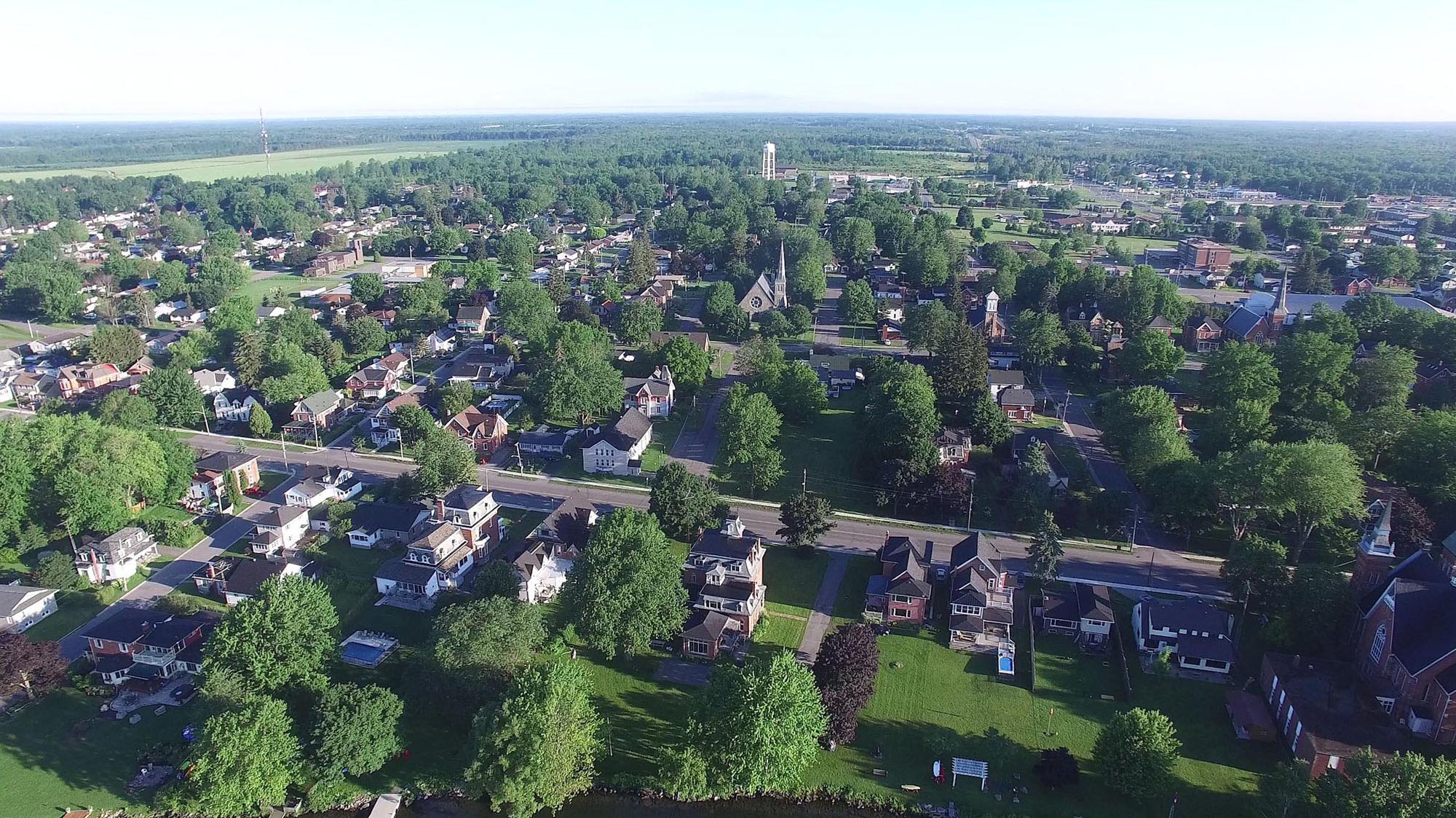 Today: Looking North from the River.