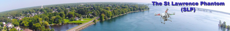
Flights of the St. Lawrence Phantom
In May 2014, I finally gave in to the temptation of adding a new dimension to my photography (literally). I purchased a DJI Phantom Vision Plus Quadcopter - to see what it is Click Here.
Direct links to all the Phantom videos:
Here are videos and pics from the latest flights of "The St. Lawrence Phantom":
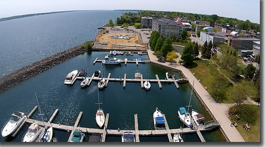
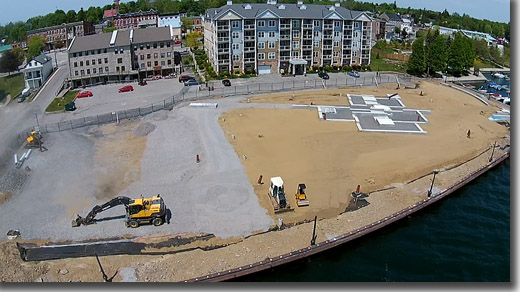
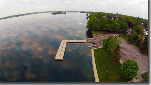
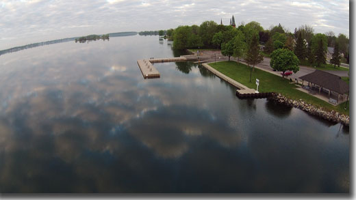
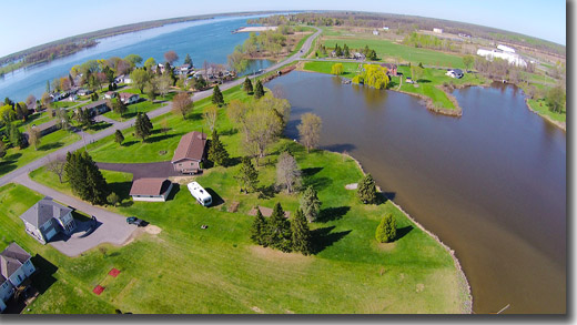
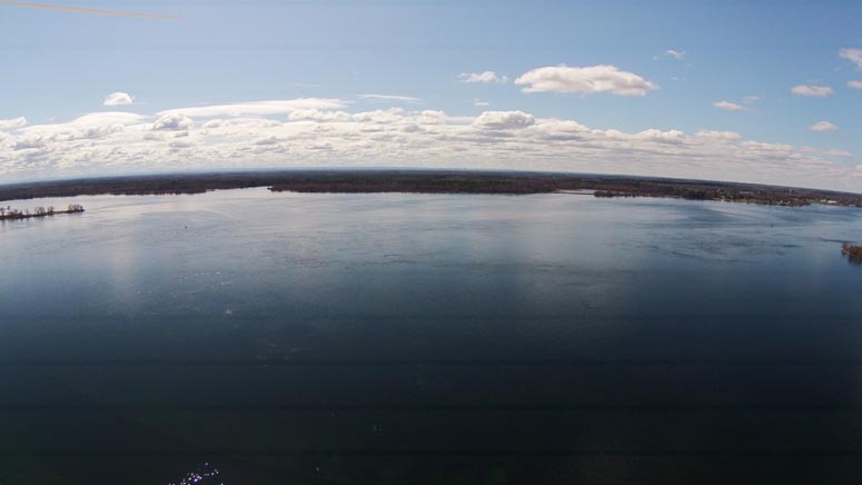
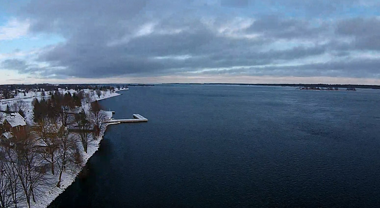
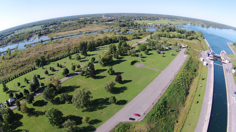
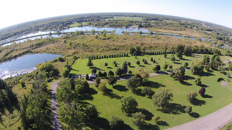
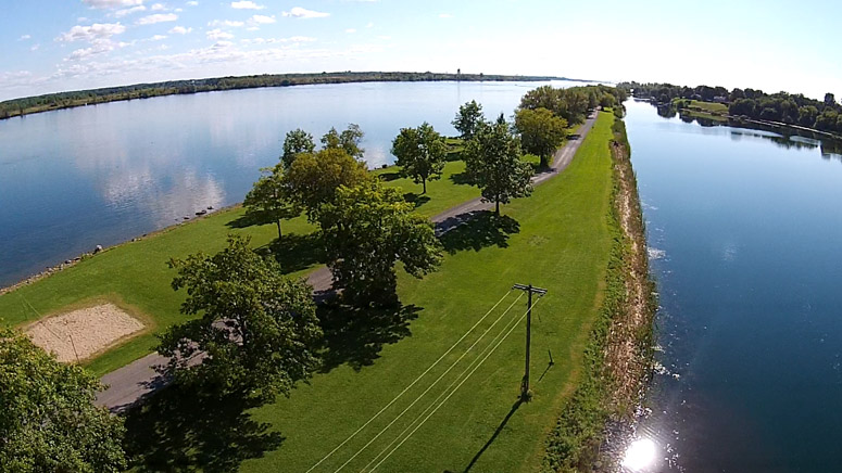
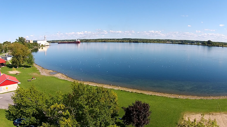
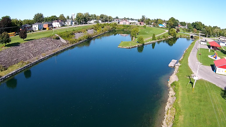
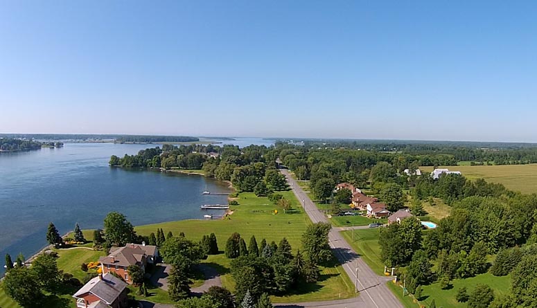
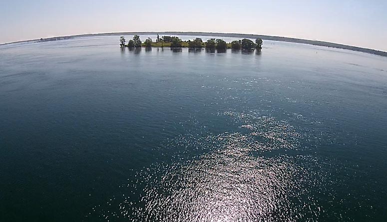
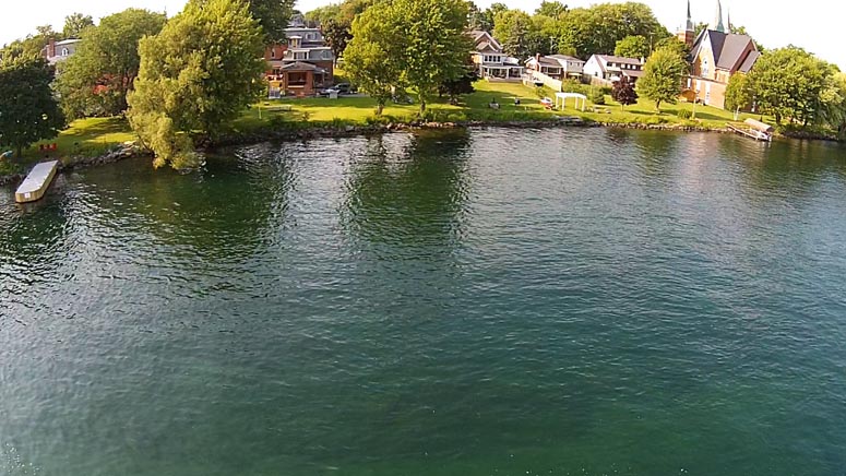
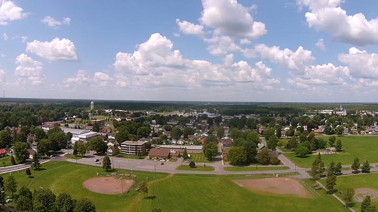
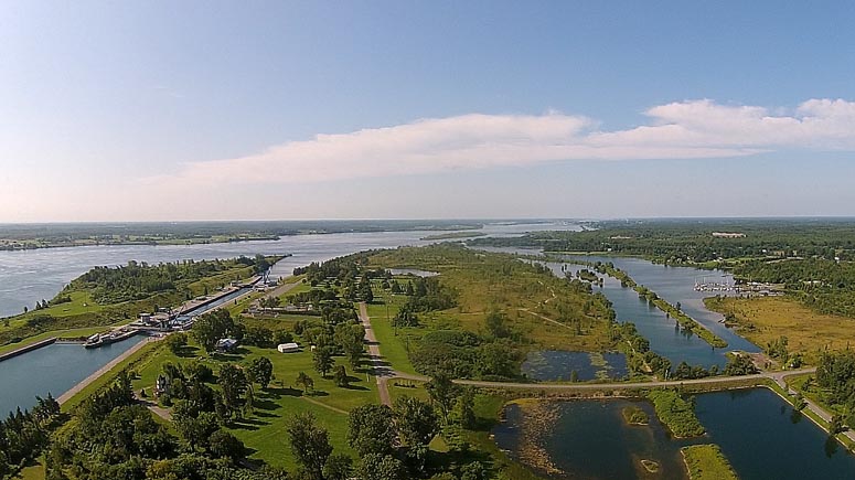
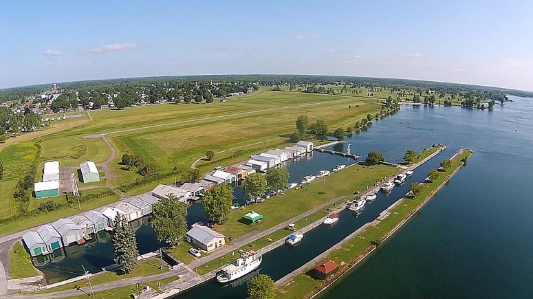
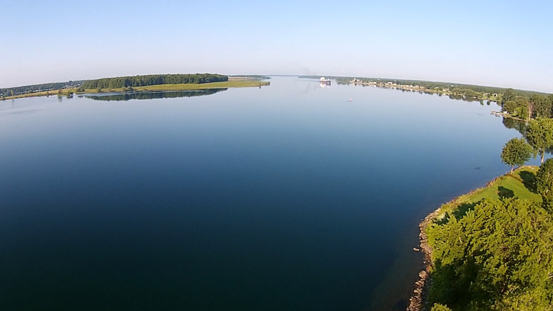
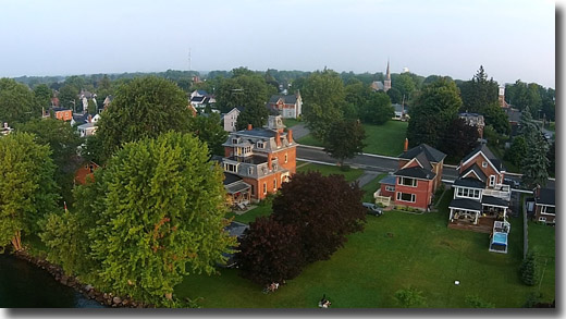
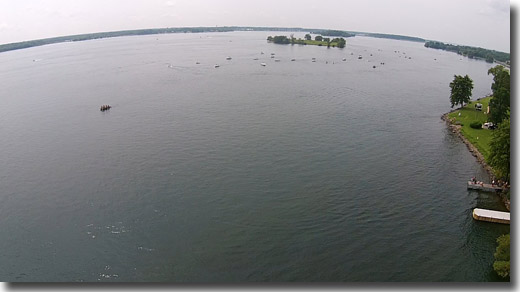
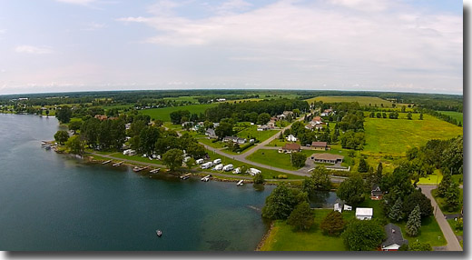
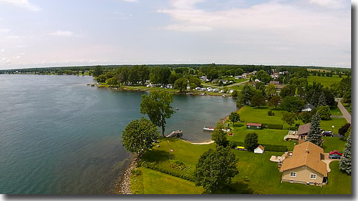
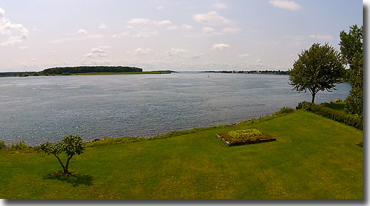
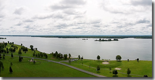
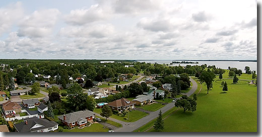
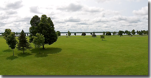
25 May, 2015 - Above the Sandra Lawn Harbour Area.
The St Lawrence Phantom flies over the Prescott Sandra Lawn Harbour Marina and Park - including 360 degree views from above.
To see the video: CLICK Here.
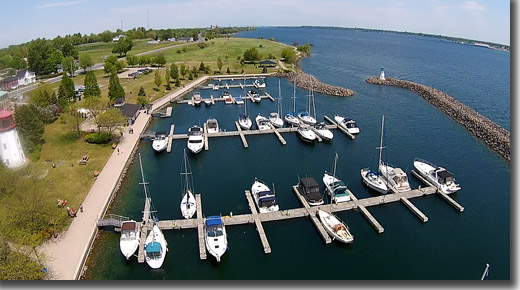
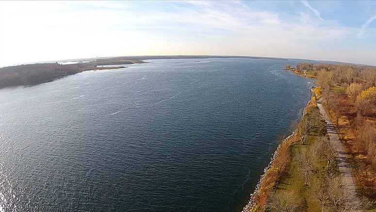
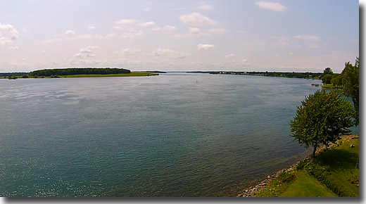
PH5209: Looking East Down River.
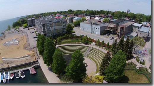
PH0365: The Waterfront Amphitheatre.
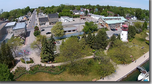
PH0947: The Park and Old Lighthouse.
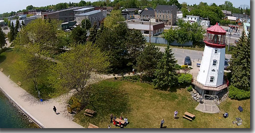
PH0106: The Lighthouse.
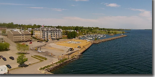
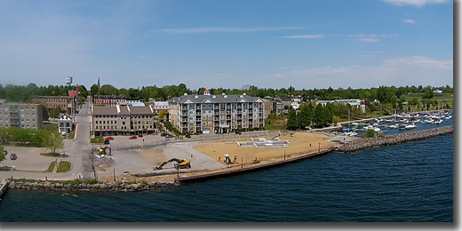
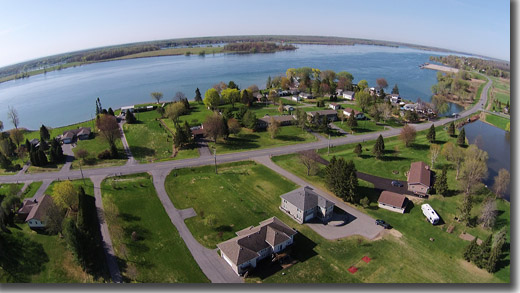
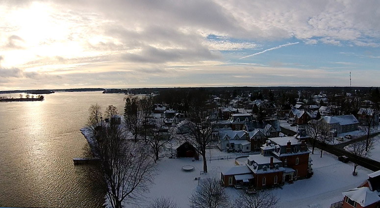
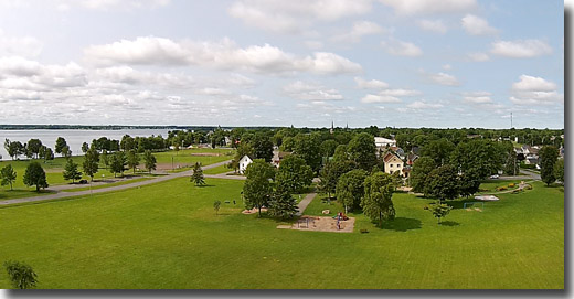
24 May, 2015 - Progress on the Prescott Waterfront Project
The St Lawrence Phantom observes progress on the Prescott Waterfront Project - including 360 degree views from above.
To see the video: CLICK Here.
PH0828: From the West.
PH1225: From the South.
PH0132: From the East.
PH2039: From Above.
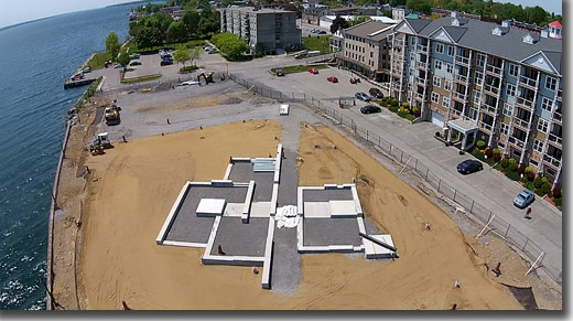
PH2551: A Closer Look.
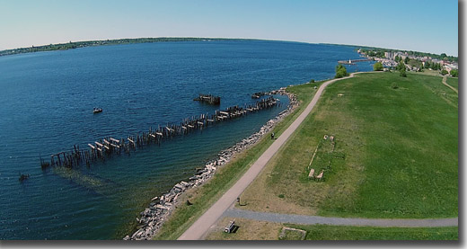
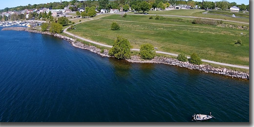
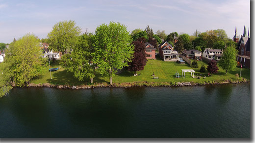
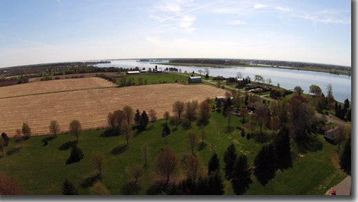
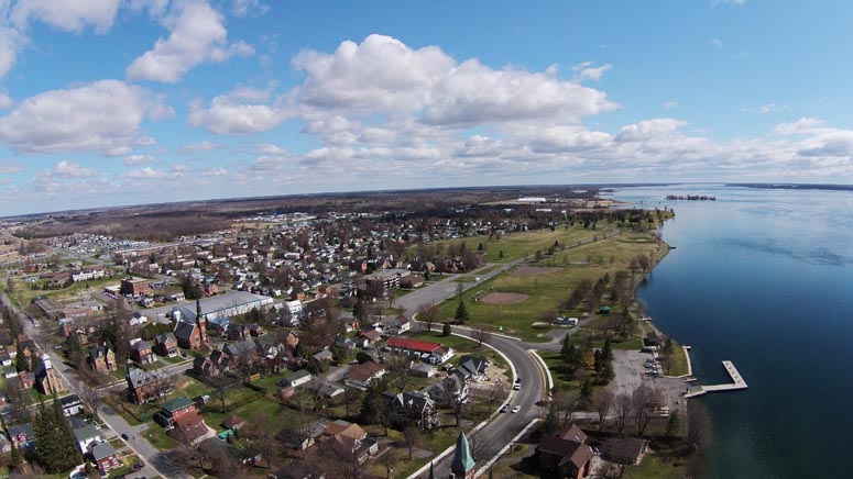
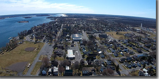
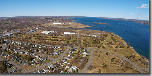
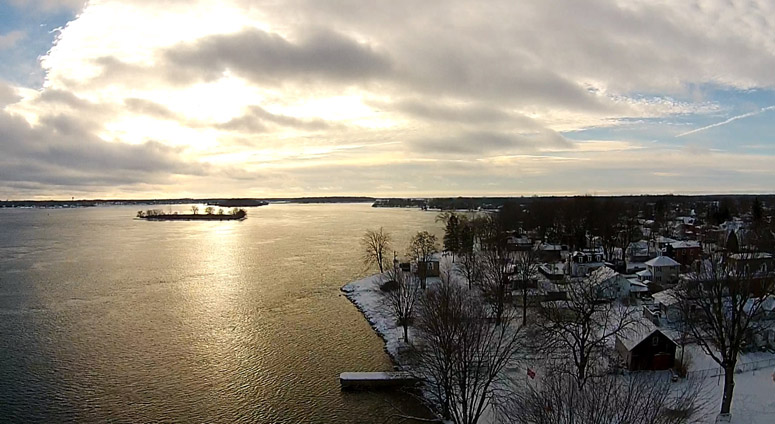
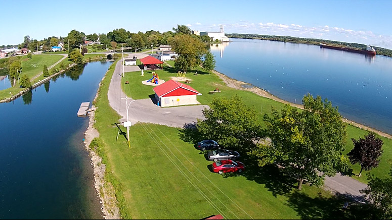
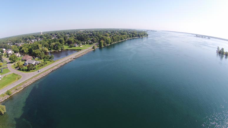
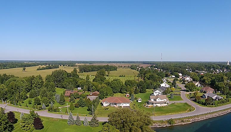
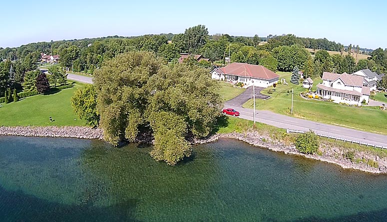
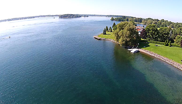
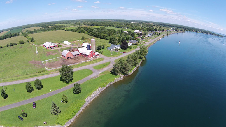
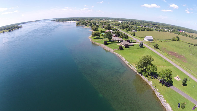
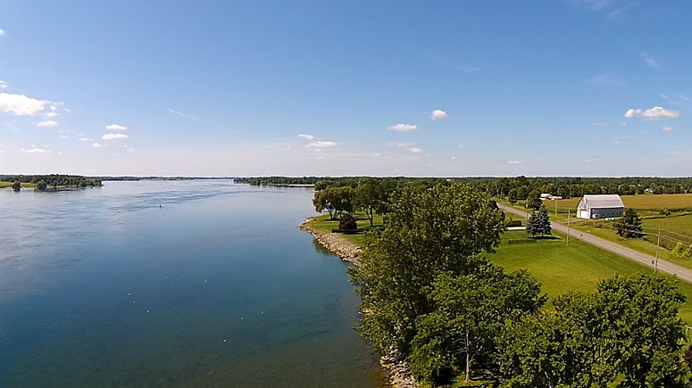
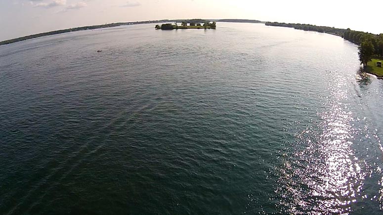
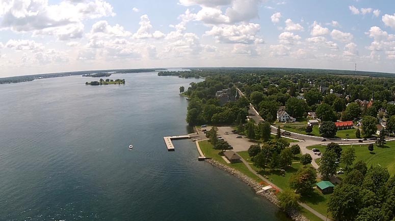
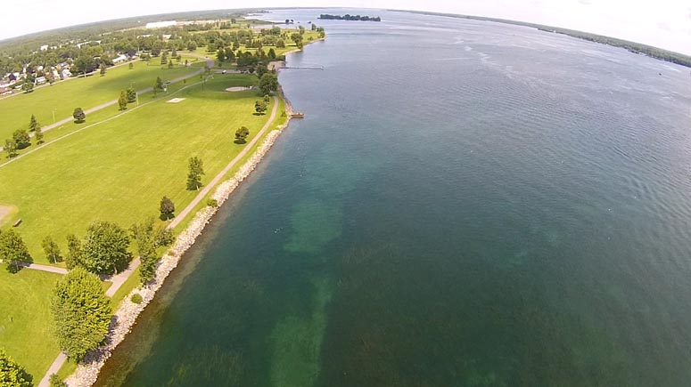
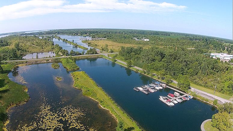
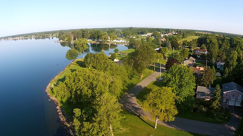
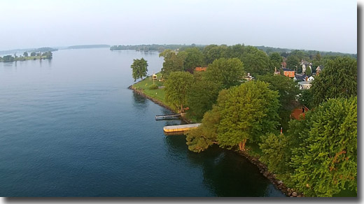
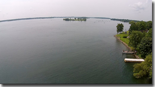
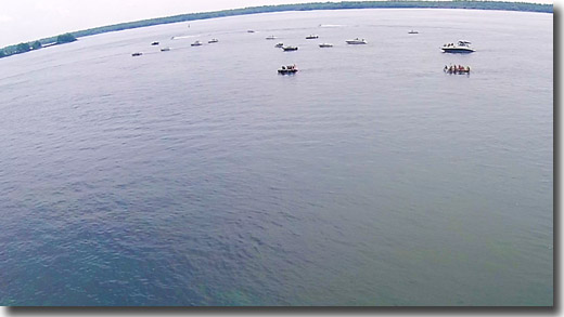
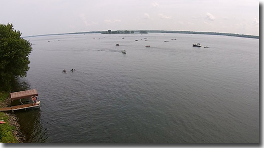
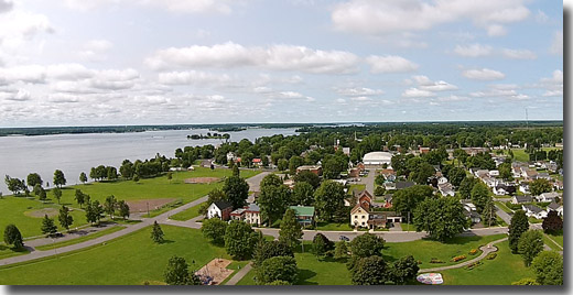
23 May, 2015 - Prescott Waterfront Trail From the Air.
We did a St Lawrence Phantom fly-over the Prescott Waterfront Trail this morning. Views of the Fort Wellington Historic Site, the old ferry wharf and across the St Lawrence River to Ogdensburg, NY are included.
To see the video: CLICK Here.
PH1554: Start of the Water Trail - East of Prescott.
PH0347: East End of the Water Trail.
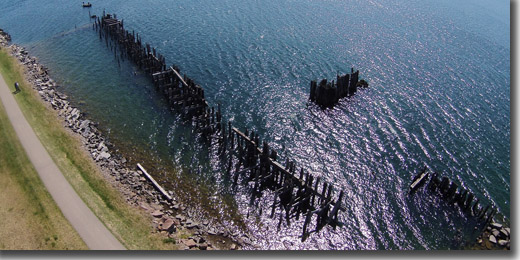
PH0350: The Remains of the Old Ferry Wharf.
PH3907: The Old Ferry Wharf Looking Up River.
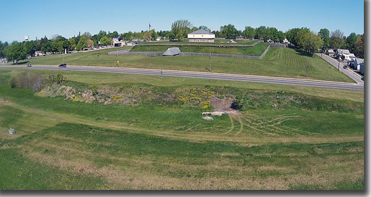
PH5246: The Fort William National Historic Site.
PH0604: West End of the Water Trail & the Marina.
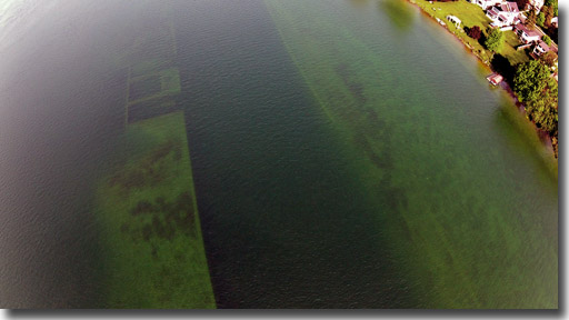
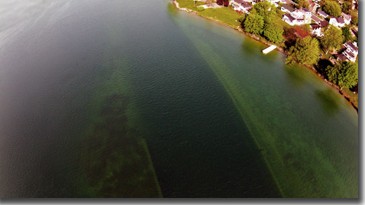
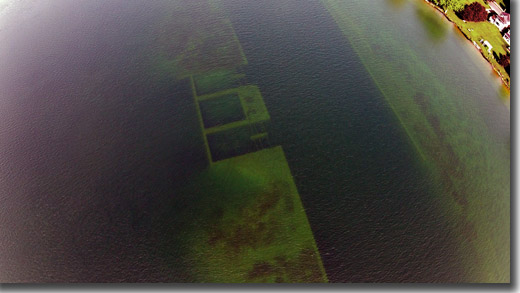
18 May, 2015 - The Old Rapide Plat Canal -
Under the St Lawrence River in Morrisburg.
The St Lawrence Phantom flies over the old Rapide Plat Canal in Morrisburg that was flooded by the St Lawrence River when the St Lawrence Seaway was built in the 1950s.
See detailed background info HERE.
To view the video Click Here.
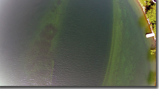
PH0326: The Old Rapide Plat Canal from High above the St Lawrence.
PH0328a: From in front of the Lakeshore United Church.
PH0330: From Higher Up.
PH0332: The Power House on the Outer Bank.
PH0334: A Lower Down Closer View.
PH0336a: What it Looks Like Now.
What it looked like before the flooding.
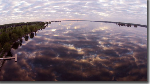
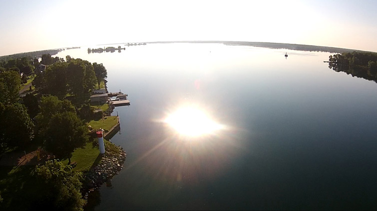
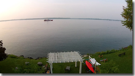
17 May, 2015 - Early Morning Reflections at the
Morrisburg Dock.
A glassy smooth river and some interesting clouds provided nice pics & video for the St Lawrence Phantom early this morning. To see the video, please Click Here.
PH0296: Looking South West Up River at the Dock.
PH0301: Down River Reflections.
PH0304: The Dock with Lakeshore United Church.
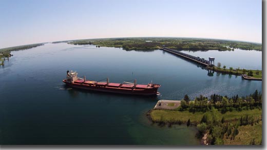
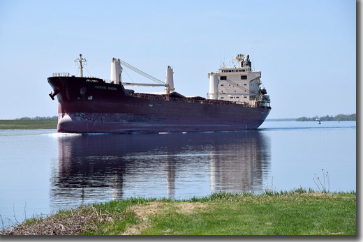
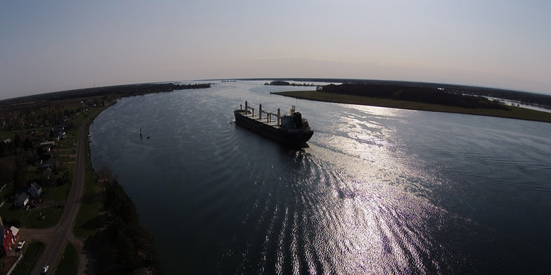
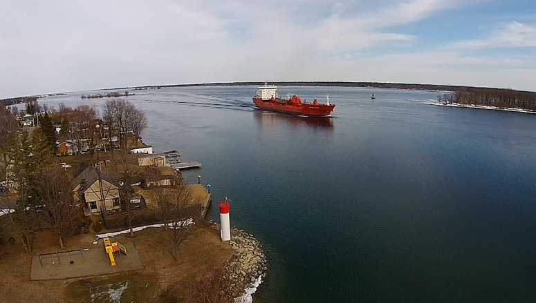
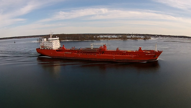
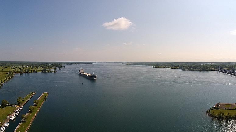
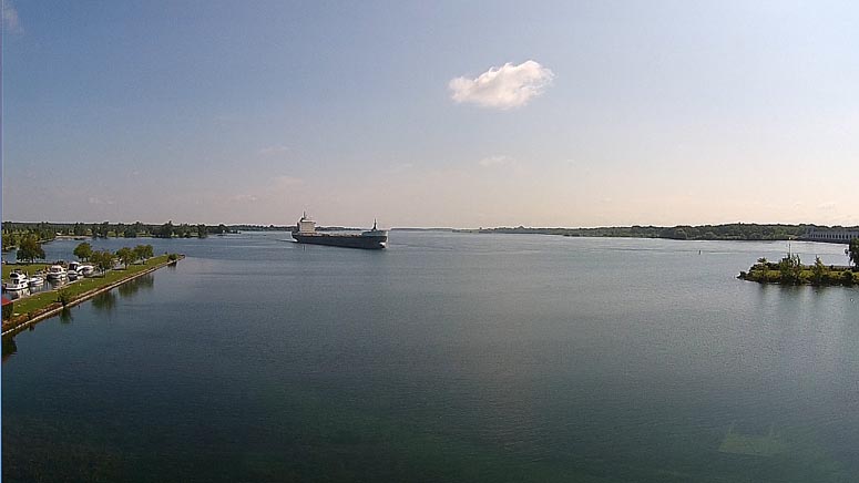
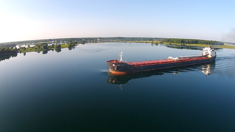
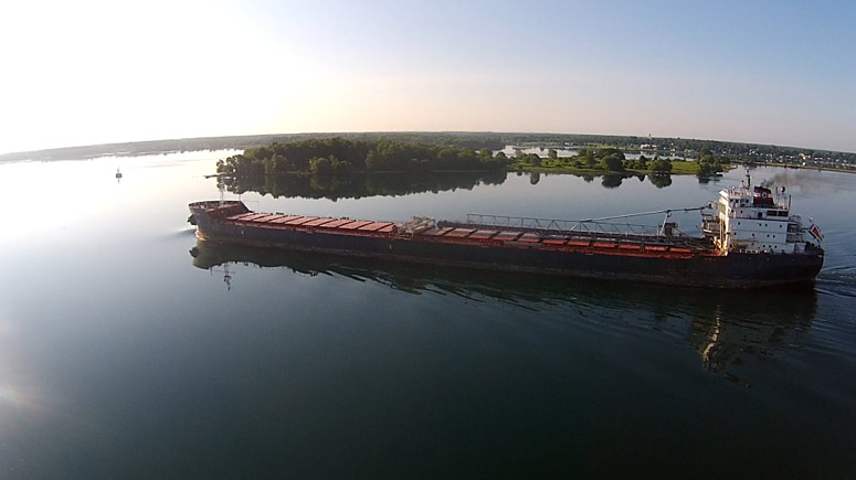
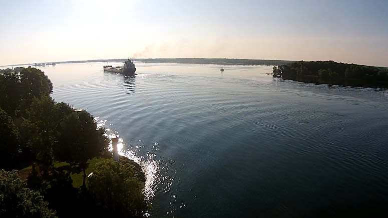
14 May, 2015 - "Federal Yoshina" at the Iroquois Locks.
The St Lawrence Phantom observes the "Federal Yoshina" as it approaches The Iroquois Locks from the East (to see the video, please Click Here). The video includes 360 degree views over the Iroquois Boat Houses, Iroquois Airport, Iroquois Village, Gallop Canal & Marina and the Iroquois Locks & Dam.
Camera pics as the "Federal Yoshina" passes through the locks are presented here.
PH0252: "Federal Yoshina" - First Sight in the East.
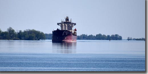
PH0899: The Heading Straight For Us.
PH0265: The "FEDERAL YOSHINA" Approaches the Locks.
PH0265A: Close Up View.
PH0902: From Ground Level.
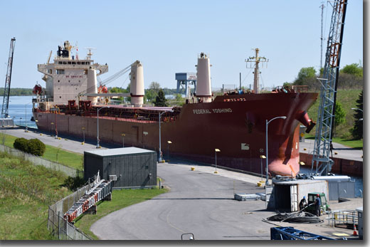
PH0913: Fully In the Lock.
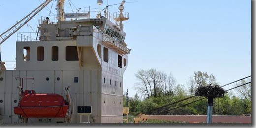
PH0928: The Osprey Observes.
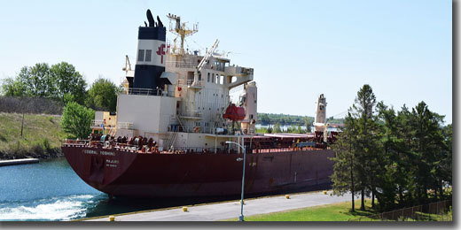
PH0935: Leaving the Locks, Continuing West.
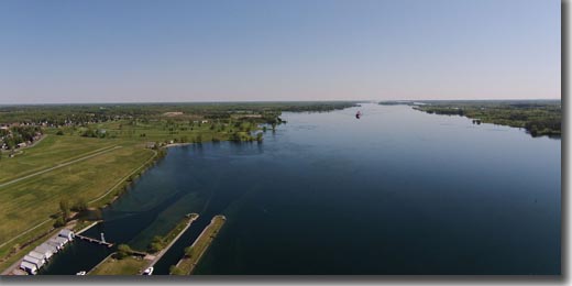
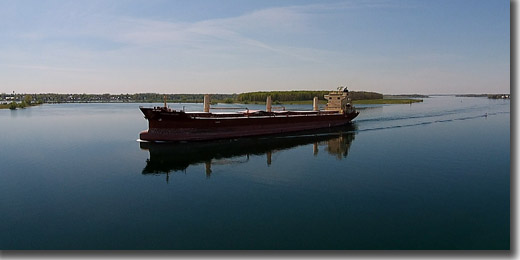
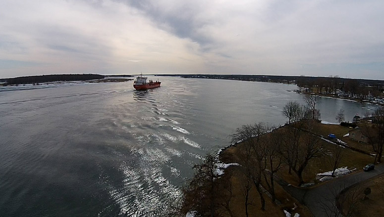
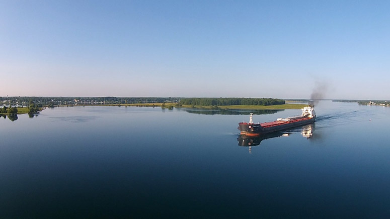
8 May, 2015 - Passage of the "FEDERAL SAKURA"
The St Lawrence Phantom observes the "Federal Sakura" as it passes Mariatown, South Dundas heading down river on glassy calm waters. A 360 degree view of Mariatown is included from about 300' above the St. Lawrence. To see the video, please Click Here.
Camera shots from the flight:
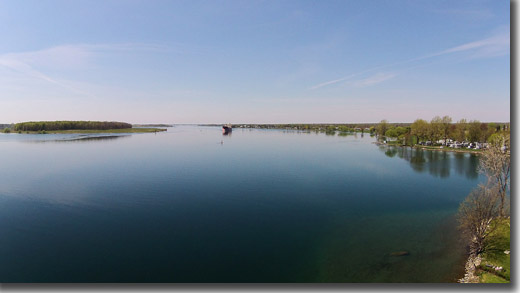
PH0238: First Sight in the West.
PH0882: The St Lawrence Phantom is Ready.
PH0242: The "FEDERAL SAKURA" Approaches from the West.
PH0884: From the Ground - Up Close.
PH1592: Passing Waddington on the US Side.
PH2031: Reflections of the "FEDERAL SAKURA"
PH2141: Leaving Mariatown from Up High.
7 May, 2015 - Up High Above Flagg Creek
Another great May morning - flying high above Flagg Creek between Morrisburg & Iroquois on Lakeshore Drive. To see the video, please Click Here.
Camera shots:
PH0223: Flagg Creek as it Flows into the St. Lawrence River (Looking West).
PH0206: Flagg Creek as it Flows into the St. Lawrence River (Looking South).
PH0218: From Above Flagg Creek Looking down the St. Lawrence River (Looking East).
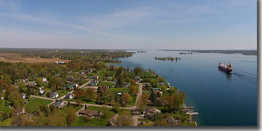
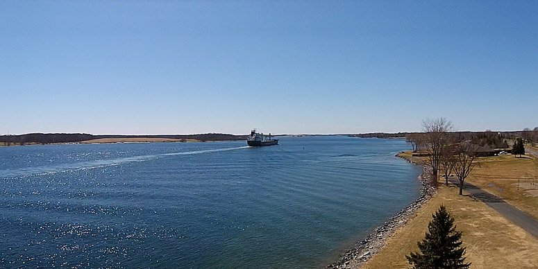
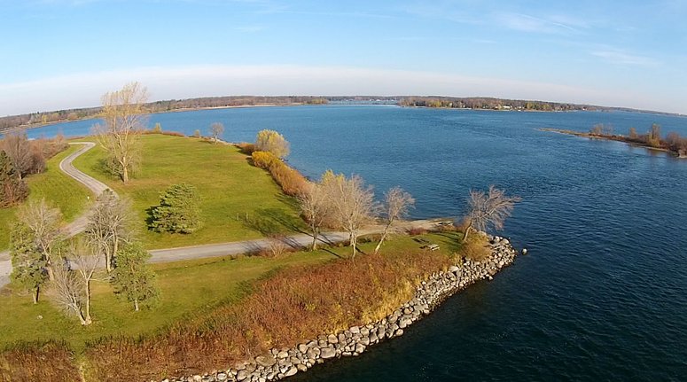
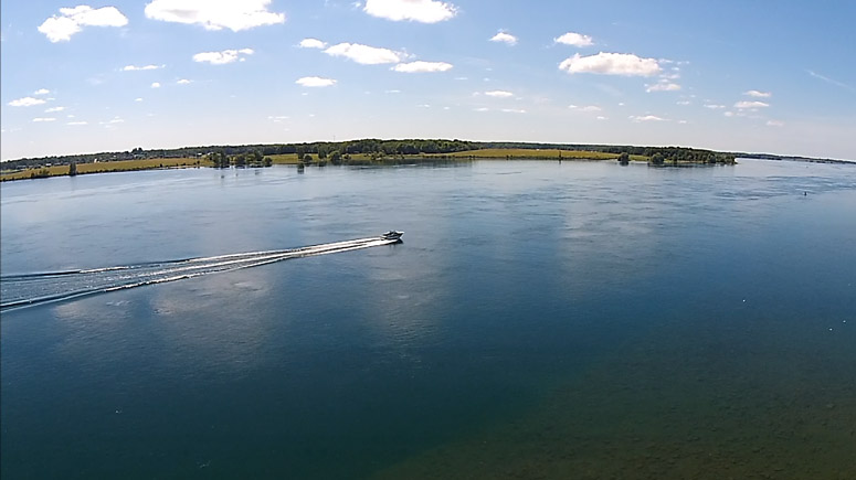
3 May, 2015 - The Juno Passes Loyalist Park
The St Lawrence Phantom welcome back the Polsteam Juno as it passes Loyalist Park, just west of Morrisburg on a beautiful spring Sunday morning. To see the video: Click Here.
Here are a couple of camera shots:
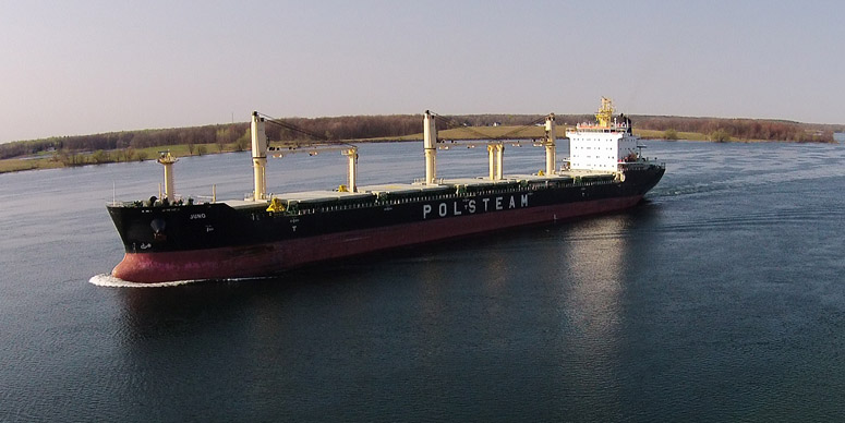
PH0190: The Juno Approaches Loyalist Park.
PH0195: Juno Heading Down River Towards Mariatown.
28 April, 2015 - Up High Above Lakeshore Drive
Today I flew the SLP high above Lakeshore Drive in Morrisburg, South Dundas. A real spring day at last!
I specifically took quite a few high resolution photographs instead of just taking an HD Video of the full flight and then taking screen grabs from the video to publish on the web site. If you click on the pics in this section you can see the full high resolution photos as PDFs (they may be a bit slow to download?). You can magnify the image as much as you like and then scroll around to look at the detail - enjoy!
Prints available - select the "Purchase" menu option.
PH0112: Looking North From About 300 Feet.
PH0113: Looking West to Mariatown
PH0114: Looking South West Up the St. Lawrence River.
PH0115: Looking South to New York State.
PH0117: Looking North East Down River.
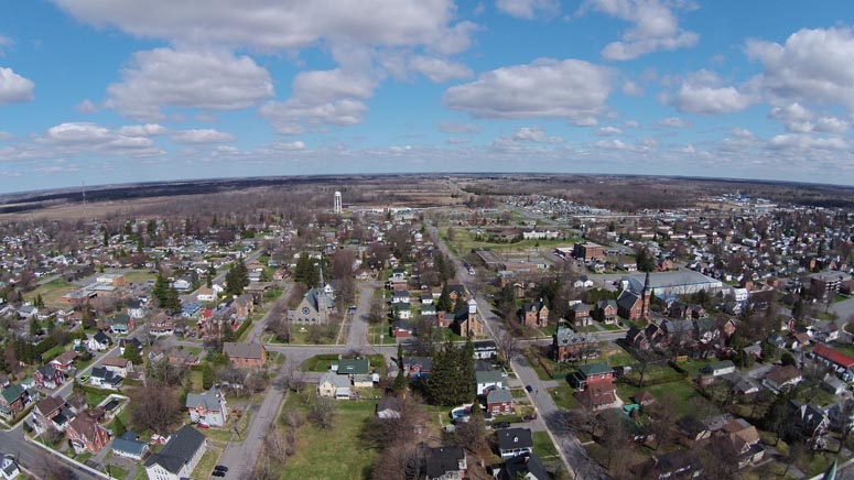
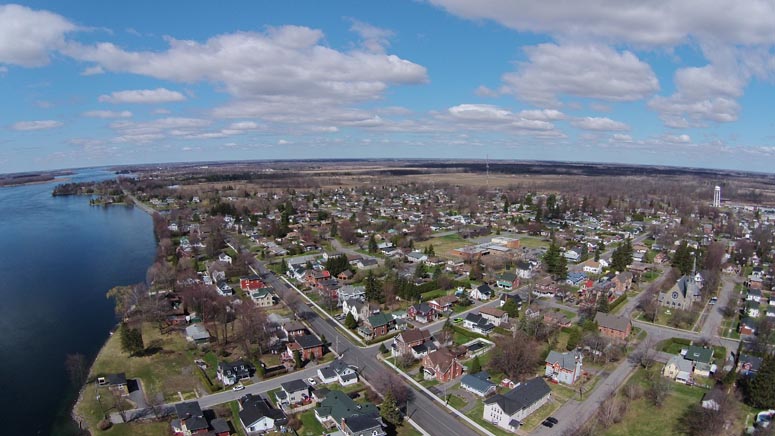
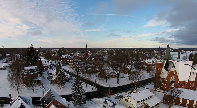
16 April, 2015 - Morrisburg from Up High
Click on pics to see an enlarged, high resolution view.
PH0419: Morrisburg from Up High - Looking West
PH0336: Morrisburg from Up High - Looking East
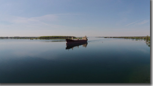
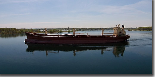
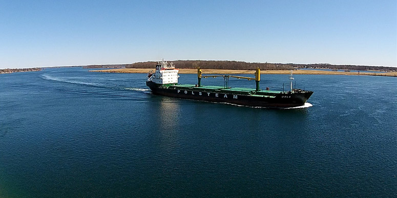
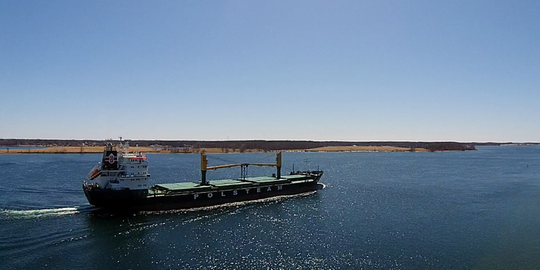
15 April, 2015 - Passage of the Polsteam ORLA
On a beautiful spring afternoon we observed the passage of the general carrier ORLA travelling upriver past the South Dundas Loyalist Park, just west of Morrisburg.
3 April, 2015 - First Salty of 2015
After a very long and hard winter, I have lately become very anxious to see the first boats on the St. Lawrence River. I also have been quite keen to give the St. Lawrence Phantom its first flight of the year. Today gave me the opportunity to do both. I hope you enjoy the pics and the video.
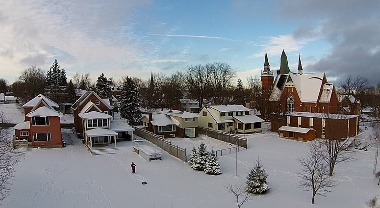
13 December - First Flight Over Snow
I decided to try taking the St Lawrence Phantom out for a new experience this afternoon - a first flight in the cold over the "white stuff". It took a while to get ready to go with the GPS locked to enough satellites to keep it stable. I went with the minimum of 6 (I usually get 9 or more).
It never seemed very stable - floating off east all the time. After a close call with a nearby tree, I decided to cut the flight short - "Better safe than sorry" has always been my motto. Considering all this, I was quite pleased with the captured flight video and the resulting pics.
11 November - Over the Long Sault Parkway (East)
Views from the St Lawrence Phantom flying over the East end of the Long Sault Parkway, Macdonell Island, on a beautiful late fall morning.
Looking North East where the Old Highway Number 2 goes beneath the waters of the St. Lawrence River.
Looking West to where Old Hwy 2 emerges from the river.
Looking North over towards Long Sault.
Looking South West up river. You can see the Long Sault Dam and the entrance to the Eisenhower Locks.
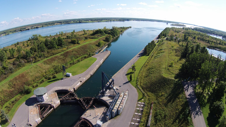
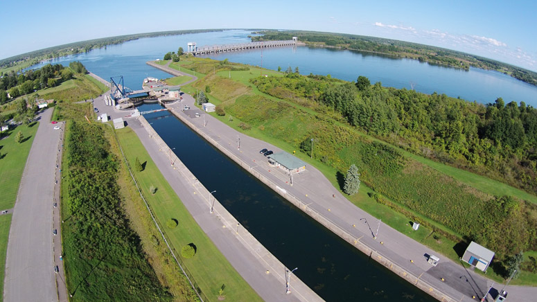
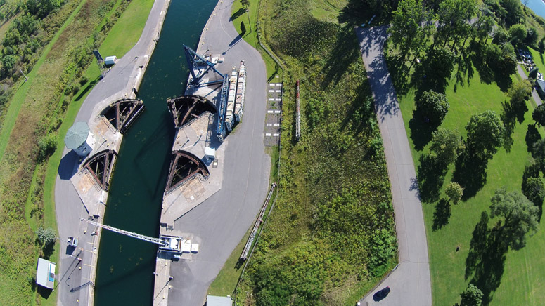
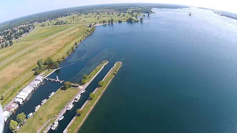
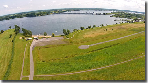
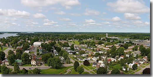
8 September - Iroquois Locks (West End)
Bird's Eye View from over Iroquois Locks (West End) - with views up river & down river and along the old Galop Canal.
8 September - Seaway Laker Approaches Cardinal
Flight of the St Lawrence Phantom from west of Cardinal - with views up river & down river and along the old Galop Canal.
24 August - Stata's Creek & West Morrisburg Waterfront
Flight of the St Lawrence Phantom over Stata's Bay - with views up river & down river.
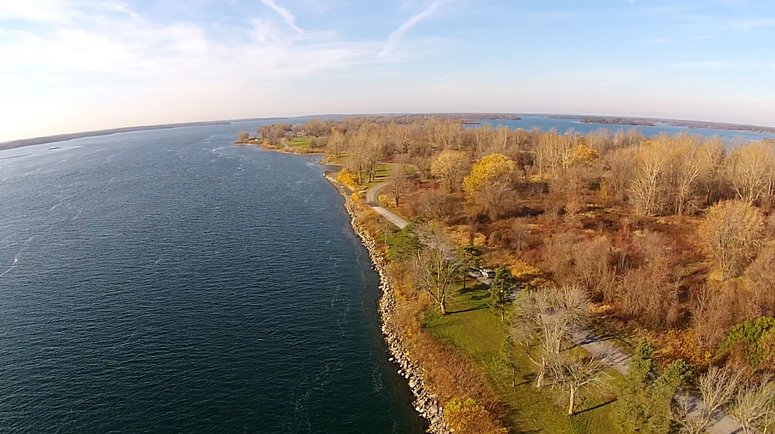
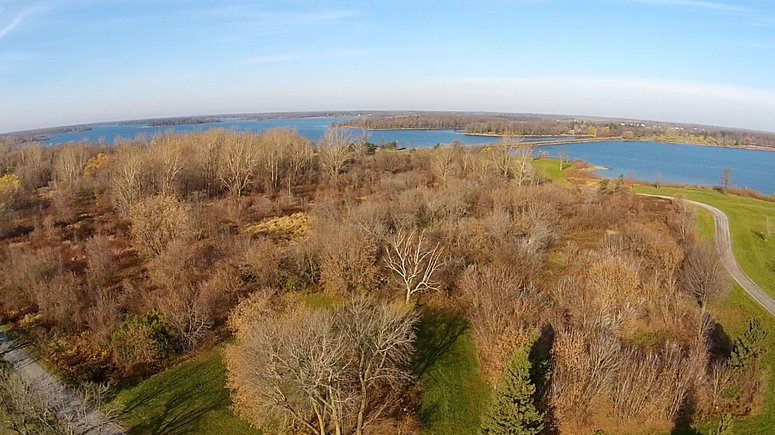
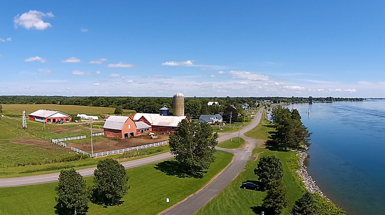
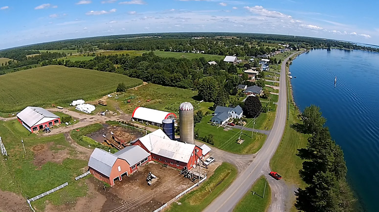
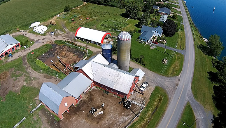
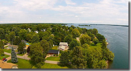
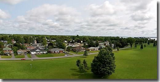
19 August - Loyalist Park & Farlinger Dairy Farm
The Loyalist Park in South Dundas is a beautiful little park on the shores of the St. Lawrence River. It is situated about 4 km west of Morrisburg on Lakeshore Drive. It is a very tranquil place on a nice summer day. This Phantom flight presents beautiful views of the St Lawrence River, the Farlinger Dairy Farm and the surrounding farm land.
Videos: Loyalist Park (5 Minutes) & More Loyalist Park with Great Views of the farm (13 Minutes).

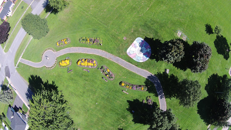
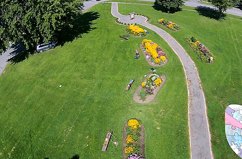
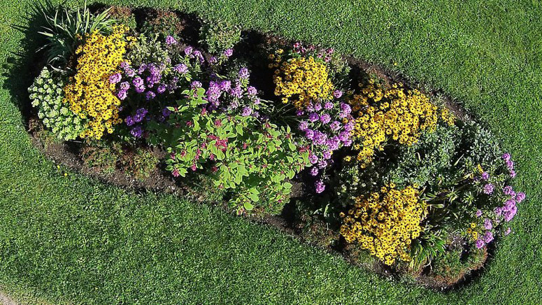
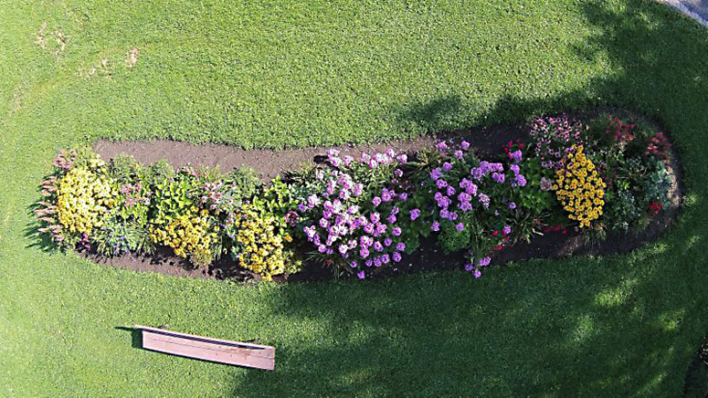
18 August - Earl Baker Park Flower Garden.
The Earl Baker Park Flower Gardens in Morrisburg were created in 2010 with a lot of hard work from a small group of dedicated volunteers. They have continued their good work every year since then and now the gardens are in full bloom. The St Lawrence Phantom provides a completely new view.
To see the video Click Here.
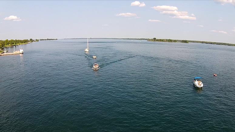
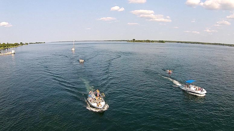
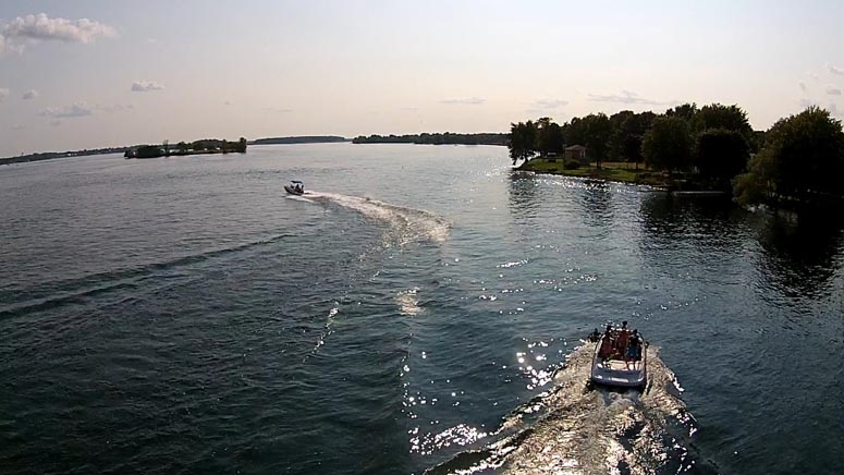
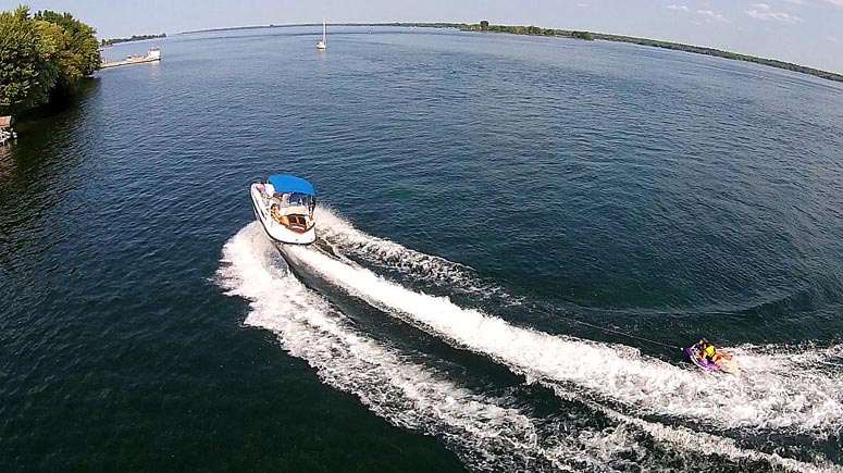
10 August - Boating fun in Morrisburg on the River.
The St Lawrence Phantom captures some boating fun on the river in Morrisburg on a beautiful Sunday afternoon. To see the video Click Here.
9 August - Morrisburg Dock
Views from between the dock & the beach.
PH4230: View of Morrisburg Dock from Down River.
PH4355: View Down River Along the Waterfront Path Towards the Cruickshank Amphitheatre & the Beach.
PH4432: View North to the Legion and Highway 2.
9 August - Crysler's Farm Battlefield Memorial
New views of the Crysler's Farm Battlefield Memorial and Upper Canada Village.
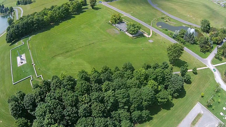
PH3538: Crysler's Farm Battlefield Memorial
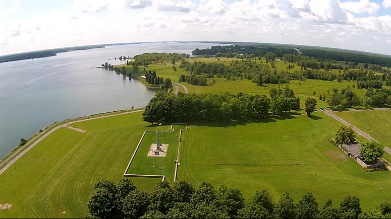
PH3149: Crysler's Farm Battlefield Memorial Looking Up River.
PH3334: Looking Down River to Upper Canada Village.
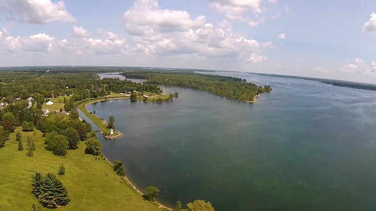
7 August - Iroquois Lock From the East
Another nice day watching the "KAMINISTIQUA" approach the Iroquois Locks from downstream.
To see the video Click Here.
The video includes some interesting shots looking down at some of the drowned parts of old Iroquois now under the St. Lawrence River.
PH4156: Iroquois Locks & the Original Galop Canal, Looking West.
PH4224: Looking East Downstream.
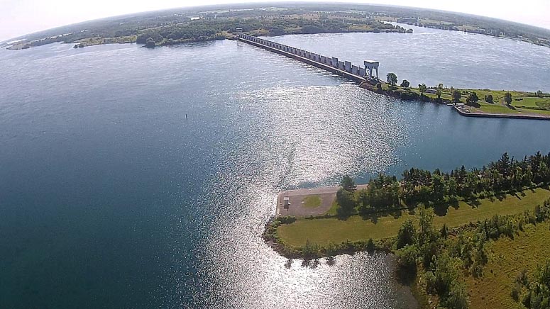
PH4227: The Iroquois Dam
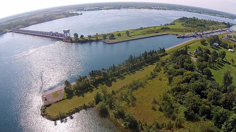
PH4531: Iroquois Dam & Lock
PH4903: Looking NE Over the Boat Houses & Airport.
PH4912: Galop Canal Looking West
PH5649: The "KAMINISTIQUA" Approaching the Lock from the East.
PH5745: Coming Closer.
6 August - Laker Passing Mariatown
A beautiful sunny calm morning. The St. Lawrence Seaway Laker, the "RADCLIFFE R LATIMER" passes Mariatown, just west of Morrisburg Ontario. To see the video Click Here.
3 August - Morrisburg Tubie Race
We had a great weekend with the Morrisburg Tubie Parade, two rounds of the Renegade Bass Derby and the the big race on Sunday (from Mariatown to the beach).
You can see the St Lawrence Phantom HD Video of the race in progress on Youtube - Click Here.
PH4707: Sun Just Up on the Bass Boats Waiting for the Start.
PH4754: Lakeshore is Still Asleep.
PH4820: Looking West Up River.
PH4953: Coast Guard Ship "The Griffin" is On Guard.
PH5439: Tubie Racers First Spotted.
PH5940: Getting Closer - A Big Lead.
PH0328: Second & Third are Quite Close.
PH1030: Home Stretch to the Beach.
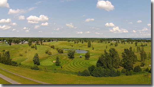
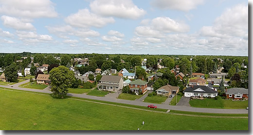
30 July - Iroquois
An interesting flight - from just west of the Iroquois Golf Club.
See the video on Youtube.
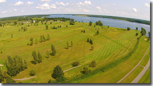
PH4136: Looking East over the Iroquois Golf Club to the St. Lawrence River.
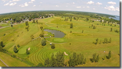
PH4155: Total View of the Golf Course.
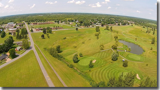
PH4158: Looking North East Towards Seaway High School.
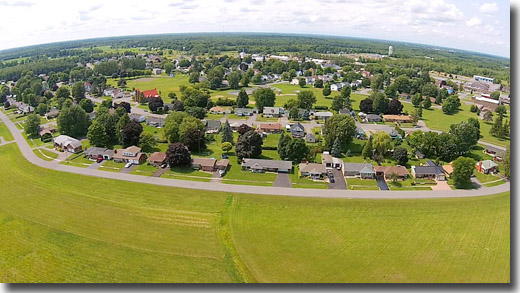
PH4203: Looking North Over Iroquois.
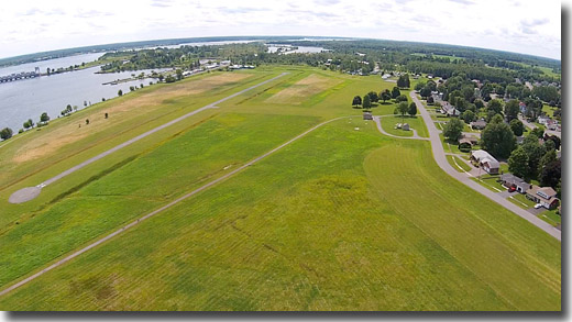
PH4206: Looking West Over the Airport, Toward the Iroquois Locks.
PH4219: Looking South West to the Beach & the Dam.
PH4414: The Pilot & His Assistant.
PH4434: Iroquois Lakeview Street.
PH4615: Lakeview St. from Higher Up.
PH4631: Looking East.
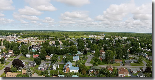
30 July - Mariatown
The flight from the west end of Mariatown is especially interesting because the Tubies Race 2014 this weekend starts from the Arlor Haven Campground just west of here.
You can see the full HD flight video on Youtube here.
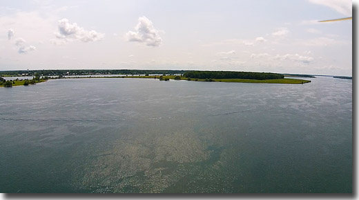
PH3417: Up High, Looking South to Ogden Island and the United States.
PH3438: Looking East Over Mariatown.
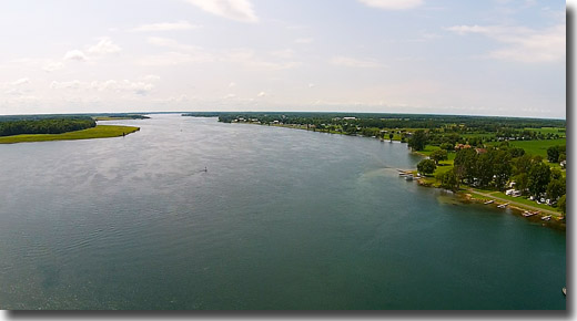
PH3504: Looking West Up the St. Lawrence towards Iroquois.
PH3535: Looking North to the Arlor Haven Campground (Start of the 2014 Tubies Race).
PH3700: Same View from Lower Down.
PH3737: Looking North East Over Mariatown.
PH3819: Looking East Down River towards Canada Island.
PH3905: Coming Down to Land, Looking Up River.
PH3918: Nearly Down.
29 July - Earl Baker Park, Morrisburg
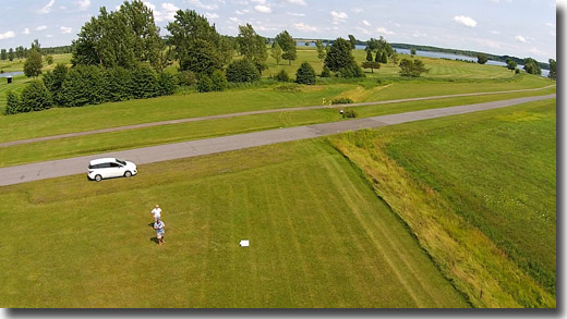
I got my replacement Phantom from Henry's in late July. After quite a bit of preparation and a couple of careful but successful practice sessions, I felt ready for a real flight - taking video & photographs. I was quite pleased with the results - hope you like them. Click on any picture to see a larger view.
PH7291: Just After Taking Off - Looking SW Towards the Playground.
PH7292: Now Looking North Towards the Pilot (me) & Park St.
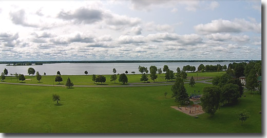
PH7293: A Bit Higher - Looking South Towards the St. Lawrence River.
PH7294: Now Looking SE Towards Cruickshank Amphitheatre & the Beach.
PH7295: High Up (about 200 feet) Looking West.
PH7296: Another View West (From a Bit Lower) Towards the Playground.
PH7297: Looking North to Park Street.
PH7298: Looking NW Towards the Water Tower.
PH7299: Looking North from 200 Feet Up Towards Highway 2.
PH7290: East Towards the Golf Club.
PH729A: Looking East Along Park Street.
PH729B: Descending Now - Looking SE Towards the Beach.
PH729Z: Safe Landing.
Click here for another place to see St Lawrence Phantom Pics & Videos (and lots more drone pics & videos).